Safety Score: 2,8 of 5.0 based on data from 9 authorites. Meaning we advice caution when travelling to Canada.
Travel warnings are updated daily. Source: Travel Warning Canada. Last Update: 2024-04-28 08:22:10
Touring Barnet
Barnet in British Columbia is a town located in Canada about 2,190 mi (or 3,524 km) west of Ottawa, the country's capital place.
Time in Barnet is now 09:45 PM (Sunday). The local timezone is named America / Vancouver with an UTC offset of -7 hours. We know of 11 airports nearby Barnet, of which 4 are larger airports. The closest airport in Canada is Vancouver Harbour Water Aerodrome in a distance of 9 mi (or 14 km), West. Besides the airports, there are other travel options available (check left side).
There is one Unesco world heritage site nearby. The closest heritage site is Olympic National Park in United states at a distance of 109 mi (or 175 km). Also, if you like the game of golf, there are several options within driving distance. We collected 10 points of interest near this location. Need some hints on where to stay? We compiled a list of available hotels close to the map centre further down the page.
Being here already, you might want to pay a visit to some of the following locations: Bellingham, Friday Harbor, Chilliwack, Victoria and Mount Vernon. To further explore this place, just scroll down and browse the available info.
Local weather forecast
Todays Local Weather Conditions & Forecast: 10°C / 49 °F
| Morning Temperature | 2°C / 36 °F |
| Evening Temperature | 9°C / 49 °F |
| Night Temperature | 4°C / 39 °F |
| Chance of rainfall | 3% |
| Air Humidity | 53% |
| Air Pressure | 1017 hPa |
| Wind Speed | Light breeze with 5 km/h (3 mph) from North-East |
| Cloud Conditions | Overcast clouds, covering 85% of sky |
| General Conditions | Light rain |
Monday, 29th of April 2024
10°C (49 °F)
5°C (41 °F)
Light rain, light breeze, overcast clouds.
Tuesday, 30th of April 2024
11°C (51 °F)
8°C (46 °F)
Light rain, light breeze, overcast clouds.
Wednesday, 1st of May 2024
8°C (47 °F)
5°C (41 °F)
Moderate rain, light breeze, overcast clouds.
Hotels and Places to Stay
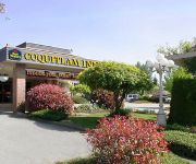
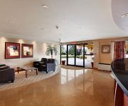
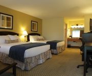
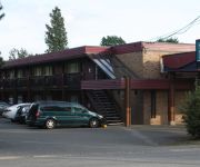
EXECUTIVE PLAZA COQUITLAM
BEST WESTERN PLUS COQUITLAM
RAMADA COQUITLAM
BEST WESTERN PLUS BURNABY HTL
Coquitlam Sleepy Lodge
Lake City Inn & Suites
BW CHELSEA INN
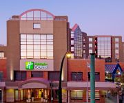
Holiday Inn Express VANCOUVER-METROTOWN (BURNABY)
HAPPY DAY INN
Videos from this area
These are videos related to the place based on their proximity to this place.
200m Effort | Burnaby Velodrome | GoPro HERO 3 Black Edition
Went to BVC for Friday night racing. I attached the GoPro to the handle bar grips as it would not fit onto the top of the bars or stem. The rubber seems to muffle the vibration quite well....
Burnaby Mountain Park, British Columbia, Canada
Видеопрогулка. Гора Бёрнаби, Ванкувер, Британская Колумбия. Канада.
1990 Miata MX5 runs Ioco hill climb
Close to Vancouver various sports car clubs have used this private road over the years to stage Hill Climbs. This time you can experience the course in a classic red 1990 Miata. Apologies...
City Crews Snow Plowing & Salting Roads Vehicles Stuck In Snow Metro Vancouver
DV-37-2 JANUARY 13 1998 Coquitlam & Burnaby City City Crews Snow plowing roads. vehicles getting stuck in the snow, winter driving coditions.
High Speed Crash Rescue Struck Light Standard Barnet Hwy Burnaby City
DV-27-6 NOVEMBER 12 1997 BURNABY CITY This vehicle was traveling at a very high rate of speed, East on Barnet Hwy. When the driver lost control and struck a light standard, driver side....
Belcarra Regional Park - Picnic Area - Belcarra, BC - BuyRIC
Exploring the Picnic Area of the beautiful Belcarra Regional Park with BuyRIC Places. -- http://www.buyric.com http://www.buyric.com/places -- http://facebook.com/buyric http://twitter.com/buyric...
4965 Robson Road Belcarra BC- Mike Rasmussenmikerasmussen.ca
View http://mike-rasmussen.myrealpagewebsite.com/mylistings.html/videos-43203713 to see PRICE and more PHOTOS. Belcarra at its best! This private, quiet and elegant waterfront estate, nestled...
Videos provided by Youtube are under the copyright of their owners.
Attractions and noteworthy things
Distances are based on the centre of the city/town and sightseeing location. This list contains brief abstracts about monuments, holiday activities, national parcs, museums, organisations and more from the area as well as interesting facts about the region itself. Where available, you'll find the corresponding homepage. Otherwise the related wikipedia article.
Simon Fraser University
Simon Fraser University (SFU) is a Canadian public research university in British Columbia with its main campus on Burnaby Mountain in Burnaby, and operates satellite campuses in downtown Vancouver and Surrey. The 1.7 km main campus on Burnaby Mountain, located 20 km from downtown Vancouver, was established in 1965 and comprises of more than 30,000 students and approximately 950 faculty members. The university is adjacent to an urban village; UniverCity,.
Deep Cove, North Vancouver
Deep Cove refers to both the community in the easternmost part of the District of North Vancouver, in British Columbia, Canada, and also the geographic name of the small bay beside the town. It is affectionately referred to as "The Cove" by local residents. Located at the foot of Mount Seymour, Deep Cove faces due east, fronting on to Indian Arm, a branch of the Burrard Inlet.
CJSF-FM
CJSF-FM is a radio station on top of Burnaby Mountain in Simon Fraser University in Burnaby, British Columbia. The station features a wide range of genres, from spoken word politics to heavy metal music shows.
Burnaby Mountain
Burnaby Mountain, elev. 370 m, is a low, forested mountain in the city of Burnaby, British Columbia, overlooking the upper arms of Burrard Inlet. It is the location of Simon Fraser University, the Discovery Park research community, and the System Control Tower of BC Hydro and a new complex of residential and commercial development called UniverCity.
Sasamat Lake
Sasamat Lake is located within Belcarra Regional Park. It is one of the warmest lakes in Greater Vancouver. At the south end of the lake there is a floating bridge, used for fishing or swimming. http://www. findfamilyfun. com/sasamat. htm At the north end of the lake is White Pine Beach. Seasonal transit service is provide by Translink (Vancouver) to White Pine Beach.
Barnet, British Columbia
Barnet is a settlement in British Columbia.
Bedwell Bay, British Columbia
Bedwell Bay is a settlement in British Columbia.
Research For Youth, Music and Education
RYME - Research For Youth, Music & Education is a Canadian research project that researches youth participation and engagement in musical activities, the research project is also known as Youth Participation in Music or as RYME Youth. The research is a funded by SSHRC and has global partnerships with universities and academic institutions.


