Safety Score: 2,8 of 5.0 based on data from 9 authorites. Meaning we advice caution when travelling to Canada.
Travel warnings are updated daily. Source: Travel Warning Canada. Last Update: 2024-05-02 08:23:34
Discover Laurentian Belaire
Laurentian Belaire in British Columbia is a city in Canada about 2,187 mi (or 3,519 km) west of Ottawa, the country's capital city.
Local time in Laurentian Belaire is now 02:06 PM (Thursday). The local timezone is named America / Vancouver with an UTC offset of -7 hours. We know of 11 airports in the vicinity of Laurentian Belaire, of which 4 are larger airports. The closest airport in Canada is Vancouver Harbour Water Aerodrome in a distance of 13 mi (or 21 km), West. Besides the airports, there are other travel options available (check left side).
There is one Unesco world heritage site nearby. The closest heritage site is Olympic National Park in United states at a distance of 105 mi (or 168 km). Also, if you like golfing, there are a few options in driving distance. We discovered 10 points of interest in the vicinity of this place. Looking for a place to stay? we compiled a list of available hotels close to the map centre further down the page.
When in this area, you might want to pay a visit to some of the following locations: Bellingham, Friday Harbor, Chilliwack, Mount Vernon and Victoria. To further explore this place, just scroll down and browse the available info.
Local weather forecast
Todays Local Weather Conditions & Forecast: 17°C / 63 °F
| Morning Temperature | 5°C / 42 °F |
| Evening Temperature | 15°C / 59 °F |
| Night Temperature | 7°C / 45 °F |
| Chance of rainfall | 0% |
| Air Humidity | 39% |
| Air Pressure | 1017 hPa |
| Wind Speed | Light breeze with 5 km/h (3 mph) from North-East |
| Cloud Conditions | Clear sky, covering 0% of sky |
| General Conditions | Sky is clear |
Thursday, 2nd of May 2024
19°C (66 °F)
10°C (49 °F)
Light rain, light breeze, overcast clouds.
Friday, 3rd of May 2024
15°C (59 °F)
7°C (45 °F)
Light rain, light breeze, overcast clouds.
Saturday, 4th of May 2024
8°C (47 °F)
6°C (42 °F)
Moderate rain, light breeze, overcast clouds.
Hotels and Places to Stay
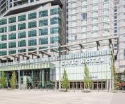
Civic Hotel Autograph Collection
EXECUTIVE PLAZA COQUITLAM
POCO INN AND SUITES HOTEL
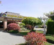
BEST WESTERN PLUS COQUITLAM
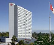
Sheraton Vancouver Guildford Hotel
Arundel Mansion
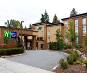
Holiday Inn Express & Suites SURREY
Four Points by Sheraton Surrey
Eagle Mountain Bed and Breakfast
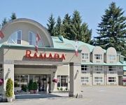
RAMADA COQUITLAM
Videos from this area
These are videos related to the place based on their proximity to this place.
2994 Pasture Circle Coquitlam BC - Real Estate Virtual Tour - Christine Solar
View http://christinesolar.com/mylistings.html/videos-46216908 to see PRICE and more PHOTOS. One of the best locations in Ranch Park - a Fully renovated home with a 3 bedroom suite. The present...
Port Moody Boardwalk and City Hall from Drone
Aerial video of Port moody City Hall and Boardwalk. It was a sunny winter day and I had noticed the view of the mountains over city hall in Port Moody. So I decided to pull over and have a...
[HD] Bad Drivers - Port Moody, BC Canada (Sudden Stop No Reason)
"Stopping in Middle of Road for No Reason is Dangerous" Silver car stops in the middle of road reason for no reason at all. There's no red light. There's no obstruction. And it's ironic that...
Dash Cam: A Close Call (Port Moody, British Columbia)
(1) There was a designated left-turn lane. (2) The left-turn was being made in the incorrect lane of travel. (3) There were no oncoming drivers that posed an immediate hazard. (4) The traffic...
Port Coquitlam & Port Moody Realtor Answers Real Estate Question of The Week
Port Coquitlam Realtor answers Real Estate question of the week. More at http://www.buybcrealestate.com Port Coquitlam Real Estate is one of the searches that brings new people to our websites....
PORT MOODY FIRE DEPARTMENT AT PROPANE LEAKE FROM TRUCK BY BCNEWSVIDEO
PORT MOODY FIRE DEPARTMENT AT PROPANE LEAKE FROM TRUCK ON ST GEORGE ST 300 BLK SEP 1 2010.m4v COPYRIGHT BCNEWSVIDEO SONY HDR CX550V LOW LIGHT TEST ...
3363 Viewmont Pl Port Moody BC - Real Estate Virtual Tour - Sandra Wyant
View http://sandrawyant.com/mylistings.html/videos-47230908 to see PRICE and more PHOTOS. Ready to invest in your future? View property just mins from Newport Village, all sorts of shopping,...
Port Moody Wearable Art Awards 2011 part 2
Second part of Tri-Cities Community Television's coverage of The Port Moody Art Centre's Wearable Art Awards in 2011.
#2507 - 651 Nootka Way, Port Moody - 2 Bed 2 Bath glorious Ocean View!
FOR FULL PROPERTY DETAILS: http://thisiscrazy.myhomemay.be/ Desirable Klahanie concrete tower apartment with stunning view of Burrard Inlet & Eagle Mountain. This 2 bedroom, 2 bathroom ...
Videos provided by Youtube are under the copyright of their owners.
Attractions and noteworthy things
Distances are based on the centre of the city/town and sightseeing location. This list contains brief abstracts about monuments, holiday activities, national parcs, museums, organisations and more from the area as well as interesting facts about the region itself. Where available, you'll find the corresponding homepage. Otherwise the related wikipedia article.
Centennial Secondary School (Coquitlam)
Centennial Secondary School is a high school located in Coquitlam, British Columbia, established in 1967, the centennial year of Canadian Confederation. It is part of School District 43 Coquitlam. Centennial has approximately 1600 students and is structured on a semester system. In addition to academic programs, it offers special programs such as Football, Computer Game Design, Culinary Arts, Automotive Technology, a Hockey Academy, and Experiential Studies.
Dr. Charles Best Secondary School
Dr. Charles Best Secondary School, is a public co-educational public high school located in Coquitlam, British Columbia. The school is named for Canadian physician Charles Best, one of the researchers responsible for the discovery of insulin as a treatment for diabetes. The school opened on March 22, 1971 as a Junior Secondary School serving students in Grades 8 through 10, and became a full secondary school (grades 9 through 12) in 2000. In 2001, the school added a French immersion program.
Coquitlam Sports Centre
Poirier Sport & Leisure Complex is a multi-purpose all-season recreation complex in Coquitlam, British Columbia. The facility is used by a wide variety of groups including hockey, lacrosse, and ringette teams, curlers, and figure skaters. The facility has 3 different playing surfaces. The main arena features an NHL standard 200' x 85' playing surface with seating for 2200 spectators. An annex provides an additional 200' x 85' playing surface and a six sheet curling rink.
Boulevard Casino
Boulevard Casino in Coquitlam, British Columbia is the largest casino in the province of British Columbia by gaming space. The casino is open 24 hours a day, is owned by Great Canadian Gaming, and features: 80,000 sq ft casino 1000 slot machines 70 table games including blackjack, roulette, baccarat, craps, etc.
Mundy Park
Mundy Park at 176 hectares, is the largest park in Coquitlam, British Columbia. The park has many walking trails that pass the park's two lakes - Mundy Lake and Lost Lake. There are also sports fields, a lacrosse box, an outdoor swimming pool, disc golf area, picnic area, and playground. The Coquitlam Reds of the B.C. Premier Baseball League play their home games at Mundy Park. Scenes from the 2006 Danny DeVito / Matthew Broderick film Deck the Halls were shot at Mundy Park.
Como Lake (British Columbia)
Como Lake is a small lake in the city of Coquitlam, British Columbia. It forms the headwaters of the Como watershed and is an urban fishing and recreation area in the city of Coquitlam as well as the Lower Mainland. The lake is very popular with joggers and walkers, the trail around the lake being 1 km in length. There are small stocked rainbow trout, carp, and catfish living in the lake.
Chimo Aquatic and Fitness Centre
The Chimo Aquatic and Fitness Centre is a 38,000-square-foot indoor aquatic centre located in central Coquitlam, British Columbia, next to the Coquitlam Sports Centre. The building was designed by Hughes Condon Marler Architects, built at a cost of $12.4 million (construction cost), and opened in the spring of 2008.
Fraser Mills
Fraser Mills is a neighbourhood and formerly separate village municipality in the southwestern part of Coquitlam, British Columbia. Located on the northern shore of the Fraser River, the area was originally the site of a sawmill. The mill was known at first as the Ross McLaren Mill and opened in 1889. However, it closed soon after when co-founder James McLaren died. The site remained unused for many years until the mill was reopened as the Fraser River Sawmills.







!['[HD] Bad Drivers - Port Moody, BC Canada (Sudden Stop No Reason)' preview picture of video '[HD] Bad Drivers - Port Moody, BC Canada (Sudden Stop No Reason)'](https://img.youtube.com/vi/fvHRedvesWs/mqdefault.jpg)


