Safety Score: 2,8 of 5.0 based on data from 9 authorites. Meaning we advice caution when travelling to Canada.
Travel warnings are updated daily. Source: Travel Warning Canada. Last Update: 2024-05-02 08:23:34
Discover Mary Hill
Mary Hill in British Columbia is a city in Canada about 2,185 mi (or 3,516 km) west of Ottawa, the country's capital city.
Local time in Mary Hill is now 03:24 PM (Thursday). The local timezone is named America / Vancouver with an UTC offset of -7 hours. We know of 11 airports in the vicinity of Mary Hill, of which 4 are larger airports. The closest airport in Canada is Boundary Bay Airport in a distance of 15 mi (or 24 km), South-West. Besides the airports, there are other travel options available (check left side).
There is one Unesco world heritage site nearby. The closest heritage site is Olympic National Park in United states at a distance of 103 mi (or 166 km). Also, if you like golfing, there are a few options in driving distance. We discovered 10 points of interest in the vicinity of this place. Looking for a place to stay? we compiled a list of available hotels close to the map centre further down the page.
When in this area, you might want to pay a visit to some of the following locations: Bellingham, Friday Harbor, Chilliwack, Mount Vernon and Victoria. To further explore this place, just scroll down and browse the available info.
Local weather forecast
Todays Local Weather Conditions & Forecast: 18°C / 64 °F
| Morning Temperature | 5°C / 41 °F |
| Evening Temperature | 15°C / 59 °F |
| Night Temperature | 8°C / 47 °F |
| Chance of rainfall | 0% |
| Air Humidity | 41% |
| Air Pressure | 1017 hPa |
| Wind Speed | Light breeze with 5 km/h (3 mph) from North-East |
| Cloud Conditions | Clear sky, covering 2% of sky |
| General Conditions | Sky is clear |
Thursday, 2nd of May 2024
19°C (67 °F)
11°C (52 °F)
Overcast clouds, light breeze.
Friday, 3rd of May 2024
13°C (56 °F)
8°C (46 °F)
Light rain, light breeze, overcast clouds.
Saturday, 4th of May 2024
8°C (46 °F)
7°C (44 °F)
Moderate rain, light breeze, overcast clouds.
Hotels and Places to Stay
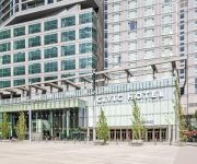
Civic Hotel Autograph Collection
POCO INN AND SUITES HOTEL
Four Points by Sheraton Surrey
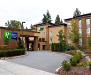
Holiday Inn Express & Suites SURREY
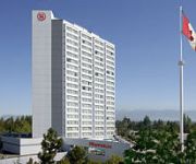
Sheraton Vancouver Guildford Hotel
Eagle Mountain Bed and Breakfast
BW KING GEORGE INN AND SUITES
Surrey Central Inn
Grouse Creek Motel
SANDMAN SUITES SURREY-GUILDFOR
Videos from this area
These are videos related to the place based on their proximity to this place.
Project 1999 EverQuest City of Mist.
Starting out in Cabilis, I venture forth to the Field of Bone, then to the Emerald Jungle in search of that elusive dungeon named the City of Mist! I get into a group and show a bit of what...
Coquitlam Police Code 5 Take Down at Gunpoint September 15 2014 Bcnewsvideo
Coquitlam police received a call about a possible stolen dump truck. After pulling a truck over at gunpoint on Kingsway, the police realized this was not the truck. They released the driver....
Port Coquitlam Motorcycle Crash On Broadway st September 15 2014
This bike was travelling south on Broadway st from Kingsway Ave, when this jeep pulled out to make a left turn. The motorcycle locked his brakes and crashed into the Jeep. The driver was ejected....
Samz Neighbourhood Pub|Coquitlam Pubs|Pubs In Surrey/Langley
The Lower Mainland's best pubs, restaurants, and liquor stores (Langley/Surrey and Port Coquitlam locations only) serving great food, providing exceptional service, and an amazing atmosphere...
Port Moody Pubs | Samz Pubs | Port Moody Beer & Liquor Stores
Port Moody Pubs - Port Moody Beer & Liquor Stores - Samz Neighbourhood Pub, Beer/Wine Stores and Liquor Stores have been a go-to destination with amazing selection so you won't need to visit...
Let's Roleplay DAI #57 Redcliffe Village.
The gates of Redcliffe are now open for us, and we go in and take advantage of this right away. We explore the village, and help who we can. Thanks for watching and don't forget to subscribe!
Let's Play Sid Meier's Civilization Beyond Earth #4 Founding a City.
We found our first city after the capital, and begin working on our first wonder. Thanks for watching and don't forget to subscribe!
Let's Roleplay DAO Awakening #9 City of Quests.
There is so much to do in Amaranthine, and we've gathered even more quests for here and elsewhere. Our list of things to do has only grown from exploring the city. Thanks for watching and...
Two Vehicle Accident Westwood st & Greene st Coquitlam City BC Canada
April 21 2015 Coquitlam, British Columbia, Canada A vehicle attempted to make a left hand turn and was struck by the other vehicle. One person was transported to hospital. Coquitlam Fire Departmen.
Let's Roleplay Baldur's Gate EE #39 Xvart Village.
In our continuing search for Captain Brage, we go west of Nashkel and encounter a hilly region with many Xvarts. Thanks for watching and don't forget to subscribe!
Videos provided by Youtube are under the copyright of their owners.
Attractions and noteworthy things
Distances are based on the centre of the city/town and sightseeing location. This list contains brief abstracts about monuments, holiday activities, national parcs, museums, organisations and more from the area as well as interesting facts about the region itself. Where available, you'll find the corresponding homepage. Otherwise the related wikipedia article.
Coquitlam River
The Coquitlam River is located in between the cities of Coquitlam and Port Coquitlam, suburban municipalities located in Metro Vancouver. This river is a tributary of the Fraser River. Each year hundreds of salmon return to spawn in the Coquitlam River. There is a reservoir near the headwaters of the river called Coquitlam Lake. This lake provides a large portion of Vancouver's drinking water. Part of the Port Coquitlam Tributary Trail and the Trans Canada trail run alongside this river.
Port Mann Bridge
The Port Mann Bridge is a newly designed 10-lane cable-stayed bridge that opened to traffic in 2012. It is currently the second longest cable-stayed bridge in North America and the widest bridge in the world. The new bridge replaced a steel bridge that spanned the Fraser River, connecting Coquitlam to Surrey in British Columbia near Vancouver.
Riverside Secondary School (British Columbia)
Riverside Secondary School is a public coeducational secondary school located in Port Coquitlam, British Columbia, Canada. It enrolls students from grades 9 to 12.
Tri-Cities (British Columbia)
The Tri-Cities are an informal grouping of three adjacent suburban cities and two villages in the north-east sector of Metro Vancouver in British Columbia. Combined, these five communities have a 2011 population of 218,509 residents:
Port Coquitlam Station
Port Coquitlam Station is a station on the West Coast Express commuter rail line connecting Vancouver to Mission, British Columbia, Canada. The station is located on the south side of the Canadian Pacific Railway (CPR) tracks in Port Coquitlam, just off Kingsway Avenue. The station opened in 1995, when the West Coast Express began operating. 280 park and ride spaces are available. All services are operated by TransLink.
Douglas Island (British Columbia)
Douglas Island is a 187-hectare island in British Columbia, Canada, located where the Fraser River and Pitt River meet. The island is uninhabited. The island was the property of Canadian Forest Products but the government bought it for $4.5 million.
Coast Meridian Overpass
The Coast Meridian Overpass is a new four-lane cable stayed bridge in Port Coquitlam, British Columbia crossing the Canadian Pacific railyard. The new bridge has a width of 25 metres, and a length of 580 m. The bridge also has a bike lane on the northbound side and a separated pedestrian walkway on the southbound side of the overpass.
Riverview Hospital (Coquitlam)
Riverview Hospital is a mental health facility located in Coquitlam, British Columbia, operating under the governance of BC Mental Health & Addiction Services. The site is currently only open to hospital traffic between 6:00am and 9:00pm.


