Safety Score: 2,8 of 5.0 based on data from 9 authorites. Meaning we advice caution when travelling to Canada.
Travel warnings are updated daily. Source: Travel Warning Canada. Last Update: 2024-05-05 08:24:42
Delve into Fleetwood
Fleetwood in British Columbia is located in Canada about 2,187 mi (or 3,519 km) west of Ottawa, the country's capital town.
Current time in Fleetwood is now 12:20 PM (Sunday). The local timezone is named America / Vancouver with an UTC offset of -7 hours. We know of 11 airports close to Fleetwood, of which 4 are larger airports. The closest airport in Canada is Boundary Bay Airport in a distance of 12 mi (or 19 km), South-West. Besides the airports, there are other travel options available (check left side).
There is one Unesco world heritage site nearby. The closest heritage site is Olympic National Park in United states at a distance of 99 mi (or 159 km). Also, if you like playing golf, there are some options within driving distance. We encountered 10 points of interest near this location. If you need a hotel, we compiled a list of available hotels close to the map centre further down the page.
While being here, you might want to pay a visit to some of the following locations: Bellingham, Friday Harbor, Chilliwack, Mount Vernon and Victoria. To further explore this place, just scroll down and browse the available info.
Local weather forecast
Todays Local Weather Conditions & Forecast: 11°C / 51 °F
| Morning Temperature | 10°C / 51 °F |
| Evening Temperature | 10°C / 50 °F |
| Night Temperature | 7°C / 45 °F |
| Chance of rainfall | 2% |
| Air Humidity | 87% |
| Air Pressure | 1004 hPa |
| Wind Speed | Moderate breeze with 9 km/h (6 mph) from North |
| Cloud Conditions | Overcast clouds, covering 100% of sky |
| General Conditions | Light rain |
Sunday, 5th of May 2024
11°C (51 °F)
6°C (44 °F)
Moderate rain, moderate breeze, broken clouds.
Monday, 6th of May 2024
12°C (54 °F)
6°C (43 °F)
Light rain, gentle breeze, few clouds.
Tuesday, 7th of May 2024
12°C (54 °F)
7°C (45 °F)
Overcast clouds, light breeze.
Hotels and Places to Stay
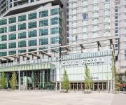
Civic Hotel Autograph Collection
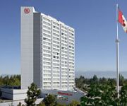
Sheraton Vancouver Guildford Hotel
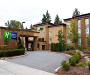
Holiday Inn Express & Suites SURREY
Four Points by Sheraton Surrey
BW KING GEORGE INN AND SUITES
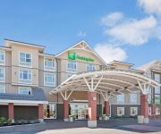
Holiday Inn & Suites SURREY EAST - CLOVERDALE
RAMADA COQUITLAM
Surrey Central Inn
Grouse Creek Motel
Clydesdale Inn
Videos from this area
These are videos related to the place based on their proximity to this place.
Mortgage Brokers Surrey BC
Visit us at www.bikkyvar.ca Dominion Lending Centres is a national mortgage brokerage and leasing company with more than 2000 members offering free expert advice across Canada - taking the...
14545 74 Ave Surrey BC - Real Estate Virtual Tour - Colin Hill
View http://www.seevirtual360.com/27549 to see PRICE and more PHOTOS. Custom -built home in a great location (Chimney Heights). Large 9 bedroom home with large open floor plan. Large dream...
Port Mann officially widest bridge in the world
The first week of tolling will be free to families and commuters when the new Port Mann Bridge officially opens in December. Transportation Minister Mary Polak made the announcement today at...
Driving over the new Port Mann Bridge on opening day
Decided to take a video of driving over the eastbound lane of the Port Mann Bridge, which opened today (Tuesday, Sept 18). Got a little impatient at Braid so I decided to cut through the one-lane...
New Port Mann Bridge opens to eight lanes of traffic
Premier Christy Clark today officially opened the new Port Mann Bridge to eight lanes of traffic, which cuts commute times and allows for the first regular transit service across the bridge...
Port Mann reaches milestone with centre span connection
The final, centre gap in the new Port Mann Bridge was closed, a major construction milestone that completes the bridge deck and superstructure required to open the bridge to traffic this December....
PORT MANN BRIDGE OCTOBER 18 2010 COPYRIGHT BCNEWSVIDEO
PANASONIC HDC TM700 REVIEW PORT MANN BRIDGE COPYRIGHT BY BCNEWSVIDEO BRITISH COLUMBIA CANADA oct 18 2010 RESOURCES NEEDED TO COMPLETE PROJECT 1158 ...
GANTRY CRANE PORT MANN BRIDGE CONSTRUCTION MAY 19 2011 BY BCNEWSVIDEO
GANTRY CRANE PORT MANN BRIDGE TRANS CANADA HWY 1 MAY 19 2011 BY BCNEWSVIDEO BRITISH COLUMBIA CANADA RESOURCES NEEDED TO COMPLETE PROJECT 1158 pre-cast ...
TIME LAPSE HD PORT MANN BRIDGE COPYRIGHT BCNEWSVIDEO MAY 25 2011
TIME LAPSE HD PORT MANN BRIDGE TRANS CANADA HWY 1 IMPROVEMENT PROJECT MAY 25 2011 BRITISH COLUMBIA CANADA BC COQUITLAM BY BCNEWSVIDEO RESOURCES ...
PORT MANN BRIDGE CONSTRUCTION WIDEST LONG SPAN BRIDGE IN THE WORLD BY BCNEWSVIDEO
PORT MANN BRIDGE WIDEST BRIDGE IN THE WORLD BY BCNEWSVIDEO RESOURCES NEEDED TO COMPLETE PROJECT 1158 pre-cast segments in the approach spans 25000 tonnes of ...
Videos provided by Youtube are under the copyright of their owners.
Attractions and noteworthy things
Distances are based on the centre of the city/town and sightseeing location. This list contains brief abstracts about monuments, holiday activities, national parcs, museums, organisations and more from the area as well as interesting facts about the region itself. Where available, you'll find the corresponding homepage. Otherwise the related wikipedia article.
School District 36 Surrey
School District 36 Surrey operates schools in Surrey, White Rock, and Barnston Island, British Columbia. It is the largest school district in British Columbia with 66,100 students during the 2005/2006 school year. District 36 includes 99 elementary schools, 20 secondary schools, and 6 learning centres. The first school in Surrey opened in 1882.
Fleetwood Town Centre
Fleetwood Town Centre or Fleetwood is a town centre of Surrey, British Columbia, Canada. According to the 2006 census, the population of Fleetwood was 50,284.
Enver Creek Secondary School
Enver Creek Secondary School is a public high school located in Surrey, British Columbia, Canada and is part of the School District 36 Surrey.
Fleetwood Park Secondary School
Fleetwood Park Secondary is a public high school in Surrey, British Columbia part of School District 36 Surrey. The school ranked 55 of 316 according to the Fraser Institute Studies in Education Policy in 2007–2008.
Fraser Heights Secondary School
Fraser Heights Secondary is a public high school in Surrey, British Columbia part of School District 36 Surrey. Around the school is a vast park area, a large field as well as the Fraser Heights Recreation Centre. The school is known for its high academic reputation in various subjects as well as its music and sports programs which have also been high ranking.
Johnston Heights Secondary School
Johnston Heights Secondary is a public high school in Surrey, British Columbia and is part of School District 36 Surrey. The newest building was built in 1989. Johnston Heights' exterior highly resembles that of its neighbouring high school, North Surrey Secondary School. The Canadian government chose to highlight the school for its program to improve intercultural understanding.
North Surrey Secondary School
North Surrey Secondary is a public high school in Surrey, British Columbia and is part of School District 36 Surrey. The current structure dates from 1994, but the site has been in use since 1949. During the 1999-2000 year, a track was constructed on property north of the main building. The school is notable for its drama and art departments, both of which have been the recipient of several awards. Several movies have been filmed at the school including Agent Cody Banks.
Holy Cross Regional High School
Holy Cross Regional High School, or "HCRHS," is a Catholic school, under the administration of CISVA (Catholic Independent Schools of the Vancouver Archdiocese) school board. Located in Surrey, British Columbia, Canada. Robert Dejulius (March 12, 1943) served 28 years as principal since the high school opened in 1982 and retired at the end of school season in 2010. Chris Blesch is the current principal. Stanley Kazun has also served as vice principal since the opening in 1982.


