Safety Score: 2,8 of 5.0 based on data from 9 authorites. Meaning we advice caution when travelling to Canada.
Travel warnings are updated daily. Source: Travel Warning Canada. Last Update: 2024-05-14 08:25:02
Discover Sunset Beach
Sunset Beach in Greater Vancouver Regional District (British Columbia) is a town in Canada about 2,203 mi (or 3,546 km) west of Ottawa, the country's capital city.
Current time in Sunset Beach is now 06:38 AM (Tuesday). The local timezone is named America / Vancouver with an UTC offset of -7 hours. We know of 10 airports near Sunset Beach, of which 4 are larger airports. The closest airport in Canada is Vancouver Harbour Water Aerodrome in a distance of 10 mi (or 15 km), South-East. Besides the airports, there are other travel options available (check left side).
There is one Unesco world heritage site nearby. The closest heritage site is Olympic National Park in United states at a distance of 118 mi (or 191 km). Also, if you like playing golf, there are a few options in driving distance. We discovered 10 points of interest in the vicinity of this place. Looking for a place to stay? we compiled a list of available hotels close to the map centre further down the page.
When in this area, you might want to pay a visit to some of the following locations: Friday Harbor, Victoria, Bellingham, Port Angeles and Coupeville. To further explore this place, just scroll down and browse the available info.
Local weather forecast
Todays Local Weather Conditions & Forecast: 14°C / 57 °F
| Morning Temperature | 11°C / 52 °F |
| Evening Temperature | 15°C / 58 °F |
| Night Temperature | 12°C / 54 °F |
| Chance of rainfall | 0% |
| Air Humidity | 76% |
| Air Pressure | 1021 hPa |
| Wind Speed | Light breeze with 4 km/h (2 mph) from East |
| Cloud Conditions | Overcast clouds, covering 99% of sky |
| General Conditions | Overcast clouds |
Tuesday, 14th of May 2024
14°C (56 °F)
13°C (56 °F)
Overcast clouds, light breeze.
Wednesday, 15th of May 2024
14°C (57 °F)
12°C (54 °F)
Light rain, gentle breeze, broken clouds.
Thursday, 16th of May 2024
14°C (57 °F)
10°C (50 °F)
Light rain, fresh breeze, scattered clouds.
Hotels and Places to Stay
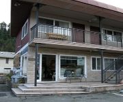
HORSESHOE BAY MOTEL
Videos from this area
These are videos related to the place based on their proximity to this place.
Hollyburn Mountain, Cypress
Just over an hour hike up, some of it enjoyable, some of it straight up. You feel like you're on top of the world, once you get there. 360' views and the Lions are just over there. February 2013.
Snowboard à Cypress Mountain
Une après midi de Snowboard à Cypress Mountain, BC, Canada. Filmé avec une GoPro HD + bandeau frontal monté sur casque. Montage réalisé avec Openshot.
Let's Ride CB500X // BC Highway 99 N - West Vancouver to Lions Bay
First post for this channel! Jeff rides the 2014 Honda CB500X to Lions Bay via Hwy 99 Northbound. Comments for future uploads are welcome and appreciated -- we want to make our videos better!
LIONS BAY
Lions Bay is a beautiful spot on the coast of Howe Sound British Columbia. Howe Sound is in dire need of conservation measures to return to health.
The West Lion - Panoramic Shot
Hiked "The Lions Binkert Trail". This trail is located just past West Vancouver in the town of Lions Bay. A shot from the top that shows the surrounding area.
Harleys Cornering on Sea to Sky
Four Hogs ripping up Hwy 99 by Lions Bay just north of Vancouver B.C.
NORTH BOWYER REEF
North Bowyer Reef is the beginning of a new video Marine Life Sanctuaries Society is producing to identify unique areas. This site is listed under the Rockfish Conservation Areas and has a...
Videos provided by Youtube are under the copyright of their owners.
Attractions and noteworthy things
Distances are based on the centre of the city/town and sightseeing location. This list contains brief abstracts about monuments, holiday activities, national parcs, museums, organisations and more from the area as well as interesting facts about the region itself. Where available, you'll find the corresponding homepage. Otherwise the related wikipedia article.
Horseshoe Bay, West Vancouver
Horseshoe Bay is a West Vancouver community of about 1,000 permanent residents. Situated right on the western tip of West Vancouver, at the entrance to Howe Sound, the village marks the western end of Highway 1 on the British Columbia mainland, as well as the southern end of the Sea-to-Sky Highway, with Lions Bay just 15 minutes north.
Whytecliff Park
Whytecliff park is located near West Vancouver's Horseshoe Bay Neighbourhood, the original name of which was White Cliff City, which opened in 1909. In 1914, Colonel Albert Whyte pressed for the spelling change from White Cliff City to Whytecliff. The Whytecliff area is now distinct from Horseshoe Bay. The park, originally Rockcliffe Park, was developed by W.W. Boultbee in 1926, and a private access road was cut from the Marine Drive highway at Batchelor Bay.
Bowyer Island
Bowyer Island is a small island in Howe Sound. It is located east of Bowen Island. BC Liberal politician, formerly Attorney-General of British Columbia, Geoff Plant is a seasonal resident. Bowyer Island was named by Capt. George Henry Richards of the HMS Plumper between 1857-1861, after Rear-Admiral George Bowyer, (1740-1800), commander of the HMS Barfleur during the Glorious First of June (all the names used in Howe Sound are in honour of the battle of the Glorious First of June).


