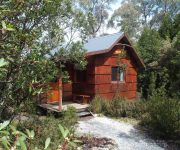
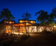
Delve into Waldheim
Waldheim in Kentish (Tasmania) is located in Australia about 473 mi (or 761 km) south of Canberra, the country's capital town.
Current time in Waldheim is now 11:48 PM (Saturday). The local timezone is named Australia / Hobart with an UTC offset of 10 hours. We know of 8 airports close to Waldheim. The closest airport in Australia is Queenstown Airport in a distance of 36 mi (or 58 km), South-West. Besides the airports, there are other travel options available (check left side).
There is one Unesco world heritage site nearby. It's Tasmanian Wilderness in a distance of 89 mi (or 144 km), North. If you need a hotel, we compiled a list of available hotels close to the map centre further down the page.
While being here, you might want to pay a visit to some of the following locations: Hobart, Currie, Melbourne, and . To further explore this place, just scroll down and browse the available info.
Local weather forecast
Todays Local Weather Conditions & Forecast: 15°C / 59 °F
| Morning Temperature | 12°C / 54 °F |
| Evening Temperature | 13°C / 55 °F |
| Night Temperature | 12°C / 53 °F |
| Chance of rainfall | 0% |
| Air Humidity | 66% |
| Air Pressure | 1034 hPa |
| Wind Speed | Gentle Breeze with 9 km/h (5 mph) from West |
| Cloud Conditions | Broken clouds, covering 74% of sky |
| General Conditions | Broken clouds |
Sunday, 12th of May 2024
14°C (58 °F)
14°C (57 °F)
Light rain, gentle breeze, scattered clouds.
Monday, 13th of May 2024
12°C (53 °F)
13°C (55 °F)
Moderate rain, fresh breeze, overcast clouds.
Tuesday, 14th of May 2024
15°C (59 °F)
11°C (51 °F)
Overcast clouds, gentle breeze.
Hotels and Places to Stay
CRADLE MOUNTAIN CHATEAU
Cradle Mountain Hotel
Cradle Mountain Highlanders Cottages
Cradle Mountain Wilderness Village
Attractions and noteworthy things
Distances are based on the centre of the city/town and sightseeing location. This list contains brief abstracts about monuments, holiday activities, national parcs, museums, organisations and more from the area as well as interesting facts about the region itself. Where available, you'll find the corresponding homepage. Otherwise the related wikipedia article.
Cradle Mountain
Cradle Mountain is a mountain in the Cradle Mountain-Lake St Clair National Park, Tasmania, Australia. Rising to 1,545 metres above sea level, it is one of the principal tourist sites in Tasmania, owing to its natural beauty. The Cradle Mountain is composed of dolerite columns, similar to many of the other mountains in the area.
Overland Track
The Overland Track is one of Australia's most famous bush walks, situated in the Cradle Mountain-Lake St Clair National Park, Tasmania. More than 8000 walkers each year complete the track. Officially, the track runs for 65 km from Cradle Mountain to Lake St Clair. However, many choose to add the hike along Lake St Clair as a natural extension, bringing the length to 82 km.
Artillery Knob
Artillery Knob is a mountain in the Cradle Mountain-Lake St Clair National Park in Tasmania, Australia. It is the 29th highest mountain in Tasmania. It is a prominent feature of the national park, and is a popular venue with bushwalkers.
Dove Lake (Tasmania)
Dove Lake is a corrie lake near Cradle Mountain in Tasmania, Australia. It lies in the Cradle Mountain-Lake St Clair National Park. The lake is a very popular visitor attraction and is encircled by well maintained walking paths which also lead up onto Cradle Mountain. Like several other lakes in the region, Lake Dove was formed by glaciation. The habitat is unique and includes the Tasmanian deciduous beech, tussock grasses, snow gums and pencil pines.


