Delve into Bradbury
The district Bradbury of Campbelltown in Campbelltown Municipality (New South Wales) is a district located in Australia about 127 mi north-east of Canberra, the country's capital town.
In need of a room? We compiled a list of available hotels close to the map centre further down the page.
Since you are here already, you might want to pay a visit to some of the following locations: Parramatta, Sydney, Katoomba, Canberra and . To further explore this place, just scroll down and browse the available info.
Local weather forecast
Todays Local Weather Conditions & Forecast: 13°C / 56 °F
| Morning Temperature | 13°C / 55 °F |
| Evening Temperature | 14°C / 57 °F |
| Night Temperature | 13°C / 55 °F |
| Chance of rainfall | 18% |
| Air Humidity | 97% |
| Air Pressure | 1025 hPa |
| Wind Speed | Light breeze with 4 km/h (3 mph) from North |
| Cloud Conditions | Overcast clouds, covering 100% of sky |
| General Conditions | Moderate rain |
Sunday, 5th of May 2024
14°C (57 °F)
13°C (56 °F)
Heavy intensity rain, gentle breeze, overcast clouds.
Monday, 6th of May 2024
18°C (64 °F)
14°C (58 °F)
Moderate rain, gentle breeze, clear sky.
Tuesday, 7th of May 2024
16°C (61 °F)
14°C (57 °F)
Light rain, light breeze, broken clouds.
Hotels and Places to Stay
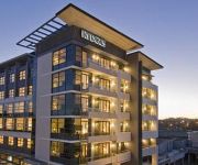
RYDGES CAMPBELLTOWN
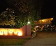
The Hermitage Motel
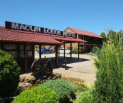
Maclin Lodge Motel
Western Sydney University Village-Campbelltown Campus
ibis budget Campbelltown
QUEST CAMPBELLTOWN
Videos from this area
These are videos related to the place based on their proximity to this place.
Dentist Campbelltown Preventive Dentistry
http://campbelltowndentalcare.com.au/campbelltown-dental-treatments/preventive-dentistry/ Dentist Campbelltown Preventive Dentistry The health of your teeth, gums, and mouth is something that...
Teeth Whitening Campbelltown
Teeth Whitening Campbelltown What are Dental Implants and why are they needed? Dental implants are titanium screws that are surgically placed in the bone. They are there to replace missing...
Campbelltown Sports Stadium and Athletics Centre
Many a great sportsman started life right here in Campbelltown... Campbelltown Sports Stadium is a first class venue with a capacity of 20000 spectators. Located within walking distance from...
Campbelltown on Show
Welcome to the City of Campbelltown - the capital of the Macarthur region. Located just 50 minutes from the Sydney CBD and within easy reach of major road and rail links to the Southern Highlands,...
Dentist Campbelltown: Dentures
http://campbelltowndentalcare.com.au/campbelltown-dental-treatments/dentures/ Dentist Campbelltowon: Dentures A denture can replace missing teeth and adjacent tissues. Although it can be argued...
Plumber Campbelltown 02 8310 4472 | Campbelltown Emergency Plumbing
http://emergencyplumber1.com/sydney Plumber Campbelltown 02 8310 4472 Campbelltown 24 hours a day, 7 days a week Emergency Plumber And Hot Water Service Repairs Looking for a plumber ...
Dentist Campbelltown: Restorative Dentistry
http://campbelltowndentalcare.com.au/campbelltown-dental-treatments/restorative-dentistry/ Dentist Campbelltown: Restorative Dentistry Restorative dentistry is a branch of modern dentistry...
Macarthur Castles - REVIEW - Campbelltown, Jumping Castles Review
Reviewed Macarthur Castles is a top reviewed Jumping Castle and Inflatable Slide business in Campbelltown and Macarthur. This video shows some of the excellent reviews and...
Dentist Campbelltown: Dental Crowns and Bridges
http://campbelltowndentalcare.com.au/campbelltown-dental-treatments/dental-crowns-bridges/ Dentist Campbelltown: Dental Crowns and Bridges Both crowns and bridges are fixed prosthetic devices.
Campbelltown skate facilities
The City of Campbelltown boasts three popular skate facilities. Skate parks are located in Leumeah and Macquarie Fields, with a smaller bowl facility in Bradbury. Visit www.campbelltown.nsw.gov.au/...
Videos provided by Youtube are under the copyright of their owners.
Attractions and noteworthy things
Distances are based on the centre of the city/town and sightseeing location. This list contains brief abstracts about monuments, holiday activities, national parcs, museums, organisations and more from the area as well as interesting facts about the region itself. Where available, you'll find the corresponding homepage. Otherwise the related wikipedia article.
Campbelltown, New South Wales
Campbelltown is a suburb in south-western Sydney, New South Wales. Campbelltown is located 60 kilometres south-west of the Sydney central business district and is the administrative centre for the local government area of the City of Campbelltown.
Eagle Vale, New South Wales
Eagle Vale is a suburb of Sydney, in the state of New South Wales, Australia. Eagle Vale is located 56 kilometres south-west of the Sydney central business district, in the local government area of the City of Campbelltown and is part of the Macarthur region. It is bordered by the suburbs of Eschol Park, Kearns, Raby, Blairmount, Woodbine, St Andrews and Claymore.
Campbelltown railway station
Campbelltown railway station is located in Campbelltown, a city on the south-western periphery of Sydney, New South Wales, Australia. It is officially located on the Main Southern line and is served by the South and Airport and East Hills lines. It is the main terminus of the Cumberland Line and most intercity Southern Highlands Line services. It is also served by some CountryLink services.
Airds, New South Wales
Airds is a suburb of Sydney, in the state of New South Wales, Australia. Airds is located 56 kilometres south-west of the Sydney central business district, in the local government area of the City of Campbelltown and is part of the Macarthur region. Airds is a predominantly residential area and the majority of houses within the suburb are owned by the New South Wales Department of Housing.
Ambarvale, New South Wales
Ambarvale is a suburb of south-western Sydney in the state of New South Wales, Australia. Ambarvale is located 55 kilometres south-west of the Sydney central business district, in the local government area of the City of Campbelltown and is part of the Macarthur region. The suburb is predominantly residential and contains a mix of public and private housing.
Macarthur railway station
Macarthur railway station is in the Sydney suburb of Campbelltown. It is on the Main South Line and is served by CityRail trains of the Airport and East Hills lines of the CityRail network. It is a terminus for electric trains. Diesel trains on the Southern Highlands line also stop here. The station is situated adjacent to Macarthur Square, which is the major shopping centre for the Macarthur region.
Leumeah railway station
Leumeah is a railway station in the south-western suburbs of Sydney and is situated on the Main South Line. It is within the Campbelltown City Council LGA, serving CityRail trains of the South, Cumberland and East Hills lines. It has two side platforms, with an overhead pedestrian bridge. The station is the main access station for Campbelltown Stadium, home of the Wests Tigers Rugby League team and to the Wests Club. It has been in use since 1886.
City of Campbelltown (New South Wales)
The City of Campbelltown is a local government area in the Macarthur region of south-western Sydney, in New South Wales, Australia. The area is located about 55 kilometres south west of the Sydney central business district and comprises 312 square kilometres . The Mayor of the City of Campbelltown is Cr. Sue Dobson, an independent Councillor.
St Helens Park, New South Wales
St Helens Park is a suburb of Sydney, in the state of New South Wales, Australia 56 kilometres south-west of the Sydney central business district, in the local government area of the City of Campbelltown. it is part of the Macarthur region.
Ruse, New South Wales
Ruse is a suburb of Sydney, in the state of New South Wales, Australia 52 kilometres south-west of the Sydney central business district, in the local government area of the City of Campbelltown.
Leumeah, New South Wales
Leumeah is a suburb of Sydney, in the state of New South Wales, Australia 52 kilometres south-west of the Sydney central business district, in the local government area of the City of Campbelltown. It is north of the suburb of Campbelltown and is part of the Macarthur region.
Rosemeadow, New South Wales
Rosemeadow is a suburb of Sydney, in the state of New South Wales, Australia. Rosemeadow is located 56 kilometres south-west of the Sydney central business district, in the local government area of the City of Campbelltown and is part of the Macarthur region.
Blairmount, New South Wales
Blairmount is a suburb of Sydney, in the state of New South Wales, Australia 58 kilometres south-west of the Sydney central business district, in the local government area of the City of Campbelltown. It is part of the Macarthur region. Its main road is Clydesdale Drive and its other streets are named after horse breeds.
Bradbury, New South Wales
Bradbury is a suburb of Sydney, in the state of New South Wales, Australia. Bradbury is located 54 kilometres south-west of the Sydney central business district, in the local government area of the City of Campbelltown and is part of the Macarthur region. The suburb features many areas of greenery with native trees characterising most streets. Many streets are home to a range of native trees.
Claymore, New South Wales
Claymore is a suburb of Sydney, in the state of New South Wales, Australia. Claymore is located 54 kilometres south-west of the Sydney central business district, in the local government area of the City of Campbelltown and is part of the Macarthur region. The majority of housing in Claymore is owned by Housing NSW. The streets are named after Australian artists.
Gilead, New South Wales
Gilead is a suburb of Sydney, in the state of New South Wales, Australia. Gilead is located 58 kilometres south-west of the Sydney central business district, in the local government area of the City of Campbelltown and is part of the Macarthur region.
Blair Athol, New South Wales
Blair Athol is a suburb of Sydney, in the state of New South Wales, Australia. Blair Athol is located 57 kilometres south-west of the Sydney central business district, in the local government area of the City of Campbelltown and is part of the Macarthur region.
Englorie Park, New South Wales
Englorie Park is a suburb of Sydney, in the state of New South Wales, Australia. Englorie Park is located 55 kilometres south-west of the Sydney central business district, in the local government area of the City of Campbelltown and is part of the Macarthur region. Englorie Park is a relatively small suburb, situated between the suburbs of Ambarvale, Campbelltown and Glen Alpine.
Glen Alpine, New South Wales
Glen Alpine is a suburb of Sydney, in the state of New South Wales, Australia. Glen Alpine is located 56 kilometres south-west of the Sydney central business district, in the local government area of the City of Campbelltown and is part of the Macarthur region.
Campbelltown Stadium
Campbelltown Stadium, formerly Orana Park and Campbelltown Sports Ground, is a rugby league stadium in Leumeah, New South Wales, Australia, owned by Campbelltown City Council. It is the full-time home ground for the Western Suburbs Magpies District Rugby League Football Club and is one of three home grounds for the Wests Tigers Rugby League Football Club.
Campbelltown High School of the Performing Arts
Thomas Reddall High School
Thomas Reddall High School is a public coeducational high school in the suburb of Ambarvale, New South Wales, Australia. The school was founded in 1991, with its first class completing the Higher School Certificate in 1996. Prior to 1991, the site of the present school was occupied by Ambarvale High School and made up entirely of demountable class rooms. Ambarvale High School was relocated to the suburb of Rosemeadow.
Leumeah High School
Leumeah High School is a comprehensive, co-educational secondary school. The grounds, landscaped by students and staff, provide a pleasant environment in which the school community work. A medium sized agricultural farm, equipped for specialist plant breeding, is a focus in the junior curriculum.
St Peter Parish, Cumberland
St Peter Parish is one of the 57 parishes of Cumberland County, New South Wales, a cadastral unit for use on land titles. Its eastern boundary is the Georges River. It is named after St Peters Anglican church, the oldest building in Campbelltown. {{#invoke:Coordinates|coord}}{{#coordinates:34|03|S|150|49|E|type:city|| |primary |name= }}
Manangle Parish, Cumberland
Manangle Parish, Cumberland (also spelled Menangle) is one of the 57 parishes of Cumberland County, New South Wales, a cadastral unit for use on land titles. Its eastern boundary is the Georges River, and western boundary the Nepean River. It includes the southern Sydney suburbs of Menangle Park, Gilead, Rosemeadow and part of Glen Alpine. Major roads in the area include the South Western Freeway, Menangle Road and Appin Road.


