Explore Gilead
The district Gilead of in Campbelltown Municipality (New South Wales) is located in Australia about 124 mi north-east of Canberra, the country's capital.
If you need a place to sleep, we compiled a list of available hotels close to the map centre further down the page.
Depending on your travel schedule, you might want to pay a visit to some of the following locations: Parramatta, Sydney, Katoomba, Canberra and . To further explore this place, just scroll down and browse the available info.
Local weather forecast
Todays Local Weather Conditions & Forecast: 13°C / 56 °F
| Morning Temperature | 13°C / 55 °F |
| Evening Temperature | 14°C / 57 °F |
| Night Temperature | 13°C / 55 °F |
| Chance of rainfall | 18% |
| Air Humidity | 97% |
| Air Pressure | 1025 hPa |
| Wind Speed | Light breeze with 4 km/h (3 mph) from North |
| Cloud Conditions | Overcast clouds, covering 100% of sky |
| General Conditions | Moderate rain |
Sunday, 5th of May 2024
14°C (57 °F)
13°C (56 °F)
Heavy intensity rain, gentle breeze, overcast clouds.
Monday, 6th of May 2024
18°C (64 °F)
14°C (58 °F)
Moderate rain, gentle breeze, clear sky.
Tuesday, 7th of May 2024
16°C (61 °F)
14°C (57 °F)
Light rain, light breeze, broken clouds.
Hotels and Places to Stay
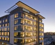
RYDGES CAMPBELLTOWN
Camden Valley Inn
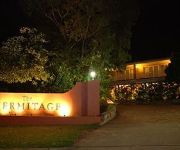
The Hermitage Motel
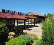
Maclin Lodge Motel
Western Sydney University Village-Campbelltown Campus
ibis budget Campbelltown
QUEST CAMPBELLTOWN
Videos from this area
These are videos related to the place based on their proximity to this place.
28 Grandview Drive, Campbelltown - Prudential Real Estate 4628 0033
INSPECT THIS SALE PROPERTY Property Address - 28 Grandview Drive, Campbelltown If you think this property may suit you, it's easy to arrange an inspection. Firstly, you can simply arrive...
Premiere Pro Tutorial - Teleporting And Time Travel Effect
Hello guys. This is a quick video of how to do teleport effect. Enjoy!
Fitzpatrick Group REVIEW - Campbelltown, Accountant Reviews
Reviewed The Fitzpatrick Group are top reviewed Accountants in Campbelltown and Macarthur. This video shows some of the excellent reviews and testimonials that have been offered...
SP34 at Campbelltown
A late running SP34 Explorer service from Canberra seen departing Macarthur and arriving at Campbelltown 26-10-09.
Trainspotting At Menangle Park Railway Station NSW
The ANZAC Weekend Southern Aurora Rail Cruise is seen passing through Menangle Park on an empty transfer lead by heritage diesels 4490, 4306 and 44211. Menangle Park is a town situated near.
1 Taber Street, Menangle Park
Menangle Park is around 5 minutes to Campbelltown and all its shops amd schools - but there is a lot going on here too. There is land of just over 2 acres for grabs right now - sound vague? ...
NSWRTM Thirlmere Flyer At Menangle Station NSW
The Thirlmere Flyer for 2014 was lead by Locomotive 3642 seen speeding through Menangle in the rain. The 10:29am servcice to Campbelltown is also seen carrying many passengers to the Inter...
44211+4001+4520 (LE - 6D64) at Menangle 9-11-12
RTM diesels 44211 & 4001 are captured returning to Thirlmere after collecting 4520 from MainTrain - Auburn.
Videos provided by Youtube are under the copyright of their owners.
Attractions and noteworthy things
Distances are based on the centre of the city/town and sightseeing location. This list contains brief abstracts about monuments, holiday activities, national parcs, museums, organisations and more from the area as well as interesting facts about the region itself. Where available, you'll find the corresponding homepage. Otherwise the related wikipedia article.
Division of Macarthur
The Division of Macarthur is an Australia Federal electoral division covering outer south-west Sydney. Its present boundaries cover the southern suburbs of Campbelltown, all of the local government area of Camden and small parts of Wollondilly. It covers 537 km² and is named after John Macarthur and his wife Elizabeth Macarthur, who were pioneers of Australia's wool industry.
Ambarvale, New South Wales
Ambarvale is a suburb of south-western Sydney in the state of New South Wales, Australia. Ambarvale is located 55 kilometres south-west of the Sydney central business district, in the local government area of the City of Campbelltown and is part of the Macarthur region. The suburb is predominantly residential and contains a mix of public and private housing.
Macarthur railway station
Macarthur railway station is in the Sydney suburb of Campbelltown. It is on the Main South Line and is served by CityRail trains of the Airport and East Hills lines of the CityRail network. It is a terminus for electric trains. Diesel trains on the Southern Highlands line also stop here. The station is situated adjacent to Macarthur Square, which is the major shopping centre for the Macarthur region.
Camden Park, New South Wales
Camden Park is an outer suburb of Sydney, New South Wales, Australia. It was named after John Macarthur's estate "Camden Park". While most of the suburb is farmland in Wollondilly Shire, the northern part of Camden Park has recently undergone suburban development as an extension of the suburb of Camden South. This development is named Bridgewater.
St Helens Park, New South Wales
St Helens Park is a suburb of Sydney, in the state of New South Wales, Australia 56 kilometres south-west of the Sydney central business district, in the local government area of the City of Campbelltown. it is part of the Macarthur region.
Narellan Vale, New South Wales
Narellan Vale is a suburb of the Macarthur Region of Sydney in the state of New South Wales, Australia in Camden Council.
Menangle Park, New South Wales
Menangle Park{{#invoke:Coordinates|coord}}{{#coordinates:34|6|10.58|S|150|44|32.79|E|region:AU | |name= }} is a village in the state of New South Wales, Australia. Menangle Park is located 56 kilometres south-west of the Sydney central business district, in the local government area of the City of Campbelltown. Menangle Park is a largely rural area and is part of the Macarthur region.
Spring Farm, New South Wales
Spring Farm is a suburb of the Macarthur Region of Sydney in the state of New South Wales, Australia in Camden Council. It is on the east side of the Nepean River. Until recently, it was mainly farmland with a winery, an electricity substation and the Jacks Gully landfill, but it is currently in the process of suburban redevelopment.
Mount Annan, New South Wales
Mount Annan is a suburb of Sydney, New South Wales. Mount Annan is located 60 kilometres south-west of the Sydney central business district, in the local government area of Camden Council and is part of the Macarthur region.
Rosemeadow, New South Wales
Rosemeadow is a suburb of Sydney, in the state of New South Wales, Australia. Rosemeadow is located 56 kilometres south-west of the Sydney central business district, in the local government area of the City of Campbelltown and is part of the Macarthur region.
Bradbury, New South Wales
Bradbury is a suburb of Sydney, in the state of New South Wales, Australia. Bradbury is located 54 kilometres south-west of the Sydney central business district, in the local government area of the City of Campbelltown and is part of the Macarthur region. The suburb features many areas of greenery with native trees characterising most streets. Many streets are home to a range of native trees.
Gilead, New South Wales
Gilead is a suburb of Sydney, in the state of New South Wales, Australia. Gilead is located 58 kilometres south-west of the Sydney central business district, in the local government area of the City of Campbelltown and is part of the Macarthur region.
Blair Athol, New South Wales
Blair Athol is a suburb of Sydney, in the state of New South Wales, Australia. Blair Athol is located 57 kilometres south-west of the Sydney central business district, in the local government area of the City of Campbelltown and is part of the Macarthur region.
Englorie Park, New South Wales
Englorie Park is a suburb of Sydney, in the state of New South Wales, Australia. Englorie Park is located 55 kilometres south-west of the Sydney central business district, in the local government area of the City of Campbelltown and is part of the Macarthur region. Englorie Park is a relatively small suburb, situated between the suburbs of Ambarvale, Campbelltown and Glen Alpine.
Glen Alpine, New South Wales
Glen Alpine is a suburb of Sydney, in the state of New South Wales, Australia. Glen Alpine is located 56 kilometres south-west of the Sydney central business district, in the local government area of the City of Campbelltown and is part of the Macarthur region.
Menangle Park railway station
Menangle Park Railway Station is a station on the Southern Highlands line of the CityRail intercity network, serving the town of Menangle Park, New South Wales, Australia. The station opened on 26 September 1937. The station has two side platforms that serve the diesel railcars that use the line. Passengers are required to cross the tracks on a pedestrian level crossing at the northern end of the station to access the opposite platform.
Menangle railway station
Menangle Railway Station is a station on the Southern Highlands line of the CityRail intercity network, serving the town of Menangle, New South Wales, Australia. The station opened on 1 July 1863. Its original buildings are now Heritage Listed. The station has two platforms that serve the diesel railcars that use the line.
Mount Annan Botanic Garden
Mount Annan Botanic Garden is a 416 hectare botanical garden in a hilly area of the southwestern Sydney suburb of Mount Annan, between Campbelltown and Camden, New South Wales. The Garden opened to the public in 1988, specializing in native plants, with a collection of over 4000 species. It is the largest botanical garden in Australia. After the discovery, on or about 10 September 1994, the Wollemi Pine was first cultivated there in 1995.
Menangle, New South Wales
Menangle is a village in the Macarthur Region of New South Wales, Australia.
Thomas Reddall High School
Thomas Reddall High School is a public coeducational high school in the suburb of Ambarvale, New South Wales, Australia. The school was founded in 1991, with its first class completing the Higher School Certificate in 1996. Prior to 1991, the site of the present school was occupied by Ambarvale High School and made up entirely of demountable class rooms. Ambarvale High School was relocated to the suburb of Rosemeadow.
Broughton Anglican College
Broughton Anglican College is a co-educational, Preparatory to Year 12 Christian school with approximately 850 students. It is a multi-campus facility, located at Menangle Park near Campbelltown, New South Wales.
Manangle Parish, Cumberland
Manangle Parish, Cumberland (also spelled Menangle) is one of the 57 parishes of Cumberland County, New South Wales, a cadastral unit for use on land titles. Its eastern boundary is the Georges River, and western boundary the Nepean River. It includes the southern Sydney suburbs of Menangle Park, Gilead, Rosemeadow and part of Glen Alpine. Major roads in the area include the South Western Freeway, Menangle Road and Appin Road.
Menangle Park Paceway
Menangle Park Paceway is a harness racing track operating in Menangle Park, New South Wales, Australia.
Glenlee railway station
Glenlee was a closed railway station on the Main South railway line in New South Wales, Australia. It was open between 1884 and 1947, and is now demolished with little trace remaining. North of the station site lies a triangle junction to the Glenlee colliery, the northern arm of which was electrified and served as the southern extent of electrification on the Main South line until it was cut back to Macarthur in the early 2000s.
Elizabeth Macarthur High School
Elizabeth Macarthur High School is an academically selective and community high school in New South Wales located in the suburb of Narellan Vale. The school is the first official partial selective high school in the Camden region, found on the outskirts of metropolitan Sydney. It is named in honour of Elizabeth Macarthur, wife of John Macarthur, who were agricultural pioneers of Australia, notable for the establishment of the Australian Merino wool industry.


