Safety Score: 2,7 of 5.0 based on data from 9 authorites. Meaning we advice caution when travelling to United States.
Travel warnings are updated daily. Source: Travel Warning United States. Last Update: 2024-05-17 08:07:57
Discover Pleasure Ridge Park
The district Pleasure Ridge Park of Pleasure Ridge Park (historical) in Jefferson County (Kentucky) with it's 25,813 citizens Pleasure Ridge Park is a district in United States about 479 mi west of Washington DC, the country's capital city.
Looking for a place to stay? we compiled a list of available hotels close to the map centre further down the page.
When in this area, you might want to pay a visit to some of the following locations: New Albany, Louisville, Jeffersonville, Shepherdsville and Corydon. To further explore this place, just scroll down and browse the available info.
Local weather forecast
Todays Local Weather Conditions & Forecast: 20°C / 68 °F
| Morning Temperature | 18°C / 64 °F |
| Evening Temperature | 18°C / 64 °F |
| Night Temperature | 17°C / 63 °F |
| Chance of rainfall | 22% |
| Air Humidity | 92% |
| Air Pressure | 1011 hPa |
| Wind Speed | Gentle Breeze with 6 km/h (4 mph) from North-West |
| Cloud Conditions | Overcast clouds, covering 100% of sky |
| General Conditions | Moderate rain |
Saturday, 18th of May 2024
19°C (66 °F)
19°C (66 °F)
Moderate rain, light breeze, overcast clouds.
Sunday, 19th of May 2024
26°C (78 °F)
19°C (67 °F)
Light rain, gentle breeze, broken clouds.
Monday, 20th of May 2024
28°C (82 °F)
21°C (70 °F)
Light rain, light breeze, broken clouds.
Hotels and Places to Stay
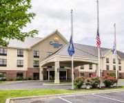
Comfort Inn Louisville
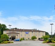
Americas Best Value Inn
COTTONWOOD SUITES LOUISVILLE
DAYS INN & SUITES LOUISVILLE S
Value Place Louisville CP
Videos from this area
These are videos related to the place based on their proximity to this place.
2001 Ford F-150 Used Cars Louisville KY
http://www.bradyautomotive.net This 2001 Ford F-150 is available from Brady Automotive. For details, call us at 502-216-4168.
Trent Erps #5 - Class of 2013 _v2
Trent Erps #5 midfielder for Christian Academy Louisville. Class of 2013. This video has been updated to include clips from Ultimate Performance Lacrosse (UPLax) in Annapolis, MD where Trent...
Haunted Attraction Animatronics & CO2 LN2 Night Club Special Effects Theatrical Events
Since 1996 http://www.kentuckyspecialfx.com has been Americas leader in special fx supplying venues with Animated Halloween Props, CO2 Ice Jets, Custom Halloween Decorations, Custom ...
Custom Built Animatronic Werewolf Project Halloween Prop Sandy Haunted House S Nevada Haunt
Sound & Motion Test 1 For Sandys custom animated Halloween werewolf project Nevada haunted attraction 2013. Built by http://www.kentuckyspecialfx.com building professional custom haunted ...
FLYING CRANK GHOST Animated Halloween Ghost Decoration FCG Haunt Prop
Professional Built Halloween Flying Crank Ghost Props and other custom Halloween themed animated Animatronic can be purchased at http://www.kentuckyspecialfx.com the number one leader in ...
Ottawa Yard Truck Transmission Mounted on Shock Absorbers - Louisville Switching
Ottawa Yard Truck Transmission Mounted on Shock Absorbers - Louisville Switching - (866) 879-8659 - Ottawa is always making improvements and will always stay ahead of the competition. Mounting.
Dante The Duck
Dante taking a walk. This is my 1st try at this i should get better so please don't be to harsh.
WakeAction.com — Shaun Murray and the Hyperlite Murray Nova Board
Wake board pro Shaun Murray gives the scoop on his new 2012 Hyperlite Murray Nova Board from the WakeAction.com booth at the Louisville Boat Show.
Owned Demolition / St. Clements Gym Demolition
This is the old St Clements church and school that is being demolished to build the new St Peter in Louisville, Ky. The house was left in place on purpose so it could act as a dust barrier...
Waverly Hills: Timmy the Child
Back in March of 2012, I visited the Waverly Sanatorium for an overnight visit. While it was extremely fun visit, I could only bring back one experience, and it is what I have presented in...
Videos provided by Youtube are under the copyright of their owners.
Attractions and noteworthy things
Distances are based on the centre of the city/town and sightseeing location. This list contains brief abstracts about monuments, holiday activities, national parcs, museums, organisations and more from the area as well as interesting facts about the region itself. Where available, you'll find the corresponding homepage. Otherwise the related wikipedia article.
Pleasure Ridge Park, Louisville
Pleasure Ridge Park is a former census-designated place in southwest Jefferson County, Kentucky, United States. The population was 26,212 at the 2010 census. In 2003, the area was annexed to the city of Louisville due to a merger between the city and Jefferson County's unincorporated communities. Pleasure Ridge Park is now a neighborhood within the city limits of Louisville.
St. Dennis, Louisville
St. Dennis is a census-designated place (CDP) in Jefferson County, Kentucky, United States. The population was 9,177 at the 2000 census.
Valley Station, Louisville
Valley Station is a former census-designated place in southwest Jefferson County, Kentucky, United States. The population was 22,946 at the 2000 census. When the government of Jefferson County merged with the city of Louisville, Kentucky in 2003, residents of Valley Station also became citizens of Louisville Metro. As a result, Valley Station is now a neighborhood within the city limits of Louisville. It was named for its location in the a valley between Muldraugh Hill and the Knobs.
Waverly Hills Sanatorium
The Waverly Hills Sanatorium is a closed sanatorium located in southwestern Louisville/Jefferson County, Kentucky. It opened in 1910 as a two-story hospital to accommodate 40 to 50 tuberculosis patients. In the early 1900s, Jefferson County was ravaged by an outbreak of tuberculosis (the "White Plague") which prompted the construction of a new hospital. The hospital closed in 1962, due to the antibiotic drug streptomycin that lowered the need for such a hospital.
Doss High School
Doss High School is a secondary school located in Louisville, Kentucky.
Horseshoe Southern Indiana
Horseshoe Southern Indiana, (formerly Caesars Indiana) is a riverboat casino operated by Caesars Entertainment Corporation. Opened in 1998, it is located outside the community of Elizabeth, Indiana, across the Ohio River from Louisville, Kentucky. The complex is located at the Harrison County line. This is the closest legal gambling location to Louisville and the large Southern Indiana cities because casino gambling is not allowed in neighboring Floyd County.
Cloverleaf, Louisville
Cloverleaf is a neighborhood in southwest Louisville, Kentucky. Its boundaries are I-264 to the north, Manslick Road to the east, Gagel Avenue to the south, and the Illinois Central railroad tracks to the east. It takes its name from Cloverleaf Acres, a development in the area. It is residential, and was annexed by Louisville in 1958.
Holy Cross High School (Louisville)
Holy Cross High School is a High school, located in Louisville, Kentucky, USA.
Greenwood, Louisville
Greenwood is a neighborhood of Louisville, Kentucky located along Cane Run Road and Greenwood Road. It is sometimes referred to by its large industrial park & shipping facility, Riverport.
Waverly Hills, Louisville
Waverly Hills is a neighborhood in Southwestern Louisville, Kentucky located centered at Dixie Highway and Pages Lane. It is located in a hilly section of the city, which is part of the larger Knobs Region which extends into Southeastern Kentucky. Its boundaries are roughly Stonestreet Road and 3rd Street Road to the South, Dixie Highway to the West, St Andrews Church Road to the North, and Auburndale to the East.
Bethany, Louisville
Bethany is a neighborhood of Louisville, Kentucky located on Dixie Highway by Bethany Cemetery.
Hunters Trace, Louisville
Hunters Trace is a neighborhood of Louisville, Kentucky located along Dixie Highway & Upper Hunters Trace.
Johnsontown, Louisville
Johnsontown is a neighborhood of Louisville, Kentucky located along Dixie Highway & Johnsontown Road.
Prairie Village, Louisville
Prairie Village is a neighborhood of Louisville, Kentucky centered along Third Street Road and Stonestreet Road.
Riverside Gardens, Louisville
Riverside Gardens is a neighborhood of Louisville, Kentucky centered along Campground Road & Lees Lane. In 2007, the first stretch of the proposed 110 mile Metro Loop Bike and pedestrian trail was completed to Lees Lane in Riverside Gardens from Riverview Park. The project included a $2 million bridge over Mill Creek. The concrete trail is expected to be connected to Shawnee Park by spring of 2008.
Lake Dreamland, Louisville
Lake Dreamland is a neighborhood of Louisville, Kentucky located along Campground Road and the Ohio River.
Valley Gardens, Louisville
Valley Gardens is a neighborhood of Louisville, Kentucky, in the United States. It is centered along Johnsontown Road and Terry Road.
Sylvania, Louisville
Sylvania is a neighborhood of Louisville, Kentucky located near Terry Road along Sylvania Road.
Parkwood, Louisville
Parkwood is a neighborhood of Louisville, Kentucky near Iroquois Park. It is located along Manslick Road and Gagel Avenue.
Valley Downs, Louisville
Valley Downs is a neighborhood of Louisville, Kentucky, USA located along Omar Khayyam Boulevard south of Johnsontown Road.
Farnsley Middle School
Farnsley Middle School is a school in Louisville, Kentucky, just southwest of downtown Louisville, Kentucky. It is ranked number one in the county and it is primarily focused on math, science, and technology. It has an afterschool technology program that lets the students experiment with and experience new technology. It also has afterschool math and science programs. Former National Basketball Association player, Clarence Glover, is an assistant principal.
WGZB-FM
WGZB-FM is an Urban Contemporary music formatted radio station licensed to Lanesville, Indiana, serving the Louisville, Kentucky area. The station is licensed by the FCC to broadcast with an ERP of 1,600 watts. In addition, the station operates a 295-watt booster as WGZB-FM1 to assist with the station's coverage.
Valley Traditional High School
For schools of the same name, see Valley High School Valley High School is a high school in Valley Station, Kentucky, Located at 10200 Dixie High Way. Valley became a "traditional" school in 1999 in an attempt to boost enrollment after it had fallen to 63% of capacity. Jefferson County High School - VALLEY was one of five high schools (each school's name denoted the section of the county that it was located in) that came about at a board of education meeting on Saturday, July 19, 1930.
Western MST Magnet High School (Louisville, Kentucky)
Western MST Magnet High School is a Public School in Louisville, Kentucky and is one of 51 high schools in Jefferson County School District. This Math Science Technology school offers programs that include: Early College, Culinary Arts, Geographic Information Systems, Help Desk, A+ certification, and Network+.
Pleasure Ridge Park Fire Protection District
The Pleasure Ridge Park Fire Protection District (abbreviated PRPFD) is one of seventeen volunteer and combination departments that make up the Jefferson County Fire Service. This department covers 56 square miles and serves the citizens of Pleasure Ridge Park and Valley Station in southwestern Jefferson County, Kentucky.


