Safety Score: 2,7 of 5.0 based on data from 9 authorites. Meaning we advice caution when travelling to United States.
Travel warnings are updated daily. Source: Travel Warning United States. Last Update: 2024-05-17 08:07:57
Discover Gorman
Gorman in Los Angeles County (California) is a town in United States about 2,309 mi (or 3,716 km) west of Washington DC, the country's capital city.
Current time in Gorman is now 03:22 AM (Friday). The local timezone is named America / Los Angeles with an UTC offset of -7 hours. We know of 10 airports near Gorman, of which 3 are larger airports. The closest airport in United States is Palmdale Regional/USAF Plant 42 Airport in a distance of 45 mi (or 73 km), East. Besides the airports, there are other travel options available (check left side).
Also, if you like playing golf, there are a few options in driving distance. Looking for a place to stay? we compiled a list of available hotels close to the map centre further down the page.
When in this area, you might want to pay a visit to some of the following locations: Bakersfield, Ventura, Santa Barbara, Los Angeles and Orange. To further explore this place, just scroll down and browse the available info.
Local weather forecast
Todays Local Weather Conditions & Forecast: 23°C / 73 °F
| Morning Temperature | 12°C / 53 °F |
| Evening Temperature | 22°C / 71 °F |
| Night Temperature | 14°C / 57 °F |
| Chance of rainfall | 0% |
| Air Humidity | 47% |
| Air Pressure | 1013 hPa |
| Wind Speed | Gentle Breeze with 8 km/h (5 mph) from North-East |
| Cloud Conditions | Clear sky, covering 0% of sky |
| General Conditions | Sky is clear |
Friday, 17th of May 2024
23°C (73 °F)
11°C (52 °F)
Sky is clear, moderate breeze, clear sky.
Saturday, 18th of May 2024
20°C (68 °F)
12°C (54 °F)
Sky is clear, gentle breeze, clear sky.
Sunday, 19th of May 2024
18°C (64 °F)
11°C (51 °F)
Broken clouds, moderate breeze.
Hotels and Places to Stay
Motel 6 Lebec
Holiday Inn Express & Suites FRAZIER PARK
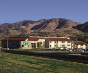
Econo Lodge Gorman
Videos from this area
These are videos related to the place based on their proximity to this place.
CampgroundViews.com - Pyramid Lake RV Resort Gorman California CA
http://www.CampgroundViews.com takes user submitted videos combined with professional editing to provide tent and RV campers with a first person view of a campground or RV park. Pyramid Lake...
Hungry Valley OHV gorman trail
2/1 いつものお仲間のNaoさんとHiroさんで ゴーマンライド 今回はGorman Trailをいつもと逆走してみました。 最高の景色です。
Helmet Cam - Gorman Motocross Race - Prospectors MC 2012 AMA So Cal MX
District King of the Track Moto 1 This is what it looks like when you put a bunch of desert guys on a motocross track! :) The better I get at the track, the more fun it is. This is more or...
CampgroundViews.com - Pyramid Lake Los Alamos Campground Gorman California CA US Forest Service
http://www.CampgroundViews.com takes user submitted videos combined with professional editing to provide tent and RV campers with a first person view of a campground or RV park. Pyramid Lake...
gorman/hungry valley/view fr antler/backbone-rider dego
Gorman Hungry Valley SRVA Sep 23, 2012 Various Trails: Rider Dego, Santa Monica, CA.
gorman/hungry valley/freemn hmstd rattler-rider dego
Gorman Hungry Valley SRVA Sep 23, 2012 Various Trails: Rider Dego, Santa Monica, CA.
Hungry Valley SVRA ATV Track
1999 Yamaha Blaster taking a lap around the ATV track at Hungry Valley SVRA, Gorman, CA.
Videos provided by Youtube are under the copyright of their owners.
Attractions and noteworthy things
Distances are based on the centre of the city/town and sightseeing location. This list contains brief abstracts about monuments, holiday activities, national parcs, museums, organisations and more from the area as well as interesting facts about the region itself. Where available, you'll find the corresponding homepage. Otherwise the related wikipedia article.
Tejon Pass
The Tejon Pass is a mountain pass, between the southwest end of the Tehachapi Mountains and northeastern San Emigdio Mountains, linking Northern California via the Central Valley to Southern California.
Peace Valley (Los Angeles County)
Peace Valley is a valley in the northern part of Los Angeles County east and southeast of Gorman.
Hungry Valley
Hungry Valley is a valley in the northern part of Los Angeles County south of Gorman.


