Safety Score: 3,5 of 5.0 based on data from 9 authorites. Meaning please reconsider your need to travel to Bosnia and Herzegovina.
Travel warnings are updated daily. Source: Travel Warning Bosnia and Herzegovina. Last Update: 2024-04-28 08:22:10
Discover Vlasulje
Vlasulje in Republika Srpska is a town in Bosnia and Herzegovina a little south-east of Sarajevo, the country's capital city.
Current time in Vlasulje is now 11:09 PM (Sunday). The local timezone is named Europe / Sarajevo with an UTC offset of 2 hours. We know of 11 airports near Vlasulje, of which 5 are larger airports. The closest airport in Bosnia and Herzegovina is Sarajevo International Airport in a distance of 7 mi (or 12 km), North-West. Besides the airports, there are other travel options available (check left side).
There are several Unesco world heritage sites nearby. The closest heritage site in Bosnia and Herzegovina is Old Bridge Area of the Old City of Mostar in a distance of 41 mi (or 66 km), South-West. Looking for a place to stay? we compiled a list of available hotels close to the map centre further down the page.
When in this area, you might want to pay a visit to some of the following locations: Trnovo, Lukavica, Sarajevo, Ilidza and Hresa. To further explore this place, just scroll down and browse the available info.
Local weather forecast
Todays Local Weather Conditions & Forecast: 20°C / 68 °F
| Morning Temperature | 7°C / 45 °F |
| Evening Temperature | 21°C / 69 °F |
| Night Temperature | 12°C / 53 °F |
| Chance of rainfall | 0% |
| Air Humidity | 45% |
| Air Pressure | 1021 hPa |
| Wind Speed | Light breeze with 3 km/h (2 mph) from North-West |
| Cloud Conditions | Few clouds, covering 20% of sky |
| General Conditions | Few clouds |
Monday, 29th of April 2024
22°C (72 °F)
12°C (54 °F)
Sky is clear, light breeze, clear sky.
Tuesday, 30th of April 2024
21°C (70 °F)
14°C (58 °F)
Sky is clear, gentle breeze, clear sky.
Wednesday, 1st of May 2024
21°C (69 °F)
12°C (53 °F)
Moderate rain, light breeze, overcast clouds.
Hotels and Places to Stay
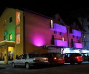
PANSION ARIZONA
Videos from this area
These are videos related to the place based on their proximity to this place.
A Guided Tour of The Austro-Hungarian Section of Sarajevo, Bosnia
http://www.TravelsWithSheila.com From the Bascarsija section (now you know why it is referred to as "Pigeon Square) into the Austro-Hungarian area of Sarajevo. Only a few of the ornate decorations...
Trebević joyride downhill
Riders: Ammar Sadović (Kona Stab Deluxe) & Irfan Hodžić (Giant Glory 01) (camera, edit) Location: Trebević mountain, Sarajevo, Bosnia-Herzegowina https://www.facebook.com/3OCK1.
Trebević kao nekad Hiljade Sarajlija uživalo u sunčanoj nedjelji
Više na http://goo.gl/cwlsRF | Video by Anadolu Agency | sarajevograd.BA.
Downhill Trebevic
Downhill to Dobre Vode in Trebevic mountain (1500m) Muddy and slippery tracks through forest Great fast ride in Bosnia Herzegovina Kuijpers Productions 2014 Soundtrack XPATS - Whatever it...
Bolnica Istočno Sarajevo - Kasindo 11.05.2014.
Najkasnije za deset dana počinju radovi na nadogradnji i rekonstrukciji dijelova Bolnice Istočno Sarajevo.
Morning run @Trebević, Sarajevo
Vozači: Irfan Hodžić (kamera) Faris Oruč Gabrijel Vilić Opremu je obezbijedio sponzor "Fitness Universe" - https://www.facebook.com/pages/Fitness-Universe/165420810178836.
Bolnica Istočno Sarajevo - Kasindo 07.02.2014.
Investitori iz Turske otvaraju privatnu kliniku za vantjelesnu oplodnju u Istočnom Sarajevu? * Ministar Bogdanić: Investicije su dobre i treba ulagati više. * Dr Ždrale: Izgradnja Bolnice...
Videos provided by Youtube are under the copyright of their owners.
Attractions and noteworthy things
Distances are based on the centre of the city/town and sightseeing location. This list contains brief abstracts about monuments, holiday activities, national parcs, museums, organisations and more from the area as well as interesting facts about the region itself. Where available, you'll find the corresponding homepage. Otherwise the related wikipedia article.
Kijevo, East Sarajevo
Kijevo is a part of the city of East Sarajevo in Trnovo municipality, City of East Sarajevo, Republika Srpska, Bosnia and Herzegovina. Kijevo is south of Sarajevo on the road M-18 Sarajevo-Trnovo-Foča-Trebinje. The closest airport is Sarajevo International Airport, located 9.7 km north west of Kijevo. The Željeznica river is one of the Kijevo's chief geographic features.
Bogatići
Bogatići is a village in the municipality of Trnovo, Bosnia and Herzegovina. According to the 1991 census it had a population of 77 people.
Čeružići
Čeružići is a village in the municipality of Trnovo, Bosnia and Herzegovina.
Grab (Trnovo)
Grab (Trnovo) is a village in the municipality of Trnovo, Bosnia and Herzegovina.
Jablanica (Trnovo)
Jablanica (Trnovo) is a village in the municipality of Trnovo, Bosnia and Herzegovina.
Mađari
Mađari is a village in the municipality of Trnovo, Bosnia and Herzegovina.
Podivič
Podivič is a village in the municipality of Trnovo, Bosnia and Herzegovina.
Klanac, Trnovo
Klanac (Trnovo) is a village in the municipality of Trnovo, Bosnia and Herzegovina.


