Discover Riverside
The district Riverside of in West Tamar (Tasmania) is a subburb in Australia about 439 mi south of Canberra, the country's capital city.
If you need a hotel, we compiled a list of available hotels close to the map centre further down the page.
While being here, you might want to pay a visit to some of the following locations: Hobart, Currie, Melbourne, and . To further explore this place, just scroll down and browse the available info.
Local weather forecast
Todays Local Weather Conditions & Forecast: 18°C / 64 °F
| Morning Temperature | 6°C / 43 °F |
| Evening Temperature | 10°C / 50 °F |
| Night Temperature | 9°C / 48 °F |
| Chance of rainfall | 0% |
| Air Humidity | 50% |
| Air Pressure | 1023 hPa |
| Wind Speed | Light breeze with 5 km/h (3 mph) from South-East |
| Cloud Conditions | Clear sky, covering 1% of sky |
| General Conditions | Sky is clear |
Sunday, 28th of April 2024
17°C (62 °F)
9°C (49 °F)
Overcast clouds, gentle breeze.
Monday, 29th of April 2024
15°C (59 °F)
5°C (40 °F)
Moderate rain, moderate breeze, clear sky.
Tuesday, 30th of April 2024
14°C (57 °F)
7°C (44 °F)
Sky is clear, light breeze, clear sky.
Hotels and Places to Stay
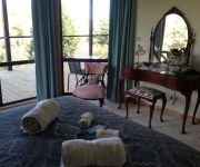
Launceston Bed and Breakfast Retreat
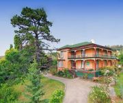
Trevallyn House
Quality Inn Edenholme Grange
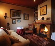
Alice's Cottages and Spa Hideaways
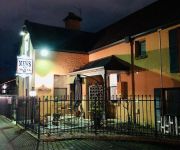
The Mews Motel
The Sebel Launceston
Auldington
COUNTRY CLUB VILLAS
COUNTRY CLUB TASMANIA
Aspect Tamar Valley Resort
Videos from this area
These are videos related to the place based on their proximity to this place.
Track Cycling - Indoor Velodrome - Launceston, Tasmania - Crash on final corner
Xmas Carnivals - Dec 28 2010. B Grade Keirin final, crash on the final corner making the end of the race pretty interesting.
Paul W at Slamduggery, Ciderhouse Launceston July 2014
My mate Paul performing some spoken word at a local poetry slam. This was his winning performance in the final.
Launceston Pony and Riding Club Home Ground Advantage
Launceston Pony and Riding Club seeks funding from Holden for an Arena Upgrade.
Australia Day 2013 à Launceston en Tasmanie
Retrouvez le Pari Australie de MixCity Radio sur http://www.mixcity.fm/le-pari-australie.
Launceston Skyline
Best of Launceston Skyline Launceston, Tasmania, Australia Population (2011 Estimate): 106153 Number of Buildings: 5.
Cataract Gorge Floodwaters Launceston Tasmania 14.08.09
Footage of floodwater coming down Cataract Gorge near Launceston, Tasmania filmed 14th August 2009.
Tours-TV.com: Launceston
Australia : Tasmania. (朗瑟士敦, ローンセストン). See on map http://tours-tv.com/en/Launceston-Valley .
Wallace Thornhill Tasmania visit 2014 part 1 - the Gorge
We hade a lovely lunch at the Stillwater Cafe and then went for a short walk to view the Cataract Gorge from the Kings Bridge over the Esk in Launceston Tasmania Australia. I know this as basalt...
Tour 2
Launceston Residential Retirement Village, Launceston, Tasmania, Australia http://launcestonresidentialvillage.com.au.
Videos provided by Youtube are under the copyright of their owners.
Attractions and noteworthy things
Distances are based on the centre of the city/town and sightseeing location. This list contains brief abstracts about monuments, holiday activities, national parcs, museums, organisations and more from the area as well as interesting facts about the region itself. Where available, you'll find the corresponding homepage. Otherwise the related wikipedia article.
Cataract Gorge
The Cataract Gorge is a river gorge in Launceston, northern Tasmania, Australia and is one of the region's premier tourist attractions. It is found at the lower section of the South Esk River. The earliest known European visitor to the site was William Collins, who discovered its entrance in 1804. A pathway, known as the King’s Bridge-Cataract Walk, and originally built by volunteers in the 1890s, runs along the north bank of the Cataract Gorge, and is a popular tourist destination.
Launceston Reception Centre
Launceston Reception Centre, formerly the Launceston Remand Centre, an Australian maximum security prison for male and female inmates held on remand, is located in Launceston, Tasmania. The facility is operated by the Tasmanian Prison Service, an agency of the Department of Justice of the Government of Tasmania.
Brooks High School (Launceston, Tasmania)
Brooks High School is an Australian public high school in Rocherlea, Tasmania. The school is co-educational, teaches grade seven to 10 and has around 700 students. The school services Invermay, Mayfield, Mowbray, Newnham, Ravenswood and Rocherlea and is part of the East Tamar Federation. The school also offers some vocation education training courses for grade 11 students. The school's students generally continue their education at Newstead and Launceston College.
Launceston Church Grammar School
Launceston Church Grammar School is an Anglican co-educational private school in Launceston, Tasmania, Australia for years kindergarten through to Year 12. Although founded in 1846, the present school was formed in 1981 from the amalgamation of the boys' Launceston Grammar School and girls' Broadland House, Church of England Girls' Grammar School.
Australian Maritime College
The Australian Maritime College (AMC) is a tertiary education institution based in Launceston, Tasmania and is an institute of the University of Tasmania. AMC is Australia's national centre for maritime education, training and research. It has two campuses located within 50 kilometres of each other in Northern Tasmania, each with different facilities and residence.
North Esk River
The North Esk River is a river in Tasmania, Australia. It is one of the tributaries of the Tamar River together with the South Esk River. It starts in the Northallerton Valley below Ben Nevis in the states North East joining with the St Patricks River, flowing through Launceston. Launceston's Old Seaport tourist feature is located on the North Esk River. The river becomes tidal downstream of Hoblers Bridge to where it meets the Tamar.
Launceston Christian School
Launceston Christian School is a private, co-educational day school based in Riverside, Launceston, Tasmania, Australia. Established in 1976, the school is operated and controlled by the 'Association For Christian Parent Controlled Schools (Launceston) Inc.'. http://www. lcs. tas. edu. au/parent-info/lcs-prospectus "LCS Prospectus"], Launceston Christian School, 7 June 2008. Launceston Christian caters for around 570 students from Kindergarten through to Year 12. The principal is Erik Hofsink.
Trevallyn Dam
The Trevallyn Dam is a dam on the South Esk River in Launceston, Tasmania, Australia and is used to provide water for hydroelectricity. The dam was completed in 1955 as part of the Trevallyn Hydro Electric Scheme and now holds the waters of Lake Trevallyn.
Trevallyn Power Station
Trevallyn Power Station is a hydroelectric power station on the Tamar River north of Launceston in Tasmania. It has four Francis turbines, with a combined generating capacity of 90 MW of electricity. It uses water diverted from the South Esk River by the Trevallyn Dam. The water enters the penstock tunnel 130 metres above sea level and leaves the power station at sea level, entering the Tamar River via the Tailrace Bay on Tie-Tree Bend.
Blackstone Heights, Tasmania
Blackstone Heights is an outer suburb of Launceston, Tasmania and is within the Meander Valley Council district.
Trevallyn, Tasmania
Trevallyn is a suburb of Launceston, in the north of Tasmania, Australia. It is located on the north western part of the city (west of the Tamar River and north of the South Esk River). It is the location of the Cataract Gorge and the Trevallyn Dam. It was the suburb in which Sir Benjamin Gill OAM called home while he lived at his home in Whitford Grove.
Queen Victoria Museum and Art Gallery
The Queen Victoria Museum and Art Gallery (QVMAG) is a museum located in Launceston, Tasmania, Australia. Established in 1891, the Queen Victoria has a strong reputation for its excellent collection, which includes fine exhibitions of colonial art, contemporary craft and design, Tasmanian history and natural sciences, specifically a zoology collection.
Legana, Tasmania
Legana is a small township on the Tamar River in northern Tasmania, Australia. It is 12 kilometres north of Tasmania's second largest city, Launceston. It is adjacent to Riverside, Bridgenorth, Grindelwald and Rosevears. At the 2006 census, Legana had a population of 2,500. The name "Legana" is based on the Aboriginal word for "fresh water" since it is at the point where the Tamar River becomes fresh water.
Kerslake Hall
Kerslake Hall is a residential college for full-time students of the University of Tasmania and Australian Maritime College. It is situated on the university's Newnham campus, Launceston, Australia. The residence is named after Irene Kerslake, a former lecturer at the Tasmanian College of Advanced Education and women's rights campaigner. The residence offers 107 self-catered rooms. Kerslake Hall is open to members of the public during university holidays, such as tourists and conference groups.
Hadspen, Tasmania
Hadspen is a small Australian town on the South Esk River in the north of Tasmania, just south west of Launceston. The centerpiece of the town is the historic property Entally House, the family home of Thomas Reibey who was the Premier of Tasmania from 1876 to 1877. Settlement began in the early 19th Century as a cluster of houses on the Launceston side of the river, near a frequently flooded ford. Over time various bridges were built, largely on the same site, across the river.
Grindelwald, Tasmania
Grindelwald is a small Swiss Village inspired town developed just north of Launceston by a Dutch immigrant to Tasmania, Roelf Vos, after he sold his supermarket chain to Woolworths. Since his son Mike Vos took over, the town was converted to a golfing center and many of the original attractions left to deteriorate. The strict building codes were also lifted and many new buildings do not reflect the Swiss theme.
Launceston College
Launceston College is located in Tasmania's second largest city of Launceston. The school offers a large variety of educational subjects for a considerable number of Tasmanians. The campus stretches over two city blocks and incorporates a state of the art gymnasium complex including a swimming pool with sauna and spa, two full size basketball courts, rock climbing wall, full weights gym and squash courts.
Riverside, Tasmania
Riverside is a residential suburb 4 kilometres north-west of the central business district of Launceston, Tasmania's second largest city. The West Tamar Highway runs through the suburb, adjoining Riverside to the West Tamar, which includes small towns: Beaconsfield, George Town and Beauty Point. Riverside is part of the West Tamar Council local government area, despite its close proximity to the Launceston CBD.
Mayfield, Tasmania
To the north of the Launceston CBD, Mayfield is situated close to the University of Tasmania campus and to the Australian Maritime College. House prices are affordable and there is an appeal for first home buyers being just a short five to ten minute drive to the city via the East Tamar Highway.
Travellers Rest, Tasmania
Travellers Rest is a very small southwestern suburb of Greater Launceston and has a population of 378. In the 19th century the area was largely uninhabited. At the junction where the road from Launceston branches—the branches lead now and led then to Longford and Hadspen—a Mr Cummings built a hotel in 1833. The hotel was initially called "Cumming's Folly" due to its distance from other buildings.
Windsor Park, Tasmania
Windsor Park is an Australian Rules football ground that is home to the Launceston Football Club and has been since 1968 when the club was a member of the former NTFA competition. It is currently a venue in the Tasmanian State League.
Tamar Island Wetlands
The Tamar Island Wetlands is a unique urban wetlands reserve near Launceston, Tasmania. It lies ten minutes' drive from Launceston on the West Tamar Highway. There are approximately 3.2 km of walking tracks at the wetlands including a boardwalk for easy access to the island.
Sacred Heart School, Launceston
Sacred Heart School is currently a Catholic Primary School in Launceston, Tasmania, noted for its historical roots, having been founded in 1873.
Country Club Casino
Country Club Tasmania is a casino in Launceston, Tasmania and is used for a variety of local events and is home to a 18 hole golf course. Targa Tasmania uses the casino as a starting point for the race.
Liffey River (Tasmania)
The Liffey River is a river in Northern Tasmania, Australia that flows from the Great Western Tiers to the Meander River near Carrick, and is one of its main tributaries. The Liffey has a modern catchment area of 224 square kilometres which has been modified by human activity, specifically diversion for irrigation. Flow is highly seasonal with the largest average monthly flows from July to September. The flow, and effective catchment area, are affected by irrigation diversion.


