Explore Wingfield
The district Wingfield of in Port Adelaide Enfield (South Australia) is located in Australia about 598 mi west of Canberra, the country's capital.
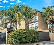
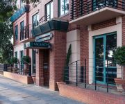
If you need a place to sleep, we compiled a list of available hotels close to the map centre further down the page.
Depending on your travel schedule, you might want to pay a visit to some of the following locations: Adelaide, Mitcham, Honiton, Koomooloo and Loxton. To further explore this place, just scroll down and browse the available info.
Local weather forecast
Todays Local Weather Conditions & Forecast: 19°C / 66 °F
| Morning Temperature | 11°C / 52 °F |
| Evening Temperature | 18°C / 64 °F |
| Night Temperature | 13°C / 56 °F |
| Chance of rainfall | 0% |
| Air Humidity | 47% |
| Air Pressure | 1029 hPa |
| Wind Speed | Gentle Breeze with 9 km/h (5 mph) from North-West |
| Cloud Conditions | Clear sky, covering 1% of sky |
| General Conditions | Sky is clear |
Friday, 3rd of May 2024
20°C (67 °F)
13°C (56 °F)
Sky is clear, gentle breeze, clear sky.
Saturday, 4th of May 2024
19°C (66 °F)
14°C (57 °F)
Sky is clear, gentle breeze, clear sky.
Sunday, 5th of May 2024
20°C (68 °F)
15°C (60 °F)
Few clouds, moderate breeze.
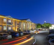
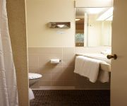
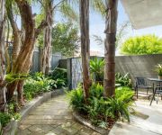
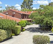
Hotels and Places to Stay
ADELAIDE INN
North Adelaide Boutique Stays Accommodation
ADELAIDE MERIDIEN HOTEL AND APARTMENTS
Adelaide DressCircle Apartments - Sussex St
Comfort Inn & Suites Sombrero
DRESSCIRCLE WARD ST
MAWSON LAKES HOTEL AND FUNCTION CENTRE
Majestic Tynte Street Apartments
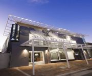
Majestic Minima Hotel
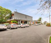
Findon Hotel
Videos from this area
These are videos related to the place based on their proximity to this place.
3109/3110 Arriving 'Wrong Way' at Woodville
During the recent Adelaide Station closure, Outer Harbor trains were terminated at Woodville. Here we see railcars 3109/3110 arriving from Outer harbor on the Down platform, ready to run back...
RIOT CITY WRESTLING - Pure Envy
Pure Envy Limos delivers the girls to the City Chicks Unleashed 2 event www.pureenvylimos.com.
Trains at Woodville Station
An Adelaide Metro train leaving Woodville Station while another is arriving. Notice how the one that is leaving hangs back so that the both cross the level crossing at the same time?
How to pay your rates at the City of Charles Sturt
Paying my Council rates at the City of Charles Sturt, 72 Woodville Road, Woodville, South Australia.
Adelaide Navratri Garba Festival, Woodville [Day 1 - 20/10/2012]
Swarnim SA - A Multi-Cultural Society - Proudly Supporting SA Power Networks Employee Foundation.
Adelaide Navratri Garba Festival, Woodville [Day 2 - 21/10/2012]
Swarnim SA - A Multi-Cultural Society - Proudly Supporting SA Power Networks Employee Foundation.
MND Ice Bucket Challenge 2014
City of Charles Sturt General Managers were nominated for the MND Ice Bucket Challenge and donation by Mayor Kirsten Alexander and Councillors Raelene Hanley and Juliann Andriani. Check out...
My Slideshow
I created this video with the YouTube Slideshow Creator (http://www.youtube.com/upload) Holiday destinations slides from Australia & BoraBora.
Videos provided by Youtube are under the copyright of their owners.
Attractions and noteworthy things
Distances are based on the centre of the city/town and sightseeing location. This list contains brief abstracts about monuments, holiday activities, national parcs, museums, organisations and more from the area as well as interesting facts about the region itself. Where available, you'll find the corresponding homepage. Otherwise the related wikipedia article.
Coopers Brewery
Coopers Brewery Limited, the largest Australian-owned brewery, is based in the Adelaide suburb of Regency Park, South Australia. Coopers is known for making a variety of high quality beers, the most famous of which are its Pale Ale and Sparkling Ale. It is also the world's largest producer of homebrewing equipment. Its shares are primarily owned by the extended Cooper family, and the company's constitution and classes of shares makes it difficult to sell shares outside the family.
Islington Works railway station
Islington Works railway station is a railway station on the Gawler Central railway line located in the inner northern Adelaide suburbs of Regency Park and Kilburn to serve the adjacent Islington Railway Workshops. It is located 6.6 km by railway from the Adelaide Railway Station, but is now in a state of disuse.
Blair Athol, South Australia
Blair Athol is located about 15 km north of the Adelaide, South Australia CBD. Blair Athol borders the suburbs of Gepps Cross, Enfield, Prospect and Kilburn. Blair Athol's main and longest street is Florence Avenue.
Enfield, South Australia
Enfield is a suburb in Adelaide, Australia. The suburb is about a 10 minute drive north from Adelaide CBD. (Central Business District). The suburb is bordered by Gepps Cross, Blair Athol and Clearview at the Northern end, and Prospect, Sefton Park and Broadview at the Southern end.
Kilburn, South Australia
Kilburn is a suburb located in the north of Adelaide, South Australia. The suburb borders Blair Athol, Gepps Cross, Wingfield, Regency Park and Prospect. Kilburn shares the same postcode as Blair Athol which is 5084 and was previously known as 'Little Chicago' before its name was changed during the 20th century.
Angle Park, South Australia
Angle Park is a north-western suburb of Adelaide 10 km from the CBD, in the state of South Australia, Australia and falls under the City of Port Adelaide Enfield. It is adjacent to Wingfield, Mansfield Park, Ferryden Park, and Regency Park. The post code for Angle Park is 5010. It is bounded to the north by Grand Junction Road, west by Trafford Street, and to the east by Days and South Road.
Ferryden Park, South Australia
Ferryden Park (postcode 5010) is a north-western suburb of Adelaide 9 km from the central business district, in the state of South Australia, Australia. Situated in the City of Port Adelaide Enfield local government area, it is adjacent to Kilkenny, Angle Park, Woodville Gardens, Croydon Park, and Regency Park. It is bounded to the north by Murray Street, west by Liberty Grove and Hassell Street, south by Regency Road and to the east by Days Road.
Woodville Gardens, South Australia
Woodville Gardens is a north-western suburb of Adelaide 10km from the CBD, in the state of South Australia, Australia and falls under the City of Port Adelaide Enfield. It is adjacent to Woodville North, Mansfield Park, Ferryden Park, and Kilkenny. The post code for Woodville Gardens is 5012. It is bounded to the south by First Avenue, and to the east by Liberty Grove, and to the west by Hanson Road.
Regency Park, South Australia
Regency Park is an inner-northern suburb of Adelaide, 8km from the City Centre, in the state of South Australia, Australia. It is located in the City of Port Adelaide Enfield, and is adjacent to Wingfield, Angle Park, Ferryden Park, Kilburn, Prospect, Dudley Park and Croydon Park. It is bounded to the north by Grand Junction Road, east by the Gawler train line, south by Regency Road and to the west by Days and South Roads. The postcode for Regency Park is 5010.
Athol Park, South Australia
Athol Park is a north-western suburb of Adelaide, South Australia. It is located in the City of Charles Sturt.
Woodville North, South Australia
Woodville North is a north-western suburb of Adelaide 10km from the Adelaide city centre, in the state of South Australia, Australia and falls under the City of Charles Sturt. The post code for Woodville North is 5012. It is adjacent to Pennington, Athol Park, Woodville Gardens, Mansfield Park, Woodville and Kilkenny. It is bordered to the east by Hanson Road to the west by Carlton Crescent, to the south by Torrens Road and to the north by Hamilton Road.
Islington railway station
Islington railway station is located on the Gawler railway line in the inner northern Adelaide suburbs of Dudley Park and Prospect. It is located 6.0 km by railway from the Adelaide Railway Station. The TNT yard adjacent to the station was used mainly by GMH (Holden) and TNT. The yard probably closed in the 1990s, and remained unused until 2008 when it was completely demolished to make way for a new residential development, which may include the station being re-built or upgraded.
Kilburn railway station, Adelaide
Kilburn railway station on the Gawler railway line is located in the inner northern Adelaide suburb of Kilburn, 7.7 km by rail from the Adelaide Railway Station. After the railway station first opened,Template:When? it was one of very few stations of the Adelaide Suburban system to have platforms either side of a level crossing. Nurlutta was the first station to have this feature. The feature was duplicated in 1976 when the Up platform at Seacliff was opened.
Dry Creek railway station
Dry Creek railway station on the Gawler Central railway line is located in the inner northern Adelaide suburb of Dry Creek, 10.6 km by rail from the Adelaide Railway Station.
Tube Mills railway station
Tube Mills railway station was a railway station on the Gawler railway line located in the inner northern Adelaide, Australia suburb of Kilburn. It was located approximately 8.4 km by railway from the Adelaide Railway Station, and was demolished in the late 1980s. The British Tube Mills (later Tubemakers) factory was located adjacent and the station could only be accessed from the factory.
Dry Creek, South Australia
Dry Creek is a mostly industrial suburb north of Adelaide, containing significant wetlands and a substantial area devoted to salt crystallization pans, managed by Cheetham Salt Limited. It is named for Dry Creek, a stream and drain which flows out to Gulf St Vincent through the Barker Inlet on the north-east border of the suburb. It was the site of the soapworks of W. H.
Wingfield, South Australia
Wingfield is a suburb situated north of Adelaide and is located on Grand Junction Road. The suburb borders Gepps Cross and Dry Creek.
Mansfield Park, South Australia
Mansfield Park is a north-western suburb of Adelaide 10 km from the CBD, in the state of South Australia, Australia and falls under the City of Port Adelaide Enfield. It is adjacent to Wingfield, Angle Park, Woodville Gardens, and Athol Park. The postcode for Mansfield Park is 5012. It is bounded to the north by Grand Junction Road, and to the west by Hanson Road. It is named after the corresponding location in Ayrshire, Scotland.
Mikawomma Reserve
The Mikawomma Reserve is found in the suburb of Woodville Gardens on the corner of Liberty Grove & Ridley Grove in South Australia, Australia. Mikawomma is the Kaurna name for the plain that lies between Adelaide and Port Adelaide. On (at) Mika plain, lived many old men . The Kaurna people are the traditional custodians of the Adelaide Plains area. The landscape design and the artworks in Mikawomma Reserve reflect indigenous plants and animals as well as culture and history.
Centro Arndale
Centro Arndale Shopping Centre is located at {{#invoke:Coordinates|coord}}{{#coordinates:-34.8744|138.5495|region:AU-SA_type:landmark|||||| |primary |name= }} in the suburb of Kilkenny in Adelaide and is currently managed by the Centro Properties Group. It was previously managed by The Westfield Group. The facility is located on a main arterial, Torrens Road.
Kilkenny, South Australia
Kilkenny is an inner north-western suburb of Adelaide, South Australia. It is located in the City of Charles Sturt.
Greyhound Park
Greyhound Park is the only greyhound racing venue located in Adelaide, South Australia and has an approximate capacity of around 4,000. The track held its first registered meeting with full betting facilities on 20 April 1972. The track has a sand surface and a cable lure system and is 457 m long with a width of 6.5 m . There are full Totalisator Agency Board (TAB) facilities and bookmakers on site with race meetings taking place on Monday and Thursday nights and Wednesday mornings.
Ottoway, South Australia
Ottoway is an industrial suburb of Adelaide, South Australia in the City of Port Adelaide Enfield local government area. It is around 12 km west-northwest of the city centre.
Ferryden Park Primary School
Ferryden Park Primary School was a primary school in the Adelaide inner north west suburb of Ferryden Park. In 1959 the student enrolment at the school peaked at 639 students, due in part to the post-war boom of the 1950s. Ferryden Park Primary School closed at the end of 2010. It merged with four similar schools of the area to form a new school to be called Woodville Gardens School and based at the old Ridley Grove Primary School.
Hinsdale Greyhound Park
The Hinsdale Greyhound Park was a horse racing track in Hinsdale, New Hampshire operational from 1958 until 2008.






!['Adelaide Navratri Garba Festival, Woodville [Day 1 - 20/10/2012]' preview picture of video 'Adelaide Navratri Garba Festival, Woodville [Day 1 - 20/10/2012]'](https://img.youtube.com/vi/u56aNOfD1b8/mqdefault.jpg)
!['Adelaide Navratri Garba Festival, Woodville [Day 2 - 21/10/2012]' preview picture of video 'Adelaide Navratri Garba Festival, Woodville [Day 2 - 21/10/2012]'](https://img.youtube.com/vi/FgmfOzSDwkA/mqdefault.jpg)


