Discover Marion
Marion in Marion (South Australia) with it's 3,626 citizens is a place in Australia about 597 mi (or 962 km) west of Canberra, the country's capital city.
Current time in Marion is now 09:36 AM (Thursday). The local timezone is named Australia / Adelaide with an UTC offset of 9.5 hours. We know of 8 airports near Marion. The closest airport in Australia is Adelaide International Airport in a distance of 4 mi (or 7 km), North. Besides the airports, there are other travel options available (check left side).
We encountered 2 points of interest in the vicinity of this place. If you need a hotel, we compiled a list of available hotels close to the map centre further down the page.
While being here, you might want to pay a visit to some of the following locations: Mitcham, Adelaide, Honiton, Koomooloo and Loxton. To further explore this place, just scroll down and browse the available info.
Local weather forecast
Todays Local Weather Conditions & Forecast: 17°C / 62 °F
| Morning Temperature | 14°C / 58 °F |
| Evening Temperature | 16°C / 60 °F |
| Night Temperature | 12°C / 53 °F |
| Chance of rainfall | 0% |
| Air Humidity | 62% |
| Air Pressure | 1029 hPa |
| Wind Speed | Gentle Breeze with 8 km/h (5 mph) from North |
| Cloud Conditions | Scattered clouds, covering 29% of sky |
| General Conditions | Light rain |
Friday, 26th of April 2024
17°C (63 °F)
12°C (53 °F)
Sky is clear, gentle breeze, clear sky.
Saturday, 27th of April 2024
16°C (60 °F)
14°C (57 °F)
Broken clouds, light breeze.
Sunday, 28th of April 2024
18°C (65 °F)
16°C (61 °F)
Sky is clear, light breeze, clear sky.
Hotels and Places to Stay
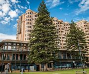
Stamford Grand Adelaide
Oaks Liberty Towers
RNR APARTMENTS ADELAIDE
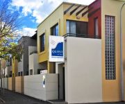
Quest King William South
Glenelg Pacific Apartments
Ensenada Motor Inn and Suites
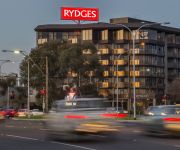
RYDGES SOUTHPARK ADELAIDE
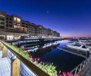
Oaks Plaza Pier
Jasper Motor Inn
The Wright Lodge
Videos from this area
These are videos related to the place based on their proximity to this place.
DEAD ISLAND | City of Moresby
Dead Island on computer, Act II in the city of Moresby Dead Island Wikia: http://deadisland.wikia.com/wiki/Walkthrough:Dead_Island:Act_II.
Travel Stories [MAPS Film School13]
3 animated travel anecdotes. Directed by Sophie Morgan. Work completed at MAPS Film School in Adelaide Sth Australia.
Harvesting Success: The launch of OzHarvest in the south of Adelaide
The Cities of Marion and Holdfast Bay used the 2013 Anti-Poverty Day to announce teaming up with OzHarvest to expand the reach of the service in the region. The City of Marion Healthy Communities.
Marion in a Minute: Oaklands wetland - Families flock to 'water farm'
The sound of parrots fill the air, dragonflies skim the water and a family strolls along a walking trail. This is Oaklands wetland on an autumn evening after it opened to the public in December...
Beneath the Shelling [MAPS Film School14]
A Film about civil war by Waeel Wayne Nassereddine. Hospitals are shut down due to ongoing attacks and rebels have now taken control over the city. We follow a boys desire to help his injured...
Grace [MAPS Film School14]
A film directed by Katherine Allen. A grieving astronaut widow is given an unexpected chance to save her husband through a powerful talisman she finds on the beach Tags: space capsule, crystal,...
Bad Driver Adelaide - can't merge 31-03-2014
Driver of red Corolla (rego: S858 AGU) speeds up at last minute (and exceeds the posted limit) to squeeze through despite there being no cars behind or to my right. Then proceeds to actually...
Bear Hunt: The Quest for Gin [MAPS Film School12]
Two English knights take a journey across town to acquire some gin. What will happen when they make it past the many obstacles that lie in their way? Will they press on like good Englishmen...
UNCHARTED ISLAND TEASER
This is the teaser trailer for my upcoming short film 'UNCHARTED ISLAND'. The film is about two dim-witted pirates that find a treasure map and decide journey across the island that they've...
Compass Australia Homes
Compass Australia Homes is proud to be forte in making Australia the great country that it is, here are some of our fine projects.
Videos provided by Youtube are under the copyright of their owners.
Attractions and noteworthy things
Distances are based on the centre of the city/town and sightseeing location. This list contains brief abstracts about monuments, holiday activities, national parcs, museums, organisations and more from the area as well as interesting facts about the region itself. Where available, you'll find the corresponding homepage. Otherwise the related wikipedia article.
Oaklands railway station
Oaklands Interchange railway station is a station on the Noarlunga Centre railway line, and is located in the southwestern Adelaide suburb of Oaklands Park. It is located 12.8 km by railway from the Adelaide Railway Station and approximately 500m from Westfield Marion.
Marion, South Australia
Marion is a suburb in the City of Marion in Adelaide around 10 km south-west of the CBD. Founded as a rural village in 1838 on the banks of the Sturt River, Marion was found to have rich soil and the population expanded rapidly. Colonel William Light laid out the plan for the village, as he had done with the City of Adelaide itself.
City of Marion
The City of Marion is a local government area in the southern suburbs of Adelaide, South Australia. The council offices are in the suburb of Sturt.
Mitchell Park, South Australia
Mitchell Park is a suburb south of Adelaide. It shares common boundaries with Marion, Bedford Park, Clovelly Park, and Ascot Park. In recent years it has undergone major redevelopments through a program of urban renewal which included the renovation of many properties owned by the former South Australian Housing Trust. These projects have won many awards. The Tonsley railway line passes through the suburb, stopping at Mitchell Park railway station.
Park Holme, South Australia
Park Holme is a suburb of Adelaide in the City of Marion, South Australia, home to the Marion Swimming Centre. Park Holme Post Office opened on 23 June 1960.
Oaklands Park, South Australia
Oaklands Park is a suburb of Adelaide, South Australia in the City of Marion. The Marion Shopping Centre is the suburb's main attraction.
Warradale, South Australia
Warradale is a suburb of Adelaide in the City of Marion. The name Warradale, deriving from Warra, an Aboriginal word for timber, has an interesting origin. It is located in the south western part of Adelaide and serviced by a train station and several main roads.
Sturt, South Australia
Sturt is a suburb of Adelaide in the City of Marion local government area. It was named after the explorer Captain Charles Sturt. Sturt is in the South Australian House of Assembly electoral district of Mitchell and the Australian House of Representatives Division of Boothby.
Marion railway station
Marion railway station is a railway station on the Noarlunga Centre railway line, and is located in the southwestern Adelaide suburb of Marion. It is located 11.4 km by railway from the Adelaide Railway Station.
Mitchell Park railway station
Mitchell Park railway station is a railway station on the Tonsley railway line, and is located in the southwestern Adelaide suburbs of Mitchell Park and Clovelly Park. It is located 11.5km by railway from the Adelaide Railway Station. Since its opening, there have been no significant changes to the station, besides the addition of a newer speaker system. This station is currently closed and could reopen in late 2013.
Clovelly Park railway station
Clovelly Park railway station is a railway station on the Tonsley railway line, and is located in the southwestern Adelaide suburbs of Mitchell Park and Clovelly Park. It is located 12.1km by railway from the Adelaide Railway Station. It was previously known as Chrysler Park railway station. This station is currently closed and may reopen in late 2013.
Sacred Heart College Middle School
Sacred Heart College Middle School is an all-boys school founded in 1967 in Mitchell Park, Adelaide, South Australia that serves boys in Years 6 to 9. Sacred Heart College Middle School is a feeder school for Sacred Heart College Senior. The Middle School belongs to a group of 3 educational facilities, the Tri-School partnership. This group consists of Sacred Heart College Senior, Sacred Heart College Middle School and Marymount College.







!['Travel Stories [MAPS Film School13]' preview picture of video 'Travel Stories [MAPS Film School13]'](https://img.youtube.com/vi/GbERtz30yug/mqdefault.jpg)


!['Beneath the Shelling [MAPS Film School14]' preview picture of video 'Beneath the Shelling [MAPS Film School14]'](https://img.youtube.com/vi/dqADbRW5Y_c/mqdefault.jpg)
!['Grace [MAPS Film School14]' preview picture of video 'Grace [MAPS Film School14]'](https://img.youtube.com/vi/3sAhtxhu90Q/mqdefault.jpg)

!['Bear Hunt: The Quest for Gin [MAPS Film School12]' preview picture of video 'Bear Hunt: The Quest for Gin [MAPS Film School12]'](https://img.youtube.com/vi/11Dpk0EvwsU/mqdefault.jpg)


