Discover Glanville
The district Glanville of in Port Adelaide Enfield (South Australia) is a district in Australia about 602 mi west of Canberra, the country's capital city.
Looking for a place to stay? we compiled a list of available hotels close to the map centre further down the page.
When in this area, you might want to pay a visit to some of the following locations: Adelaide, Mitcham, Honiton, Koomooloo and Whyalla. To further explore this place, just scroll down and browse the available info.
Local weather forecast
Todays Local Weather Conditions & Forecast: 18°C / 64 °F
| Morning Temperature | 13°C / 56 °F |
| Evening Temperature | 19°C / 65 °F |
| Night Temperature | 15°C / 58 °F |
| Chance of rainfall | 0% |
| Air Humidity | 53% |
| Air Pressure | 1030 hPa |
| Wind Speed | Gentle Breeze with 6 km/h (4 mph) from West |
| Cloud Conditions | Clear sky, covering 0% of sky |
| General Conditions | Sky is clear |
Tuesday, 7th of May 2024
19°C (66 °F)
15°C (60 °F)
Sky is clear, moderate breeze, clear sky.
Wednesday, 8th of May 2024
20°C (68 °F)
16°C (60 °F)
Sky is clear, gentle breeze, clear sky.
Thursday, 9th of May 2024
20°C (68 °F)
16°C (62 °F)
Overcast clouds, gentle breeze.
Hotels and Places to Stay
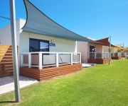
Discovery Parks – Adelaide Beachfront
Hendon Hotel
Links Hotel
Lindy Lodge Motel
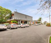
Findon Hotel
City West Motel
Port Adelaide Backpackers
CHIFLEY ON SOUTH TERRACE
Videos from this area
These are videos related to the place based on their proximity to this place.
Port Adelaide - Carrera Rally 2014 (14/12/14)
A short teaser video made from a couple of clips taken on the day of the Carrera Rally in Port Adelaide, South Australia. The main car featured in this video is Luke Boomer's race-built Laurel.
Port Adelaide Carpet Cleaning Service - CALL 08 7100 1225
We specialize in budget carpet cleaning services in Port Adelaide, surrounding services and greater metropolitan Adelaide. We provide a fast, reliable carpet cleaning service that includes,...
Port Adelaide, Adelaide, South Australia
See Port Adelaide and Australia- travel guides - videos, photos, accommodation and holiday information.
Port Adelaide Rowing Regatta - January 2013
The Port Adelaide Rowing Club hosted their first regatta since the 1930s on Saturday morning, 26 January 2013. The Australia Day Sprint Regatta christened an artificial beach, which was built...
Port Adelaide Motorsport Carrera
The footage was recorded at the Port Adelaide Carrera on the 14th of December. More information on the rally sprint can be found below. http://www.bensonmotorsports.com/#!port-adelaide/c22po.
Port Adelaide Caledonian Society- Burns Supper_Food Lovers Guide to Australia.
In January 2002 the SBS Network filmed a segment for their "Food Lover's Guide to Australia" at the Port Adelaide Caledonian Society's Burns Supper, featuring Scottish cuisine, particularly...
Paranormal Investigation: National Railway Museum Port Adelaide
The National Train Museum in Port Adelaide SA, is truly an amazing location. Not only is the history amazing, including the Steam Trains within, but to get to spend the night in such a location...
Port Adelaide Caledonian Society Highland Dancers
Highland Dancers at private function at the Port Adelaide Soccer Club.
Videos provided by Youtube are under the copyright of their owners.
Attractions and noteworthy things
Distances are based on the centre of the city/town and sightseeing location. This list contains brief abstracts about monuments, holiday activities, national parcs, museums, organisations and more from the area as well as interesting facts about the region itself. Where available, you'll find the corresponding homepage. Otherwise the related wikipedia article.
City of Port Adelaide Enfield
The City of Port Adelaide Enfield was established on 1 January 1997 by the amalgamation of the City of Port Adelaide and the City of Enfield, and is one of the larger metropolitan councils within South Australia. Extending from the River Torrens to Outer Harbor, and covering an area of approximately 97 km², the City offers some of the South Australia's finest historical buildings and landmarks, together with a wealth of beautiful parks and excellent cultural and recreational facilities.
Port Adelaide railway station
Port Adelaide station is on the suburban line between Adelaide and Outer Harbor, 11.7 km (7¼ miles) from Adelaide, in the suburb of Port Adelaide. Port Adelaide station’s two elevated platforms are on a viaduct that carries the railway across Commercial Road. The station is unstaffed and has no buildings or other facilities except basic passenger shelters on each platform. It is the only railway station on the Adelaide network on a viaduct (South Road tram stop is on a viaduct.
Port Adelaide
Port Adelaide is a suburb of Adelaide lying about 14 kilometres northwest of the City of Adelaide. It lies within the City of Port Adelaide Enfield and is the main port for the city of Adelaide. Port Adelaide played an important role in the formative decades of Adelaide and South Australia, with the port being early-Adelaide's main supply and information link to the rest of the world.
Port Dock railway station
Port Dock railway station was located in the commercial centre of Port Adelaide, South Australia at the corner of St Vincent Street and Lipson Street. This station was the original terminus of the railway between Adelaide and Port Adelaide, which opened in 1856. Since closure in 1981, the site of the passenger station has been redeveloped as the Port Adelaide Police Station and Magistrates' Court.
Ethelton railway station
Ethelton station is on the suburban rail route between Adelaide and Outer Harbor, 13.1 km (8¼ miles) from Adelaide. Ethelton station has been unstaffed since the ticket office closed in 1980. There are minimal facilities provided for passengers, in common with most of the smaller stations on the Adelaide Metro network. There is a small interchange for local buses adjacent to the station.
Largs railway station, Adelaide
Largs railway station is a railway station on the Outer Harbor railway line which is located in the northwestern Adelaide suburb of Largs Bay. It is located 15.5 km by railway from the Adelaide Railway Station and caters for broad gauge (1600mm) suburban trains only. It was named after the Largs on the Firth of Clyde, Scotland. A short branch to Largs Jetty started just south of the station. This closed in 1908.
Peterhead railway station, Adelaide
Peterhead railway station is a railway station on the Outer Harbor railway line which is located in northwestern Adelaide, straddling the suburbs of Peterhead, Birkenhead, and Exeter on the LeFevre Peninsula. It is located 14.6 km by railway from the Adelaide Railway Station and caters for broad gauge (1600mm) suburban trains only. The current station was opened in 1911, along with the Glanville to Outer Harbor extension.
Glanville railway station
Glanville Interchange railway station is a railway station with four platforms on the Outer Harbor railway line which is located in the northwestern Adelaide suburb of Glanville on the LeFevre Peninsula. It is located 13.8 km (8 miles 44 chains) by railway from the Adelaide Railway Station. The station is one of the busiest stations on the Outer Harbour Line, especially during peak hour and when trains do a shuttle terminus at Glanville.
Semaphore, South Australia
Semaphore is a north-western seaside suburb of Adelaide of the LeFevre Peninsula 14km (8.4 mi) from the CBD, in the state of South Australia, Australia and falls under the City of Port Adelaide Enfield. It is adjacent to Semaphore South, Glanville, Exeter and Largs Bay. The postcode for Semaphore is 5019. It is bounded to the north by Union and Hargrave Streets, to the south by Hart Street, to the west by Gulf St Vincent and to the east by Woolnough Road and Swan Terrace.
Largs Bay, South Australia
Largs Bay is a north-western suburb of Adelaide 16km from the CBD, on the LeFevre Peninsula, in the state of South Australia, Australia and falls under the City of Port Adelaide Enfield. It is adjacent to Largs North and Semaphore, Exeter and Peterhead. The post code for Largs Bay is 5016. It is bounded to the north by Walcot and Warwick Street, to the south by Wills, Hargrave and Union Streets and in the west and east by Gulf St Vincent and the Port River respectively.
Peterhead, South Australia
Peterhead is a north-western suburb of Adelaide 15 km from the CBD, on the LeFevre Peninsula, in the state of South Australia, Australia and falls under the City of Port Adelaide Enfield. It is adjacent to Largs Bay and Birkenhead. The postcode for Peterhead is 5016. It is bounded to the north by Wills Street, to the south by Hargrave Street and in the west and east by the Outer Harbor railway line and the Port River respectively.
Birkenhead, South Australia
Birkenhead is a north-western suburb of Adelaide 14 km from the CBD, on the Lefevre Peninsula, in the state of South Australia, Australia and falls under the City of Port Adelaide Enfield. It is adjacent to Peterhead, Exeter and Glanville. It is bounded to the south by the Gawler Reach of the Port River, to the north by Hargrave Street and in the west and east by the Outer Harbor railway line and the Port River respectively.
Exeter, South Australia
Exeter is a north-western suburb of Adelaide 14 km from the CBD, on the LeFevre Peninsula, in the state of South Australia, Australia and falls under the City of Port Adelaide Enfield. It is adjacent to Semaphore, Birkenhead, Largs Bay and Glanville. The post code for Exeter is 5019. It is bounded to the south by Exmouth Street, to the north by Hargrave Street and in the east and west by the Outer Harbor railway line and Woolnough Road respectively. Exeter is essentially a residential suburb.
Ethelton, South Australia
Ethelton is a north-western suburb of Adelaide 13 km from the CBD, on the LeFevre Peninsula, in the state of South Australia, Australia and is within the City of Port Adelaide Enfield. It is adjacent to Semaphore, Semaphore South and Glanville. It is bounded to the north by Hart Street, to the south by Bower Road and in the west and east by the Swan Terrace and the Port River, respectively. Ethelton is a residential suburb.
Semaphore South, South Australia
Semaphore South is a beachside suburb of Adelaide, in the City of Port Adelaide Enfield. Semaphore South Post Office opened on 3 November 1947 and closed in 1978.
John Hart (South Australian colonist)
Captain John Hart (25 February 1809 – 28 January 1873) was a South Australian politician and a Premier of South Australia.
Rosewater, South Australia
Rosewater is one of the western suburbs of Adelaide and is located 10 km north-west of Adelaide's central business district (CBD). Although mainly residential, there are many shops along Grand Junction Road and the retired "Rosewater Loop" railway line runs through the suburb. Rosewater is split in half by Grand Junction Road and bordered on the east by Addison and on the south by Torrens Road.
National Railway Museum (Port Adelaide)
The National Railway Museum, Port Adelaide, South Australia, is the current site of the Port Dock Station Railway Museum's vast Australian Railway Collection.
Glanville, South Australia
Glanville is a north western suburb of Adelaide, in the City of Port Adelaide Enfield.
Queenstown, South Australia
Queenstown is a north-western suburb of Adelaide about 10.5 km from the CBD, in the state of South Australia, Australia and the city council area of Port Adelaide Enfield.
Tom 'Diver' Derrick Bridge
The Tom 'Diver' Derrick Bridge, commonly referred to as the 'Diver' Derrick Bridge, is an opening single-leaf bascule bridge over the Port River, Port Adelaide. It was opened for traffic on 3 August 2008. The entire bridge project cost approximately $178 million. It is located between Docks 1 and 2 at Port Adelaide and links to Francis Street to the east and Victoria Road to the west.
Semaphore Park, South Australia
Semaphore Park is a suburb of Adelaide in the City of Charles Sturt. Glanville Blocks Post Office opened on 1 September 1896, was renamed Semaphore Park in 1947 and was replaced by the West Lakes Shore office in 1997.
Fort Glanville Conservation Park
Fort Glanville Conservation Park is a registered heritage conservation area in Semaphore South, South Australia, a seaside suburb of Adelaide, that incorporates a functional 19th century fort. The fort was built after more than 40 years of indecision over the defence of South Australia. It was the first colonial fortification in the state and is the best preserved and most functional in Australia.
Royal Park, South Australia
Royal Park is located in the western suburbs of Adelaide. It is home to a large Polish community, as evidenced by the establishment of St Stanislaus of Cracow Catholic Church. Other ethnic groups represented include Italian, Croatian, Bosnian, Irish, Macedonian and Greek residents. It used to contain large numbers of public housing trusts but, in recent years, has seen large-scale developments that include private housing and a soon-to-be-built retirement village.
West Lakes Shore, South Australia
West Lakes Shore is a suburb of Adelaide, located in the City of Charles Sturt local government area. It is around 10 km west northwest of the Adelaide city centre, near a man-made lake which flows into the Port River and extends to the Gulf St Vincent. It is surrounded by the suburbs of Tennyson, Seaton, West Lakes and Semaphore Park.


