Explore Gillman
The district Gillman of in Port Adelaide Enfield (South Australia) is located in Australia about 600 mi west of Canberra, the country's capital.
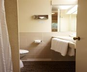
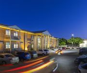
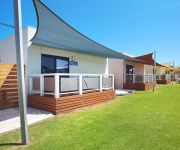
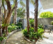
If you need a place to sleep, we compiled a list of available hotels close to the map centre further down the page.
Depending on your travel schedule, you might want to pay a visit to some of the following locations: Adelaide, Mitcham, Honiton, Koomooloo and Whyalla. To further explore this place, just scroll down and browse the available info.
Local weather forecast
Todays Local Weather Conditions & Forecast: 18°C / 64 °F
| Morning Temperature | 13°C / 56 °F |
| Evening Temperature | 19°C / 65 °F |
| Night Temperature | 15°C / 58 °F |
| Chance of rainfall | 0% |
| Air Humidity | 53% |
| Air Pressure | 1030 hPa |
| Wind Speed | Gentle Breeze with 6 km/h (4 mph) from West |
| Cloud Conditions | Clear sky, covering 0% of sky |
| General Conditions | Sky is clear |
Tuesday, 7th of May 2024
19°C (66 °F)
15°C (60 °F)
Sky is clear, moderate breeze, clear sky.
Wednesday, 8th of May 2024
20°C (68 °F)
16°C (60 °F)
Sky is clear, gentle breeze, clear sky.
Thursday, 9th of May 2024
20°C (68 °F)
16°C (62 °F)
Overcast clouds, gentle breeze.
Hotels and Places to Stay
Comfort Hotel Adelaide Riviera
ADELAIDE MERIDIEN HOTEL AND APARTMENTS
ADELAIDE INN
Discovery Parks – Adelaide Beachfront
Adelaide DressCircle Apartments - Sussex St
DRESSCIRCLE WARD ST
Majestic Tynte Street Apartments
Comfort Inn & Suites Sombrero
North Adelaide Boutique Stays Accommodation
Majestic Old Lion Apartments
Videos from this area
These are videos related to the place based on their proximity to this place.
Port Adelaide - Carrera Rally 2014 (14/12/14)
A short teaser video made from a couple of clips taken on the day of the Carrera Rally in Port Adelaide, South Australia. The main car featured in this video is Luke Boomer's race-built Laurel.
Port Adelaide Carpet Cleaning Service - CALL 08 7100 1225
We specialize in budget carpet cleaning services in Port Adelaide, surrounding services and greater metropolitan Adelaide. We provide a fast, reliable carpet cleaning service that includes,...
Port Adelaide, Adelaide, South Australia
See Port Adelaide and Australia- travel guides - videos, photos, accommodation and holiday information.
Port Adelaide Rowing Regatta - January 2013
The Port Adelaide Rowing Club hosted their first regatta since the 1930s on Saturday morning, 26 January 2013. The Australia Day Sprint Regatta christened an artificial beach, which was built...
Port Adelaide Motorsport Carrera
The footage was recorded at the Port Adelaide Carrera on the 14th of December. More information on the rally sprint can be found below. http://www.bensonmotorsports.com/#!port-adelaide/c22po.
Paranormal Investigation: National Railway Museum Port Adelaide
The National Train Museum in Port Adelaide SA, is truly an amazing location. Not only is the history amazing, including the Steam Trains within, but to get to spend the night in such a location...
NATIONAL RAILWAY MUSEUM PORT ADELAIDE-801 CAB RIDE
SAR 800 Class No.801 Cab Ride at the National Railway Museum Port Adelaide. Sorry about the filming I wasn't really concentrating in the filming.
Paintball Games at Indoor Paintball SA, Port Adelaide
Recorded on a 720p Glasses Camera placed under the visor mask for a true POV. A very accurate depiction of visability, including my fogged up mask at times. A great day was had by all involved.
Videos provided by Youtube are under the copyright of their owners.
Attractions and noteworthy things
Distances are based on the centre of the city/town and sightseeing location. This list contains brief abstracts about monuments, holiday activities, national parcs, museums, organisations and more from the area as well as interesting facts about the region itself. Where available, you'll find the corresponding homepage. Otherwise the related wikipedia article.
Port Adelaide railway station
Port Adelaide station is on the suburban line between Adelaide and Outer Harbor, 11.7 km (7¼ miles) from Adelaide, in the suburb of Port Adelaide. Port Adelaide station’s two elevated platforms are on a viaduct that carries the railway across Commercial Road. The station is unstaffed and has no buildings or other facilities except basic passenger shelters on each platform. It is the only railway station on the Adelaide network on a viaduct (South Road tram stop is on a viaduct.
Alberton, South Australia
Alberton is a metropolitan suburb in Adelaide, South Australia, about 20 minutes drive from the city. Part of the City of Port Adelaide Enfield, it is bordered by the suburbs of Rosewater, Queenstown, Cheltenham and Port Adelaide.
Port Adelaide
Port Adelaide is a suburb of Adelaide lying about 14 kilometres northwest of the City of Adelaide. It lies within the City of Port Adelaide Enfield and is the main port for the city of Adelaide. Port Adelaide played an important role in the formative decades of Adelaide and South Australia, with the port being early-Adelaide's main supply and information link to the rest of the world.
Alberton railway station, Adelaide
Alberton railway station is on the suburban rail route from Adelaide to Port Adelaide and Outer Harbor. Alberton is 10.2 km from Adelaide. The Fussel Street crossing not far from Alberton Station has the Caution More Than One Train Lights. This is used during various times of the day.
Port Dock railway station
Port Dock railway station was located in the commercial centre of Port Adelaide, South Australia at the corner of St Vincent Street and Lipson Street. This station was the original terminus of the railway between Adelaide and Port Adelaide, which opened in 1856. Since closure in 1981, the site of the passenger station has been redeveloped as the Port Adelaide Police Station and Magistrates' Court.
Athol Park, South Australia
Athol Park is a north-western suburb of Adelaide, South Australia. It is located in the City of Charles Sturt.
Pennington, South Australia
Pennington is an outer urban suburb of Adelaide, South Australia. It is located in the City of Charles Sturt. The suburb is residential, apart from a light industrial pocket to the south.
Woodville North, South Australia
Woodville North is a north-western suburb of Adelaide 10km from the Adelaide city centre, in the state of South Australia, Australia and falls under the City of Charles Sturt. The post code for Woodville North is 5012. It is adjacent to Pennington, Athol Park, Woodville Gardens, Mansfield Park, Woodville and Kilkenny. It is bordered to the east by Hanson Road to the west by Carlton Crescent, to the south by Torrens Road and to the north by Hamilton Road.
Cheltenham railway station, Adelaide
Cheltenham railway station is a railway station on the Outer Harbor railway line which is located in the northwestern Adelaide suburb of Cheltenham. It is located 9.2 km by railway from the Adelaide Railway Station.
Cheltenham, South Australia
Cheltenham is a suburb of Adelaide, South Australia. It is located in the City of Charles Sturt.
Alberton Oval
Alberton Oval is located in Alberton, a north-western suburb of Adelaide, South Australia. The ground is primarily used for Australian rules football and has a capacity of 17,000 people with seated grandstands holding 2,000,. The record crowd for Alberton is 22,738 which was set in 1977 for aSouth Australian National Football League (SANFL) match between Port Adelaide and their traditional SANFL rivals Norwood.
John Hart (South Australian colonist)
Captain John Hart (25 February 1809 – 28 January 1873) was a South Australian politician and a Premier of South Australia.
Rosewater, South Australia
Rosewater is one of the western suburbs of Adelaide and is located 10 km north-west of Adelaide's central business district (CBD). Although mainly residential, there are many shops along Grand Junction Road and the retired "Rosewater Loop" railway line runs through the suburb. Rosewater is split in half by Grand Junction Road and bordered on the east by Addison and on the south by Torrens Road.
Mount Carmel College
Mount Carmel College is a Catholic secondary school located in Rosewater, South Australia. Established in 1927 by the Marist Brothers, it was an all-boys school until December 1966. In February 1967 the Sisters of St Joseph transferred the all-girls school from the Pennington Terrace School to the present site of Mount Carmel College and in 1983 the school became a co-educational institution.
Mansfield Park, South Australia
Mansfield Park is a north-western suburb of Adelaide 10 km from the CBD, in the state of South Australia, Australia and falls under the City of Port Adelaide Enfield. It is adjacent to Wingfield, Angle Park, Woodville Gardens, and Athol Park. The postcode for Mansfield Park is 5012. It is bounded to the north by Grand Junction Road, and to the west by Hanson Road. It is named after the corresponding location in Ayrshire, Scotland.
Woodville High School
There is also Woodville High School in Woodville, TX USA. Facebook redirects to this page. Woodville High School, is a secondary school in Woodville, a north western suburb of Adelaide, South Australia. It was opened at its current site in 1915, open to all ethnicities.
National Railway Museum (Port Adelaide)
The National Railway Museum, Port Adelaide, South Australia, is the current site of the Port Dock Station Railway Museum's vast Australian Railway Collection.
Gillman, South Australia
Gillman is a north-western suburb of Adelaide, in the City of Port Adelaide Enfield.
Rosewater railway station
Rosewater railway station was a railway station located in the northwestern Adelaide suburb of Rosewater. The station was right next to the Eric Sutton Oval, and was located about 7 km from Dry Creek station on the Dry Creek to Port Adelaide line.
Tom 'Diver' Derrick Bridge
The Tom 'Diver' Derrick Bridge, commonly referred to as the 'Diver' Derrick Bridge, is an opening single-leaf bascule bridge over the Port River, Port Adelaide. It was opened for traffic on 3 August 2008. The entire bridge project cost approximately $178 million. It is located between Docks 1 and 2 at Port Adelaide and links to Francis Street to the east and Victoria Road to the west.
Ottoway, South Australia
Ottoway is an industrial suburb of Adelaide, South Australia in the City of Port Adelaide Enfield local government area. It is around 12 km west-northwest of the city centre.
Gillman Speedway
Gillman Speedway is a purpose built motorcycle speedway located in the Adelaide suburb of Gillman in South Australia. The track opened in 1998 and runs approximately 10 meetings per season from October to April.
North Arm Speedway
North Arm Speedway was the first dedicated motorcycle speedway ever built in Adelaide, South Australia and was located in the industrial suburb of Gillman. It was run by the Speedway Riders' Association of South Australia and ran from 1981 until its forced closure in 1997.
Alberton Cemetery
Alberton Cemetery is located at the end of Parker Street, Alberton, South Australia. Parker Street is a very short street which runs off Port Road, between the old Alberton Baptist and Alberton Uniting Churches (neither now used as churches). The cemetery is no longer used for burials, and has been made into a public park, with some gravestones still evident.
St. Clair railway station, Adelaide
St Clair railway station is a proposed railway station on the Outer Harbour railway line. It will be built to service the residents that will be living in the new housing development at the former Cheltenham Racecourse. It will be located on the eastern side of Cheltenham Parade.


