Delve into Clarence Gardens
The district Clarence Gardens of in Mitcham (South Australia) with it's 2,124 habitants Clarence Gardens is a subburb in Australia about 596 mi west of Canberra, the country's capital town.
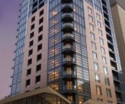
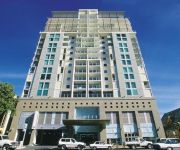
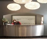
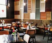
If you need a hotel, we compiled a list of available hotels close to the map centre further down the page.
While being here, you might want to pay a visit to some of the following locations: Mitcham, Adelaide, Honiton, Koomooloo and Loxton. To further explore this place, just scroll down and browse the available info.
Local weather forecast
Todays Local Weather Conditions & Forecast: 19°C / 67 °F
| Morning Temperature | 12°C / 54 °F |
| Evening Temperature | 18°C / 64 °F |
| Night Temperature | 14°C / 56 °F |
| Chance of rainfall | 0% |
| Air Humidity | 45% |
| Air Pressure | 1024 hPa |
| Wind Speed | Gentle Breeze with 6 km/h (3 mph) from North-East |
| Cloud Conditions | Clear sky, covering 4% of sky |
| General Conditions | Sky is clear |
Sunday, 5th of May 2024
20°C (68 °F)
14°C (57 °F)
Sky is clear, gentle breeze, clear sky.
Monday, 6th of May 2024
18°C (65 °F)
13°C (56 °F)
Sky is clear, gentle breeze, clear sky.
Tuesday, 7th of May 2024
20°C (69 °F)
17°C (63 °F)
Broken clouds, light breeze.
Hotels and Places to Stay
PEPPERS WAYMOUTH HOTEL
Astra Apartments Adelaide
Oaks Embassy
Hilton Adelaide
Windsor Apartments
Franklin Central Apartments
QUEST ON FRANKLIN
The Franklin Hotel
iStay Precinct
Quality Hotel Tiffins On The Park
Videos from this area
These are videos related to the place based on their proximity to this place.
Travel Stories [MAPS Film School13]
3 animated travel anecdotes. Directed by Sophie Morgan. Work completed at MAPS Film School in Adelaide Sth Australia.
Beneath the Shelling [MAPS Film School14]
A Film about civil war by Waeel Wayne Nassereddine. Hospitals are shut down due to ongoing attacks and rebels have now taken control over the city. We follow a boys desire to help his injured...
Grace [MAPS Film School14]
A film directed by Katherine Allen. A grieving astronaut widow is given an unexpected chance to save her husband through a powerful talisman she finds on the beach Tags: space capsule, crystal,...
Bear Hunt: The Quest for Gin [MAPS Film School12]
Two English knights take a journey across town to acquire some gin. What will happen when they make it past the many obstacles that lie in their way? Will they press on like good Englishmen...
UNCHARTED ISLAND TEASER
This is the teaser trailer for my upcoming short film 'UNCHARTED ISLAND'. The film is about two dim-witted pirates that find a treasure map and decide journey across the island that they've...
Compass Australia Homes
Compass Australia Homes is proud to be forte in making Australia the great country that it is, here are some of our fine projects.
Exhibition Studios - Ball Machine
Ball Machine - Scitech Discovery Centre, Perth ES designed, built and installed this 7 metre high, 81 metre square iconic exhibit as an exploration of forces and gravity. Bowling and...
16 Naomi Terrace, Pasadena SA
16 Naomi Tce Pasadena Renovated home on sub-dividable allotment (with plans -- STCC). Situated in a quiet family friendly area this home offers a cool lifestyle with large back yard and development.
Paradise in the Heart of Plympton at 47 James Street Plympton
This private oasis in the Heart of Plympton has it all with 5 spacious bedrooms, 2 updated bathrooms as well as a home office, gym space, workshop and large undercover entertaining area surrounded.
Videos provided by Youtube are under the copyright of their owners.
Attractions and noteworthy things
Distances are based on the centre of the city/town and sightseeing location. This list contains brief abstracts about monuments, holiday activities, national parcs, museums, organisations and more from the area as well as interesting facts about the region itself. Where available, you'll find the corresponding homepage. Otherwise the related wikipedia article.
Unley Park railway station
Unley Park railway station is a station on the Belair railway line located 7.0 km south of Adelaide Railway Station. It is located on the boundary between Hawthorn and Westbourne Park, on the south side of Cross Road. It is located 7.0 km by railway from the Adelaide Railway Station. It was temporarily closed in 1995 when one set of tracks through the station was converted to standard gauge for interstate trains. The former up (western) platform was demolished at the time of this change.
Colonel Light Gardens, South Australia
Colonel Light Gardens is a model garden suburb, featuring wide, tree-lined streets, rounded street corners, and lots of open space, located within the City of Mitcham in the greater City of Adelaide, capital of South Australia. The area is 1.58 km². It contains Colonel Light Gardens Primary School, the Colonel Light Gardens RSL, a number of sporting clubs using the name Reade Park, and a multitude of historical parks and gardens.
Tabor College Australia
Tabor College, originally called The House of Tabor, in Australia, began as a Christian tertiary college offering a range of courses from certificate to post-graduate studies in the areas of counseling, education, ministry, performing arts, mission, youth studies and humanities in Adelaide. It spawned five additional campuses: Adelaide, Hobart, Melbourne, Perth and Sydney. Each College is now a separate institution and offers its own awards.
Millswood railway station
Millswood railway station is a closed railway station on the Belair railway line in Adelaide, South Australia. It is situated 5.9 km from Adelaide Railway Station, adjacent to the Goodwood Road underpass, on the border of the suburbs of Millswood and Kings Park.
Hawthorn railway station, Adelaide
Hawthorn railway station on the Belair Railway Line, located in the inner southern suburb of Hawthorn 7.5 km by rail from Adelaide Railway Station, was closed in 1995. It runs parallel to Egmont Terrace. It is 500m south of the Unley Park railway station, and consists of two earth-filled concrete faced platforms, one each side of the dual lines, which were originally both broad gauge.
Westbourne Park, South Australia
Westbourne Park is an inner southern suburb of the State capital of South Australia, Adelaide. The suburb was named after Westbourne, a village in Sussex, England, and was laid out in 1881.
Glandore, South Australia
Glandore (postcode 5037) is a suburb of Adelaide, South Australia, partly in the City of Marion and partly in the City of West Torrens. The name is believed to come from Glandore in County Cork, Ireland, from whence came the family of John O'Dea, one of the original property owners of the area. Glandore lies south-west of Adelaide, halfway between the beachside suburb of Glenelg and the central business district.
Everard Park, South Australia
Everard Park is a suburb of Adelaide in the City of Unley, part of the once extensive land holdings of the prominent colonist Dr. Charles George Everard, and the location of "Marshfield", the home of part of his family. Some of the streets that are located within Everard Park are Norman Terrace, Everard Terrace and Orchard Avenue.
Clarence Park, South Australia
Clarence Park (formerly Goodwood South) is an inner southern suburb of Adelaide, South Australia in the City of Unley. Its borders are Mills Street (north), the Noarlunga railway line (north-west from East Avenue to Emerson Crossing), Goodwood Road (east) and Cross Road (south).
Black Forest, South Australia
Black Forest is an inner southern suburb of Adelaide, South Australia. It is located in the City of Unley.
Kings Park, South Australia
Kings Park is a small, triangular shaped suburb of Adelaide in the City of Unley surrounded by Goodwood Road, Cross Road and the Belair railway line. The nearest railway station is Unley Park.
Millswood, South Australia
Millswood is an inner-southern suburb of Adelaide in the City of Unley. It is dissected by Goodwood Road, which travels north to the Adelaide central business district from the southern suburb of Pasadena. Millswood also had its own railway station along the Goodwood-Belair line, but this was closed in 1995. Goodwood Road passes under the railway line in a deep underpass which may flood during heavy rain.
Pasadena High School (South Australia)
Pasadena High School is a secondary school located in the southern Adelaide suburb of Pasadena, on the corner of Goodwood and Daws Roads. It was opened in 1964 as Daws Road High School and operated under this name until 2001. Pasadena High School now operates a "basketball focus" option whereby students have access to specific coaching and development in the sport, all which is integrated into the learning outcomes of the SACSA educational framework.
Edwardstown, South Australia
Edwardstown is an inner Southern suburb located 6 km southwest of Adelaide in the City of Marion. Edwardstown is in the South Australian House of Assembly Electoral district of Elder and the Australian House of Representatives Division of Hindmarsh. Edwardstown is home to the Castle Plaza Shopping Centre.
Edwardstown railway station
Edwardstown railway station is a railway station on the Noarlunga and Tonsley railway lines, and is located in the inner southwestern Adelaide suburb of Edwardstown. It is located 7.9 km by railway from the Adelaide Railway Station. It is of an island platform construction, with pedestrian access at the northern and southern ends and the railway tracks on either side to the east and west. The station is unattended and there are no facilities, other than a shelter shed and public address system.
Clarence Park railway station
Clarence Park railway station is a railway station on the Noarlunga Centre and Tonsley railway lines, and is located in the inner southwestern Adelaide suburbs of Black Forest and Clarence Park. It is located 6.3 km by railway from the Adelaide Railway Station.
Emerson railway station
Emerson railway station is a railway station on the Noarlunga and Tonsley railway lines, which is located in the inner southwestern Adelaide suburbs of Black Forest and Clarence Park. It is located 7.1km by railway from the Adelaide Railway Station. In July 2008 Emerson station became the first station to install a Caution More than One Train (CMToT) warning device.
Woodlands Park railway station
Woodlands Park railway station is a railway station on the Noarlunga and Tonsley railway lines. It is named after the old suburb of Woodlands Park is located in the inner southwestern Adelaide suburb of Edwardstown. It is the last railway station common to the two lines. It is located 9.1 km by railway from the Adelaide Railway Station. It is quite a popular, well frequented station, and services the southern part of Edwardstown, as well as the northern part of Ascot Park.
Clarence Gardens, South Australia
Clarence Gardens is an inner southern suburb of Adelaide, South Australia in the City of Mitcham. It is bounded to the north by Cross Road, the west by South Road, the east by Winston Avenue and the south by Edward Street. There are many attractions in Clarence Gardens which include the Clarence Gardens Lawn Bowls club, the pirate ship park and the Clarence Gardens Rugby club. Clarence Gardens Post Office opened on 1 August 1946.
Melrose Park, South Australia
Melrose Park is a suburb of Adelaide, South Australia in the City of Mitcham. It is bordered by South Road, Daws Road, Winston Avenue and Edward Street. Until 1989, Melrose Park was part of the suburb of Edwardstown. The name change occurred as the suburb was quite large, located on either side of South Road and was in the jurisdiction of two local government councils, with the larger western side belonging to the City of Marion.
Hawthorn, South Australia
Hawthorn is a suburb of Adelaide in the City of Mitcham. It is bounded to the north by Cross Road, to the south by Grange Road, to the west by Sussex Terrace and to the east by Belair Road. The Belair train line runs through the suburb. To the west is Westbourne Park, and to the east is Kingswood. Several parks are situated here, including the Mitcham Memorial Gardens. The closest Primary School the suburb is Mitcham School and the closest High School is Unley High School.
Daw Park, South Australia
Daw Park is an inner southern suburb of Adelaide, Australia, in the local government area of the City of Mitcham. The suburb is divided into two parts, with a smaller exclave separated from the larger southern part by a section of Colonel Light Gardens. This smaller exclave is surrounded by the suburbs of Colonel Light Gardens to the south and east, Cumberland Park to the north and Melrose Park to the west.
Cumberland Park, South Australia
Cumberland Park is an inner-southern suburb of Adelaide, South Australia in the City of Mitcham.
Castle Plaza
Castle Plaza is a shopping centre located in the Adelaide suburb of Edwardstown approximately 7 km from the CBD, along South Road. It was expanded in the mid 1980s and the new development was opened in July 1987. Attending that day were a number of local personalities including John Platten. Providing the guard of honour were the 1st Ascot Park Scout Group.
Cabra Dominican College
Cabra Dominican College is a private independent high school located at Cumberland Park, an inner-southern suburb in Adelaide, South Australia. It was established by an order of Dominican sisters from Cabra, Dublin in February 1886 with nine sisters, and caring for 37 boarders and 4 day girls. Originally offering a co-educational primary education and a high school education for girls, it began accepting boys into the high school in 1978.






!['Travel Stories [MAPS Film School13]' preview picture of video 'Travel Stories [MAPS Film School13]'](https://img.youtube.com/vi/GbERtz30yug/mqdefault.jpg)
!['Beneath the Shelling [MAPS Film School14]' preview picture of video 'Beneath the Shelling [MAPS Film School14]'](https://img.youtube.com/vi/dqADbRW5Y_c/mqdefault.jpg)
!['Grace [MAPS Film School14]' preview picture of video 'Grace [MAPS Film School14]'](https://img.youtube.com/vi/3sAhtxhu90Q/mqdefault.jpg)
!['Bear Hunt: The Quest for Gin [MAPS Film School12]' preview picture of video 'Bear Hunt: The Quest for Gin [MAPS Film School12]'](https://img.youtube.com/vi/11Dpk0EvwsU/mqdefault.jpg)


