Discover Oaklands Park
The district Oaklands Park of in Marion (South Australia) is a subburb in Australia about 598 mi west of Canberra, the country's capital city.
If you need a hotel, we compiled a list of available hotels close to the map centre further down the page.
While being here, you might want to pay a visit to some of the following locations: Mitcham, Adelaide, Honiton, Koomooloo and Loxton. To further explore this place, just scroll down and browse the available info.
Local weather forecast
Todays Local Weather Conditions & Forecast: 19°C / 67 °F
| Morning Temperature | 13°C / 55 °F |
| Evening Temperature | 17°C / 63 °F |
| Night Temperature | 13°C / 56 °F |
| Chance of rainfall | 0% |
| Air Humidity | 47% |
| Air Pressure | 1029 hPa |
| Wind Speed | Gentle Breeze with 8 km/h (5 mph) from North |
| Cloud Conditions | Clear sky, covering 0% of sky |
| General Conditions | Sky is clear |
Saturday, 11th of May 2024
19°C (65 °F)
14°C (57 °F)
Few clouds, light breeze.
Sunday, 12th of May 2024
18°C (64 °F)
15°C (59 °F)
Sky is clear, light breeze, clear sky.
Monday, 13th of May 2024
17°C (63 °F)
14°C (57 °F)
Broken clouds, light breeze.
Hotels and Places to Stay
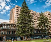
Stamford Grand Adelaide
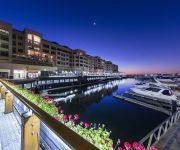
Oaks Plaza Pier
RNR APARTMENTS ADELAIDE
Quest King William South
Glenelg Pacific Apartments
Ensenada Motor Inn and Suites
RYDGES SOUTHPARK ADELAIDE
Oaks Liberty Towers
St Francis Winery
The Wright Lodge
Videos from this area
These are videos related to the place based on their proximity to this place.
DEAD ISLAND | City of Moresby
Dead Island on computer, Act II in the city of Moresby Dead Island Wikia: http://deadisland.wikia.com/wiki/Walkthrough:Dead_Island:Act_II.
Delay to repair road - Duty of care issue - Holdfast City Council
Reported to Holdfast Council (by www.roadrepair.wikispaces.com) on 7 Nov 2007, and repeated requests to fix the hazard, the patch was repaired on 28 Dec, after it got to a depth of over 80mm....
Harvesting Success: The launch of OzHarvest in the south of Adelaide
The Cities of Marion and Holdfast Bay used the 2013 Anti-Poverty Day to announce teaming up with OzHarvest to expand the reach of the service in the region. The City of Marion Healthy Communities.
Marion in a Minute: Oaklands wetland - Families flock to 'water farm'
The sound of parrots fill the air, dragonflies skim the water and a family strolls along a walking trail. This is Oaklands wetland on an autumn evening after it opened to the public in December...
20100522_cyclistServiceCover.wmv
The cyclist goes outside of the bike lane to go around a service cover. A passing car does not expect the cyclist to change the line of travel. Avoiding or i...
Longboarding - Day to Night - Nikon D3100 - Nikkor 35 f/1.4
Shot with: Nikon D3100 Lens: Nikkor 35 f/1.4 I know there aren't really any special tricks but I just wanted to experiment with different ways to film. Flickr: http://www.flickr.com/photos...
Electric Train Departing Oaklands Station
One of Adelaide's new electric trains departing Oaklands station near the Marion Shopping Centre.
Vintage 2WD Buggy - Adelaide Radio Controlled Raceway December 14th 2013
A special race to end the year. Pre 1991 Vintage/Classic. Associated Engineering RC10's, Tamiya Madcap etc.
Warburton Builders and Constructive Concept Homes - Promo Video
Welcome to Warburton Builders & Constructive Concept Homes As a principal builder with over 30 years experience, our technical skill, experience and physical resources enable us to successfully...
scott throw aways
unused and throw away footage of what ive collected so far *sorry about the start must have done it when i uploaded it* doesn't take much to hit the like button! like, share, comment and subscribe!
Videos provided by Youtube are under the copyright of their owners.
Attractions and noteworthy things
Distances are based on the centre of the city/town and sightseeing location. This list contains brief abstracts about monuments, holiday activities, national parcs, museums, organisations and more from the area as well as interesting facts about the region itself. Where available, you'll find the corresponding homepage. Otherwise the related wikipedia article.
Oaklands railway station
Oaklands Interchange railway station is a station on the Noarlunga Centre railway line, and is located in the southwestern Adelaide suburb of Oaklands Park. It is located 12.8 km by railway from the Adelaide Railway Station and approximately 500m from Westfield Marion.
Marion, South Australia
Marion is a suburb in the City of Marion in Adelaide around 10 km south-west of the CBD. Founded as a rural village in 1838 on the banks of the Sturt River, Marion was found to have rich soil and the population expanded rapidly. Colonel William Light laid out the plan for the village, as he had done with the City of Adelaide itself.
City of Marion
The City of Marion is a local government area in the southern suburbs of Adelaide, South Australia. The council offices are in the suburb of Sturt.
Brighton, South Australia
Brighton is a coastal suburb of Adelaide, South Australia, situated between Seacliff and Glenelg and aside Holdfast Bay. Some notable features of the area are the Brighton-Seacliff Yacht Club, the Brighton Surf Lifesaving Club, the Brighton Jetty, and its excellent beach. The Windsor Theatre constructed in 1925 is a long standing institution, showing cinema to the locals usually two films per night.
Dover Gardens, South Australia
Dover Gardens is a suburb of Adelaide in the City of Marion.
Oaklands Park, South Australia
Oaklands Park is a suburb of Adelaide, South Australia in the City of Marion. The Marion Shopping Centre is the suburb's main attraction.
Warradale, South Australia
Warradale is a suburb of Adelaide in the City of Marion. The name Warradale, deriving from Warra, an Aboriginal word for timber, has an interesting origin. It is located in the south western part of Adelaide and serviced by a train station and several main roads.
Sturt, South Australia
Sturt is a suburb of Adelaide in the City of Marion local government area. It was named after the explorer Captain Charles Sturt. Sturt is in the South Australian House of Assembly electoral district of Mitchell and the Australian House of Representatives Division of Boothby.
Seacombe Heights, South Australia
Seacombe Heights is a suburb of Adelaide in the City of Marion.
Seaview Downs, South Australia
Seaview Downs is a suburb of Adelaide in the City of Marion.
Seacombe Gardens, South Australia
Seacombe Gardens is a suburb of Adelaide in the City of Marion, South Australia.
Seacliff Park, South Australia
This article is about the suburb of Adelaide, Australia. See also: Seacliff (disambiguation) Seacliff ParkAdelaide, South Australia Population: 2,017 (2006 census) Postcode: 5049 LGA: City of Holdfast Bay City of Marion Suburbs around Seacliff Park: Seacliff South Brighton Dover Gardens Kingston Park Seacliff Park Seaview Downs Marino Hallett Cove Trott Park Seacliff Park is a suburb of Adelaide partly in the City of Marion and the City of Holdfast Bay.
Marion railway station
Marion railway station is a railway station on the Noarlunga Centre railway line, and is located in the southwestern Adelaide suburb of Marion. It is located 11.4 km by railway from the Adelaide Railway Station.
Warradale railway station
Warradale railway station is a railway station on the Noarlunga Centre railway line, which is located in the southwestern Adelaide suburb of Warradale. It is located 13.7 kilometres by railway from the Adelaide Railway Station. It was gutted by fire a few years ago and subsequently rebuilt.
Hove railway station, Adelaide
Hove railway station is a railway station on the Noarlunga Centre railway line, which is located in the southwestern Adelaide suburb of Hove. It is located 14.6 km by railway from the Adelaide Railway Station. Until the 1990s, Hove station had a ticket office, toilets and an underground pedestrian tunnel, but heavy graffiti and vandilism led to these facilities being closed and demolished. Like many stations on the Adelaide Metro network, the tunnel was replaced with a level pedestrian crossing.
Brighton railway station, Adelaide
Brighton railway station on the Noarlunga Centre railway line in the south-western Adelaide suburbs is 16.0 km by railway from Adelaide Railway Station. It is the second Brighton station. The original station was adjacent to Beach Road, 15.8 km by railway from Adelaide Railway Station, and opened on 24 November 1913 on the opening of the line from Goodwood. Platforms 2 and 3 are used to terminate trains during the day on weekdays only.
Seacliff railway station
Seacliff railway station on the Noarlunga Centre railway line in the southwestern Adelaide suburbs is 17.0km from Adelaide railway station. Seacliff was one of four stations on the Adelaide Metro network to have platforms on opposite sides of a level crossing, the others being Nurlutta, Kilburn and (before being upgraded) Munno Para on the Gawler Central line. The down platform is 121.9 m in length. The up platform, opened in 1976, is of similar length.
City of Holdfast Bay
The City of Holdfast Bay is a local government area in the south-western coastal suburbs of Adelaide, South Australia.
Brighton Secondary School
Brighton Secondary School (formerly Brighton High School) resides in Brighton, a beach suburb of Adelaide, South Australia. The school provides secondary education from year 8 to 12, with programs in music and volleyball. Program entry in to music and volleyball are competitive with the requirement of auditions or try outs.
Hove, South Australia
Hove is a coastal suburb of Adelaide, South Australia. It is situated north of Brighton, west of Warradale, and south of North Brighton. Running along the west of the suburb is the Esplanade, a street with numerous townhouses with views of the Gulf St Vincent. The suburb is bisected by its major thoroughfare, Brighton Road. Property prices are generally higher on the coastal side of Brighton Road.
Marymount College, Adelaide
Marymount College is an all-girls school in the suburb of Hove in Adelaide, South Australia that caters for girls in years 6 to 9. Marymount belongs to a group of three educational facilities, known as the Tri-School partnership. This group also consists of Sacred Heart College Senior and Sacred Heart College Middle School. Most of the students that pass through either of the middle schools continue on to the senior school, located nearby Marymount, in Somerton Park.
South Brighton railway station, Adelaide
South Brighton railway station is a former railway station on the current Noarlunga Centre line in Adelaide, Australia. It was located about 15.8 km by railway from Adelaide Railway Station. The station closed in 1976, and was demolished shortly after, A newer station was built 200 metres to the south of that station in the same year. The old subway that went below the old station was in use until the early 1990s, but has now been filled in and replaced with a ground level passenger walkway.
North Brighton, South Australia
North Brighton is a suburb of Adelaide in South Australia. The northern reaches of the suburb are occupied by Brighton Secondary School and the campus of Minda Inc, a large disability support organisation. To the south, the suburb is bounded by the Townsend Park Retirement Village and Marymount College. Other points of interest are a small shopping centre on the corner of Holder and Brighton Roads, and North Brighton Beach.
South Brighton, South Australia
South Brighton is a small, primarily residential suburb of Adelaide in South Australia. Brighton South Post Office opened on 7 November 1961. It was renamed South Brighton in 1968 and replaced by the Seacliff Park office in 1995.
Brighton Town Hall, Hove
Brighton Town Hall, Hove, is located on Brighton Road, Hove, in the city of Adelaide in South Australia. The Brighton Town Hall was built in 1869 and was just the fourth Town Hall built in the colony of South Australia. The architect and builder was George William Highet who arrived in the colony in 1836. G. W. Highet served as a town clerk and Councillor and died in Brighton aged 80 years.


