Delve into Bulli
The district Bulli of in Wollongong (New South Wales) with it's 5,455 habitants Bulli is a subburb in Australia about 121 mi north-east of Canberra, the country's capital town.
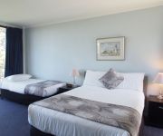
If you need a hotel, we compiled a list of available hotels close to the map centre further down the page.
While being here, you might want to pay a visit to some of the following locations: Parramatta, Sydney, Katoomba, Canberra and . To further explore this place, just scroll down and browse the available info.
Local weather forecast
Todays Local Weather Conditions & Forecast: 16°C / 62 °F
| Morning Temperature | 12°C / 54 °F |
| Evening Temperature | 14°C / 58 °F |
| Night Temperature | 10°C / 51 °F |
| Chance of rainfall | 0% |
| Air Humidity | 56% |
| Air Pressure | 1026 hPa |
| Wind Speed | Gentle Breeze with 7 km/h (4 mph) from North-West |
| Cloud Conditions | Clear sky, covering 1% of sky |
| General Conditions | Sky is clear |
Thursday, 23rd of May 2024
16°C (61 °F)
12°C (54 °F)
Sky is clear, light breeze, clear sky.
Friday, 24th of May 2024
16°C (61 °F)
13°C (55 °F)
Overcast clouds, light breeze.
Saturday, 25th of May 2024
17°C (62 °F)
14°C (56 °F)
Overcast clouds, light breeze.
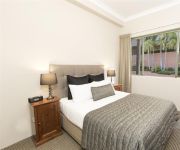
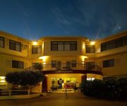
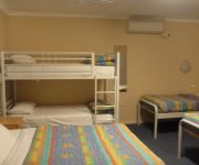
Hotels and Places to Stay
Novotel Wollongong Northbeach
BELMORE ALL SUITE HOTEL
QUEST WOLLONGONG
Beach Park Motel
Normandie Motel and Function Centre
Flinders Motel
Boat Harbour Motel
Comfort Inn Towradgi Beach
Quality Suites Pioneer Sands
Videos from this area
These are videos related to the place based on their proximity to this place.
City of Queanbeyan Pipe Band at Bulli
The band's performance at the Bulli Fair 20080921. The drill movement wasn't exactly what we planned, but you wouldn't know it to watch! Good improvisation guys! sorry for the wind noise -...
Friday night light Combat SAMBO sparring
Some light sparring for throw points, idea was to explore clinch and trip style throws SAMBO scores from throw points https://www.facebook.com/southernsambo.
Woonona - Pedestrian level crossings do work!
Safe, convenient, and not that expensive. Woonona (near Wollongong) has new pedestrian access across its railway line thanks to a new level crossing opened in early 2009. Save Our Rail would...
Woody/Spitz Duo - 'Needle and the Damage Done'
Woody/Spitz Duo perform Neil Young's "The Needle And The Damage Done" in the recently reopened 'Governors Inn', Woonona Bull RSL. www.woodyspitzduo.weebly.com ...
Skate Cam Test 1 of 4
Testing my Surf Pro camera on my longboard skateboard, you may get a little nauseous and the vibrations kept making the camera pan down. Sorry.
Spearfishing Sandon Point, Bulli and Bellambi
Change quality to 720p for best results *** The fish in the videos are: A Leatherjacket caught by my girl A blackfish but the fish wiggled off the spear line so in the meantime caught...
Bulli Pass.mpg
South of Sydney, on the coast approaching Wollongong, Bulli Pass traverses from the beach near Thirroul to the top of the escarpment to join the Princes Highway. The pass is windey and steep,...
'Counting Stars' @ Woonona Bulli RSL
A clip filmed back in March 2014 of One Republic's "Counting Stars". Filmed with my son's GoPro. Hope you enjoy it!
Videos provided by Youtube are under the copyright of their owners.
Attractions and noteworthy things
Distances are based on the centre of the city/town and sightseeing location. This list contains brief abstracts about monuments, holiday activities, national parcs, museums, organisations and more from the area as well as interesting facts about the region itself. Where available, you'll find the corresponding homepage. Otherwise the related wikipedia article.
Bulli, New South Wales
Bulli is a northern suburb of Wollongong situated on the south coast of New South Wales, Australia. Bulli is derived from an Aboriginal word signifying "double or two mountains". Originally inhabited by Wodi Wodi Aborigines, European wood cutters worked in the area from about 1815. The area was once abundant in Red Cedars, these are now still seen but thinly.
Towradgi, New South Wales
Towradgi is a small beach-side suburb approximately 5 km north of Wollongong. Towradgi is a corruption of the aboriginal word "Kow-radgi" meaning "guardian of the sacred stones". On an early map it was called Towroger. Towradgi is served by Towradgi station, opened in 1948. Electric double deck trains serve Towradgi. It is bordered to the north by Corrimal, the west by Fernhill & Tarrawanna and to the south by Fairy Meadow. The Pacific Ocean can be found to the east.
Thirroul, New South Wales
Thirroul is a northern seaside suburb of the city of Wollongong, Australia, with the name supposedly Aboriginal for "Valley of Cabbage Tree Palms". Situated between Austinmer and Bulli, it is approximately 13 kilometres north of Wollongong, and 69 km south of Sydney. It lies between the Pacific Ocean and a section of the Illawarra escarpment known as Lady Fuller Park, adjacent to Bulli Pass Scenic Reserve.
Balgownie, New South Wales
Balgownie is a small suburb of Wollongong City, New South Wales, Australia. Balgownie lies to the north-west of the Wollongong CBD. It stretches from the lower slopes of Mount Keira along the Illawarra escarpment to the base of the Broker's Nose promontory. To the east, Balgownie is bordered by the light industrial and commercial suburb of Fairy Meadow. The main street, Balgownie Road, connects the suburb to the nearby Princes Highway.
Woonona railway station
Woonona is a CityRail railway station on Sydney's South Coast railway line. It serves the residential suburb of Woonona which is a suburb of Wollongong. The station has two side platforms, connected by a footway at a level crossing. The station is served by about one train per hour for most of the time, with additional trains at weekday peak hours. The station has street access to both platforms, via a level crossing. This allows for the station to classed as having Easy Access for wheelchairs.
Bulli railway station
Bulli is a CityRail railway station on the South Coast railway line of New South Wales, Australia. It serves the residential area of Bulli, which is a suburb of Wollongong. The station has two side platforms on straight track. The station is served by one train per hour for most of the time (usually a Wollongong local service that connects at Thirroul or Wollongong), with additional trains at weekday peak hours.
Woonona, New South Wales
Woonona is a northern suburb of Wollongong, New South Wales, Australia, on the northern area of the Illawarra coastal plain. It is served by Woonona Station on the South Coast (Illawarra) Line, and by the Princes Highway. The suburb has a strip of commerce along the highway and several historic buildings. It is mostly light-density residential, though some new two-storey buildings have been made. The local beach is known for surfing conditions, and surfers frequent it during high wave times.
Coledale railway station
Coledale is a railway station on the South Coast Line of the CityRail interurban network, serving the beachside town of Coledale, a small town on the Illawarra escarpment. The station has an island platform. It is served by one train every two hours during the off-peak, with more trains during peak hours. At 6:50pm on 25 January 2011, a 9-year-old girl was killed at Coledale Station after reportedly playing on the tracks.
Austinmer railway station
Austinmer is a railway station on the South Coast Line of the CityRail interurban network, serving the town of Austinmer, a small town in the northern Illawarra area with a renowned beach. The station has two side platforms. It is served by one train per hour during the off-peak, with more trains during peak hours. It is not possible to cross from one platform to the other without leaving the station. To cross from one side to the other requires the use of a nearby road bridge.
Corrimal railway station
Corrimal is a CityRail railway station on the South Coast railway line. It serves the residential suburb of Corrimal which is a suburb of Wollongong. The station has two side platforms, connected by a footway at a level crossing. The station is served by about one train per hour for most of the time (usually a Thirroul-Port Kembla local service), with additional trains at weekday peak hours. The station has street access to both platforms, via a level crossing.
Thirroul railway station
Thirroul is a railway station on the South Coast Line of the CityRail interurban network in New South Wales, Australia. It serves the suburb of Thirroul, one of the most northerly suburbs of Wollongong. The station has three platforms, one side platforms for trains to Sydney, a platform for trains to Wollongong, Port Kembla and Bomaderry, and a third for terminating trains.
Towradgi railway station
Towradgi is a CityRail railway station on the South Coast railway line. It serves the residential suburb of Towradgi which is a suburb of Wollongong. The station has two side platforms, connected by a footway along a road overpass. The station is served by about one train per hour for most of the time (usually a Thirroul-Port Kembla local service), with additional trains at weekday peak hours.
Fairy Meadow railway station
Fairy Meadow is a CityRail railway station on the South Coast railway line. It serves the residential Wollongong suburb of Fairy Meadow. The station has two side platforms, connected by a pedestrian overbridge and level crossing. The station is served by about one train per hour for most of the time (usually a Thirroul-Port Kembla local service), with additional trains at weekday peak hours.
Austinmer, New South Wales
Austinmer is a northern suburb of Wollongong on the south coast of New South Wales, Australia. It sits in the northern Illawarra region, south of Stanwell Park and immediately north of Thirroul. The town's main beach is Austinmer Beach, a patrolled surf beach and a popular tourist beach. A second smaller and unpatrolled beach lies directly to the north of Austinmer beach, and is known locally as "Little Austi".
Corrimal, New South Wales
Corrimal is a northern suburb of the city of Wollongong, New South Wales, Australia. Corrimal's CBD is situated on the Princes Highway, and several streets adjacent to it. The main shopping centres are Stockland Corrimal and Corrimal Park Mall next to the park on the highway. Outside this centre is an old locomotive that Corrimal is known for, the welcome signs featuring it. It ran on the Bulli Colliery Line (no longer existent) to Bellambi Haven from 1909 to 1967.
Bellambi, New South Wales
Bellambi is a suburb of Wollongong in the Illawarra region of New South Wales, Australia. It has a station (opened 1889) on the CityRail South Coast line. Bellambi is situated directly north of Corrimal and east of Russell Vale. It has a beach, Bellambi Beach, on the Wollongong to Thirroul Bike Track. Bellambi lies on the flat northern Illawarra coastal plain, with views of the escarpment to the west, one of note being Broker's Nose, 440 metres high.
Bulli Pass
Bulli Pass is a mountain pass northwest of Bulli, New South Wales, Australia. It is situated on the Illawarra Escarpment west of the Illawarra coastal plain. It was built during the 19th century for use by loggers and locals transporting goods to and from Sydney. Beforehand sea travel was the only reliable method. It currently takes the Princes Highway from the Illawarra plain to the Woronoa Plateau, rising over 300 metres in doing so.
North Dalton Park
North Dalton Oval is located on Pioneer Rd, Towradgi, in the northern suburbs of Wollongong, New South Wales, Australia. The ground has a grandstand on the western side, where plastic bucket seats were installed over the concrete steps in late 2007. The remainder of the ground is surrounded by a small hill which gives the ground an overall capacity of around 6,000. The scoreboard is at the northern end of the ground.
Queen of Nations (clipper ship)
Queen Of Nations was an 827-ton wooden clipper ship. She was built in Aberdeen in 1861, and sailed out of Auckland, New Zealand, on the Sydney to Liverpool route. Queen of Nations wrecked in May 1881 on Corrimal Beach, New South Wales, Australia.
Tarrawanna, New South Wales
Tarrawanna is a northern suburb of Wollongong, New South Wales, Australia, extending westward from the Princes Highway over the Illawarra Escarpment.
Corrimal High School
Corrimal High School is a comprehensive high school located in East Corrimal in Wollongong, New South Wales. The school has been operating since 1951. The subjects include English, Mathematics, Science, Geography, History, PDHPE, Industrial Arts, Visual Arts, Music, Agriculture, Food Technology and Sport Science.
Brokers Nose
Brokers Nose or Mount Corrimal is the name of an outcrop of the Illawarra Escarpment west of Corrimal, New South Wales. Its summit is 440 metres above sea level and there is a television transmission tower atop it. There is a track leading to the top but both track and summit are not open to the public; the summit is protected as part of the Illawarra Escarpment State Recreation Area. The name is vague in its origins and there are three possible explanations for it.
Sublime Point
Sublime Point is a feature of the Illawarra Escarpment west of Austinmer. It is a summit on the plateau edge where the escarpment turns to go in a more northerly direction from a more northeasterly direction. The summit has a cafe and lookout and is visited regularly. Sublime Point Lookout may be reached by road from the Princes Highway above Austinmer, or by a walking track from Austinmer and Thirroul.
East Corrimal, New South Wales
East Corrimal is a northern seaside suburb of Wollongong, New South Wales, Australia. Predominantly residential, the suburb includes Corrimal High School and Corrimal East Public School, as well as Corrimal Beach and tourist park at the eastern end. A park was opened in 1959 to the west of the high school and north of the primary school, named Phil Adams Park, which features tall trees, paths and several seats.
Russell Vale, New South Wales
Russell Vale is a small suburb of Wollongong in the Illawarra region of New South Wales, Australia. It straddles the Princes Highway. The suburb is suggested to have been named after the son of Francis Peter MacCabe, Russell, who died in an accident; although "Russell" it is more likely to be named after the MacCabe property, Russell, the namesake of Francis McCabe's mother.


