Delve into Glenfield
The district Glenfield of in Campbelltown Municipality (New South Wales) with it's 6,758 habitants Glenfield is a subburb in Australia about 136 mi north-east of Canberra, the country's capital town.
If you need a hotel, we compiled a list of available hotels close to the map centre further down the page.
While being here, you might want to pay a visit to some of the following locations: Parramatta, Sydney, Katoomba, Canberra and . To further explore this place, just scroll down and browse the available info.
Local weather forecast
Todays Local Weather Conditions & Forecast: 18°C / 65 °F
| Morning Temperature | 13°C / 55 °F |
| Evening Temperature | 16°C / 61 °F |
| Night Temperature | 15°C / 59 °F |
| Chance of rainfall | 11% |
| Air Humidity | 74% |
| Air Pressure | 1030 hPa |
| Wind Speed | Light breeze with 4 km/h (3 mph) from North-West |
| Cloud Conditions | Overcast clouds, covering 92% of sky |
| General Conditions | Moderate rain |
Thursday, 9th of May 2024
15°C (58 °F)
14°C (57 °F)
Moderate rain, light breeze, overcast clouds.
Friday, 10th of May 2024
17°C (63 °F)
14°C (57 °F)
Moderate rain, light breeze, overcast clouds.
Saturday, 11th of May 2024
14°C (58 °F)
14°C (57 °F)
Moderate rain, light breeze, overcast clouds.
Hotels and Places to Stay
The William Inglis - MGallery by Sofitel
BEST WESTERN CASULA MOTOR INN
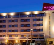
Mercure Sydney Liverpool
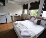
Blueys Retreat
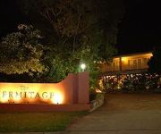
The Hermitage Motel
Crossroads Hotel Liverpool
Pritchards Hotel
Holiday Inn WARWICK FARM
ibis budget Campbelltown
Country Comfort Liverpool
Videos from this area
These are videos related to the place based on their proximity to this place.
Sydney Rail Vlog 17: Ingleburn
Ingleburn station, where a bit of construction is going on for a renovation of the station. Special train in this video. Filmed on: 15/10/14.
5/135-137 Cumberland Road, Ingleburn - Prudential Real Estate 9605 5000
Situated only minutes drive from the heart of Ingleburn you will be close to local schools, transport and a number of shops when you move into this lavish double storey three bedroom duplex....
Ingleburn NSW Property Management
http://www.prudential.com.au/ Prudential Real Estate 31-33 Oxford Rd, Ingleburn NSW 2565 PH: 02 9605 5000.
Australia: Thirlmere Flyer on Sydney's East Hills line, 01Mar15
More GoPro video! The Thirlmere Flyer, a double headed steam hauled special train returns to Sydney along the East Hills line. This video shows scenes of the trip between Glenfield & Tempe,...
Australian Air League - Riverwood Hornets Performing At A NSAA Parade
Our world renowned band performing at a National Servicemen's Association of Australia (NSAA) parade at Ingleburn in August 2012.
Ninos Nissan 180sx 563kw
Check out Ninos's crazy SR20 setup. Produced an amazing 563kw at the wheels on E85 fuel. Build by Advance Motor Mechanics at South Strathfield. Tuned by Just Engine Management Ingleburn.
2/6 Mary Street, Macquarie Fields - Prudential Real Estate 9605 5000
You will be impressed from the moment you step into this great two bedroom villa featuring two built-in wardrobes and quality fittings throughout. There is a renovated kitchen with stainless...
2/201-207 Harrow Road, Glenfield - Prudential Real Estate 9605 5000
Private and spacious, this recently renovated two bedroom home has many luxury features you and the family are going to love. With next to nothing to spend, you will feel like you're living...
29 Azalea Place, Macquarie Fields - Prudential Real Estate 9605 5000
Experience an elegant family home of grand design and an open-plan feel. Four large bedrooms ensure plenty of space for the entire family, ensuite access to the main for convenience and with...
Excellence In Engineering - Marine, Automotive, Aerospace, Precision.
Broens Industries specialises in the design and manufacture of ground support equipment, special purpose machines, automation, composite tooling equipment and precision components machining....
Videos provided by Youtube are under the copyright of their owners.
Attractions and noteworthy things
Distances are based on the centre of the city/town and sightseeing location. This list contains brief abstracts about monuments, holiday activities, national parcs, museums, organisations and more from the area as well as interesting facts about the region itself. Where available, you'll find the corresponding homepage. Otherwise the related wikipedia article.
Casula, New South Wales
Casula is a suburb of Sydney in the state of New South Wales, Australia 35 kilometres south-west of the Sydney central business district, in the local government area of the City of Liverpool. Casula is the first suburb immediately south of Liverpool on the Hume Highway and the Main Southern Railway between Sydney and Melbourne. Casula consists of undulating, gently rolling land, with elevations across the suburb being mostly between 30 and 70 metres above sea level.
Glenfield, New South Wales
Glenfield is a suburb of Sydney, in the state of New South Wales, Australia. Glenfield is located 40 kilometres south-west of the Sydney central business district, in the local government areas of the City of Campbelltown and the City of Liverpool. It is part of the Macarthur region.
702 ABC Sydney
702 ABC Sydney is an ABC radio station in Sydney, Australia. It is the flagship station in the ABC Local Radio network and broadcasts on 702 kHz on the AM dial. 702 ABC Sydney was the first full-time radio station in Australia, having commenced broadcasting on 23 November 1923. Its first callsign was 2SB where 2 denotes the State of New South Wales and SB stood for Broadcasters (Sydney) Limited. However, the callsign was soon altered to 2BL for Broadcasters (Sydney) Limited.
Hurlstone Agricultural High School
Hurlstone Agricultural High School (abbreviated HAHS) is an agricultural and selective, co-educational, public high school, located in Glenfield, a south-western suburb of Sydney, New South Wales, Australia. It is the oldest government boarding school in New South Wales (NSW). Hurlstone is unique in that it is the state's only public selective and agricultural school that also includes a coeducational boarding school.
Macquarie Fields, New South Wales
Macquarie Fields is a suburb of Sydney, in the state of New South Wales, Australia. Macquarie Fields is located 42 kilometres south-west of the Sydney central business district, in the local government area of the City of Campbelltown and is part of the Macarthur region. Macquarie Fields has a mix of public and private housing and is surrounded by bushland. Nearby Macquarie Links, is a high-security housing estate based around an international standard golf course.
Casula railway station
Casula railway station is a station on the South line, located in the Sydney suburb of Casula. A station opened on the site in 1894. Due to its low patronage, Casula is unattended by CityRail staff and there was previously no ticket vending machines (due to vandalism). As of July 2009, a ticket machine has been installed at the station. The Southern Sydney Freight Line passes by the eastern side of the station.
Glenfield railway station, Sydney
Glenfield railway station is an important junction station serving the small Sydney suburb of Glenfield. To the north of the station is a junction between the Main South line and the East Hills Line. To the south, a junction between the Main South and the future South West line is under construction. The station currently has one side platform and an island platform. Platform 1 is a side turnback for terminating trains via Liverpool.
Ingleburn railway station
Ingleburn railway station is a heritage-listed railway station in the serving the south-western Sydney suburb of Ingleburn. Situated on the Main South Line, it is served by CityRail trains of the South, Cumberland and East Hills lines. Ingleburn is used by an average of 7880 commuters each weekday.
Ashcroft, New South Wales
Ashcroft is a suburb in South-western Sydney, in the state of New South Wales, Australia 35 kilometres south-west of the Sydney central business district, in the local government area of the City of Liverpool.
Macquarie Fields railway station
Macquarie Fields railway station is a railway station in the south-western suburbs of Sydney and is situated on the Main South Line. It is served by CityRail trains of the South, East Hills and Cumberland lines. It serves a residential area, and opened in 1888. It consists of two side platforms. A goods-only track was opened at the west of the station in 1995, part of the Glenfield- Ingleburn passing loop. It was subsequently incorporated into the Southern Sydney Freight Line.
Wattle Grove, New South Wales
Wattle Grove is a suburb of Sydney, in the state of New South Wales, Australia. Wattle Grove is located 30 kilometres south-west of the Sydney central business district in the local government area of the City of Liverpool. Wattle Grove is a residential suburb with a small shopping centre and a number of recreational areas such as Wattle Grove Park, Lakeside Park and Australis Park. Anzac Village is a locality across the northern part of Wattle Grove and Holsworthy.
Prestons, New South Wales
Prestons is a suburb of Sydney in the state of New South Wales, Australia 37 kilometres south-west of the Sydney central business district, in the local government area of the City of Liverpool.
Lurnea, New South Wales
Lurnea is a suburb of Sydney in the state of New South Wales, Australia 35 kilometres south-west of the Sydney central business district, in the local government area of the City of Liverpool.
City of Liverpool (New South Wales)
The City of Liverpool is a local government area to the south-west of Sydney, in the state of New South Wales, Australia. The area encompasses 305.5 square kilometres and its administrative centre is located in the suburb of Liverpool. The Mayor of the City is Cr. Ned Mannoun, a member of the Liberal Party.
Cartwright, New South Wales
Cartwright is a suburb in south-western Sydney, in the state of New South Wales, Australia 38 kilometres south-west of the Sydney central business district, in the local government area of the City of Liverpool.
Edmondson Park, New South Wales
Edmondson Park is a suburb of Sydney, in the state of New South Wales, Australia. Edmondson Park is located 40 kilometres south-west of the Sydney central business district, in the local government area of the City of Liverpool.
Long Point, New South Wales
Note: There are several other locations in New South Wales also called Long Point. Long PointSydney, New South Wales 270pxAerial view (looking west) of Long Point and Ingleburn.
Macquarie Links, New South Wales
Macquarie Links is not Macquarie Fields or Macquarie Park. Macquarie LinksSydney, New South Wales Postcode: 2565 Location: 42 km south-west of Sydney CBD LGA: City of Campbelltown State/territory electorate(s): Macquarie Fields Federal Division(s): Werriwa Suburbs around Macquarie Links: Denham Court Edmondson Park Glenfield Denham Court Macquarie Links Macquarie Fields Ingleburn Ingleburn Macquarie Fields Macquarie Links is a suburb of Sydney, in the state of New South Wales, Australia.
Macquarie Fields High School
Macquarie Fields High School (abbreviated MFHS) is a co-educational, academically selective high school in Macquarie Fields, Sydney, Australia. Macquarie Fields High School is a selective and comprehensive high school catering for grades seven to twelve, located in the south-west of Sydney. The school is administered by the New South Wales state government.
All Saints Catholic Senior College
Ingleburn High School
Ingleburn High School is a co-educational, comprehensive, public High School located in Ingleburn, New South Wales, Australia. The school follows the NSW Board of Studies' curriculum, which is provided to all schools in NSW. The School's motto is "Tolerance, Integrity and Excellence". The school consists of 63.6 teaching staff and around 881 students. Of the year 7 cohort, 2007, 50% met national numeracy benchmarks.
Lurnea High School
Lurnea High School (often abbreviated to LHS) is a co-education secondary school located in the suburb of Lurnea, New South Wales, Australia. It is a public high school that caters for roughly 800 students from Year 7 through Year 12. An Intensive English Centre and Hearing Impaired Unit are also established at Lurnea High School. The school was first opened in 1965. Lurnea High School also has numerous science, art and cooking classrooms. It also has 10 Interactive White Boards (Smartboards).
Casula Powerhouse
The Casula Powerhouse is located in Casula, New South Wales, Australia, on the banks of the George's River within the City of Liverpool. Formerly a 1950s power station, Casula Powerhouse has become a contemporary multi-arts facility and quickly established itself as a leading community cultural development organisation.
James Meehan High School
James Meehan High School is a high school in Macquarie Fields, New South Wales, Australia, That opened up in 1975. It is situated in the metropolitan south-west region of Sydney in the local government area of Campbelltown City. The address is 58 Harold Street, Macquarie Fields. The school is a public comprehensive, co-educational secondary school serving the requirements of the Macquarie Fields community. The student population ranges from 11 to 19 years old.
Glenwood Public School
Glenwood Public School is a primary school in the South-Western suburbs of Sydney that is noted for its national and international award-winning movies.


