Explore Carramar
The district Carramar of in Fairfield (New South Wales) with it's 3,431 inhabitants Carramar is located in Australia about 142 mi north-east of Canberra, the country's capital.
If you need a place to sleep, we compiled a list of available hotels close to the map centre further down the page.
Depending on your travel schedule, you might want to pay a visit to some of the following locations: Parramatta, Sydney, Katoomba, Canberra and . To further explore this place, just scroll down and browse the available info.
Local weather forecast
Todays Local Weather Conditions & Forecast: 15°C / 59 °F
| Morning Temperature | 15°C / 58 °F |
| Evening Temperature | 16°C / 60 °F |
| Night Temperature | 15°C / 59 °F |
| Chance of rainfall | 5% |
| Air Humidity | 82% |
| Air Pressure | 1030 hPa |
| Wind Speed | Gentle Breeze with 6 km/h (4 mph) from North-West |
| Cloud Conditions | Overcast clouds, covering 100% of sky |
| General Conditions | Light rain |
Wednesday, 8th of May 2024
19°C (66 °F)
13°C (56 °F)
Moderate rain, gentle breeze, scattered clouds.
Thursday, 9th of May 2024
16°C (60 °F)
14°C (58 °F)
Light rain, gentle breeze, overcast clouds.
Friday, 10th of May 2024
17°C (63 °F)
15°C (59 °F)
Heavy intensity rain, gentle breeze, overcast clouds.
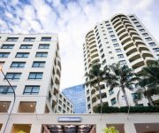
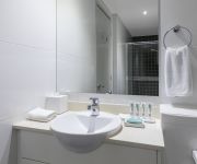
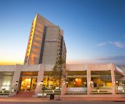
Hotels and Places to Stay
The William Inglis - MGallery by Sofitel
Mantra Parramatta
Meriton Suites George Street
Travelodge Bankstown Sydney
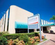
BREAKFREE BANKSTOWN INTERNATIONAL
Parkroyal Parramatta
Waldorf Parramatta Apartment Hotel
RYDGES PARRAMATTA
RYDGES BANKSTOWN SYDNEY
Novotel Sydney Parramatta
Videos from this area
These are videos related to the place based on their proximity to this place.
Remote Control Jet Boats.MOV
Glen And Jake Down at Chipping Norton Lakes in Sydney NSW Australia we stopped to watch a couple of dudes test out their remote control jet boats.
WRECKING 2008 HOLDEN COMMODORE ENGINE 3.6, VE, LY7 SV6 TYPE, V6 (J13561)
EBAY STORE: http://bit.ly/EBAYSTOREJJ CALL: 02-9724-8099 EMAIL: sales@jjautoparts.com.au WEBSITE: http://www.jjautoparts.com.au CONTACT US TO ORDER PARTS OR FOR MORE ...
WRECKING 2003 NISSAN PATHFINDER ENGINE 3.3, AUTOMATIC (J14867)
WEBSITE: http://www.jjautoparts.com.au EBAY STORE: http://bit.ly/EBAYSTOREJJ CALL: 02-9724-8099 EMAIL: sales@jjautoparts.com.au We are currently wrecking this 2003 NISSAN PATHFINDER ...
Videos provided by Youtube are under the copyright of their owners.
Attractions and noteworthy things
Distances are based on the centre of the city/town and sightseeing location. This list contains brief abstracts about monuments, holiday activities, national parcs, museums, organisations and more from the area as well as interesting facts about the region itself. Where available, you'll find the corresponding homepage. Otherwise the related wikipedia article.
Cabramatta, New South Wales
Cabramatta is a suburb in south-western Sydney, in the state of New South Wales, Australia. Cabramatta is located 30 kilometres south-west of the Sydney central business district, in the local government area of the City of Fairfield. Cabramatta is colloquially known as 'Cabra' and has the largest Vietnamese community in Australia.
Fairfield, New South Wales
Fairfield is a western suburb of Sydney, in the state of New South Wales, Australia. Fairfield is located 29 kilometres west of the Sydney central business district and is the administrative centre for the local government area of the City of Fairfield and is also partly in the local government area of the City of Holroyd.
Yennora, New South Wales
Yennora is a suburb of Sydney in the state of New South Wales, Australia 29 kilometres west of the Sydney central business district. It is primarily in the local government area of the City of Fairfield, however parts of the suburb are also in the City of Parramatta and the City of Holroyd. It is part of the Greater Western Sydney region.
Villawood, New South Wales
Villawood, a suburb of local government areas City of Bankstown and City of Fairfield, is 25 kilometres west of the Sydney central business district, in the state of New South Wales, Australia is a part of the Greater Western Sydney region. Villawood is a residential suburb with its name often associated with the notoriety of the detention centre located here.
Fairfield High School (New South Wales)
Fairfield High School is a comprehensive, co-educational school in Fairfield, Sydney, Australia, part of the South Western Sydney School Region and the Fairfield School Education Area. When Fairfield High School was established in 1955, the school was divided into two adjacent single sex high schools: Fairfield Boys High School and Fairfield Girls High School.
Cabramatta railway station
Cabramatta is a junction station on the CityRail network where the South line and Inner West line merge. The station has two side platforms, with a ramp connecting the two platforms. It serves the Sydney suburb of Cabramatta. The station opened in 1870.
Yennora railway station
Yennora is a CityRail railway station on Sydney's South line. It serves an industrial area in the suburb of Yennora. The station was opened in 1927 as a private siding for a Mrs McCreadie. The station has two side platforms with street access to both platforms, connected by a footbridge. It does not therefore qualify as having Easy Access for wheelchairs. Access to platforms from their respective exits is by a ramp.
Fairfield railway station, Sydney
Fairfield is a CityRail railway station on Sydney's South line. It serves a residential and commercial area in the suburb of Fairfield. It has a major bus interchange including services further in the Fairfield city and Parramatta. It has two side platforms, one side for Campbelltown via Liverpool trains, the other for City Circle via Granville or Blacktown via Parramatta services. The station was opened with the line in 1856 when a single platform and crossing loop were provided.
Canley Vale railway station
Canley Vale railway station is a CityRail station located on the Old Main South railway line in the suburb of Canley Vale. The station is predominately served by trains of the CityRail South line and consists of two side platforms with street access to both platforms, connected by a footbridge at the southern end. The station opened in 1878.
Villawood railway station
Villawood is a minor railway station on the CityRail Inner West railway line in Australia. It serves the Sydney suburb of Villawood, a residential area with some industry. It has an island platform, built with the opening of the line. The station has an overhead footbridge connected to the platforms by stairs. Thus the station does not qualify as having Easy Access for wheelchairs. A third track called the Southern Sydney Freight Line carries freight trains separately from the passenger lines.
Carramar railway station
Carramar is a railway station on the main southern railway line, served by trains of CityRail's Inner West and Bankstown railway lines. It serves the Sydney suburb of Carramar, which is mainly a residential area. It has an island platform, built with the opening of the line. A third track called the Southern Sydney Freight Line carries freight trains separately from the passenger lines.
Leightonfield railway station
Leightonfield is a CityRail railway station on Sydney's Bankstown and Inner West railway lines. It serves an industrial area in the suburb of Villawood. It has two side platforms with access to both platforms via stairs. This does not allow for Easy Access for wheelchairs. A small yard for freight trains lies on the southern side of the station. From 2011 the yard connects to the Southern Sydney Freight Line. A passing loop on the SSFL exists here as well.
Old Guildford, New South Wales
Old Guildford is a suburb of Sydney, in the state of New South Wales, Australia 24 kilometres west of the Sydney central business district, in the local government area of the City of Fairfield. It is part of the Greater Western Sydney region.
Lansvale, New South Wales
Lansvale is a suburb of Sydney, in the state of New South Wales, Australia 28 kilometres south-west of the Sydney central business district, the other side of Chipping Norton and its lake, in the local government areas of the City of Fairfield and is part of the South-western Sydney region.
Canley Vale, New South Wales
Canley Vale is a suburb of Sydney, in the state of New South Wales, Australia. Canley Vale is located 30 kilometres south-west of the Sydney central business district, in the local government area of the City of Fairfield and is part of the South-western Sydney region.
Carramar, New South Wales
Carramar is a suburb of Sydney, in the state of New South Wales, Australia. Carramar is located 30 kilometres west of the Sydney central business district, in the local government area of the City of Fairfield and is part of the Greater Western Sydney region.
Fairfield Heights, New South Wales
Fairfield Heights is a suburb of Sydney, in the state of New South Wales, Australia. Fairfield Heights is located 31 kilometres west of the Sydney central business district in the local government area of the City of Fairfield. Fairfield Heights is part of the Greater Western Sydney region. Fairfield Heights shares the postcode of 2165 with the separate suburbs of Fairfield, Fairfield East and Fairfield West.
Fairfield East, New South Wales
Fairfield East is a suburb of Sydney, in the state of New South Wales, Australia. Fairfield East is located 28 kilometres west of the Sydney central business district in the local government area of the City of Fairfield. Fairfield East is part of the Greater Western Sydney region. Fairfield East shares the postcode of 2165 with nearby suburbs of Fairfield, Fairfield Heights and Fairfield West.
Patrician Brothers' College, Fairfield
Patrician Brothers' College, Fairfield is a systemic Roman Catholic, secondary, day school for boys, located in Fairfield, a western suburb of Sydney, New South Wales, Australia. Founded by the Patrician Brothers in 1953, the college formerly catered for students in Years 5 to 12, however the primary section was merged into the local parish primary school and closed in 2006.
Leightonfield, New South Wales
Leightonfield is a suburb of Sydney, New South Wales, Australia. It is serviced by Cityrail and various bus routes. Leightonfield's postcode is 2163.
Canley Vale High School
Canley Vale High School is a New South Wales Government co-educational high school located in south-west Sydney, in the suburb of Canley Vale, NSW, Australia. It was established in 1965, on which was once an area of orchards and currently provides for over 1200 students. The school caters for International students mainly from countries like China and Vietnam.
Lansdowne, New South Wales
Lansdowne is a suburb in south-western Sydney, in the state of New South Wales, Australia. Lansdowne is located 27 kilometres west of the Sydney central business district, in the local government areas of the City of Bankstown and is part of the South-western Sydney region.
Magic Kingdom, Sydney
Magic Kingdom was a small amusement park located in Lansvale, New South Wales, Australia. It is now closed.
Freeman Catholic College
Freeman Catholic College is a co-education, systemic Roman Catholic secondary school (year 7 to 12) located in Bonnyrigg Heights, a western suburb of Sydney, New South Wales, Australia. The school was founded in 1985, and named after Cardinal Sir James Freeman, the 6th Roman Catholic Archbishop of Sydney. The College has a student population of approximately 1250, with 250 students in the each grade from 7-10 and 125 in each grade from 11-12.
Chipping Norton Lakes
Chipping Norton Lakes locates at Chipping Norton, New South Wales. It is a part of Georges River. It is managed by Liverpool City Council.


