Explore Mount Victoria
The district Mount Victoria of in Blue Mountains Municipality (New South Wales) with it's 828 inhabitants Mount Victoria is located in Australia about 133 mi north-east of Canberra, the country's capital.
If you need a place to sleep, we compiled a list of available hotels close to the map centre further down the page.
Depending on your travel schedule, you might want to pay a visit to some of the following locations: Katoomba, Parramatta, Sydney, Canberra and . To further explore this place, just scroll down and browse the available info.
Local weather forecast
Todays Local Weather Conditions & Forecast: 11°C / 52 °F
| Morning Temperature | 8°C / 46 °F |
| Evening Temperature | 9°C / 48 °F |
| Night Temperature | 9°C / 47 °F |
| Chance of rainfall | 1% |
| Air Humidity | 79% |
| Air Pressure | 1022 hPa |
| Wind Speed | Light breeze with 4 km/h (3 mph) from North |
| Cloud Conditions | Overcast clouds, covering 94% of sky |
| General Conditions | Light rain |
Monday, 6th of May 2024
10°C (51 °F)
8°C (47 °F)
Moderate rain, gentle breeze, broken clouds.
Tuesday, 7th of May 2024
9°C (49 °F)
8°C (47 °F)
Light rain, light breeze, overcast clouds.
Wednesday, 8th of May 2024
9°C (48 °F)
9°C (48 °F)
Moderate rain, calm, overcast clouds.
Hotels and Places to Stay
Kubba Roonga Guesthouse
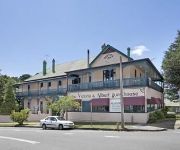
The Victoria & Albert Guesthouse
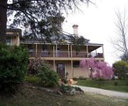
Mount Victoria Manor
Blackheath Motor Inn
La Roussette
Comfort Inn Redleaf Resort
Videos from this area
These are videos related to the place based on their proximity to this place.
Blackheath Fireworks Display
The Blackheath fireworks display is one of the most anticipated London fireworks displays each year, bringing colour and light to the skies of Lewisham in a truly dazzling display of fireworks....
Walls Cave Blackheath
I came accross this cool river crossing when bushwalking to walls cave at Blackheath on the weekend. The walk is not well signposted from the road so not many people walk the trail. The path...
Snowfall in Blackheath
this time last year we were packing the pets and the family photos into the car and doing a bolter down the hill to escape the bushfires. This year we had an unexpected dump of snow. A similar...
Amazing Blueys Climbing Trip
Eight days climbing at the Blue Mountains in NSW! This was a farewell trip for Timmy and Alice who have moved to Darwin, and a chance to pull on some bolts!
Blackheath Airstrip Development Town Meeting. Part 4 of 7 - 31/05/2012
The Blackheath Airstrip Development Town Meeting 31 May 2012. This meeting was held by Blue Mountains City Council in response to growing opposition to the p...
Development or Community?
Help save the bike track and surrounding area. Click on the link, sign the online petition then share it with your friends. http://www.gopetition.com/petitio...
Rhododendron Garden in Blue Mountains Private Tour
Explore the Blue Mountains in all its glory with an experienced, knowledgeable Sydneysider who will be your private guide and driver, showing you the most fascinating sights and attractions...
Grand Canyon Walking Track Australia
Blue Mountains National Park has lots of day walks and hikes, this was a day walk on the Grand Canyon walking track at Blackheath Australia. It took 3.5hrs and the views were stunning. Everything...
Videos provided by Youtube are under the copyright of their owners.
Attractions and noteworthy things
Distances are based on the centre of the city/town and sightseeing location. This list contains brief abstracts about monuments, holiday activities, national parcs, museums, organisations and more from the area as well as interesting facts about the region itself. Where available, you'll find the corresponding homepage. Otherwise the related wikipedia article.
Blackheath, New South Wales
Blackheath (elevation 1065 metres) is a town located near the top of the Blue Mountains in New South Wales, Australia, 120 kilometres west north-west of Sydney, 11 kilometres north-west of Katoomba and 30 kilometres south-east of Lithgow. In 2006, Blackheath had a population of 4,177 people.
Grose Valley
The Grose Valley is a rugged valley in the Blue Mountains, New South Wales, Australia. It has been formed by the Grose River, the headwaters of which are in the Mount Victoria area. The valley is located between the Great Western Highway and Bells Line of Road, the two major routes across the Blue Mountains. The majority of the valley falls within the Blue Mountains National Park.
Medlow Bath, New South Wales
Medlow Bath is an Australian small town located near the highest point of the Blue Mountains, between Katoomba and Blackheath. It has an approximate altitude of 1050 m and is located approximately 115 kilometres west north west of Sydney and 5 kilometres north west of Katoomba. At the 2006 census, Medlow Bath had a population of 461 people.
Perrys Lookdown
Perrys Lookdown is situated on the edge of the Grose Valley in the Blue Mountains, Australia. Free campsites (five individual sites) are adjacent to the car park. The Blue Gum Forest is often accessed by foot from here, 656 vertical metres below the lookdown. The road to Blackheath is unsealed.
Blue Gum Forest, Blue Mountains
The Blue Gum Forest is situated in the Grose Valley, in Blue Mountains National Park, west of Sydney, Australia. It is one of the best-known bushwalking sites in Australia. As part of the Greater Blue Mountains, the forest is within the UNESCO World Heritage area. The forest survived through the efforts of early Australian conservationists. The forest consists predominantly of towering Blue Gum trees (Eucalyptus deanei), with an understory of shrubs.
Evans Lookout
Evans Lookout is a lookout in the Blue Mountains, New South Wales, Australia. Overlooking the sandstone cliffs of the Grose River Valley, the lookout is also an access point for pedestrian access to the valley floor. Nearby walks include the Grand Canyon and trails to Govetts Leap lookout. A popular, easily accessible location, the lookout is located within the Blue Mountains National Park close to the town of Blackheath.
City of Blue Mountains
The City of Blue Mountains is a local government area of New South Wales, Australia, governed by the Blue Mountains City Council. The city is located in the Blue Mountains range west of Sydney. The Mayor of Blue Mountains City Council is Cr. Daniel Myles, a member of the Liberal Party.
Mount Victoria, New South Wales
Mount Victoria is a small township in the Blue Mountains of New South Wales, Australia. It is the westernmost village in the City of Blue Mountains, located approximately 120 kilometres via road from Sydney and 1043 metres above sea-level. The settlement has a population of 828 people as of the 2006 Census.
Hartley, New South Wales
Hartley is a historical village in New South Wales, Australia, in the City of Lithgow, located approximately 150 kilometres west of Sydney. It is below the western escarpment of the Blue Mountains. It was once a major administrative centre on the Great Western Highway. It has since fallen into decline, replaced by other towns that are on the railway line. At the 2006 census, Hartley had a population of 497 people.
Medlow Bath railway station
Medlow Bath railway station is a regional railway station on the Blue Mountains Line of the CityRail intercity network, serving the town of Medlow Bath in the Upper Blue Mountains in New South Wales, Australia. The station opened in 1880. The station has an island platform and is served by one train each way every two hours in off-peak, with additional services during peak hours.
Blackheath railway station, New South Wales
Blackheath railway station is a regional railway station on the Blue Mountains Line of the CityRail intercity network, serving the town of Blackheath in the Upper Blue Mountains in New South Wales, Australia. The station has an island platform and is served by trains every two hours each way in off-peak, with additional services during peak hours. On weekends, the station is serviced by one train per hour in each direction, with every second outbound train terminating at Mount Victoria.
Mount Victoria railway station
Mount Victoria railway station is a regional railway station on the Blue Mountains Line of the CityRail intercity network, serving the town of Mount Victoria in the Upper Blue Mountains in New South Wales, Australia. The station opened in 1869 with the opening of the Main Western railway through the area. The station has two side platforms and is served by one train every two hours in off-peak on weekdays, with additional services during peak hours.
Bell railway station, New South Wales
Bell railway station, originally called Mount Wilson, is a regional railway station on the Blue Mountains Line of the CityRail intercity network, serving the villages of Mount Wilson, Bell and surrounding areas in the Upper Blue Mountains in New South Wales, Australia.
Michael Eades Reserve
The bushland in Michael Eades Reserve and surrounds is rich in sensitive vegetation, unique to the upper Blue Mountains plateau, in New South Wales, Australia. Many of the significant plants in the area, such as Acacia ptychoclada and Grevillea acanthifolia, do not appear anywhere else in the world.
Mermaids Cave
Mermaids Cave is an undercut sandstone cave located in the Blue Mountains of New South Wales, Australia. It was named in 1882 and was also known as Mermaid's Glen. Accessible by a short walking trail from the Megalong Valley road. A scene from Mad Max Beyond Thunderdome was filmed there.
Newnes Junction railway station
Newnes Junction is a closed railway station on the Blue Mountains Line, New South Wales, Australia. It opened in 1910 and served the former private branch line to Newnes. The station closed to passenger services in 1975, although still physically exists and is occasionally used for coal trains visiting the nearby Clarence Colliery. The station consists of an island 'Up' platform, and a single side 'Down' platform.
Bell, New South Wales
Bell is a small rural/residential village in the Blue Mountains with an elevation of approximately 1100 metres above sea level. Bell is approximately 125 km west of Sydney, Australia by road or 137 km by rail, some 20 km east of Lithgow and 10 km north of Mount Victoria. It is a locality on the junction of the Bells Line of Road, Chifley Road and the Darling Causeway. Bell is in the north-west corner of the local government area of the City of Blue Mountains.
Shipley, New South Wales
Shipley is a small hamlet village in the state of New South Wales, Australia in the City of Blue Mountains.
Clarence railway station
Clarence is a railway station on the Blue Mountains section of the Main Western railway line in New South Wales, Australia. It opened in 1874 on the original alignment from Bell to the Clarence Tunnel. With the opening of Dargan's Deviation, it was rebuilt to its second location. When the Ten Tunnels Deviation was completed in 1910, the station was rebuilt on the new line but was closed in 1974. Little trace of this third station now remains.
Mount York
Mount York is a 1,061 metres mountain in the western Blue Mountains of New South Wales, Australia, located approximately 150 kilometres west of Sydney. It is in fact a projection of the Blue Mountains plateau, creating a promontory of the western escarpment with a minor rise at its summit.
Mount Piddington
Mount Piddington, or Wirindi, is a mountain in the Blue Mountains village of Mount Victoria in New South Wales. It has a lookout, restrooms and a picnic area at its summit, surrounded by a loop road, Mount Piddington Road, which runs from the summit to Mount Victoria village. It is also the starting point of several bushwalking tracks that descend to the cliffs of Hornes Point and the Fairy Bower reserve. Notable sites on the slopes of Mount Piddington include Coxs Leap and Bushranger Cave.
Clarence, New South Wales
Clarence is a place in New South Wales, Australia. It was originally a railway outpost on the original railway line across the Blue Mountains, but by 1908 when Clarence was used as headquarters for the Ten Tunnel deviation works, the town population had flourished to over 5,000 residents, the majority being the navvies employed on the deviation works. When the deviation was opened in 1910, the town population quickly fell, despite a new platform built on the new deviation.
Clarence Tunnel
The Clarence Tunnel is a railway tunnel that was originally part of the Main Western railway line across the Blue Mountains, New South Wales, Australia. It is approximately 494 meters long.
Hartley Vale, New South Wales
Hartley Vale is a small village in the Blue Mountains area of New South Wales, Australia. It is approximately 150 kilometres west of Sydney and 12 kilometres south-east of Lithgow. It is in the Local Government Area of the City of Lithgow.
Little Hartley, New South Wales
Little Hartley is a village in the Blue Mountains area of New South Wales, Australia. It is located approximately 150 kilometres west of Sydney and 20 kilometres south-east of Lithgow, on the Great Western Highway. It is in the Local Government Area of the City of Lithgow.


