Safety Score: 2,8 of 5.0 based on data from 9 authorites. Meaning we advice caution when travelling to Portugal.
Travel warnings are updated daily. Source: Travel Warning Portugal. Last Update: 2024-04-26 08:02:42
Discover Alporchinhos
The district Alporchinhos of in Faro is a district in Portugal about 119 mi south of Lisbon, the country's capital city.
Looking for a place to stay? we compiled a list of available hotels close to the map centre further down the page.
When in this area, you might want to pay a visit to some of the following locations: Lagoa, Silves, Monchique, Loule and Faro. To further explore this place, just scroll down and browse the available info.
Local weather forecast
Todays Local Weather Conditions & Forecast: 17°C / 62 °F
| Morning Temperature | 13°C / 55 °F |
| Evening Temperature | 16°C / 61 °F |
| Night Temperature | 14°C / 58 °F |
| Chance of rainfall | 0% |
| Air Humidity | 63% |
| Air Pressure | 1010 hPa |
| Wind Speed | Fresh Breeze with 14 km/h (9 mph) from East |
| Cloud Conditions | Overcast clouds, covering 96% of sky |
| General Conditions | Light rain |
Saturday, 27th of April 2024
16°C (62 °F)
11°C (52 °F)
Light rain, fresh breeze, broken clouds.
Sunday, 28th of April 2024
16°C (60 °F)
12°C (54 °F)
Light rain, moderate breeze, few clouds.
Monday, 29th of April 2024
18°C (65 °F)
13°C (55 °F)
Sky is clear, fresh breeze, clear sky.
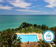
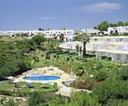
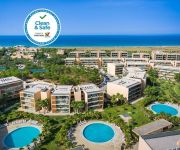
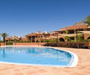
Hotels and Places to Stay
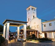
Vila Vita Parc Resort & Spa
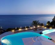
Suites Alba Resort & SPA
Vidamar Resort Hotel Algarve - Dining Around Half-Board
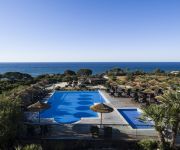
Vilalara Thalassa Resort
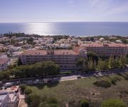
Hotel Vila Galé Atlântico
Pestana Viking Beach & Spa Resort
Rocha Brava Village Resort
Salgados Vila das Lagoas
SALGADOS DUNAS SUITES
Amendoeira Golf Resort
Videos from this area
These are videos related to the place based on their proximity to this place.
DAVID LAMY - CAVES TRIP IN ALGARVE
A FANTASTIC TRIP TO THE AMAZING CAVES IN LAGOA ALGARVE BY DAVID LAMY.
Algarve, Senhora da Rocha - Trilho / Trail / hiking / trekking / caminhada
Trilho da Nossa Senhora da Rocha Senhora da Rocha Praia das Fontainhas Alporchinhos Porches Lagoa Algarve GPS. N 37º 5' 49,73" W 8º 23' 9,14" Google maps geo:lat=37.096914 ...
The Algarve Coast
The Algarve coast is known for dramatic cliff faces, rock-formations and fine sand beaches. Felesia (golden flag) at Pine Cliffs, Lagos, Armação de Pera, Benagil, Vilalara Thalassa Resort...
Sunset in Armação de Pêra, Algarve, Portugal, Europe
Armação de Pêra is a Portuguese parish (freguesia) in the municipality of Silves. The population in 2011 was 4867, in an area of 7.99 km². The village used to be called Pêra de Baixo...
VILA VITA Biergarten in Porches (Algarve, Portugal)
The VILA VITA Biergarten, at the nearby village of Porches, in Portugal, is an authentic Bavarian beer garden, offering traditional specialties including Paulaner beer, sausages, "schnitzel",...
Salvamento de banhistas
Salvamento de um casal de banhistas na Praia da Cova Redonda (Alporchinhos, Algarve), 08.07.2013.
Trilho da Senhora da Rocha - old
Trilho da Senhora da Rocha Praia das Fontainhas Alporchinhos Porches Lagoa Algarve GPS. N 37º 5' 49,73" W 8º 23' 9,14" Google maps geo:lat=37.09691494370456 geo:lon=-8.386945724487304.
Guinness Surger, Water Dog Pub, Armacao de Pera, Algarve, Portugal, Europe
Guinness is an Irish dry stout that originated in the brewery of Arthur Guinness (1725–1803) at St. James's Gate, Dublin. Guinness is one of the most successful beer brands worldwide. It...
Senhora da Rocha Portugal (HD)
PRAIA DA SENHORA DA ROCHA PORCHES, Senhora da Rocha beach is a beach with golden sand and is a refuge for fishermen, to go to the beach through you'll have to pass a tunnel and is the ...
Videos provided by Youtube are under the copyright of their owners.
Attractions and noteworthy things
Distances are based on the centre of the city/town and sightseeing location. This list contains brief abstracts about monuments, holiday activities, national parcs, museums, organisations and more from the area as well as interesting facts about the region itself. Where available, you'll find the corresponding homepage. Otherwise the related wikipedia article.
Carvoeiro (Lagoa)
Carvoeiro, or more commonly Praia de Carvoeiro (although this is no longer its formal name), is a Portuguese civil parish/freguesia in Lagoa Municipality, about 5 km south of the city itself (on the Atlantic Ocean), 14.12 km² in area with 2,784 inhabitant (2001). The population density is 197.2 people/km². It was created as a separate freguesia in 1985 and raised to the status of town on April 19, 2001.
Algoz
Algoz is a freguesia (parish) in the municipality of Silves. The name of the village has its origins in the Arabic word “Al-Gûzz” which derives from the name of the Turkic Oghuz people from the Middle East, whose members settled in the area in the 12th century. The patron saint of the village is Our Lady of Mercy. To the south of the village on a hill is the Chapel of Nossa Senhora do Pilar, from here there are fine views across the area.
Armação de Pêra
Armação de Pêra is a Portuguese parish in the municipality of Silves. The village used to be called Pêra de Baixo or Lower Pêra to distinguish it from the present Pêra, which was then named Pêra de Cima or Upper Pêra. The village of Armação de Pêra is, today, a popular tourist center with fine beaches, hotels, cafés and restaurants. The village is on a broad bay that stretches from Pont da Galé to Senhora da Rocha.
Praia da Rocha
Praia da Rocha is the beach and built up area on the Atlantic Ocean which is the southern section of the municipality/concelho of Portimão, Algarve, southern Portugal. The beach soccer tournament, Mundialito de Futebol de Praia, that hosts some of the worlds best national team, has taken place here every year since 2005. 40x40px Wikimedia Commons has media related to: Praia da Rocha
Pêra (Silves)
Pêra is a Portuguese parish in the municipality of Silves. The village is 12.5 kilometres south east of Silves and is 261 kilometres south south east of Lisbon. The village used to be called Pêra de Cima or Upper Pêra to distinguish it from the present Armação de Pêra, which was then named Pêra de Baixo (Lower Pêra).
Praia da Marinha
Praia da Marinha is one of the most emblematic and beautiful beaches of Portugal, located on the Atlantic coast in Caramujeira, Lagoa Municipality, Algarve, and considered by the Michelin Guide as one of the 10 most beautiful beaches in Europe and as one of the 100 most beautiful beaches in the world. In 1998, it was also awarded with the distinguished "Golden Beach" award by the Portuguese Ministry of the Environment because of its outstanding natural qualities.
Arade River
The Arade is a river located in the region of the Algarve, southern Portugal. the river's course takes it through the municipalities of Silves, Lagoa and Portimão. The source of the river lies to the southwest of the Serra do Caldeirão mountain ridge, in a valley called Barranco do Pé do Coelho. The river has a total length of 46.6 miles, with its source being 481 metres above sea level.
Estádio Municipal de Portimão
Estádio Municipal de Portimão is the current stadium of Portimonense S.C.. It is located in the centre of Portimão in the Algarve, Portugal and was opened in 1937 for local football club Portimonense S.C.. Its capacity is 9,544 people. It hosted Portimonense's stay in the Primeira Liga in the 1980s. In 2006, Portimonense were forced to play away from the Estádio Municipal in the Estádio Algarve, which – built for Euro 2004 – is 70 kilometres from Portimão.
Albufeira (parish)
Albufeira is a Portuguese parish in Albufeira Municipality. It has a population of 16,237 (2001) and an area of 26.49 km². It belongs to the city of Albufeira.
Guia (Albufeira)
Guia is a Portuguese parish in the municipality of Albufeira. It has a population of 3,630 (as of 2001) and an area of 18.45 km². It is approximately 5 km from the coast. The nearest beaches are Laurenco and Gale. It is famous for its numerous chicken piri-piri restaurants, and is known locally as "The Capital of Chicken". The very first chicken piri-piri was supposedly grilled here in 1974 by José Carlos Ramires whose eponymous restaurant is still open today.
Silves Cathedral
Silves Cathedral (Portuguese: Sé Catedral de Silves) in the city of Silves, in the Algarve region of southern Portugal, was mostly built in the 15th century and is considered the main Gothic monument in the Algarve.
Lagoa (parish)
Lagoa is a Portuguese civil parish/freguesia at the center of the municipality/concelho of Lagoa, 25.67 km² in area, with 6,059 inhabitants (2001 census). The population density is 236.0 inhabitants per km². The offices of the freguesia are in part of the Convento de São José.
Praia da Angrinha (Ferragudo)
Praia da Angrinha is situated along the wide estuary of the Rio Arade, south of Ferragudo, in the municipality/concelho of Lagoa. Map location: {{#invoke:Coordinates|coord}}{{#coordinates:37|07|12|N|8|31|20|W| | |name= }} Protected by the large moles extending out towards the Portimão shore opposite, the beach is long and enclosed by heights in the land, now much eroded by the elements.
Praia Grande (Ferragudo)
Praia Grande is on the east bank of the wide estuary of the Rio Arade, south of Ferragudo, in the municipality/concelho of Lagoa (Algarve), in Portugal. Map location: {{#invoke:Coordinates|coord}}{{#coordinates:37|07|12|N|8|31|20|W| | |name= }} This beach is just inside the mole which shields the river entrance and the port area of Portimão, and runs north to the Forte de São João do Arade.
Estômbar
Estômbar is a Portuguese civil parish/freguesia in the municipality/concelho of Lagoa, just west of the city of Lagoa itself. It is 23.83 km² in area, with 4,658 inhabitants (2001 census); the population density is 195.5 inhabitants per km². Its civil status was raised to that of a town on August 16, 1991. Estômbar is mainly as a bedroom community for Portimão, and many of its residents travel daily across the Rio Arade to work in the neighboring municipality.
Parchal
Parchal is a Portuguese civil parish/freguesia in the northwest sector Lagoa Municipality, 4.5 km² in area, with 3,378 inhabitants (2001 census). The population density is 750.7 inhabitants per km². Parchal serves mainly as a bedroom community for Portimão, and many of its residents travel daily across the Rio Arade to work in the neighboring municipality.
Porches (Lagoa)
Porches is a civil parish/freguesia in the municipality/concelho of Lagoa (Algarve) in Portugal, about 10 km east of the city of Lagoa. It is 15.57 km² in area, with 1,901 inhabitants (2001); its population density is 122.1 persons/km². It was elevated to the status of a town on July 12, 2001.
Portimão (parish)
Portimão is a freguesia (parish) in the municipality of Portimão.
International Sand Sculpture Festival
Described as the largest sand sculpture event in the world, the International Sand Sculpture Festival or Festival Internacional de Escultura em Areia (FIESA) has been held in Pêra, Algarve, Portugal annually since 2003. The site at {{#invoke:Coordinates|coord}}{{#coordinates:37.1289|N|8.3310|W|region:PT|||| |primary |name= }} occupies 15,000 square metres . Each year about 60 artists use 35000 tons of sand to create 50 works of art.
Praia Santa Eulália
Praia Santa Eulália is a beach within the Municipality of Albufeira, in the Algarve, Portugal. The beach is 2.7 miles east of the town of Albufeira and is 20.5 miles west of the regions capital of Faro. In 2012 Praia Santa Eulália has been designated a blue Flag beach.
Praia do Evaristo
Praia do Evaristo is a beach within the Municipality of Albufeira, in the Algarve, Portugal. The beach is 37 miles west of the town of Albufeira and is 31.3 miles west of the regions capital of Faro. In 2012 Praia do Evaristo has been designated a blue Flag beach.


