Safety Score: 2,7 of 5.0 based on data from 9 authorites. Meaning we advice caution when travelling to United States.
Travel warnings are updated daily. Source: Travel Warning United States. Last Update: 2024-05-11 07:34:58
Delve into Bold Springs
Bold Springs in Walton County (Georgia) is located in United States about 510 mi (or 821 km) south-west of Washington DC, the country's capital town.
Current time in Bold Springs is now 07:18 AM (Saturday). The local timezone is named America / New York with an UTC offset of -4 hours. We know of 10 airports close to Bold Springs, of which 5 are larger airports. The closest airport in United States is Athens Ben Epps Airport in a distance of 27 mi (or 44 km), East. Besides the airports, there are other travel options available (check left side).
There is one Unesco world heritage site nearby. It's Great Smoky Mountains National Park in a distance of 136 mi (or 219 km), North-East. Also, if you like playing golf, there are some options within driving distance. We encountered 4 points of interest near this location. If you need a hotel, we compiled a list of available hotels close to the map centre further down the page.
While being here, you might want to pay a visit to some of the following locations: Winder, Monroe, Lawrenceville, Covington and Jefferson. To further explore this place, just scroll down and browse the available info.
Local weather forecast
Todays Local Weather Conditions & Forecast: 22°C / 72 °F
| Morning Temperature | 11°C / 52 °F |
| Evening Temperature | 22°C / 72 °F |
| Night Temperature | 17°C / 63 °F |
| Chance of rainfall | 0% |
| Air Humidity | 36% |
| Air Pressure | 1012 hPa |
| Wind Speed | Gentle Breeze with 8 km/h (5 mph) from South-East |
| Cloud Conditions | Clear sky, covering 0% of sky |
| General Conditions | Sky is clear |
Saturday, 11th of May 2024
24°C (74 °F)
18°C (65 °F)
Broken clouds, gentle breeze.
Sunday, 12th of May 2024
16°C (62 °F)
16°C (61 °F)
Light rain, gentle breeze, overcast clouds.
Monday, 13th of May 2024
20°C (68 °F)
18°C (65 °F)
Light rain, gentle breeze, overcast clouds.
Hotels and Places to Stay
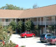
WHITS INN
Holiday Inn Express BETHLEHEM
Videos from this area
These are videos related to the place based on their proximity to this place.
2010 SERC #4 - Winder, GA
The fourth race of the 2010 SERC series took place at Ft. Yargo State Park in Winder, GA. The race was a US Cup qualifier. Rain overnight made for a slick start, but trails dried nicely for...
BES Hip Hop Club at The Arts Center 3
Bethlehem Elementary School Hip Hop Club at the arts center in Winder GA.
BES Hip Hop Club at The Arts Center 2
Bethlehem Elementary School Hip Hop Club at the arts center in winder GA.
FtYargo Horseshoe Drop
The Horse shoe drop on the trails in Yargo State Park in Georgia. The drop is probably between 25 and 30 feet deep. You have to peddle hard to make sure you make it up the other side.
2008 GHSA Region 8AAAA - Loganville
Loganville High School at the 2008 GHSA 8AAAA Region Cheerleading Competition at Loganville High School on 11/1/2008.
2008 GHSA Region 8AAAA - Apalachee
Apalachee High School at the 2008 8AAAA Region Cheerleading Competition at Loganville High School on 11/1/2008.
2008 GHSA Region 8AAAA - Habersham Central
Habersham Central High School at the 2008 GHSA 8AAAA Region Cheerleading Competition at Loganville High School on 11/1/2008.
802 Creek Bottom Rd, Loganville, GA Presented by Jamie Parker.
Click to see more: http://www.searchallproperties.com/listings/2057023/802-Creek-Bottom-Rd-Loganville-GA/auto?reqpage=video 802 Creek Bottom Rd Loganville, GA 30052 Contact Jamie Parker for.
2008 GHSA Region 8AAAA - Heritage
Heritage High School at the 2008 GHSA 8AAAA Region Cheerleading Competition at Loganville High School on 11/1/2008.
2008 GHSA Region 8AAAA - Salem
Salem High School at the 2008 GHSA 8AAAA Region Cheerleading Competition at Loganville High School on 11/1/2008.
Videos provided by Youtube are under the copyright of their owners.
Attractions and noteworthy things
Distances are based on the centre of the city/town and sightseeing location. This list contains brief abstracts about monuments, holiday activities, national parcs, museums, organisations and more from the area as well as interesting facts about the region itself. Where available, you'll find the corresponding homepage. Otherwise the related wikipedia article.
WFSH-FM
Branded as "104.7 the Fish", WFSH-FM is an FM radio station in Atlanta, Georgia broadcasting at 104.7 MHz. The station format is called "Safe For The Whole Family", a hybrid of Christian pop and clean secular music with a mainstream feel. Between Thanksgiving and Christmas Day, the station plays all Christmas music, both religious and secular. WFSH-FM transmits from the tallest radio masts and towers in Georgia (2000 feet or 600 meters) in Loganville, 30 miles (48 km) east of Atlanta.
WYAY
WYAY is a 77,000 watt Atlanta FM radio station that broadcasts an all-news format. Its city of license is Gainesville, Georgia, northeast of Atlanta, but the station moved in toward the metro area in early 1985.
Bold Springs, Georgia
Bold Springs is an unincorporated community in Walton County, Georgia, United States. It is located around Georgia State Route 81 and Bold Springs Road. The elevation is 925 feet. The majority of Bold Springs is owned and corporated by the Mitchell family.


