Safety Score: 2,7 of 5.0 based on data from 9 authorites. Meaning we advice caution when travelling to United States.
Travel warnings are updated daily. Source: Travel Warning United States. Last Update: 2024-05-13 08:03:22
Delve into Tuttletown
Tuttletown in Tuolumne County (California) with it's 668 habitants is a town located in United States about 2,328 mi (or 3,747 km) west of Washington DC, the country's capital town.
Time in Tuttletown is now 02:09 PM (Monday). The local timezone is named America / Los Angeles with an UTC offset of -7 hours. We know of 10 airports closer to Tuttletown, of which 5 are larger airports. The closest airport in United States is Oakdale Airport in a distance of 25 mi (or 40 km), South-West. Besides the airports, there are other travel options available (check left side).
Also, if you like the game of golf, there are some options within driving distance. We saw 1 points of interest near this location. In need of a room? We compiled a list of available hotels close to the map centre further down the page.
Since you are here already, you might want to pay a visit to some of the following locations: Sonora, San Andreas, Jackson, Modesto and Merced. To further explore this place, just scroll down and browse the available info.
Local weather forecast
Todays Local Weather Conditions & Forecast: 24°C / 76 °F
| Morning Temperature | 12°C / 53 °F |
| Evening Temperature | 21°C / 70 °F |
| Night Temperature | 14°C / 57 °F |
| Chance of rainfall | 0% |
| Air Humidity | 24% |
| Air Pressure | 1011 hPa |
| Wind Speed | Gentle Breeze with 9 km/h (5 mph) from East |
| Cloud Conditions | Few clouds, covering 11% of sky |
| General Conditions | Few clouds |
Monday, 13th of May 2024
24°C (75 °F)
13°C (55 °F)
Light rain, gentle breeze, clear sky.
Tuesday, 14th of May 2024
24°C (76 °F)
15°C (58 °F)
Sky is clear, gentle breeze, clear sky.
Wednesday, 15th of May 2024
24°C (76 °F)
15°C (59 °F)
Sky is clear, gentle breeze, clear sky.
Hotels and Places to Stay
Historic National Hotel
The Palm Hotel
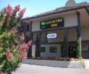
COUNTRY INN SONORA
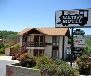
Jamestown Railtown Motel
MINERS MOTEL JAMESTOWN
SONORA GOLD LODGE
Sonora Inn
AMERICAS BEST VALUE INN
Rodeway Inn Sonora
INNS OF CALIFORNIA SONORA
Videos from this area
These are videos related to the place based on their proximity to this place.
21899 Parrotts Ferry Rd Columbia CA 95310
View full virtual tour: http://www.justsnooping.com/tours/2628355/
Where There's a Will, There's Kung Fu
Definitively NOT one of the finest kung-fu films ever devised. This is the English dub version, and thank goodness for that. Directed by and starring legendary hack director Sid Weaver.
Flight up to Columbia state park with ATC
At the same time as we were have multiple presidential TFR's over the bay area we headed East to the gold mining town of Columbia in the foothills of the Sierra Nevada's. This was a Mach Buffet...
My Time Machine Landed in 1850's Columbia, CA
I wanted to go to the source to learn about California's statehood, the city of Columbia (was the 2nd largest city in the 1850s and was almost chosen to be the state capital,) mining in that...
Columbia Father's Day Fly In 2
2014 Columbia Father's Day Fly In - Sunday Flight - from the back seat of #3.
S-2AT's Departing and Landing at Columbia Airport O22 with random Deer at the end
Multiple Takeoffs and Landings at Columbia Air Attack Base California. I believe these are the S-2AT civil firefighting conversion of the S-2 Tracker, but not the Convair Firecat version.
Charmer near Historical Columbia State Park
For more details: http://www.visualtour.com/showvt.asp?t=3347212 11088 State Street Columbia, CA 95310 $247000, 3 bed, 2.0 bath, 1747 SF, MLS# 20140747 This home features a beautiful yard,...
A Snake, A Landing, A Tombstone, and another Landing
Filmed from the Springfield cemetary, a 19th century cemetary just off the end of Columbia Airport.
Videos provided by Youtube are under the copyright of their owners.
Attractions and noteworthy things
Distances are based on the centre of the city/town and sightseeing location. This list contains brief abstracts about monuments, holiday activities, national parcs, museums, organisations and more from the area as well as interesting facts about the region itself. Where available, you'll find the corresponding homepage. Otherwise the related wikipedia article.
Railtown 1897 State Historic Park
Railtown 1897 State Historic Park, and its operating entity, the Sierra Railway, is known as "The Movie Railroad. " Both entities are a heritage railway and are a unit of the California State Park System. Railtown 1897 is located in Jamestown, California. The entire park preserves the historic core of the original Sierra Railway of California (later reincorporated as the Sierra Railroad Company).
Melones, California
For the existing town formerly called Melones, see Carson Hill, California.
Archie Stevenot Bridge
The Stevenot Bridge carries State Route 49 over New Melones Lake between Calaveras and Tuolumne Counties in the U.S. state of California and was completed in 1976.


