Safety Score: 2,7 of 5.0 based on data from 9 authorites. Meaning we advice caution when travelling to United States.
Travel warnings are updated daily. Source: Travel Warning United States. Last Update: 2024-05-20 08:01:38
Delve into Triangle Court
The district Triangle Court of Richmond in Contra Costa County (California) is a subburb in United States about 2,429 mi west of Washington DC, the country's capital town.
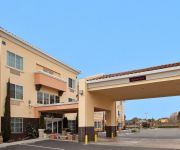
If you need a hotel, we compiled a list of available hotels close to the map centre further down the page.
While being here, you might want to pay a visit to some of the following locations: Oakland, San Rafael, San Francisco, Martinez and Napa. To further explore this place, just scroll down and browse the available info.
Local weather forecast
Todays Local Weather Conditions & Forecast: 20°C / 69 °F
| Morning Temperature | 13°C / 55 °F |
| Evening Temperature | 17°C / 63 °F |
| Night Temperature | 14°C / 58 °F |
| Chance of rainfall | 0% |
| Air Humidity | 45% |
| Air Pressure | 1014 hPa |
| Wind Speed | Gentle Breeze with 8 km/h (5 mph) from North-East |
| Cloud Conditions | Clear sky, covering 0% of sky |
| General Conditions | Sky is clear |
Wednesday, 22nd of May 2024
18°C (64 °F)
13°C (56 °F)
Sky is clear, moderate breeze, clear sky.
Thursday, 23rd of May 2024
18°C (64 °F)
13°C (55 °F)
Broken clouds, gentle breeze.
Friday, 24th of May 2024
17°C (62 °F)
13°C (55 °F)
Sky is clear, moderate breeze, clear sky.
Hotels and Places to Stay
DoubleTree by Hilton Berkeley Marina
Holiday Inn Express & Suites SAN PABLO - RICHMOND AREA
Courtyard Richmond Berkeley
Holiday Inn Express & Suites BERKELEY
La Quinta Inn Berkeley
SANDS INN AND SUITES - SAN PABLO
Marina Inn
SureStay Plus Hotel By Best Western Point Richmond
DAYS INN PINOLE BERKELEY
MOTEL 6 PINOLE
Videos from this area
These are videos related to the place based on their proximity to this place.
IDPA Match, Richmond Hotshots, CA, January 11, 2015
Score: 162.99s (22 points down). 1st/3 SSP Master, 1st/26 SSP, 1st/43 Overall. Most Accurate. High Senior. Got 15(!) points down on the first stage (Stage 8), kept emotions under control and...
Richmond Hotshots USPSA Match, March 15, 2015
3rd/27 Production (92%) and 22nd/97 Overall (72%). Pistol: Glock 34; Handloads: Montana Gold CMJ 147gn, Titegroup 3.3gn, 1.13"; 900fps; Camera: Tachyon OPS HD; Editor: Avidemux 2.5.
Bed Bug Spraying in Richmond CA 510-545-4044 Free Bed Bug Inspection
Visit: http://richmondpestcontrolca.com/ Bed Bug Treatments by Official Pest Control in Richmond CA 510-545-4044 Free Bed Bug Inspection Serving Northern California since 2000 with over 33000...
Pest Management Insect Control 510-545-4044 Richmond CA
Visit: http://richmondpestcontrolca.com/ Pest Control 510-545-4044 Richmond CA 94804 Serving Contra Costa California Since 2000. Pest control company, ant control, bed bugs, rodent removal,...
Richmond Hotshots USPSA Match, January 18, 2015
3rd/31 Production (95%) and 20th/96 Overall (65%). Pistol: Glock 34; Handloads: Montana Gold CMJ 147gn, Titegroup 3.3gn, 1.13"; 900fps; Camera: Tachyon OPS HD; Editor: Avidemux 2.5 (32-bit).
Official Pest Control Richmond CA 510-545-4044 Bed Bug, Tick, Spider Control
Visit: http://richmondpestcontrolca.com/ Official Pest Control 510-545-4044 Richmond CA 94804 Serving Contra Costa County California Since 2000. Pest control company, ant control, bed bugs,...
Official Pest Control Richmond CA 510-545-4044 Bed Bugs Treatment
Visit: http://richmondpestcontrolca.com/ Pest Control 510-545-4044 Richmond CA 94804 Serving Contra Costa California Since 2000. Pest control company, ant control, bed bugs, rodent removal,...
Richmond Personal Injury Lawyer, CA
http://www.richmond.epersonalinjurylawyer.org/ Richmond Legal Group.
Fixie Tricks! angle1 Richmond Fixed Soldiers! Rich City Rides!
Richmond Fixed Soldier and Rich City Rides member Christian shows off rolling reverse with a wheelie for you.
Richmond Four Bedroom Rental
Recently updated 4 bedroom, 2 bath rancher. Newer cabinets, counters, appliances in the eat-in kitchen, Updated bathrooms. Jacuzzi in master bath. Inside laundry area. 2 car garage. Wood burning...
Videos provided by Youtube are under the copyright of their owners.
Attractions and noteworthy things
Distances are based on the centre of the city/town and sightseeing location. This list contains brief abstracts about monuments, holiday activities, national parcs, museums, organisations and more from the area as well as interesting facts about the region itself. Where available, you'll find the corresponding homepage. Otherwise the related wikipedia article.
Richmond, California
Richmond is a city in western Contra Costa County, California, United States. The city was incorporated on August 7, 1905. Located in the eastern region of the San Francisco Bay Area, Richmond encompasses the city of San Pablo and the unincorporated areas of North Richmond, El Sobrante and East Richmond Heights. Under the McLaughlin Administration, Richmond is the largest city in the United States served by a Green Party Mayor. As of the 2010 U.S. Census, the city's population is at 103,701.
Contra Costa College
Contra Costa College, in San Pablo, California, is the west campus of the Contra Costa Community College District. It is part of the California community colleges system, one of the three college systems in California.
Salesian High School (Richmond)
Salesian High School is a coeducational Roman Catholic preparatory high school in the Roman Catholic Diocese of Oakland. The school's patron saint is Saint John Bosco, the Italian founder of the Salesian order. The school's motto is "loyalty, excellence."
Richmond Station (California)
"Richmond Station (Amtrak)" and "Richmond (BART station)" redirect here. For other places, see Richmond Station. Richmond Station is an at-grade Bay Area Rapid Transit (BART) and Amtrak station located in Richmond, California. Each system is served by an island platform. The Capitol Corridor, San Joaquins, and California Zephyr stop here and connect to BART. The station was rebuilt and rededicated on October 18, 2007.
Point Richmond, Richmond, California
Point Richmond, also sometimes referred to locally as The Point, is a neighborhood in Richmond, California, USA, near the eastern end of the Richmond-San Rafael Bridge, between Interstate 580 and the San Francisco Bay. Its compact size and many historic buildings give it a quaint "small town" feel that has also been described as "highbrow".
Richmond High School (Richmond, California)
Richmond High School (RHS) is a public high school located on 23rd Street, Richmond, California, USA. It is part of the West Contra Costa Unified School District (WCCUSD).
23rd Street (Richmond, California)
23rd Street is a major north-south trunk street in Richmond and San Pablo, California flanked by many Latino-oriented businesses.
Golden State Model Railroad Museum
The Golden State Model Railroad Museum is an operating model railroad exhibit located in Point Richmond, California, within the boundary of the Miller/Knox Regional Shoreline park. It is located in the Brickyard Cove area and features dozens of realistic city and country scenes, with trains from different eras running on several layouts in different scales. It is on the US National Register of Historic Places.
Iron Triangle, Richmond, California
The Iron Triangle, sometimes known as Central Richmond, is a neighborhood in Richmond, California. It is a largely residential area but includes the downtown Richmond business district along Macdonald Avenue. Commercial areas on Cutting Boulevard and near Interstate 580 are also in the neighborhood if the more extensive of two possible definitions of its area is used. The neighborhood gets its name from three major railroad tracks which form a rough triangle and define its boundaries.
The Masquers Playhouse
The Masquers Playhouse has been the home to The Masquers performing group since 1960 and is a San Francisco Bay Area landmark. The non-profit Masquers have been in constant operation since 1955. The playhouse is located in the Point Richmond neighborhood of the East Bay city of Richmond. Various plays and musicals are performed with local actors. The theatre has been presented with honors and recognition from various members of Congress, state legislature, and other politicians.
The Plunge
The Richmond Municipal Natatorium, commonly known as The Plunge or The Richmond Plunge, is a historic swim center in the Point Richmond neighborhood of Richmond, California. It was closed in August 2001 for seismic retrofitting and reopened in August 2010. It now is back to a regular schedule.
Richmond Medical Center
Richmond Medical Center also known as Kaiser Richmond, Kaiser Foundation Hospital Richmond and RMC is a large Kaiser Permanente hospital in downtown Richmond, California which serves 77,000 members registered under its medical plans. It opened in 1995 replacing the historic 1942 Richmond Field Hospital that serviced Liberty shipyard workers and thus gave birth to the HMO. However it was deemed seismically unsafe and this new campus was built.
Downtown Richmond, Richmond, California
Downtown Richmond is the old center of Richmond, California. The area is roughly bordered by 6th street to the west, 23rd Street to the east, Barrett Avenue to the north, and Macdonald Avenue to the south. The area once featured major department stores and other chains such as J.C. Penney, S. H. Kress & Co. , and Sears before Hilltop Mall was built in the 1970s.
Richmond Ferry Terminal
Richmond Ferry Terminal (historically Ellis Landing) is a former ferry terminal located in the Marina Bay neighborhood of Richmond, California.
Rancho San Pablo
Rancho San Pablo was a 17,939-acre land grant in present day Contra Costa County, California given in 1823 by Governor Luís Antonio Argüello to Francisco María Castro (1775 - 1831), a former soldier at the San Francisco Presidio and one-time alcalde of the Pueblo of San José. The grant was reconfirmed by Governor José Figueroa in 1834 to the heirs of Francisco Castro, including Víctor Castro.
San Pablo Peninsula
San Pablo Peninsula is a landform in western Richmond, California.
Lauritzen Canal
The Lauritzen Canal is a shipping waterway which is part of the larger Port of Richmond in Richmond, California. It was dredged out of the former expanse of the now atrophied Castro Cove wetlands of the West Richmond Watershed. It was created for shipbuilding yards in World War II. Today is serves as part of the operation of the Port of Richmond for largely petrochemical, liquid bulk, and vehicle imports.
Keller Beach
Kellar Beach is a public beach on the San Francisco Bay in Richmond, California.
Breuner Marsh
Breuner Marsh is a 238 acre (96 ha) regional park on San Pablo Bay in the East San Francisco Bay Area city of Richmond, California, In 2009 the East Bay Regional Parks District acquired the Breuner Marsh site, adding it to Point Pinole Regional Shoreline. A habitat restoration plan for 60 acres of wetlands and 90 acres of California coastal prairie was subsequently approved.
Chevron Richmond Refinery
The Chevron Richmond Refinery is a 2,900-acre petroleum refinery in Richmond, California, on San Francisco Bay. It is owned and operated by Chevron Corporation and employs more than 1,200 workers, making it the city's largest employer. The refinery processes approximately 240,000 barrels of crude oil a day in the manufacture of petroleum products and other chemicals. The refinery's primary products are motor gasoline, jet fuel, diesel fuel and lubricants.
Atchison, California
Atchison is a former settlement in Contra Costa County, California. It was located 1 mile southeast of Richmond. Its site has now been incorporated by Richmond. The town was most noted as the local headquarters of the Atchison, Topeka, and Santa Fe Railroad, after which it was named. A post office operated at Atchison from 1903 to 1911.
Abella Center
Abella Center formerly International Marketplace and originally El Portal Shopping Center is a mixed-use city services, business, shopping center and housing village transit-oriented development that was formerly a mall in San Pablo, California.
San Pablo Lytton Casino
Casino San Pablo is a Native American reservation with a gambling hall located in San Pablo, California. It is operated by the Lytton Band of Pomo Indians. It is adjecent to Doctors Medical Center.
Sugar Bowl Casino
The Sugar Bowl Casino is a planned 2,000 slot gambling hall in North Richmond, California. The project has met little opposition for area residents that believe it will provide jobs and added police presence allowing for reduced crime.
Doctors Medical Center San Pablo Campus
Doctors Medical Center (originally Brookside Hospital) is an eight-story creekside hospital in San Pablo, California. It is the only cardiac/STEMI, stroke, and cancer center in Contra Costa County. The health facility employs 1,100 people. The hospital has been described as the "backbone" of the community of 250,000 people between that is bordered by Vallejo to the north and Berkeley to the south.


