Safety Score: 2,7 of 5.0 based on data from 9 authorites. Meaning we advice caution when travelling to United States.
Travel warnings are updated daily. Source: Travel Warning United States. Last Update: 2024-05-12 08:29:37
Delve into South Shore
The district South Shore of Alameda in Alameda County (California) is a subburb in United States about 2,427 mi west of Washington DC, the country's capital town.
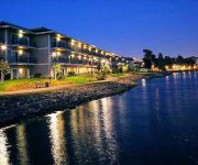
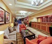
If you need a hotel, we compiled a list of available hotels close to the map centre further down the page.
While being here, you might want to pay a visit to some of the following locations: Oakland, San Francisco, Redwood City, Martinez and San Rafael. To further explore this place, just scroll down and browse the available info.
Local weather forecast
Todays Local Weather Conditions & Forecast: 18°C / 64 °F
| Morning Temperature | 12°C / 53 °F |
| Evening Temperature | 15°C / 59 °F |
| Night Temperature | 11°C / 53 °F |
| Chance of rainfall | 0% |
| Air Humidity | 60% |
| Air Pressure | 1014 hPa |
| Wind Speed | Gentle Breeze with 9 km/h (5 mph) from East |
| Cloud Conditions | Clear sky, covering 0% of sky |
| General Conditions | Sky is clear |
Tuesday, 14th of May 2024
20°C (67 °F)
12°C (54 °F)
Few clouds, gentle breeze.
Wednesday, 15th of May 2024
19°C (66 °F)
13°C (55 °F)
Sky is clear, moderate breeze, clear sky.
Thursday, 16th of May 2024
20°C (67 °F)
13°C (56 °F)
Sky is clear, gentle breeze, clear sky.
Hotels and Places to Stay
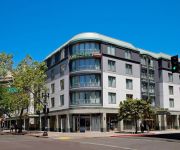
Oakland Marriott City Center
BEST WESTERN PLUS BAYSIDE HTL
Courtyard Oakland Downtown
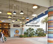
Waterfront Hotel
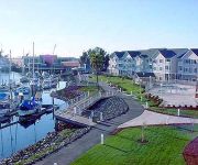
Homewood Suites by Hilton - Oakland Waterfront
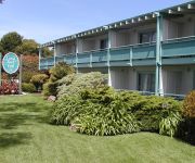
THE CORAL REEF INN AND SUITES
EXECUTIVE INN AND SUITES EMBARCADERO
HAWTHORN SUITES BY WYNDHAM OAK
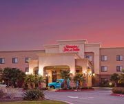
Hampton Inn - Suites Oakland Airport-Alameda
Civic Center Lodge
Videos from this area
These are videos related to the place based on their proximity to this place.
Breast Augmentation In California | Dr. Rex E. Moulton-Barrett, MD
Website: http://moulton-barrett.com/ Breast Plastic Surgery in San Francisco Bay Area, Oakland, and Walnut Creek Dr. Moulton-Barrett offers a variety of breast plastic surgeries in the Oakland...
Gamer Dave Visits the Pacific Pinball Museum in Alameda, CA
I made a day trip out of driving to the Pacific Pinball Museum in Alameda, CA. Let's see what they have! http://pacificpinball.org/
Roofing Alameda (510) 210-0272
Roofing Alameda CA - Alameda Roofing Roofing Contractor Alameda Call (510) 210-0272 For Service We specialize in roofing Alameda CA. We are licensed and insured and only care about ...
Lipstick Creation at Avalon School Of Cosmetology Alameda
http://avalon.edu Student Ericka Germany from the Esthetics Program at Avalon School of Cosmetology in Alameda shows us how to combine ingredients to create a lipstick that works just right...
Solar Panels Alameda (866) 858-7346
Solar Panels Alameda CA - Solar Panel Installation Alameda If you are looking for solar panel installation in Solar Panels Alameda California then you have found the right place. Benefits...
Queue Management in City of Alameda
City of Alameda is using Qminder in their permit centre. Qminder iPad app on the App Store: http://itunes.apple.com/app/qminder-connect/id533847552 Qminder: http://qminderapp.com City of Alameda: ...
Avalon School of Cosmetology Alameda - Hair Color Experiment
http://avalon.edu Student Raul Orozco from the Cosmetology Program at Avalon School of Cosmetology in Alameda shows us hair coloring techniques on different types of hair. Learn more about...
Probate Tips with Alameda County Probate Attorney - George Derieg
Call for a free probate consult: 866-599-3406 Probate Attorney Doing probate right so it gets done in a timely fashion and getting estates settled so families can move on is a tricky subject....
Videos provided by Youtube are under the copyright of their owners.
Attractions and noteworthy things
Distances are based on the centre of the city/town and sightseeing location. This list contains brief abstracts about monuments, holiday activities, national parcs, museums, organisations and more from the area as well as interesting facts about the region itself. Where available, you'll find the corresponding homepage. Otherwise the related wikipedia article.
Wind River Systems
Wind River Systems, Inc. is a company providing embedded systems, development tools for embedded systems, middleware, and other types of software. The company was founded in Berkeley, California in 1981 by Jerry Fiddler and David Wilner. On June 4, 2009, Wind River announced that Intel had bought the company for a reported $884 million. Wind River continues to exist as a wholly owned subsidiary of Intel.
Brooklyn, California
Brooklyn is a former city in Alameda County, California, now annexed to Oakland, California. Brooklyn first formed from the amalgamation in 1856 of two settlements, the sites of which are both now within the city limits of Oakland: San Antonio and Clinton. The name Brooklyn commemorated the ship that had brought Mormon settlers to California in 1846. In 1870, Brooklyn absorbed the nearby town of Lynn, which housed a footwear industry, and incorporated as a city.
Encinal High School
Encinal High School is a public coeducational high school serving grades 9-12. It is located in Alameda, California and is part of the Alameda Unified School District.
Coast Guard Island
Coast Guard Island is in the Oakland Estuary between Oakland and Alameda, California. The 67-acre island is situated in the historic Brooklyn Basin, now known as Embarcadero Cove. It is within the Alameda city limits, but is tied to the main land only via a bridge from Dennison Street in Oakland.
Bay Farm Island, Alameda, California
Bay Farm Island is a district of the city of Alameda, California, though it is separated from the rest of the city on Alameda Island by an estuary. Its ZIP code is 94502. The location was originally an island in San Francisco Bay, but due to land fill it has become a peninsula and is now connected to the mainland of Oakland and Oakland International Airport. Marshes and other areas of the island were also reclaimed by landfill.
St. Joseph Notre Dame High School
St. Joseph Notre Dame High School in Alameda, California is a coeducational Roman Catholic high school. It is one of the few Catholic high schools in the world to possess an on-campus minor basilica, the Basilica of St. Joseph, Alameda. It is accredited by the Western Association of Schools and Colleges, and by the Western Catholic Educational Association. It is located in the Roman Catholic Diocese of Oakland.
Posey and Webster Street tubes
The Posey tube and the Webster Street tube are two parallel underwater tunnels connecting the cities of Oakland and Alameda, California, running beneath the Alameda–Oakland Estuary. Currently, the Posey tube carries Oakland-bound traffic under the Estuary, while the Webster tube carries traffic bound for Alameda. The Posey tube is the second-oldest underwater vehicular tunnel in the US, preceded only by the Holland Tunnel.
Peralta Community College District
The Peralta Community College District is the community college district serving northern Alameda County, California. The district operates four community colleges: Berkeley City College, Laney College and Merritt College in Oakland, and College of Alameda. From 1968 to 1988, non-contiguous Plumas County was part of the district, and Feather River College was operated by the district. Plumas County and Feather River College are now the Feather River Community College District.
College of Alameda
College of Alameda is a two-year community college located in Alameda, California. The college is part of the Peralta Community College District and was opened in 1968. The college has been located at its campus at Atlantic Avenue and Webster Street since 1970. The college in addition to the other three campuses of the Peralta College District are currently on probation for "fiscal insolvency and stability" imposed by WASC.
Oakland Harbor Light
Oakland Harbor Light is a former lighthouse, now a restaurant in Embarcadero Cove, California.
Crown Memorial State Beach
Crown Memorial State Beach is a state park in the city of Alameda, CA on the shores of San Francisco Bay. It is operated by East Bay Regional Parks District. The park's Crab Cove Visitor Center features exhibits about the marine life environment of San Francisco Bay, the history of Alameda, and the importance of the Bay. There is an 800-gallon aquarium system with interactive stations for viewing sea creatures up close.
Integrated Support Command Alameda
Integrated Support Command Alameda (ISC Alameda) is a large operating base of the United States Coast Guard, located on Coast Guard Islandhttp://www. uscg. mil/MLCPAC/ISCALAMEDA/cgIsland. asp in Alameda, California ISC Alameda provides a wide variety of services in direct support of Coast Guard activities throughout the west coast of the United States of America.
Park Street Bridge
The Park Street Bridge is a double-leaf bascule drawbridge spanning 372 feet of the Oakland Estuary in the San Francisco Bay Area. It links the cities of Oakland and Alameda. The bridge is opened approximately 1700 times a year. The bridge carries an average of 38,200 vehicles per year. The bridge was built when the Oakland Estuary was trenched, converting Alameda from a peninsula to an island. The Park Street bridge is one of the four bridges that allow access to Alameda.
Fruitvale Bridge
The Fruitvale Bridge is a small drawbridge that crosses the Oakland Estuary. It links the cities of Oakland and Alameda.
Alameda Science and Technology Institute
The Alameda Science and Technology Institute (ASTI) is an Early College High School in Alameda, California. Alameda Science and Technology Institute Location Alameda, California, USA 94501 Information Type Public Established 2004 School district Alameda Unified School District Principal Steven Fong Faculty Approximately 5 Enrollment Approximately 150 Mascot Phoenix Website http://www. astischool. com/
San Francisco Bay Area
The San Francisco Bay Area, commonly known as the Bay Area, is a populated region that surrounds the San Francisco and San Pablo estuaries in Northern California, United States. The region encompasses the major cities and metropolitan areas of San Francisco, Oakland, and San Jose, along with smaller urban and rural areas. The Bay Area's nine counties are Alameda, Contra Costa, Marin, Napa, San Francisco, San Mateo, Santa Clara, Solano, and Sonoma.
Alameda Theatre (Alameda, California)
The Alameda Theatre is an Art Deco movie theatre built in 1932 in Alameda, California. It opened with a seating capacity of 2,168. It was designed by architect Timothy L. Pflueger and was the last grand movie palace built in the San Francisco Bay Area. It closed in the 1980s as a triplex theatre and was later used as a gymnastics studio. A restoration and expansion project was completed in 2008, making the historic theater the primary anchor of an eight-screen multiplex.
Basilica of St. Joseph, Alameda
Fernside, Alameda, California
Fernside is a neighborhood of Alameda in Alameda County, California. It lies at an elevation of 13 feet (4 m). It was formerly an unincorporated community.
South Shore, Alameda, California
South Shore is a neighborhood in Alameda in Alameda County, California. It lies at an elevation of 13 feet (4 m). It is located mostly on landfill extending from the (old sea wall) original south shore of the island, now a chain of artificial lagoons.
West End, Alameda, California
West End (originally, Bowman's Point) is a neighborhood in Alameda in Alameda County, California. It lies at an elevation of 20 feet (6 m). It corresponds to the western end of the island prior to its extension by landfill. It was formerly a separate settlement from Alameda. The original name is in honor of Charles C. Bowman, an early settler. A post office operated at West End from 1877 (having been transferred from Encinal) to 1891.
Woodstock, Alameda, California
Woodstock is a neighborhood in Alameda in Alameda County, California. It lies at an elevation of 13 feet (4 m). It was one of the original three settlements on Alameda island out of which the city of Alameda was formed in 1853.
Alameda Hospital
Alameda Hospital is a hospital in Alameda, California, United States.
Alameda Museum
The Alameda Museum is a history museum about the history and culture of Alameda, California. It is located in Alameda, California, in the United States. The museum includes exhibitions about old dioramas, model ships and toys, Native American culture, the Alameda fire department, Neptune Beach and Phyllis Diller. The museum also features rotating exhibitions and partners frequently with children to create exhibits.
High Street Bridge
The High Street Bridge is a double-leaf bascule drawbridge spanning 296 feet of the Oakland Estuary in the San Francisco Bay Area. It links the cities of Oakland and Alameda. The bridge is opened approximately 1400 times a year. The bridge carries an average of 26,000 vehicles per year. The bridge was built when the Oakland Estuary was trenched, converting Alameda from a peninsula to an island. The High Street bridge is one of the four bridges that allow access to Alameda.


