Safety Score: 2,7 of 5.0 based on data from 9 authorites. Meaning we advice caution when travelling to United States.
Travel warnings are updated daily. Source: Travel Warning United States. Last Update: 2024-05-04 08:22:41
Explore Prado del Sol
Prado del Sol in Maricopa County (Arizona) is located in United States about 1,974 mi (or 3,177 km) west of Washington DC, the country's capital.
Local time in Prado del Sol is now 11:29 PM (Saturday). The local timezone is named America / Phoenix with an UTC offset of -7 hours. We know of 9 airports in the wider vicinity of Prado del Sol, of which 3 are larger airports. The closest airport in United States is Phoenix Sky Harbor International Airport in a distance of 9 mi (or 14 km), North-West. Besides the airports, there are other travel options available (check left side).
There is one Unesco world heritage site nearby. The closest heritage site is El Pinacate and Gran Desierto de Altar Biosphere Reserve in Mexico at a distance of 91 mi (or 147 km). Also, if you like golfing, there are multiple options in driving distance. If you need a place to sleep, we compiled a list of available hotels close to the map centre further down the page.
Depending on your travel schedule, you might want to pay a visit to some of the following locations: Phoenix, Florence, Globe, Prescott and Tucson. To further explore this place, just scroll down and browse the available info.
Local weather forecast
Todays Local Weather Conditions & Forecast: 26°C / 79 °F
| Morning Temperature | 21°C / 69 °F |
| Evening Temperature | 27°C / 81 °F |
| Night Temperature | 21°C / 70 °F |
| Chance of rainfall | 0% |
| Air Humidity | 22% |
| Air Pressure | 1007 hPa |
| Wind Speed | Fresh Breeze with 16 km/h (10 mph) from East |
| Cloud Conditions | Scattered clouds, covering 48% of sky |
| General Conditions | Scattered clouds |
Sunday, 5th of May 2024
26°C (78 °F)
24°C (75 °F)
Sky is clear, moderate breeze, clear sky.
Monday, 6th of May 2024
26°C (79 °F)
25°C (77 °F)
Sky is clear, moderate breeze, clear sky.
Tuesday, 7th of May 2024
27°C (81 °F)
24°C (75 °F)
Sky is clear, moderate breeze, clear sky.
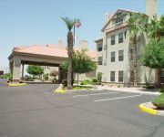
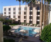
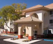
Hotels and Places to Stay
Element Chandler Fashion Center
Four Points by Sheraton Phoenix South Mountain
SpringHill Suites Phoenix Chandler/Fashion Center
Hampton Inn Phoenix-Chandler
Courtyard Phoenix Chandler
Homewood Suites by Hilton Phoenix-Chandler
Chandler Southgate Hotel (former Radisson Phoenix Chandler)
TownePlace Suites Phoenix Chandler/Fashion Center
OAKWOOD TEMPE
Fairfield Inn & Suites Phoenix Chandler
Videos from this area
These are videos related to the place based on their proximity to this place.
2010 Chrysler Town Country Chandler AZ
We are proud to present this 2010 Chrysler Town and Country . Please visit our website at http://azforddealer.dealerconnection.com/ and if you have any quest...
2007 Chrysler Town Country Chandler AZ
We are proud to present this 2007 Chrysler Town and Country . Please visit our website at http://azforddealer.dealerconnection.com/ and if you have any quest...
Fallout NV Modded - Part 2: Deputy Laz
Thanks for watching! Mods used in game: Project Nevada - http://goo.gl/axDefe Fellout - http://goo.gl/DHQNAT A World Of Pain - http://goo.gl/dgBrLM E.V.E - http://goo.gl/N2XQF0 More Perks...
Fallout NV Modded - Part 1: Shrapnel and Farsight
Thanks for watching! If you like my videos, check out Raptor's http://www.youtube.com/user/RaptorNapTime Mods used in game: Project Nevada - http://goo.gl/axDefe Fellout - http://goo.gl/DHQNAT...
Torsion Spring Replacement Chandler, AZ | 480-270-8035 | Replacement, Repair
Fixing garage door tracks and garage door safety sensors are services from garage door repair contractor in Chandler, Arizona. Services are available at all ...
Videos provided by Youtube are under the copyright of their owners.
Attractions and noteworthy things
Distances are based on the centre of the city/town and sightseeing location. This list contains brief abstracts about monuments, holiday activities, national parcs, museums, organisations and more from the area as well as interesting facts about the region itself. Where available, you'll find the corresponding homepage. Otherwise the related wikipedia article.
Mountain Pointe High School
Mountain Pointe High School is a secondary school located in the community of Ahwatukee, which is in the southern part of Phoenix, Arizona. Mountain Pointe is a part of the Tempe Union High School District. On April 16, 2010, the school was awarded the A+ School of Excellence Award, the first school in the district to ever do so.
Ahwatukee, Phoenix
Ahwatukee is a triangular shaped sub-urban village of Phoenix, Arizona bordered on the north by South Mountain Park and Baseline Road, on the east by Interstate 10 and the cities of Chandler, Guadalupe, and Tempe, and on the south and west by the Gila River Indian Community. It is the southernmost of the city's 15 urban villages. As of 2010, the 35.8 square-mile (92.7 km²) neighborhood has a population of 77,249.
Rio Salado Brewing Company
Rio Salado Brewing Company was an American brewery established in 1998 by Tim Gossack in Tempe, Arizona. It was named after the Rio Salado, which runs through Tempe.
Corona del Sol High School
Corona del Sol High School located in Tempe, Arizona, United States, was established in 1977 and is a part of the Tempe Union High School District. It expanded in 1986 and in 2001.
Stellar Airpark
Stellar Airpark is a public-use airport and residential airpark located three miles (5 km) west of the central business district of Chandler, a city in Maricopa County, Arizona, United States. It is privately owned by the Stellar Runway Utilizers Association, Inc.
Desert Breeze Lake
Desert Breeze Lake is located in Desert Breeze Park in west Chandler, southwest of Ray Road and McClintock Drive on Desert Breeze Boulevard.
Valley Christian High School (Chandler, Arizona)
Valley Christian High School is a private high school located in Chandler, Arizona, USA.
Heart Attack Grill
The Heart Attack Grill is an American hamburger restaurant in Las Vegas, Nevada (formerly located in Chandler, Arizona). It has courted controversy by serving high-calorie menu items with deliberately provocative names coupled with waitresses in sexually provocative clothing. The establishment is a hospital theme restaurant: waitresses ("nurses") take orders ("prescriptions") from the customers ("patients").


