Safety Score: 2,7 of 5.0 based on data from 9 authorites. Meaning we advice caution when travelling to United States.
Travel warnings are updated daily. Source: Travel Warning United States. Last Update: 2024-05-06 08:04:52
Touring Holiday Spa Mobile Home Park
Holiday Spa Mobile Home Park in Maricopa County (Arizona) is a town located in United States about 1,973 mi (or 3,175 km) west of Washington DC, the country's capital place.
Time in Holiday Spa Mobile Home Park is now 01:32 PM (Monday). The local timezone is named America / Phoenix with an UTC offset of -7 hours. We know of 9 airports nearby Holiday Spa Mobile Home Park, of which 3 are larger airports. The closest airport in United States is Phoenix Sky Harbor International Airport in a distance of 10 mi (or 17 km), South. Besides the airports, there are other travel options available (check left side).
There is one Unesco world heritage site nearby. The closest heritage site is El Pinacate and Gran Desierto de Altar Biosphere Reserve in Mexico at a distance of 109 mi (or 176 km). Also, if you like the game of golf, there are several options within driving distance. Need some hints on where to stay? We compiled a list of available hotels close to the map centre further down the page.
Being here already, you might want to pay a visit to some of the following locations: Phoenix, Florence, Prescott, Globe and Flagstaff. To further explore this place, just scroll down and browse the available info.
Local weather forecast
Todays Local Weather Conditions & Forecast: 23°C / 74 °F
| Morning Temperature | 17°C / 63 °F |
| Evening Temperature | 28°C / 82 °F |
| Night Temperature | 25°C / 76 °F |
| Chance of rainfall | 0% |
| Air Humidity | 13% |
| Air Pressure | 1013 hPa |
| Wind Speed | Moderate breeze with 10 km/h (6 mph) from East |
| Cloud Conditions | Clear sky, covering 4% of sky |
| General Conditions | Sky is clear |
Monday, 6th of May 2024
27°C (80 °F)
26°C (78 °F)
Sky is clear, moderate breeze, clear sky.
Tuesday, 7th of May 2024
26°C (80 °F)
24°C (76 °F)
Sky is clear, fresh breeze, clear sky.
Wednesday, 8th of May 2024
25°C (78 °F)
27°C (81 °F)
Sky is clear, moderate breeze, clear sky.
Hotels and Places to Stay
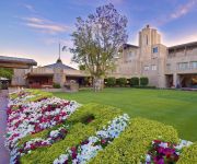
Arizona Biltmore A Waldorf Astoria Resort
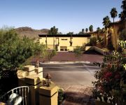
Pointe Hilton Tapatio Cliffs Resort
Pointe Hilton Squaw Peak Resort
Sheraton Crescent Hotel
Four Points by Sheraton Phoenix North
Embassy Suites by Hilton Phoenix Scottsdale
SpringHill Suites Phoenix North
Residence Inn Phoenix
Candlewood Suites PHOENIX
Hyatt Place Phoenix-North
Videos from this area
These are videos related to the place based on their proximity to this place.
Arizona Golf Vacation - 2009
Stonecreek, Starfire (Scottsdale Country Club), Legion at Arrowhead, Lookout Mountain (Pointe Hilton Tapatio Cliffs Resort), Coyote Lakes.
North Mountain, Phoenix, Arizona Hike
Panorama from the top of North Mountain, in the Phoenix Mountain Preserve, in Maricopa County, AZ. North Mountain -- one of the Seven Summit Challenge mountains -- has outstanding views of...
Ocotillo bloom, Sunnyslope, Phoenix, Hiking Arizona
Amazing muy gigante (very big) ocotillo cactus blooms all along the Phoenix Mountain Preserve's Trail #100, near Cave Creek Rd., in the Sunnyslope neighborhood of Phoenix, Arizona. Triplog...
1008 E GRISWOLD RD PHOENIX AZ 55020 | NEW NORTHTOWN |
FOR RENT - SEE OUR WEBSITE FOR MORE INFO www.KeyIPM.com This 3 Bed, 2 Bath home has just gone through an extensive remodel! New Tile, New Bathrooms, New paint. Comes with ...
Pollution in Phoenix, Arizona (northeast Valley)
Smog in northeast Valley of Maricopa County / Scottsdale. It used to be that smog was basically found along the I-10 corridor, but in recent years it is often hard to see the McDowell Mountains....
Wally in Wild Card Utility PFOC Feb 09
Australian Terrier Wally competes in AKC non-regular Wild Card Utility at PFOC in Phoenix in Feb 09. This was his first time in the utility ring and only the 2nd time he's done a complete...
observing with minox dcm
this is me observing north mountain with my vortex razor hd spotting scope.
Videos provided by Youtube are under the copyright of their owners.
Attractions and noteworthy things
Distances are based on the centre of the city/town and sightseeing location. This list contains brief abstracts about monuments, holiday activities, national parcs, museums, organisations and more from the area as well as interesting facts about the region itself. Where available, you'll find the corresponding homepage. Otherwise the related wikipedia article.
Shadow Mountain High School
Shadow Mountain High School is a public high school located in the north valley of Phoenix, Arizona, United States. The school is part of the Paradise Valley Unified School District. The school's athletic teams are known as the Matadors. Shadow Mountain's school colors are navy blue and gold. 1,749 students attend Shadow Mountain as of 1 October 2010. It opened in 1974.
Arizona Christian University
Arizona Christian University is a private, non-profit Christian university located in Phoenix, Arizona, United States.
K25DM
K25DM is a low-power broadcast television station located in Phoenix, Arizona. It transmits on channel 25 from Shaw Butte in North Phoenix. The station is owned by Mako Communications of Corpus Christi, Texas.
KWSS-LP
KWSS-LP is a non-commercial low-power FM radio station in Phoenix, Arizona, USA. Originally broadcast on 106.7 FM, the station now broadcasts at 93.9 FM. It airs a community radio format.
Sunnyslope High School
Sunnyslope High School is in the Glendale Union High School District in Phoenix, Arizona and offers courses for grades 9–12.
Sunnyslope Mountain
Sunnyslope Mountain a.k.a. "S" Mountain is a large, rocky, nearly symmetrical hill in the Sunnyslope section of Phoenix, Arizona. It is located near Central Avenue and Hatcher. The southern slope of the mountain is adorned with a 150 foot white majuscule "S". The mountain, in particular the large "S", can be seen from thirty miles away on a clear day, and is distinctly visible to nearby airplane passengers.
Sunnyslope, Arizona
The Sunnyslope community is a long-established cohesive neighborhood within the borders of the city of Phoenix, Arizona. The geographic boundaries are 19th Avenue to the west, Cactus Road to the north, 16th Street to the east, and Northern Avenue to the south. This area covers approximately nine square miles and is divided into nine census tracts. The Sunnyslope community is included in parts of three zip code areas: 85020, 85021 and 85029.
North Mountain and Shaw Butte Preserves
North Mountain Preserve and Shaw Butte Preserve are two adjacent Phoenix Mountain Preserves in Phoenix, Arizona. The preserves lie to the south of Thunderbird Road, north of Hatcher Road, east of North 19th Avenue, and west of North Cave Creek Road.


