Safety Score: 3,1 of 5.0 based on data from 9 authorites. Meaning please reconsider your need to travel to Sri Lanka.
Travel warnings are updated daily. Source: Travel Warning Sri Lanka. Last Update: 2024-04-28 08:22:10
Discover Hinnarangahakumbura
Hinnarangahakumbura in Province of Uva is a city in Sri Lanka about 82 mi (or 132 km) east of Colombo, the country's capital city.
Local time in Hinnarangahakumbura is now 02:49 AM (Monday). The local timezone is named Asia / Colombo with an UTC offset of 5.5 hours. We know of 8 airports in the vicinity of Hinnarangahakumbura, of which one is a larger airport. The closest airport in Sri Lanka is Amparai Airport in a distance of 45 mi (or 73 km), North-East. Besides the airports, there are other travel options available (check left side).
There are several Unesco world heritage sites nearby. The closest heritage site in Sri Lanka is Sacred City of Kandy in a distance of 33 mi (or 53 km), North-West. Looking for a place to stay? we compiled a list of available hotels close to the map centre further down the page.
When in this area, you might want to pay a visit to some of the following locations: Badulla, Kandy, Ratnapura, Kurunegala and Katunayaka. To further explore this place, just scroll down and browse the available info.
Local weather forecast
Todays Local Weather Conditions & Forecast: 23°C / 74 °F
| Morning Temperature | 14°C / 57 °F |
| Evening Temperature | 17°C / 62 °F |
| Night Temperature | 15°C / 59 °F |
| Chance of rainfall | 2% |
| Air Humidity | 53% |
| Air Pressure | 1011 hPa |
| Wind Speed | Light breeze with 4 km/h (3 mph) from South-West |
| Cloud Conditions | Overcast clouds, covering 98% of sky |
| General Conditions | Light rain |
Monday, 29th of April 2024
22°C (71 °F)
14°C (57 °F)
Moderate rain, light breeze, overcast clouds.
Tuesday, 30th of April 2024
20°C (69 °F)
14°C (58 °F)
Moderate rain, calm, overcast clouds.
Wednesday, 1st of May 2024
24°C (74 °F)
14°C (58 °F)
Light rain, light breeze, overcast clouds.
Hotels and Places to Stay
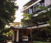
River Side Hotel
Vista River Side
Videos from this area
These are videos related to the place based on their proximity to this place.
By train from Nanu Oya to Badulla Sri Lanka
By train from Nanu Oya to Badulla Sri Lanka. The clip show you any scenes during the trip through the highland of Sri Lanka. I think, travel by train in Sri Lanka is nice adventure.
Sri Lanka Rail Road Udarata Manike Veyangoda to Badulla
Short video clip about Udarata Menike train. Trip from Veyangoda to Badulla Total travel time was ten hours (30-50Kmph) This has First, Second and Third classes including air conditioned...
Videografix Badulla - [ Wedding ] [ Sri Lanka ] achala dressing.mkv
Bridle Dressing. Location : Ella Filming and editing @ video grafix - The ultimate video editing studio - Badulla.
Videografix Badulla - [ Wedding ] [ Sri Lanka ] Chandima & Mihiri wedding.mkv
location : Badulla. a video production of video grafix - the ultimate video editing studio - Badulla.
Badulla Train Adventure Journey
Sry I missed to add that 7:16 ,It was Demodara Station Thank You For Watching! Subscribe Please ! FACEBOOK - Yehan Banula Namarathna INSTAGRAM ...
Narangala Hike - hiking paths
narangala #hike #narangalahike #narangalarock #narangalamountain #srilanka #hikingplacesinsrilanka #gopro #goprosrilanka #goprovideos #goprohero5.
Ella, Badulla , Nine arch bridge, Little adams peak
Ella, Badulla , Nine arch bridge, Little adams peak srilanka traveling video.
Videos provided by Youtube are under the copyright of their owners.
Attractions and noteworthy things
Distances are based on the centre of the city/town and sightseeing location. This list contains brief abstracts about monuments, holiday activities, national parcs, museums, organisations and more from the area as well as interesting facts about the region itself. Where available, you'll find the corresponding homepage. Otherwise the related wikipedia article.
Sri Lanka
Sri Lanka, officially the Democratic Socialist Republic of Sri Lanka, is an island country in the northern Indian Ocean off the southern coast of the Indian subcontinent in South Asia. Known until 1972 as Ceylon, Sri Lanka has maritime borders with India to the northwest and the Maldives to the southwest. Sri Lanka's documented history spans three thousand years.
Geography of Sri Lanka
Sri Lanka, formerly called Ceylon, is an island nation in the Indian Ocean, located in Southern Asia, southeast of India, in a strategic location near major Indian Ocean sea lanes. It has a total area of 65,610 km², with 64,740 km² of land and 870 km² of water. Its coastline is 1,340 km long. Sri Lanka's climate includes tropical monsoons: the northeast monsoon (December to March), and the southwest monsoon (June to October).
Dunhinda Falls
Dunhinda Falls is a waterfall located about 5 kilometres from Badulla town in Sri Lanka. The Dunhinda Falls is one of Sri Lanka's most beautiful waterfalls. The waterfall, which is 210 feet (64 m) high gets its name from the smoky dew drops spray, (Dun in sinhala means mist or smoke) which surrounds the area at the foot of the waterfall. The water fall is created by the river called Badulu Oya which goes through the Badulla town.


!['Videografix Badulla - [ Wedding ] [ Sri Lanka ] achala dressing.mkv' preview picture of video 'Videografix Badulla - [ Wedding ] [ Sri Lanka ] achala dressing.mkv'](https://img.youtube.com/vi/uhYmqN_py2A/mqdefault.jpg)
!['Videografix Badulla - [ Wedding ] [ Sri Lanka ] Chandima & Mihiri wedding.mkv' preview picture of video 'Videografix Badulla - [ Wedding ] [ Sri Lanka ] Chandima & Mihiri wedding.mkv'](https://img.youtube.com/vi/smBKRACnD2w/mqdefault.jpg)


