Safety Score: 3,4 of 5.0 based on data from 9 authorites. Meaning please reconsider your need to travel to Indonesia.
Travel warnings are updated daily. Source: Travel Warning Indonesia. Last Update: 2024-05-07 07:59:51
Delve into Babakancangkuang
Babakancangkuang in Jawa Barat is a town located in Indonesia about 36 mi (or 57 km) south of Jakarta, the country's capital town.
Time in Babakancangkuang is now 04:50 PM (Tuesday). The local timezone is named Asia / Jakarta with an UTC offset of 7 hours. We know of 7 airports closer to Babakancangkuang, of which one is a larger airport. The closest airport in Indonesia is Halim Perdanakusuma International Airport in a distance of 31 mi (or 50 km), North. Besides the airports, there are other travel options available (check left side).
There is one Unesco world heritage site nearby. It's Ujung Kulon National Park in a distance of 152 mi (or 245 km), North-West. We saw 1 points of interest near this location. In need of a room? We compiled a list of available hotels close to the map centre further down the page.
Since you are here already, you might want to pay a visit to some of the following locations: Cianjur, Cibinong, Ngamprah, Pasirreungit and Cibeber. To further explore this place, just scroll down and browse the available info.
Local weather forecast
Todays Local Weather Conditions & Forecast: 30°C / 85 °F
| Morning Temperature | 22°C / 72 °F |
| Evening Temperature | 26°C / 78 °F |
| Night Temperature | 23°C / 73 °F |
| Chance of rainfall | 14% |
| Air Humidity | 65% |
| Air Pressure | 1011 hPa |
| Wind Speed | Light breeze with 3 km/h (2 mph) from South |
| Cloud Conditions | Scattered clouds, covering 25% of sky |
| General Conditions | Moderate rain |
Wednesday, 8th of May 2024
28°C (82 °F)
23°C (73 °F)
Moderate rain, light breeze, scattered clouds.
Thursday, 9th of May 2024
28°C (82 °F)
23°C (73 °F)
Moderate rain, calm, overcast clouds.
Friday, 10th of May 2024
26°C (79 °F)
23°C (73 °F)
Moderate rain, light breeze, overcast clouds.
Hotels and Places to Stay
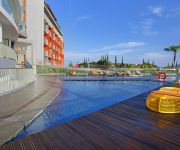
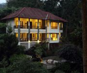
Puncak Pesona Alam Resort and Spa
De One Villages
Plataran Puncak A True Escape to Environmental Elegance, Seclusion and Comfort
Palace Hotel
Berlian Resort
Videos from this area
These are videos related to the place based on their proximity to this place.
Jalur NuRA, Rindu Alam
Ini adalah secuil video di Jalur New RA, Rindu Alam, video ini dibuat bulan Februari 2011 Cerita lengkapnya bisa dilihat di Regards, http//ekoprobo.wordpress.com/ http://about.me/ekoprobo...
JPG Gowes Merdeka 2011 (Tentang Track NuRA)
kali ini om mahendra menjelaskan tentang karakter track NuRA terutama saat NR Rekaman ini diambil bersamaa dengan wawancara om mahendra dengan JakTV tanggal 16 Agustus 2011 ...
Gerakan Pemuda GPIB Jemaat PNIEL DKI Jakarta
Hidup Yang Sedih Jadi Melodi (Ret - Reat Katekisasi 2015)
ID MTB: GoBar with SCI - 21 Dec 2013
Biking with Santa Cruz Indonesia at NuRa & TW5 trails, Puncak, West Java, Indonesia.
Track MTB RA Classic Part 3 (Cam: Drift HD Ghost)
Test action camera DRIFT HD Ghost. 720p / 25fps. Field of view 170°. Exposure: Auto, http://ekoprobo.wordpress.com/ Twitter & Instagram: @ekoprobo.
GPS-88 Gowes to Puncak
GPS-88 Gowes bersahabat dengan alam Jalur TW-5 Klasik Puncak, 11 Januari 2015.
Track MTB NuRA (2) Rindu Alam Puncak
Video ini menggambarkan jalur MTB NuRA di RIndu Alam, Puncak Track ini menggambarkan jalur awal offroad setelah tanjakan aspal, awal masuk track sudah enak untuk memacu speed sepeda ...
Videos provided by Youtube are under the copyright of their owners.
Attractions and noteworthy things
Distances are based on the centre of the city/town and sightseeing location. This list contains brief abstracts about monuments, holiday activities, national parcs, museums, organisations and more from the area as well as interesting facts about the region itself. Where available, you'll find the corresponding homepage. Otherwise the related wikipedia article.
Puncak
Puncak is the popular name for the area surrounding the peak of Mt. Gede-Pangrango, located in the Bogor-Cianjur-Sukabumi regencies, in the province of West Java, Indonesia. This area is a popular holiday area for the residents of Jakarta, the capital city, and its satellite cities. It has fresh air and mountain scenery. The area is about two hours drive from Jakarta, if there is no traffic jam, but severe traffic jams occur from Friday afternoon until Sunday afternoon all through the year.
Kebun Raya Cibodas
Kebun Raya Cibodas (KRC or the Cibodas Botanical Gardens) is a 125-hectares botanical garden located approximately 1,300-1,425 meters on the slopes of Mount Gede, 23 kilometers to the northwest of the township of Cianjur. The gardens are in the Cibodas subdistrict of West Java, Indonesia, around 100 kilometers from Jakarta. They were founded in 1862 by the Dutch botanist Johannes Elias Teysjmann as an extension of the Bogor Botanical Gardens.
Taman Safari
Taman Safari Indonesia or simply Taman Safari are safari parks in Bogor at West Java, in Mount Arjuno at East Java, and in Marina Beach at Bali. Part of the same organization, they are known as Taman Safari I, II and III. The most popular is Taman Safari I.


