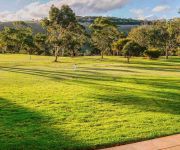
Discover Carrickalinga
Carrickalinga in Yankalilla (South Australia) is a city in Australia about 609 mi (or 979 km) west of Canberra, the country's capital city.
Local time in Carrickalinga is now 09:34 AM (Sunday). The local timezone is named Australia / Adelaide with an UTC offset of 9.5 hours. We know of 8 airports in the vicinity of Carrickalinga. The closest airport in Australia is Penneshaw Airport in a distance of 30 mi (or 49 km), South-West. Besides the airports, there are other travel options available (check left side).
We discovered 1 points of interest in the vicinity of this place. Looking for a place to stay? we compiled a list of available hotels close to the map centre further down the page.
When in this area, you might want to pay a visit to some of the following locations: Mitcham, Adelaide, Honiton, Koomooloo and Loxton. To further explore this place, just scroll down and browse the available info.
Local weather forecast
Todays Local Weather Conditions & Forecast: 18°C / 64 °F
| Morning Temperature | 15°C / 58 °F |
| Evening Temperature | 19°C / 66 °F |
| Night Temperature | 18°C / 64 °F |
| Chance of rainfall | 0% |
| Air Humidity | 53% |
| Air Pressure | 1022 hPa |
| Wind Speed | Moderate breeze with 10 km/h (6 mph) from South |
| Cloud Conditions | Clear sky, covering 6% of sky |
| General Conditions | Sky is clear |
Monday, 29th of April 2024
16°C (62 °F)
13°C (56 °F)
Overcast clouds, fresh breeze.
Tuesday, 30th of April 2024
15°C (59 °F)
13°C (56 °F)
Sky is clear, fresh breeze, clear sky.
Wednesday, 1st of May 2024
17°C (62 °F)
15°C (58 °F)
Sky is clear, moderate breeze, clear sky.
Hotels and Places to Stay
Links Lady Bay Resort
Wirrina Hotel & Golf Resort
Videos from this area
These are videos related to the place based on their proximity to this place.
Family Fishing Boat Trip With Jumping Dolphins Adelaide Sellicks Beach
Awesome day with the family aboard my fishing boat, we were so lucky to witness the dolphins chasing huge schools of salmon at Sellicks Beach, Adelaide, South Australia. Very greatful to thoughs...
Over the cliff at Sellicks Beach
Practicing a bit of quad-copter flying over the cliffs at Sellicks beach. You can also see Willunga Hill and Aldinga. Perfect blue water and fantastic cloud formations. Freaky video twists...
2014 10 04 P2V+ Myponga Reservoir 2 Dashware
2014 10 04 P2V+ Myponga Reservoir 2 (Vision+ Utility Pro & Dashware)
Australian National Vincent Rally 2012 ~ Myponga Clip
This is a clip of the recent Australian National Vincent Rally held in Aldinga, South Australia where part of it was a visit to the Myponga Reservoir. The Adelaide Hills has some fantastic...
Sportster 1200 Run
A passenger's eye view of my Dad taking his sportster 1200 for a spin from Myponga Dam to Main South Road.
Le Fleurieu: Fleurieu Way (Inman Valley, Fleurieu Peninsula)
For one of the most scenic drives on the Fleurieu Peninsula, head down to Inman Valley. You'll be sure to come accross something that strikes your fancy!
Erosion control case study of a creek, Yankalilla
Erosion can impact greatly on land production and the environment. This erosion control case study is on a farm located near Yankalilla on the Fleurieu Peninsula. Over the years the creek has...
Lifestyle
Overlooking the pristine waters of Yankalilla Bay on the oceans doorstep just one hour from Adelaide is a lifestyle like no other at Sorrento Living.
Normanville Junior Carnival 2014
Timelapse video taken over the carnival weekend 17 to 19th January 2014........and not forgetting Yankalilla Bakery.
Videos provided by Youtube are under the copyright of their owners.
Attractions and noteworthy things
Distances are based on the centre of the city/town and sightseeing location. This list contains brief abstracts about monuments, holiday activities, national parcs, museums, organisations and more from the area as well as interesting facts about the region itself. Where available, you'll find the corresponding homepage. Otherwise the related wikipedia article.
District Council of Yankalilla
The District Council of Yankalilla is a local government area centred on the town of Yankalilla on South Australia's Fleurieu Peninsula. The council was established in 1854, two years after legislation was passed allowing the formation of District Councils in South Australia. The district has a rich history, as one of the earliest South Australian coastal settlements, and a wide range of agricultural activities having taken place.
Carrickalinga, South Australia
Carrickalinga is a small coastal town about 60 km south of Adelaide on the Fleurieu Peninsula overlooking Gulf St Vincent. The town has no shops, with the nearest being in Normanville, one kilometre away.
Normanville, South Australia
Normanville (postcode 5204) is a small rural town on the west coast of the Fleurieu Peninsula, South Australia. It is situated next to the mouth of the Bungala River.
Yankalilla, South Australia
Yankalilla is an agriculturally-based town situated on the southern Fleurieu Peninsula in South Australia, located 72 km south of the state's capital of Adelaide. The town is nestled in the Bungala River valley, overlooked by the southern Mount Lofty Ranges and acts as a service centre for the surrounding agricultural district.
Bungala River
The Bungala River is a small river that runs north west through the lower Fleurieu Peninsula, in South Australia through primarily agricultural surroundings. The Bungala runs past the town of Yankalilla, and enters the sea near Normanville. It originates in the lower Inman Valley region a mountainous catchment area.


