Touring Bolivar
The district Bolivar of in Salisbury (South Australia) with it's 120 residents Bolivar is a subburb located in Australia about 596 mi west of Canberra, the country's capital place.
Need some hints on where to stay? We compiled a list of available hotels close to the map centre further down the page.
Being here already, you might want to pay a visit to some of the following locations: Adelaide, Mitcham, Honiton, Koomooloo and Loxton. To further explore this place, just scroll down and browse the available info.
Local weather forecast
Todays Local Weather Conditions & Forecast: 20°C / 69 °F
| Morning Temperature | 14°C / 57 °F |
| Evening Temperature | 17°C / 62 °F |
| Night Temperature | 14°C / 57 °F |
| Chance of rainfall | 0% |
| Air Humidity | 42% |
| Air Pressure | 1026 hPa |
| Wind Speed | Moderate breeze with 9 km/h (6 mph) from North-West |
| Cloud Conditions | Scattered clouds, covering 34% of sky |
| General Conditions | Scattered clouds |
Monday, 6th of May 2024
19°C (66 °F)
13°C (55 °F)
Sky is clear, light breeze, clear sky.
Tuesday, 7th of May 2024
21°C (70 °F)
15°C (58 °F)
Sky is clear, gentle breeze, clear sky.
Wednesday, 8th of May 2024
21°C (70 °F)
14°C (58 °F)
Sky is clear, gentle breeze, clear sky.
Hotels and Places to Stay
MAWSON LAKES HOTEL AND FUNCTION CENTRE
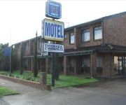
Pooraka Motor Inn
Rose & Crown Hotel
ibis Styles Adelaide Manor
Comfort Inn Manhattan
Playford Tavern
QUEST MAWSON LAKES
Videos from this area
These are videos related to the place based on their proximity to this place.
Three Car Train at Salisbury Station
A three car diesel train arriving on platform 2 at Salisbury Station heading towards Gawler Central.
Evening Thunderstorm- October 29-30, 2008
Evening Thunderstorms near Adelaide, South Australia on the 29th and 30th of October, 2008.
The Ghan passing Chidda Railway station
I was lucky to get this as I did not realise that it took less than ten minutes for the Ghan to get here from Adelaide Railway Station.
Rookie Class Final - 2010 City of Adelaide Kart Titles
Rookie Class final from the 2010 City of Adelaide Titles, hosted by the Southern Go Kart Club at their Bolivar, South Australia race track. Pure Motorsport: http://puremotorsport.tv Like Pure...
Junior National Pro Class Final - 2010 City of Adelaide Kart Titles
Junior National Pro Class final from the 2010 City of Adelaide Titles, hosted by the Southern Go Kart Club at their Bolivar, South Australia race track. Pure Motorsport: http://puremotorsport.tv...
Restricted 125 Combined Class Final - 2010 City of Adelaide Kart Titles
Restricted 125 Combined Class final from the 2010 City of Adelaide Titles, hosted by the Southern Go Kart Club at their Bolivar, South Australia race track. Pure Motorsport: http://puremotorsport....
Leopard Pro Class Final - 2010 City of Adelaide Kart Titles
Leopard Pro Class final from the 2010 City of Adelaide Titles, hosted by the Southern Go Kart Club at their Bolivar, South Australia race track. Pure Motorsport: http://puremotorsport.tv Like...
Clubman Heavy Class Final - 2010 City of Adelaide Kart Titles
Clubman heavy class final from the 2010 City of Adelaide Titles, hosted by the Southern Go Kart Club at their Bolivar, South Australia race track. Pure Motorsport: http://puremotorsport.tv...
Junior Clubman Class Final - 2010 City of Adelaide Kart Titles
Junior Clubman Class final from the 2010 City of Adelaide Titles, hosted by the Southern Go Kart Club at their Bolivar, South Australia race track. Pure Motorsport: http://puremotorsport.tv...
Clubman Pro Class Final - 2010 City of Adelaide Kart Titles
Clubman Pro class final from the 2010 City of Adelaide Titles, hosted by the Southern Go Kart Club at their Bolivar, South Australia race track. Pure Motorsport: http://puremotorsport.tv Like...
Videos provided by Youtube are under the copyright of their owners.
Attractions and noteworthy things
Distances are based on the centre of the city/town and sightseeing location. This list contains brief abstracts about monuments, holiday activities, national parcs, museums, organisations and more from the area as well as interesting facts about the region itself. Where available, you'll find the corresponding homepage. Otherwise the related wikipedia article.
City of Salisbury
The City of Salisbury is a local government area (LGA) located on the northern fringes of Adelaide, South Australia. It has an estimated population of 130,022 people and encompasses an area of 158 km². The council's main offices are situated in the Salisbury central business district. Geographically, the region is located on the outskirts of Adelaide. In recent years the council has become a leader in water management and the use of recycled water.
Greenfields railway station
Greenfields railway station is a railway station on the Gawler railway line which is located adjacent to Parafield Airport, in the northern Adelaide suburbs of Parafield and Parafield Gardens. It is located 15.5 km by railway from the Adelaide Railway Station. The station was opened in 1969 and was originally referred to as 'Green Fields' in passenger timetables. Greenfields is one of only two stations on the Gawler line to have a pedestrian underpass (the other is Parafield Gardens).
Parafield Gardens railway station
Parafield Gardens railway station is a railway station on the Gawler railway line which is located adjacent to Parafield Airport, in the northern Adelaide suburbs of Parafield and Parafield Gardens. It is located 16.6 km by railway from the Adelaide Railway Station. Parafield Gardens is one of only two stations on the Gawler line to have a pedestrian underpass remaining (the other is Greenfields), as other stations have had theirs closed due to concerns with safety and vandalism.
Parafield railway station
Parafield railway station is a railway station on the Gawler railway line which is located in the northern Adelaide suburbs of Parafield and Parafield Gardens. The station was originally opened in 1928 to serve the then under construction airport adjacent to the line. In 1982 the station was rebuilt at the same time as standardisation of the mainline from Adelaide to Port Pirie. Commencing in April 2008, the station was rebuilt again.
Chidda railway station
Chidda railway station is a railway station on the Gawler railway line which is located in the northern Adelaide suburbs of Salisbury, Salisbury South and Salisbury Downs. It is located 18.6 km by railway from the Adelaide Railway Station. Initially, step down platforms with a length of 121.9 metres were provided. In the second half of 1974 they were replaced by the current island platform which also has a length of 121.9 metres.
Mawson Interchange
Mawson Interchange is a railway station and bus interchange in the new, developing suburb of Mawson Lakes, north of Adelaide, South Australia. The Interchange serves nearby residential and commercial developments and also the Mawson Lakes campus of the University of South Australia and Technology Park. Mawson Interchange is on the Gawler railway line. 14.3 km from Adelaide Railway Station.
Salisbury railway station, Adelaide
Salisbury Interchange is a railway station and bus interchange in the northern suburbs of Adelaide, South Australia. Salisbury Interchange is on the Gawler Central railway line, 18.6 km (11½ miles) from Adelaide station There are a large bus interchange and a park-and-ride facility alongside the station . Salisbury is an important regional centre for shopping, recreation and government services.
Parafield, South Australia
Parafield is a non-residential suburb of Adelaide approximately 18 km north of the CBD. It is completely occupied by Parafield Airport. It is bordered by Main North Road to the east, Kings Road to the north and the Gawler railway line to the west, where it is served by Parafield station. To the south it abuts the Mawson Lakes campus of the University of South Australia. Parafield Post Office opened on 1 July 1946, was renamed Parafield Airport in 1965 and closed in 1986.
Little Para River
The Little Para River is a seasonal creek running across the Adelaide plains of South Australia, whose catchment fills reservoirs that supply some of the water needs of Adelaide’s northern suburbs. It runs from its source near Lower Hermitage in the Mount Lofty Ranges, flows north westerly to the Little Para Reservoir and then westerly to the Barker Inlet of the Gulf St Vincent at Globe Derby Park.
Hilra railway station
Hilra railway station is a former railway station on the defunct Penfield railway line which is located in the northern Adelaide suburb of Salisbury North. It is located 21.7km by railway from the Adelaide Railway Station. The station was located parallel to Langford Terrace, adjacent to the freight train line, and inline roughly to Compton Street. The station was opened in 1941 along with the Penfield line.
Penfield 1 railway station
Penfield 1 railway station was a railway station on the defunct Penfield railway line located in what is now the northern Adelaide suburb of Edinburgh. It was located 23.2 km by railway from the Adelaide Railway Station. The station opened between 1940 and 1942 and had a platform which was 213.4 metres long. The station closed on 4 January 1991, along with Penfield 2 station and the line. The station has since been demolished.
Parafield Gardens, South Australia
Parafield Gardens is a suburb of Adelaide, South Australia. The suburb is largely residential, with a pocket of industrial land in the southwest corner. There are two small shopping centres in the area, one on Salisbury Highway which has a Foodland (South Australia), and another on Sheperdson Road which has an Independent Grocers of Australia.
Burton, South Australia
Burton is a small residential suburb approximately 21 kilometres north of the CBD of Adelaide, South Australia. It is located five km north-west of Salisbury in the flat terrain of the Adelaide Plains. The suburb contains two wetland reserves, including Kaurna Park.
Paralowie, South Australia
Paralowie is a suburb in the north of Adelaide, South Australia. It is predominantly a residential suburb.
Salisbury, South Australia
Salisbury is a northern suburb in Adelaide, South Australia. It is the seat of the City of Salisbury, and in the South Australian Legislative Assembly electoral district of Ramsay and the Australian House of Representatives divisions of Wakefield and Port Adelaide. The suburb is a service area for the City of Salisbury district, with an abundance of parklands, shops, cafes and restaurants.
Green Fields, South Australia
Green Fields is a suburb of Adelaide, the capital of South Australia. It is around 13 km north of the city centre, and mostly consists of industrial warehouses and light industry.
Bolivar, South Australia
Bolivar is an outer northern suburb of Adelaide, South Australia. It is located in the City of Salisbury.
Globe Derby Park
Globe Derby Park is a suburb of Adelaide, South Australia. It is located in the City of Salisbury.
Globe Derby Park (harness racing)
Globe Derby Park is considered the premier Standardbred harness racing venue in South Australia. It is located 15 kilometres north of the Adelaide CBD. The first public meeting was held on the afternoon of 24 June 1969. Globe Derby Park was named after the stallion Globe Derby, who was considered the most influential Standardbred sire in Australian and New Zealand. The track has a crushed granite surface and is 845.50 metres long with races running anti-clockwise.
Salisbury South, South Australia
Salisbury South is a suburb located in the City of Salisbury, Adelaide, South Australia.
Salisbury North, South Australia
Salisbury North is a suburb located in the City of Salisbury, Adelaide, South Australia. Salisbury Adams Road Post Office opened on 22 November 1965 and was renamed Salisbury North Whites Road in 1968.
Salisbury Downs, South Australia
Salisbury Downs is a suburb located in the City of Salisbury, Adelaide, South Australia. Salisbury Downs Post Office opened on 8 July 1991.
Direk, South Australia
Direk is a suburb located in the City of Salisbury, Adelaide, South Australia.
Dry Creek (South Australia)
Dry Creek or Dry Creek Drain is a seasonal stream in South Australia. In season it flows from its source near Yatala Vale in the Mount Lofty Ranges to the Barker Inlet of the Gulf St Vincent via a manufactured drain near Globe Derby Park. It passes through Modbury, Walkley Heights and Pooraka. The suburb of Dry Creek and Dry Creek railway station are named after the stream.
Bolivar railway station, South Australia
Bolivar is a railway station in South Australia on the standard gauge line between Adelaide and Crystal Brook, originally with little more than a crossing loop for passing trains going in opposite directions. The original crossing loop is located about 30 km by rail from Mile End, South Australia, between Taylors Road, (now the western end of the Northern Expressway), and King Road, both in Virginia, South Australia. (The King Road gated level crossing actually crosses two tracks.


