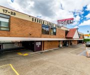
Discover Lakemba
The district Lakemba of in Canterbury (New South Wales) with it's 14,468 citizens Lakemba is a subburb in Australia about 145 mi north-east of Canberra, the country's capital city.
If you need a hotel, we compiled a list of available hotels close to the map centre further down the page.
While being here, you might want to pay a visit to some of the following locations: Parramatta, Sydney, Katoomba, Canberra and . To further explore this place, just scroll down and browse the available info.
Local weather forecast
Todays Local Weather Conditions & Forecast: 16°C / 60 °F
| Morning Temperature | 15°C / 59 °F |
| Evening Temperature | 15°C / 59 °F |
| Night Temperature | 15°C / 59 °F |
| Chance of rainfall | 21% |
| Air Humidity | 86% |
| Air Pressure | 1029 hPa |
| Wind Speed | Light breeze with 5 km/h (3 mph) from North |
| Cloud Conditions | Overcast clouds, covering 100% of sky |
| General Conditions | Moderate rain |
Saturday, 4th of May 2024
18°C (64 °F)
14°C (57 °F)
Light rain, gentle breeze, overcast clouds.
Sunday, 5th of May 2024
15°C (59 °F)
15°C (59 °F)
Moderate rain, gentle breeze, overcast clouds.
Monday, 6th of May 2024
18°C (64 °F)
16°C (61 °F)
Moderate rain, moderate breeze, overcast clouds.
Hotels and Places to Stay
Pullman at Sydney Olympic Park
SUNDOWNER GARDENIA BASS HILL
Quest at Sydney Olympic Park
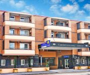
Comfort Inn & Suites Burwood
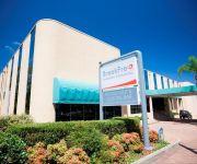
BREAKFREE BANKSTOWN INTERNATIONAL
Travelodge Bankstown Sydney
Novotel Sydney Olympic Park
High Flyer Hotel
Garden Lodge Sydney
Garden-Lodge Sydney
Videos from this area
These are videos related to the place based on their proximity to this place.
www.CraftMe.co- FREE Download Scrapbooking Making Secrets eBook - How to Creative Card Making Ideas
Direct download for the eBook http://www.facebook.com/CraftMe.co http://www.craftme.co/stores.php Top 10 Scrapbook Secrets! A new eBook for craft lovers! A FREE Gift exclusively to...
Business leaders and the National Relay Service
Senior managers at the St George and Commonwealth banks explain why being Relay Service friendly is important for their organisations. And Suzanne Colbert from the Australian Employers' Network.
Australia - Sydney (Bondi beach) Gabbiani e onde.
Alcuni spezzoni di vita vissuta in Australia a Sydney, nella prima parte ci troviamo nel prato che precede la spiaggia più famosa della città, Bondi beah, siamo circondati da gabbiani in...
Lets play Minecraft: Storm the castle (minecraft xbox 360 edition)
Munky556, steviebob, and lillyth74 playing a challenge created by Munky556 like if it looks like it could be fun and add me (munky556) on xbox live and i will give you a run through in a group...
Malaysia Airlines B747-400 | On Approach into Sydney Kingsford International Airport (SYD)
Description: Airline: Malaysia Airlines Aircraft: Boeing 747-400 REG: 9M-MPE Month/Year: August 2011 Flight:On Approach to Sydney Kingsford Smith International Airport (SYD) - Australian Airspace.
Red Light Runner - Beverly Hills
This driver (AO40BI) was seen running a red light in the should on the on-ramp to the M5 at Beverly Hills, NSW.
Australia - Arrivo a Sydney Bondi beach.
Australia - Sydney Bondi beach. Siamo all'inizio della nostra avventura e dopo 24 ore di volo ci dirigiamo nella spiaggia più famosa della città, Bondi beach. L'oceano sembra così calmo,...
Green Printing at Focus Press
http://www.focuspress.com.au A short video produced by Enterprise Connect detailing the journey toward sustainable printing undertaken by Focus Press, Australia's most innovative green printing...
Small Block Chevy 355 dyno 604 HP - Hercules Competition Engines
355 SB Chevy dyno run. Bowtie Iron Heads and Bowtie block, rule limited to max 7500 rpm endurance motor.
GTA V-Custom Racing (Loops, Massive Ramps and Crashing)
I hope you guys enjoy the video. This video is about us racing and completely failing.Don't forget to SUBSCRIBE leave a COMMENT and SHARE the video with your friends.
Videos provided by Youtube are under the copyright of their owners.
Attractions and noteworthy things
Distances are based on the centre of the city/town and sightseeing location. This list contains brief abstracts about monuments, holiday activities, national parcs, museums, organisations and more from the area as well as interesting facts about the region itself. Where available, you'll find the corresponding homepage. Otherwise the related wikipedia article.
Lakemba, New South Wales
Lakemba is a suburb in south-western Sydney, in the state of New South Wales, Australia. Lakemba is located 15 kilometres south-west of the Sydney central business district, in the local government area of the City of Canterbury. Lakemba is in the Cooks River watershed. This river is tidal up to the edge of Lakemba. A bike and walking trail takes walkers and cyclists all the way from nearby Belfield to the east along the Cooks River, to where it flows into Botany Bay.
Wiley Park railway station
Wiley Park is a CityRail railway station on Sydney's Bankstown line. Located in the suburb of Wiley Park, it serves a residential area and a small shopping precinct. It has two side platforms.
Punchbowl railway station
Punchbowl railway station is a railway station on the CityRail Bankstown line, located in the Sydney suburb of Punchbowl. It has an island platform.
Division of Watson
The Division of Watson is an Australian Electoral Division in the state of New South Wales. It is located in the southern suburbs of Sydney, and includes the suburbs of Belfield, Belmore, Burwood Heights, Campsie, Chullora, Clemton Park, Enfield, Greenacre, Lakemba, Mount Lewis, Roselands, Strathfield South and Wiley Park and parts of Ashbury, Bankstown, Beverly Hills, Burwood, Canterbury, Croydon, Croydon Park, Earlwood, Kingsgrove, Narwee, Punchbowl, Riverwood and Strathfield.
Campsie railway station
Campsie railway station is a railway station on the Bankstown line of Sydney's CityRail rail network in New South Wales, Australia. It serves the Sydney suburb of Campsie.
Belmore railway station
Belmore railway station is a station on the CityRail Bankstown line, located in the Sydney suburb of Belmore. It opened in 1895 and was the terminus of the line until 1909 when the line was extended to Bankstown. It is generally served by four trains per hour in each direction, although this can vary during peak hours when there may be extra services, and also after hours when services are less frequent.
Lakemba railway station
Lakemba railway station is a railway station on the CityRail Bankstown Line, located in the Sydney suburb of Lakemba.
City of Canterbury (New South Wales)
The City of Canterbury is a local government area in the inner south–west region of Sydney, New South Wales, Australia. Canterbury is primarily residential and light industrial in character. The city is home to over 130 nationalities, with a majority of its residents being born overseas. Hence Canterbury calls itself "the City of Cultural Diversity. " The City was previously called the Municipality of Canterbury. The Mayor of the City of Canterbury Council is Cr.
Wiley Park, New South Wales
Wiley Park is a suburb in south-western Sydney, in the state of New South Wales, Australia. Wiley Park is located 17 kilometres south-west of the Sydney central business district in the City of Canterbury.
Strathfield South, New South Wales
Strathfield South is a suburb, in the inner-west of Sydney, in the state of New South Wales, Australia 14 kilometres west of the Sydney central business district, in the local government area of the Municipality of Strathfield. North Strathfield and Strathfield are separate suburbs, to the north. Strathfield South is located between Liverpool Road and the Cooks River, bordered on the east by Coronation Parade and to the west by the Enfield Marshalling Yards.
Punchbowl, New South Wales
Punchbowl, a suburb of local government areas City of Bankstown and the City of Canterbury is located 17 kilometres south-west of the Sydney central business district, in the state of New South Wales, Australia, and is a part of the South-western Sydney region.
Narwee, New South Wales
Narwee is a suburb in southern Sydney, in the state of New South Wales, Australia. Narwee is located 18 kilometres south of the Sydney central business district and is part of the St George area. Narwee lies across the local government areas of the City of Hurstville and the City of Canterbury. The postcode is 2209, which it shares with neighbouring Beverly Hills.
Mount Lewis, New South Wales
Mount Lewis, a suburb of local government area City of Bankstown, is 18 km south-west of the Sydney central business district, in the state of New South Wales, Australia. It is a part of the South-western Sydney region.
Greenacre, New South Wales
Greenacre, a suburb of local government areas City of Bankstown and the Municipality of Strathfield, is located 17 kilometres south-west of the Sydney central business district in the state of New South Wales, Australia, and is a part of the South-western Sydney region.
Campsie, New South Wales
Campsie is a suburb in Western Sydney, in the state of New South Wales, Australia. Campsie is located 13 kilometres south-west of the Sydney central business district, on the southern bank of the Cooks River. Campsie is the commercial and administrative centre of the City of Canterbury.
Belfield, New South Wales
Belfield is a suburb in south-western Sydney, in the state of New South Wales, Australia 14 kilometres south-west of the Sydney central business district, in the local government area of the City of Canterbury and partly in the Municipality of Strathfield.
Belmore, New South Wales
Belmore is a suburb of Sydney, New South Wales, Australia. Belmore is located 15 kilometres south-west of the Sydney central business district, in the local government area of the City of Canterbury. It is almost part of the inner-west.
Narwee railway station
Narwee is a railway station on the Airport and East Hills Line of the CityRail network. Located in the Sydney suburb of Narwee, it serves a residential area.
Beverly Hills railway station
Beverly Hills railway station is a CityRail station on the East Hills railway line in Sydney. It serves the suburb of Beverly Hills. It has an island platform. East of the station, the four track section to Wolli Creek junction begins. By 2010, it is proposed that 4 tracks will pass through Beverly Hills as a result of quadruplication between Kingsgrove and Revesby as part of the Clearways Project. Beverly Hills is used by approximately 3500 commuters each weekday.
Narwee High School
Narwee High School, known from 1958-1991 as Narwee Boys' High School, is a former high school in the southern Sydney suburb of Narwee, New South Wales, Australia. Narwee High School operated as a boys' high school from January 1958 until December 1990. However, due to declining enrolments, the school became co-educational in January 1991.
Belmore Sports Ground
Belmore Sports Ground, formerly known as Belmore Oval, is a multi-purpose stadium in Belmore, New South Wales, Australia. The park covers 22 acres and from 1951 has contained the Belmore Bowling Recreation Club green. It is close to Belmore railway station. The stadium has a capacity of 25,000 people and was built in 1920. The ground record crowd for Belmore was set on 12 April 1993 when 27,804 fans saw Canterbury defeat local rivals Parramatta 42-6.
Centro Roselands
Centro Roselands (previously called Roselands Shopping Centre) is a medium-sized shopping centre in Roselands, a suburb in south-western Sydney, in the state of New South Wales, Australia. Opened in 1965, Roselands was the largest shopping centre in the Southern hemisphere for years, even though it is quite small by today's standards. Roselands is currently owned by Centro Properties Group. The nearest competing shopping centres are the Centro-owned Centro Bankstown and Westfield Hurstville.
Enfield South, New South Wales
Enfield South is a former locality in the suburb of Enfield in the inner-west Sydney, New South Wales, Australia. Enfield South is designated as a neighbourhood by the NSW Geographical Names Board.
Melkite Catholic Eparchy of St Michael, Archangel
The Melkite Catholic Eparchy of Saint Michael, Archangel is in Sydney, Australia. The eparchy is administered by Bishop Robert Rabbat. The Rt. Rev. Abdallah Sayegh is the current vicar general. The eparchy was established in March 1987.
Canterbury Hospital
Canterbury Hospital is a metropolitan hospital in Campsie, a south-western suburb of Sydney, New South Wales, Australia. Canterbury Hospital has been in business since 1929 and was rebuilt in 1998. Canterbury Hospital is one of many hospitals in a network under the management of Sydney Local Health District.


