Delve into Panania
The district Panania of Revesby in Bankstown (New South Wales) is a subburb in Australia about 140 mi north-east of Canberra, the country's capital town.
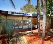
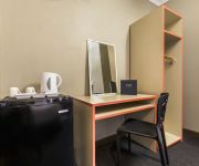
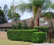
If you need a hotel, we compiled a list of available hotels close to the map centre further down the page.
While being here, you might want to pay a visit to some of the following locations: Parramatta, Sydney, Katoomba, Canberra and . To further explore this place, just scroll down and browse the available info.
Local weather forecast
Todays Local Weather Conditions & Forecast: 16°C / 61 °F
| Morning Temperature | 14°C / 58 °F |
| Evening Temperature | 15°C / 60 °F |
| Night Temperature | 14°C / 58 °F |
| Chance of rainfall | 20% |
| Air Humidity | 86% |
| Air Pressure | 1024 hPa |
| Wind Speed | Light breeze with 5 km/h (3 mph) from North-West |
| Cloud Conditions | Overcast clouds, covering 100% of sky |
| General Conditions | Moderate rain |
Sunday, 5th of May 2024
15°C (58 °F)
15°C (59 °F)
Heavy intensity rain, moderate breeze, overcast clouds.
Monday, 6th of May 2024
19°C (65 °F)
16°C (61 °F)
Moderate rain, moderate breeze, clear sky.
Tuesday, 7th of May 2024
17°C (62 °F)
15°C (59 °F)
Light rain, gentle breeze, broken clouds.
Hotels and Places to Stay
The William Inglis - MGallery by Sofitel
Travelodge Bankstown Sydney
SUNDOWNER GARDENIA BASS HILL
BREAKFREE BANKSTOWN INTERNATIONAL
High Flyer Hotel
Chester Hill Hotel
ibis budget Enfield
Sutherland Motel
Getaway Holiday House Bankstown
Holiday Inn WARWICK FARM
Videos from this area
These are videos related to the place based on their proximity to this place.
Koalas in the Wild
On the coast of Australia close to a major city there is a large colony of Koalas living in the gum trees.
real_estate_agents
First National Real Estate Davidson Shop 54, 38-62 Walder Road, Hammondville, NSW, 2170 (02) 8798 2661 www.davidsonfirst.com.au Centrally located in Hammondville this team of real estate ...
Moorebank Sports Soccer; The Boys Score!
Final minute on extra time Arvind scores the final goal that sealed their win for the final.
Overtaking on the left and speeding is BAD
While on a trip from Sydney to Wollongong I had this smart cookie speed and overtake me on the left. VERY silly and VERY dangerous.
BetaLFIELD 4 GAMEPLAY: Snipe Fest & Teleporters?! SIEGE OF SHANGHAI Ep2 (Conquest)
More footage on the Exclusive Beta, this time spiced up with a conquest match with vehicles & airburst guns. -Comment, Rate and Sub, thanks :D.
Avalon Beach Sydney - Beach Travel
Avalon Beach Sydney - Beach Travel Avalon is located 35 kilometres north of the Sydney central business district, in the local government area of Pittwater Council, in the Northern Beaches region.
SOLD! Sensational Three Level Home - 272a Edgar St, Condell Park NSW - Sydney Property
Contact Richard Matthews Real Estate http://www.richardmatthews.com.au or call 02 9642 4288 SOLD! 272a Edgar Street, Condell Park NSW Sensational Family Livi...
Videos provided by Youtube are under the copyright of their owners.
Attractions and noteworthy things
Distances are based on the centre of the city/town and sightseeing location. This list contains brief abstracts about monuments, holiday activities, national parcs, museums, organisations and more from the area as well as interesting facts about the region itself. Where available, you'll find the corresponding homepage. Otherwise the related wikipedia article.
Voyager Point, New South Wales
Voyager Point is a small suburb, in Southern Sydney, in the state of New South Wales, Australia. Voyager Point is located 25 kilometres (35 min) south of the Sydney central business district, in the local government area of the City Of Liverpool. The only adjacent suburbs are Sandy Point, Holsworthy and Pleasure Point. Milperra, Panania and East Hills are located on the opposite bank of the Georges River.
Revesby railway station
Revesby railway station is the main intermediate terminus on the Airport & East Hills line of the CityRail network. It services the Sydney suburb of Revesby. Revesby has an island platform and a side platform. It is serviced by both all-stations and faster limited-stop trains. An additional island platform and new footbridge were built as part of the Rail Clearways upgrade, which allows Easy Access for wheelchairs via lifts.
East Hills railway station
East Hills is a railway station on the East Hills line, at East Hills in the south-western suburbs of Sydney, Australia. It was the original terminus of the line, hence the line bears its name.
Panania railway station
Panania station is a CityRail intermediate station on the East Hills line. It services the Sydney suburb of Panania. It is located west of Revesby and east of East Hills. It is approximately 22.5 km from Central Station via Wolli Creek and Airport Stations by rail. Panania features an island platform serving 2 tracks.
Panania, New South Wales
Panania, a suburb of local government area City of Bankstown, is located 23 kilometres inner south-west of the Sydney central business district in the state of New South Wales, Australia, and is a part of the South-western Sydney region. The postcode is 2213, which it shares with adjacent suburbs East Hills and Picnic Point. Panania is bounded on the north by the M5 South Western Motorway and the suburb of Milperra. Picnic Point, to the south, features parklands along the Georges River.
Milperra massacre
The Milperra Massacre, Milperra bikie shoot-out{{#invoke:Footnotes|sfn}} or Father's Day Massacre was a firearm battle between rival motorcycle gang members on 2 September 1984, in Milperra, a south-western suburb of Sydney, New South Wales. The shootout had its roots in an intense rivalry that developed after a group of Comancheros broke away and formed the first Bandidos Motorcycle Club chapter in Australia.
Alfords Point, New South Wales
Alfords Point is a suburb in southern Sydney, in the state of New South Wales, Australia. Alfords Point is located 28 kilometres south of the Sydney central business district, in the local government area of the Sutherland Shire in the area commonly called Menai. Alfords Point shares the postcode of 2234 with neighbouring suburbs of Menai, Bangor and Illawong. Alfords Point is located on the southern bank of the Georges River.
Padstow railway station, Sydney
Padstow is a railway station on the Airport and East Hills Line of the CityRail network. Located in the Sydney suburb of Padstow, it serves a residential area. Padstow is an intermediate station with an island platform serving two tracks. It opened in 1931 with the opening of the East Hills railway line from Tempe to East Hills, and opened with only one track until the line to East Hills was duplicated in 1987.
Revesby, New South Wales
Revesby, a suburb of local government area City of Bankstown, is located 22 kilometres south-west of the Sydney central business district, in the state of New South Wales, Australia, and is a part of the South-western Sydney region. Revesby is mostly a residential suburb, which was developed as part of Sydney's post-war urban sprawl, and contains many modest freestanding bungalows built from asbestos cement sheeting.
Bankstown Lidcombe Hospital
Bankstown Lidcombe Hospital is a principal referral group A1B hospital with tertiary affiliations to the University of NSW, University of Sydney and University of Western Sydney providing a wide range of general medical and surgical services and sub-specialty services to a local Bankstown/Canterbury community. It is part of South Western Sydney Local Health District.
Sandy Point, New South Wales
Sandy Point is a suburb in south-western Sydney, in the state of New South Wales, Australia 28 km south of the Sydney central business district, in the local government area of the Sutherland Shire. Sandy Point is also a geographical formation on the southern bank of the Georges River, east of Deadmans Creek. The Sandy Point estate was created here in 1925 and it was later adopted as the suburb’s name. Holsworthy and Pleasure Point are the only adjacent suburbs.
Revesby Heights, New South Wales
Revesby Heights, a suburb of local government area City of Bankstown, is 23 kilometres south-west of the Sydney central business district, in the state of New South Wales, Australia. It is a part of the South-western Sydney region. Revesby Heights is located on the northern bank of the Georges River and west of Little Salt Pan Creek.
Pleasure Point, New South Wales
Pleasure Point is a small suburb, in south-western Sydney, in the state of New South Wales, Australia. Pleasure Point is 27 km south west of the Sydney central business district, in the local government area of the City Of Liverpool. Its postcode is 2172. Pleasure Point is a geographical formation on the southern bank of the Georges River which lends its name to the suburb. The only adjacent suburbs are Voyager Point, Sandy Point and Holsworthy.
Picnic Point, New South Wales
Picnic Point, a suburb of local government area City of Bankstown, is 23 kilometres south-west of the Sydney central business district, in the state of New South Wales, Australia. It is a part of South-western Sydney region . Picnic Point is a residential suburb on the northern bank of the Georges River.
Condell Park, New South Wales
Condell Park, a suburb of local government area City of Bankstown, is 22 kilometres south-west of the Sydney central business district, in the state of New South Wales, Australia, and is a part of the South-western Sydney region. The postcode of Condell Park is 2200, which is shared with Bankstown, Bankstown Airport, and Mount Lewis.
East Hills, New South Wales
East Hills, a suburb of local government area City of Bankstown, is located 26 kilometres south-west of the Sydney central business district, in the state of New South Wales, Australia, and is a part of the South-western Sydney region. East Hills is a residential suburb on the northern bank of the Georges River. The adjacent suburbs are Panania and Picnic Point. Nearby suburbs on the opposite bank of the Georges River include Pleasure Point, Voyager Point, Sandy Point and Hammondville.
Hammondville, New South Wales
Hammondville is a suburb, in south-western Sydney, in the state of New South Wales, Australia. Hammondville is located 31 kilometres south-west of the Sydney central business district in the local government area of the City of Liverpool.
Holsworthy railway station, Sydney
Holsworthy railway station is on the East Hills railway line, Sydney. The station serves the suburbs of Holsworthy, Hammondville and Wattle Grove. The station is a modern concrete and steel construction, and has an island platform with a commuter carpark. Holsworthy station is linked to City of Liverpool by bus routes 901 and 902 served by Veolia Transport NSW. A lift and stairs connect the pedestrian overbridge with the platform.
Georges River Grammar School
Georges River Grammar (GRG) is an independent, co-educational, day school located in Georges Hall, a suburb of South-Western Sydney, New South Wales, Australia. Established in 1986, the school has a non-selective enrolment policy and currently caters for approximately 900 students from Kindergarten to 12.
Alfords Point Bridge
Alfords Point Bridge is one of three major road crossings of the lower Georges River. It was opened on the 7 September 1973. The bridge links Padstow Heights in the City of Bankstown to Alfords Point in the Sutherland Shire. It is part of Metroad 6. The two other road crossings over the Georges River downstream of the Alfords Point Bridge are the Captain Cook Bridge, which opened in 1965 and Tom Uglys Bridge, which opened in 1929. Tom Uglys Bridge connects Blakehurst to Sylvania.
East Hills Boys High School
East Hills Boys High School is a boys only public secondary school run by the New South Wales Department of Education, located in Panania, New South Wales, a suburb in south-western Sydney. As a comprehensive school it is inclusive, catering for all boys of all abilities. Although it has a long list of distinguished HSC academic achievement, it is noted for its sporting achievement. Olympic swimmer Ian Thorpe and cricketers Mark and Steve Waugh are notable former students.
2BCR
BFM (callsign 2BCR), is one of three Australian broadcasters currently sharing the frequency 100.9 FM. It operates under a Temporary Community Broadcasting Licence. The licence area is Bankstown and Auburn in Sydney.
Bankstown Senior College
Bankstown Senior College, formally Bankstown Boys High school, is a senior college located in the suburb of Bankstown, in the City of Bankstown, New South Wales, Australia.
Australian Aviation Museum
Australian Aviation Museum, is located on Starkie Drive, Bankstown Airport in the suburb of Bankstown The Museum was opened by the then Prime Minister the Hon. Paul Keating in February, 1994, and showcases the history and future of aviation, space technology and the progress in world aviation. The Australian Aviation Museum has on display a mock up Boeing 747-400 which is used as a Movie set.
Picnic Point High School
Picnic Point High School is a government high school located in the suburb of Picnic Point, New South Wales, Australia. The school has approximately 1000 students in Years 7 to 12. It prepares students for the Higher School Certificate (HSC) in Year 12, and the Record of School Achievement for those students who leave school before attaining the HSC. The school celebrated its 50th anniversary on Saturday, 31 March 2012.


