Safety Score: 2,7 of 5.0 based on data from 9 authorites. Meaning we advice caution when travelling to United States.
Travel warnings are updated daily. Source: Travel Warning United States. Last Update: 2024-05-01 08:01:32
Delve into Sonora Knolls
The district Sonora Knolls of Sonora in Tuolumne County (California) is a district located in United States about 2,325 mi west of Washington DC, the country's capital town.
In need of a room? We compiled a list of available hotels close to the map centre further down the page.
Since you are here already, you might want to pay a visit to some of the following locations: San Andreas, Jackson, Mariposa, Merced and Modesto. To further explore this place, just scroll down and browse the available info.
Local weather forecast
Todays Local Weather Conditions & Forecast: 19°C / 66 °F
| Morning Temperature | 5°C / 42 °F |
| Evening Temperature | 16°C / 61 °F |
| Night Temperature | 8°C / 46 °F |
| Chance of rainfall | 0% |
| Air Humidity | 21% |
| Air Pressure | 1012 hPa |
| Wind Speed | Moderate breeze with 9 km/h (6 mph) from East |
| Cloud Conditions | Clear sky, covering 0% of sky |
| General Conditions | Sky is clear |
Thursday, 2nd of May 2024
19°C (66 °F)
9°C (49 °F)
Broken clouds, moderate breeze.
Friday, 3rd of May 2024
19°C (66 °F)
9°C (48 °F)
Sky is clear, gentle breeze, clear sky.
Saturday, 4th of May 2024
9°C (49 °F)
1°C (33 °F)
Rain and snow, gentle breeze, overcast clouds.
Hotels and Places to Stay
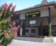
COUNTRY INN SONORA
The Palm Hotel
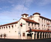
Historic National Hotel
BW PLUS SONORA OAKS HOTEL CONF
Sonora Inn
SONORA GOLD LODGE
MINERS MOTEL JAMESTOWN
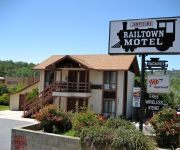
Jamestown Railtown Motel
Aladdin Inn
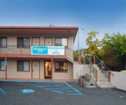
Rodeway Inn Sonora
Videos from this area
These are videos related to the place based on their proximity to this place.
Amgen Tour of California 2012- Stage 4 Sonora Sierra No 3.wmv
Quite an impressive caravan of over 100 vehicles in support of the Amgen Tour of California 2012, Stage 4, leaving Sonora. Oh, and some bikes. The entire entourage passed The Movie Star Locomotiv.
Chinese Camp Ghost Town Tuolumne County Sonora California Video 1 of 5
Remnants of Chinese Camp Ghost Town. Old California Gold Rush Mining Town.
A Weekend in Sonora
Sonora, Ca 2013 con los amigos. A quick look around the barn and a dip in God's Bath.
Ghost Town Sonora California Chinese Camp Video 3 of 5
Do you see ghost or spirit of a older women face in the top left hand window??
Sonora RC Raceway
Sonora RC Raceway Nov. 14 2012 SC XXX-t 2wd Races are Wednesdays start around 6:30pm Go in the Hobby Shop for parts and meet Pop's who makes everyone welcome. 659 Sanguinetti Rd.
Huge Ford Focus Burnout
Long burnout in the parking lot of Creative Sounds here in Sonora. My car is a 2004 Ford Focus ZX3 with the 2.3L Duratec engine. Go-fast mods are; - K&N Cold Air Intake - Wrapped F2 Header...
Starlight Serenaders - As Time Goes By
Herman Hupeld's "As Time Goes By" performed by the Starlight Serenaders on February 23, 2013 at Stage 3 Theatre, Sonora, CA.
mTech Legacy: Technic Classic - Series Intro
Welcome to a new series: the Legacy Series. In which I play old and forgotten packs and mods (mostly Technic) and show the world how modding once was. Enjoy! Also, the TFC series went for 6...
Thaumcraft 4 Research Tutorial
Tutorial on the research aspects (no pun intended) of Thaumcraft 4. Sorry that I haven't uploaded in a while, I had a lot going on. The version used in this video was 4.05b, along with expansions...
Propane Awareness: Tank Monitoring
To ensure you stay warm this winter we have installed many tank monitors on our customer's tanks. You might be wondering how a tank monitors keep you warm? The main benefit you will see is...
Videos provided by Youtube are under the copyright of their owners.
Attractions and noteworthy things
Distances are based on the centre of the city/town and sightseeing location. This list contains brief abstracts about monuments, holiday activities, national parcs, museums, organisations and more from the area as well as interesting facts about the region itself. Where available, you'll find the corresponding homepage. Otherwise the related wikipedia article.
Chinese Camp, California
Chinese Camp is a census-designated place (CDP) in Tuolumne County, California, United States. The population was 126 at the 2010 census, down from 146 at the 2000 census. It lies in the grassy foothills of the Sierra Nevada near the southern end of California's Gold Country.
East Sonora, California
East Sonora is a census-designated place (CDP) in Tuolumne County, California, United States. The population was 2,266 at the 2010 census, up from 2,078 at the 2000 census.
Columbia, California
Columbia is a town located in the Sierra Nevada foothills, in Tuolumne County, California, United States. It was founded as a boomtown in 1850 when gold was discovered in the vicinity during the California Gold Rush, and was known as the "Gem of the Southern Mines. " The town's historic central district is within Columbia State Historic Park, which preserves the 19th century mining town features. The U.S.
Mono Vista, California
Mono Vista is a census-designated place (CDP) in Tuolumne County, California, United States. The population was 3,127 at the 2010 census, up from 3,072 at the 2000 census.
Jamestown, California
Jamestown is a census-designated place (CDP) in Tuolumne County, California, United States. The population was 3,433 at the 2010 census, up from 3,017 at the 2000 census. Formerly a California Gold Rush town, Jamestown is now a California Historical Landmark. A scene from the movie Hidalgo was filmed in Jamestown. Exterior scenes from the TV series Petticoat Junction and Green Acres were filmed in and near Jamestown.
Phoenix Lake-Cedar Ridge, California
Phoenix Lake-Cedar Ridge is a former census-designated place (CDP) in Tuolumne County, California, United States. The population was 5,123 at the 2000 census. It was abolished prior to the 2010 census, and Phoenix Lake and Cedar Ridge became CDPs.
Sonora, California
Sonora is the county seat of Tuolumne County, California. As of the 2010 census, the city population was 4,903, up from 4,423 at the 2000 census. Sonora is the only incorporated community in Tuolumne County.
Soulsbyville, California
Soulsbyville is an unincorporated census-designated place in Tuolumne County, California, United States. The population was 2,215 at the 2010 census, up from 1,729 at the 2000 census. Formerly a California Gold Rush town, Soulsbyville is now registered as a California Historical Landmark.
Tuolumne City, California
Tuolumne (or Tuolumne City) is a census-designated place (CDP) in Tuolumne County, California, United States. The population was 1,779 at the 2010 census, down from 1,865 at the 2000 census.
Railtown 1897 State Historic Park
Railtown 1897 State Historic Park, and its operating entity, the Sierra Railway, is known as "The Movie Railroad. " Both entities are a heritage railway and are a unit of the California State Park System. Railtown 1897 is located in Jamestown, California. The entire park preserves the historic core of the original Sierra Railway of California (later reincorporated as the Sierra Railroad Company).
Douglas Flat, California
Douglas Flat (formerly, Douglasflat and Douglass Flat) is an unincorporated community in Calaveras County, California. It lies at an elevation of 1965 feet (599 m) and is located at {{#invoke:Coordinates|coord}}{{#coordinates:38|06|52|N|120|27|18|W| | |name= }}. The community is in ZIP code 95229 and area code 209. Douglas Flat was a roaring mining camp of the early 1850s. In 1857 the Harper and Lone Star Claims produced $130,000 worth of gold.
Carson Hill, California
Carson Hill (also, Carson Flat and Melones and Slumgullion) is a ghost town in Calaveras County, California. It sits at an elevation of 1447 feet (441 m) above sea level and is located at {{#invoke:Coordinates|coord}}{{#coordinates:38|01|42|N|120|30|24|W| | |name= }}, about 4 miles south-southeast of Angels Camp. It was one of the most productive mining camps in the state, with nearly $26 million in gold and quartz found in the area.
Melones, California
For the existing town formerly called Melones, see Carson Hill, California.
Archie Stevenot Bridge
The Stevenot Bridge carries State Route 49 over New Melones Lake between Calaveras and Tuolumne Counties in the U.S. state of California and was completed in 1976.
New Melones Lake
New Melones Lake is an artificial lake in the central Sierra Nevada foothills of Calaveras- and Tuolumne County, California, United States near Jamestown. This reservoir created by the construction of the New Melones Dam across the Stanislaus River has a 2,400,000 acre·ft capacity with a surface area of 12,500 acres . When full, the shoreline is more than 100 miles .
Columbia College (California)
Columbia College is a community college located in the Yosemite Community College District in Sonora, California along with Modesto Junior College. Established in September 1968 as Columbia Junior College, the college dropped "Junior" in 1978. The architectural style of the college is that of California during the Gold Rush era. The college also has a fire department on campus that is staffed by an on duty crew of at least two personnel daily.
Columbia Airport (California)
Columbia Airport is a public airport located one mile (1.6 km) southwest of the central business district of Columbia, in Tuolumne County, California, United States. It is owned by the County of Tuolumne.
Twisted Oak Winery
Twisted Oak Winery is a family-owned boutique winery in Vallecito, California specializing in wine made from grape varieties native to the Mediterranean regions of western Europe. The winery is located on a hilltop at 2280 ft (695 m) above sea level in the foothills of the Sierra Nevada Mountains, and most of the grapes for the wines are sourced from nearby vineyards in Calaveras County. The winery name and logo design are derived from a California Blue Oak tree on the property.
KYCC
KYCC 90.1 FM and KCJH 89.1 FM are radio stations broadcasting a Christian music format. Licensed respectively to Stockton, California and Livingston, California, the stations are currently owned by Christian Life College. The station also has several satellites and repeaters throughout the western US.
Ironstone Vineyards
Ironstone is noted for several leading US brands. These include the Ironstone Vineyards brand, Leaping Horse Vineyards, Dog Tail Vineyards, and Sonoma Creek. As of 2004, Ironstone has been listed as the 17th largest winery (in terms of cases sold) in the US. Ironstone also sell significant amounts of wine in the international markets including the UK, Canada and 40 other countries.
KCVR-FM
KCVR-FM is a radio station licensed to Columbia, California, USA. The station is currently owned by Entravision Holdings, LLC.
KKBN
KKBN is a radio station broadcasting a Country music format. Licensed to Twain Harte, California, USA, the station serves the Modesto area. The station is currently owned by Clarke Broadcasting Corporation.
Big Valley, Calaveras County, California
Big Valley is an unincorporated community in Calaveras County, California. It lies at an elevation of 2155 feet (657 m).
Brownsville, Calaveras County, California
Brownsville is a former settlement in Calaveras County, California, about 1 mile (1.6 km) east of Murphys. Brownsville, named for Alfred Brown, operated as a mining camp in the 1850s and 1860s.
James E. Roberts Bridge
The James E. Roberts Memorial Bridge is a 1,400 foot two-lane highway bridge on California State Highway 120, in Tuolumne County, California. The bridge spans the Tuolumne River just north of Lake Don Pedro, near the community of Chinese Camp. It opened in 1971. Originally named the Tuolumne River Bridge, it was renamed in 2007 in honor of James E. Roberts by legislative resolution.


