Safety Score: 2,7 of 5.0 based on data from 9 authorites. Meaning we advice caution when travelling to United States.
Travel warnings are updated daily. Source: Travel Warning United States. Last Update: 2024-05-01 08:01:32
Discover Del Cielo Mobile Estates
The district Del Cielo Mobile Estates of Orcutt in Santa Barbara County (California) is a district in United States about 2,391 mi west of Washington DC, the country's capital city.
Looking for a place to stay? we compiled a list of available hotels close to the map centre further down the page.
When in this area, you might want to pay a visit to some of the following locations: San Luis Obispo, Santa Barbara, Ventura, Bakersfield and Hanford. To further explore this place, just scroll down and browse the available info.
Local weather forecast
Todays Local Weather Conditions & Forecast: 24°C / 75 °F
| Morning Temperature | 10°C / 50 °F |
| Evening Temperature | 16°C / 61 °F |
| Night Temperature | 11°C / 51 °F |
| Chance of rainfall | 0% |
| Air Humidity | 29% |
| Air Pressure | 1012 hPa |
| Wind Speed | Gentle Breeze with 8 km/h (5 mph) from South-East |
| Cloud Conditions | Clear sky, covering 0% of sky |
| General Conditions | Sky is clear |
Friday, 3rd of May 2024
23°C (74 °F)
11°C (52 °F)
Sky is clear, moderate breeze, clear sky.
Saturday, 4th of May 2024
17°C (62 °F)
10°C (51 °F)
Light rain, gentle breeze, overcast clouds.
Sunday, 5th of May 2024
14°C (57 °F)
7°C (45 °F)
Light rain, fresh breeze, clear sky.
Hotels and Places to Stay
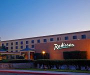
CA Radisson Hotel Santa Maria
HISTORIC SANTA MARIA INN
BEST WESTERN PLUS BIG AMERICA
Fairfield Inn & Suites Santa Maria
Holiday Inn & Suites SANTA MARIA
Town and Country
Solaire Inn & Suites
Econo Lodge Inn & Suites Santa Maria
Motel 6 Santa Maria - South
Candlewood Suites SANTA MARIA
Videos from this area
These are videos related to the place based on their proximity to this place.
Pelota Mixteca Santa Maria CA USA
video de un torneo que se realizo en santa maria california en agosto del 2009 vinieron jugadores de varios lugares de california como fresno,napa,san diego,bekersfield,watsonville etc,...
2012 CDCRA Dwarf Car National @ Santa Maria Speedway.wmv
Dwarf Pro Saturday night A main. In car camera, Joe Frock 16D. Top 5 1. 75B Camron Diatte 2. 15X Ryan Coterell 3. 40D Derek Rosse 4. 16D Joe Frock 5. 1V Monster Williams.
Tempur-Pedic Santa Maria Mattress Land SleepFIT Authorized Dealer
Santa Maria TempurPedic Dealer http://www.mattressland.com/tempur-pedic.asp Every Tempur-Pedic mattress is designed to deliver your best night's sleep. Here's how: • More responsive...
Tempur-Pedic Adjustable Beds at Mattress Land sleepfFIT in Santa Maria
Tempur-Pedic in Santa Maria http://www.mattressland.com/tempur-pedic.asp . Be "Fit" to the right TempurPedic mattress! "The Most Highly Recommended Bed In America" Unmatched in comfort and...
Memory Foam Mattress Santa Maria | Gel Memory Foam or TEMPUR-Pedic? Mattress Land SleepFIT
Memory Foam Santa Maria | Test TempurPedic at http://www.mattressland.com/tempur-pedic.asp We've seen the fads come and go and now it seems the new kid on the block is gel memory foam, "gel...
Banda La ChaKaloza de Mazatlan Sinaloa en Santa Maria CA.
Banda La ChaKaloza de Mazatlan Sinaloa en Santa Maria CA.
Kitchen Remodeling in Orcutt Highlights
Chuck Winkles, President of New Life Bath & Kitchen shares a few of the key features of a recently remodeled kitchen in Orcutt, CA. www.newlifehi.com.
Orcutt Plumbers | Plumber Reviews in Orcutt CA | Review
Orcutt plumbers http://www.griffin-plumbing.com/ at Griffin Plumbing of Orcutt provide all types of plumbing services including drain cleaning, rooter service and sewer repair as well water...
Open Mic Night at Lucia's in Old Orcutt 2013 12 19
Savanna, Chad, and me playing Lolo PS: Our camera mad had some trouble about half way through. I think he "forgot" which end to point at the band.
Dignity Health of the Central Coast Holiday Greetings 2013 AGCH HD
Produced by: KCOY TV Production Editor: Ben Slocum Videographer: Ben Slocum.
Videos provided by Youtube are under the copyright of their owners.
Attractions and noteworthy things
Distances are based on the centre of the city/town and sightseeing location. This list contains brief abstracts about monuments, holiday activities, national parcs, museums, organisations and more from the area as well as interesting facts about the region itself. Where available, you'll find the corresponding homepage. Otherwise the related wikipedia article.
Orcutt, California
Orcutt is an unincorporated town located in the Santa Maria Valley of California, and a census-designated place; it is in Santa Barbara County, California, United States. Orcutt is named for William Warren Orcutt, the manager of the Geological, Land and Engineering Departments of the Union Oil Company. Known as the “Dean of Petroleum Geologists" Orcutt is credited with discovering fossilized prehistoric animal bones preserved in pools of asphalt on the Hancock Ranch.
Santa Maria, California
Santa Maria is a city in Santa Barbara County, in Southern California. It is approximately 120 miles northwest of the Los Angeles City limits (Woodland Hills), and approximately 150 miles northwest of Downtown Los Angeles. The 2010 census population was 100,062, putting it ahead of Santa Barbara for the first time and making it the largest city in the county.
Allan Hancock College
Allan Hancock College is a California public community college located in Santa Maria in northern Santa Barbara County. In the 2009-2010 year 37,722 students had enrolled. In which 28,382 were credit and more than 9,340 were noncredit students. In 2011, Allan Hancock College was ranked as one of the five best community colleges in California and one of the nation’s top 120 community colleges.
Twitchell Reservoir
Twitchell Reservoir is a reservoir in southern San Luis Obispo County and northern Santa Barbara County in California. The reservoir has a capacity of 197,756 acre·ft and is formed by Twitchell Dam on the Cuyama River about 66 miles from its headwaters in the Chumash Wilderness Area and about 6 miles from its confluence with the Sisquoc River, where they form the Santa Maria River. Twitchell Dam was built by the United States Bureau of Reclamation between 1956 and 1958.
Cuyama River
The Cuyama River is a 118-mile-long river in southern San Luis Obispo County, northern Santa Barbara County, and northern Ventura County, in the U.S. state of California. It joins the Sisquoc River forming the Santa Maria River. The river's name comes from an Indian village named for the Chumash word kuyam, meaning "clam" or "freshwater mollusk".
Bien Nacido Vineyards
Bien Nacido Vineyards is cool-climate vineyard on the central coast of California. Located midway up the Santa Maria Valley, it is known for growing Burgundian and Rhone varieties of wine grapes. Bien Nacido has the distinction of being one of the major viticultural nurseries in the state for certified, varietal budwood. Most of the vines were originally from stock grown by the University of California at Davis.
Au Bon Climat
Au Bon Climat is a U.S. based winery, founded in 1982. The winery is in Santa Maria, California. The winery produces over 30,000 cases of wine annually, including Pinot Noir, Chardonnay, Pinot Blanc and Pinot Gris varietals. According to the winery's website, the primary source for Au Bon Climat's grapes is the Bien Nacido Vineyards, in northern Santa Barbara County.
KSNI-FM
KSNI-FM is a commercial radio station located in Santa Maria, California, broadcasting to the Santa Maria-Lompoc, California, area on 102.5 FM. KSNI-FM airs a country music format branded as "Sunny Country".
Central Coast Wine Services
Central Coast Wine Services is a multi-winery processing and warehouse facility located in Santa Maria, CA. Founded in 1988, Central Coast Wine Services serves as a warehouse facilities for wineries throughout the Central Coast (California) and includes a custom crush facility as well as bottling line and winemaking equipment rental. The company owns a branch location in Paso Robles.
St. Joseph High School (Santa Maria, California)
St. Joseph High School is a private, Roman Catholic high school in Orcutt, California. It is located in the Roman Catholic Archdiocese of Los Angeles.
KWVE (AM)
KWVE is a radio station broadcasting a Christian format. Licensed to Oildale, California, USA, it serves the Bakersfield area. The station is owned by Calvary Chapel Costa Mesa.
KRQZ
KRQZ is a non-commercial Contemporary Christian radio station, licensed to Lompoc, California and serving the Santa Maria area. The station receives its programming via satellite from WUFM in Columbus, Ohio.
Betteravia, California
Betteravia, named for the French word for sugar beet roots, was a community in northern Santa Barbara County, California on Betteravia Road, six miles west of Santa Maria. It is notable as a rare ghost town on the Central Coast of California.
KUHL
KUHL is a radio station licensed to serve Santa Maria, California, USA. The station, established in 1946, is currently owned by Knight Broadcasting, Inc. It broadcasts a News Talk Information format to the greater San Luis Obispo, California, area. The station was re-assigned the KUHL call letters by the Federal Communications Commission on January 27, 2009.
KSBQ
KSBQ is a radio station broadcasting a Regional Mexican format. Licensed to Santa Maria, California, USA, it serves the Santa Maria-Lompoc area. The station is currently owned by Lazer Licenses, LLC.
KTAP
KTAP is a radio station broadcasting a Regional Mexican format. Licensed to Santa Maria, California, USA, it serves the Santa Maria-Lompoc area. The station is currently owned by Emerald Wave Media.
Santa Maria Town Center
Santa Maria Town Center (sometimes simply referred as Town Center) is a shopping center located in Santa Maria, California, United States. It is located on the junction of Routes 135 (Broadway) and 166 (Main Street), as well as intersection of Cook Street, and Miller Street. Santa Maria Town Center is known to be the largest enclosed shopping center at Central Coast of California, with about 600,000 square feet (55,740 square meters).
KSMX (AM)
KSMX (1240 AM, "News Talk 1240") is a radio station broadcasting a News Talk Information format. Licensed to Santa Maria, California, USA, the station serves the Santa Maria-Lompoc area. The station is currently owned by EDB SLO License LLC and features programing from Fox News Radio, Premiere Radio Networks and Westwood One.
Pioneer Valley High School
Pioneer Valley High School is the newest public high school in the Santa Maria Joint Union High School District serving Santa Maria, California, in northern Santa Barbara County, California. It first opened its doors to a class of freshmen and sophomores on August 11, 2004.
Orcutt Oil Field
The Orcutt Oil Field is a large oil field in the Solomon Hills south of Orcutt, in Santa Barbara County, California. Discovered in 1901 by William Warren Orcutt, it was the first giant field (over 100 million barrels in ultimate recovery) to be found in Santa Barbara County, and its development engendered the boom town of Orcutt, now the major unincorporated southern suburb of Santa Maria.
Rancho Suey
Rancho Suey was a 48,834-acre Mexican land grant in present day southern San Luis Obispo County and northern Santa Barbara County, California given in 1837 by Governor Juan B. Alvarado to María Ramona Carrillo de Pacheco. The grant was east of present day Santa Maria and extended along the San Luis Obispo-Santa Barbara County line, and between the Santa Maria River and the Cuyama River.
Hancock Field (California)
Hancock Field is a former airport and military airfield located approximately 2 miles south-southeast of Santa Maria, California. Also known as Santa Maria Municipal Airport, the airport was closed about 1959 and today is the site of Allan Hancock College.
Rancho Todos Santos y San Antonio
Rancho Todos Santos y San Antonio was a 20,772-acre Mexican land grant in present day Santa Barbara County, California given in 1841 by Governor Juan B. Alvarado to William Edward Petty Hartnell. The grant extended along San Antonio Creek and encompassed present day Orcutt. , northwest of Lompoc
Rancho Punta de Laguna
Rancho Punta de Laguna was a 26,648-acre Mexican land grant in present day northern Santa Barbara County, California and southern San Luis Obispo County given in 1844 by Governor Manuel Micheltorena to Luis Arellanes and Emigdio Miguel Ortega. The name of this rancho means "point of the lagoon" and refers to the irregular lake lying within its territory. The grant is east of Rancho Guadalupe and encompassed present day Santa Maria and Betteravia.
The Hitching Post
The Hitching Post and The Hitching Post II are upscale American sister steakhouse restaurants.


