Safety Score: 2,7 of 5.0 based on data from 9 authorites. Meaning we advice caution when travelling to United States.
Travel warnings are updated daily. Source: Travel Warning United States. Last Update: 2024-04-28 08:22:10
Delve into Sunset Palisades
The district Sunset Palisades of Miles in San Luis Obispo County (California) is a district located in United States about 2,399 mi west of Washington DC, the country's capital town.
In need of a room? We compiled a list of available hotels close to the map centre further down the page.
Since you are here already, you might want to pay a visit to some of the following locations: San Luis Obispo, Santa Barbara, Hanford, Ventura and Bakersfield. To further explore this place, just scroll down and browse the available info.
Local weather forecast
Todays Local Weather Conditions & Forecast: 18°C / 64 °F
| Morning Temperature | 12°C / 53 °F |
| Evening Temperature | 15°C / 59 °F |
| Night Temperature | 13°C / 55 °F |
| Chance of rainfall | 0% |
| Air Humidity | 63% |
| Air Pressure | 1018 hPa |
| Wind Speed | Fresh Breeze with 16 km/h (10 mph) from South-East |
| Cloud Conditions | Clear sky, covering 0% of sky |
| General Conditions | Sky is clear |
Monday, 29th of April 2024
18°C (64 °F)
13°C (55 °F)
Sky is clear, fresh breeze, clear sky.
Tuesday, 30th of April 2024
19°C (66 °F)
13°C (55 °F)
Sky is clear, fresh breeze, clear sky.
Wednesday, 1st of May 2024
20°C (67 °F)
15°C (59 °F)
Sky is clear, moderate breeze, clear sky.
Hotels and Places to Stay
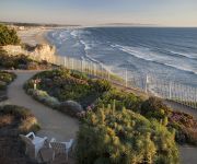
Dolphin Bay Resort And Spa
COTTAGE INN BY THE SEA
SPYGLASS INN
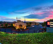
Hilton Garden Inn San Luis Obispo-Pismo Beach
AVILA LIGHTHOUSE SUITES
THE SEACREST OCEANFRONT HOTEL
PISMO LIGHTHOUSE SUITES
Pismo Beachwalker Inn & Suites
The Palomar Inn
Motel 6 Pismo Beach - Pacific Ocean
Videos from this area
These are videos related to the place based on their proximity to this place.
Pismo Beach Places to stay & activities
Pismo Beach is classic California. Surf, sun and sand. Great weather year round. Lots to do with golfing, surfing, sunning, wineries, ocean side hotels, cottages & condos.
Pismo Beach Sunset Time Laps 12-29-11
Time laps of a beautiful sunset at Pismo Beach, Ca 12-29-11 One of my first real Time laps and not the last. Tell me what you think.
Surf and Pier Fishing at Avila Beach
This weekend my family and I decided to go camping at Avila Beach, CA. While we were there I went fishing off the Port San Luis Pier, and at Fisherman's Beach. Don't forget to comment and subscribe!
White Croaker Fishing at the Avila Beach Pier, CA
On 2/15/15 I went to the Avila Beach Pier, to go shark fishing. I waited most of the night, but didn't get any bites. So I got a 4/0 Gamakastu Octopus hook, and put a little piece of anchovy...
Avila Beach Video Tour
A quick 30 second tour of Avila Beach and the surrounding area. http://www.visitavilabeach.com.
Ávila Beach, CA
Views of Ávila Beach, California. ************************************************************ *** Copyright 2013 © CCDVProductions.com.
Surfers March 15th, 2011, The Cliffs, Shell Beach, CA
Went down to the beach and shot these surfers at it again. Nice swells and offshore conditions made for crowded waves.
Videos provided by Youtube are under the copyright of their owners.
Attractions and noteworthy things
Distances are based on the centre of the city/town and sightseeing location. This list contains brief abstracts about monuments, holiday activities, national parcs, museums, organisations and more from the area as well as interesting facts about the region itself. Where available, you'll find the corresponding homepage. Otherwise the related wikipedia article.
Arroyo Grande, California
Arroyo Grande is a city in San Luis Obispo County, California, United States. The population was 17,252 at the 2010 census.
Grover Beach, California
Grover Beach is a city in San Luis Obispo County, California, United States. The population was 13,156 at the 2010 census, up from 13,067 at the 2000 census.
Oceano, California
Oceano is a census-designated place (CDP) in San Luis Obispo County, California, United States. The population was 7,286 at the 2010 census, up from 7,260 at the 2000 census.
Pismo Beach, California
Pismo Beach is a beach city in southern San Luis Obispo County, in the Central Coast area of California, United States. The population was 7,655 at the 2010 census, down from 8,551 at the 2000 census. It is part of the Five Cities Area, a cluster of cities in that area of San Luis Obispo County.
Madonna Inn
The Madonna Inn is a motel in San Luis Obispo, California. Opened for business in 1958, it quickly became a landmark on the Central Coast of California. The Inn was created by Alex Madonna, a successful construction magnate and entrepreneur (d. April 2004), and his wife Phyllis. The well-known motor inn, which includes a restaurant and bakery, is prominently located on the west side of US Route 101 and situated on the lower eastern portion of Cerro San Luis Obispo.
Cerro San Luis Obispo
Cerro San Luis Obispo is a 1,292 feet mountain in San Luis Obispo, California. It is part of the chain of peaks called the Nine Sisters, and is often referred to as San Luis Mountain, Mount San Luis, or Madonna Mountain. It is a popular spot for mountain biking and hiking, offering spectacular views and steep terrain. There is a wide dirt road traversing the mountain that leads to the peak.
San Luis Obispo County Regional Airport
San Luis Obispo County Regional Airport, also known as McChesney Field, is an airport located in San Luis Obispo, California serving San Luis Obispo County. The airport is mostly used for general aviation, but is also served by two commercial airlines. Located just south of the City of San Luis Obispo, the San Luis Obispo County Regional Airport serves areas as far north as Southern Monterey County and as far south as Northern Santa Barbara County.
Islay Hill
Islay Hill is a volcanic cone and is the southernmost of the nine major morros that make up the Nine Sisters. This chain of extinct volcanoes stretches from Morro Bay in San Luis Obispo County, California.
KVEC
KVEC 920 AM is a radio station located in San Luis Obispo on the Central Coast of California in the United States. The station airs a variety of nationally syndicated talk show programs in addition to shows such as that of Dave Congalton.
Point San Luis Light
The Point San Luis Lighthouse, also known as the San Luis Opisbo Light Station, is the only surviving Prairie Victorian model lighthouse that remains in existence on the West Coast of the United States. It is on the National Register of Historic Places and is presently being refurbished by the Point San Luis Lighthouse Keepers, a volunteer group. The lighthouse is located near Avila Beach on the Central Coast of California.
Oceano County Airport
Oceano County Airport is a public airport located one mile (1.6 km) west of the central business district (CBD) of Oceano, in San Luis Obispo County, California, USA. The airport covers 58 acres and has one runway. It is mostly used for general aviation.
Grover Beach (Amtrak station)
The Grover Beach/Pismo Beach Amtrak Station is an Amtrak rail station in the city of Grover Beach, California. It is served by Amtrak's Pacific Surfliner from San Luis Obispo to San Diego. Four Pacific Surfliner trains serve the station daily. The current $1.6 million station opened in November 1996; the project was a coordinated effort between Caltrans, Amtrak, and the city of Grover Beach with funding from State Transit Capital Improvement and Proposition 116 bonds.
San Luis Obispo (Amtrak station)
The San Luis Obispo Amtrak Station is an Amtrak rail station in the city of San Luis Obispo, California. It is the northern terminus of Amtrak's Pacific Surfliner from San Luis Obispo to San Diego and it also serves the Coast Starlight from Seattle, Washington to Los Angeles, California. Four Pacific Surfliner trains and two Coast Starlight trains (one in each direction) serve the station daily. The station is fully staffed with ticketing and checked baggage services.
Kundert Medical Clinic
The Kundert Medical Clinic is a building in San Luis Obispo, California, USA, designed by Frank Lloyd Wright in the 1950s. It is notable for being one of the few commercial buildings designed by Wright. This building is now owned and occupied by cardiologist Kenneth Tway, MD.
Bubblegum Alley
Bubblegum Alley is a local tourist landmark in downtown San Luis Obispo, California, known for its accumulation of used bubble gum on the walls of an alley. It is a 15-foot high and 70-foot long alley lined with chewed gum left by passers-by. The locally created, "most-talked-about landmark" covers a stretch of 20 meters between 733 and 734 Higuera Street in downtown San Luis Obispo.
Mission College Preparatory High School
Mission College Preparatory Catholic High School is a private Roman Catholic high school in San Luis Obispo, California. It is located in the Roman Catholic Diocese of Monterey.
KXTZ
KXTZ (95.3 FM, "The Beach") is a commercial radio station located in San Luis Obispo, California. KXTZ airs a classic rock music format (with a focus on 1980s era rock music), and is a simulcast with sister station KXDZ (on 100.5 FM), branded as "95.3 The Beach". The station was assigned the KXTZ call sign by the Federal Communications Commission on April 17, 1998. In April 2002, Howard Broadcasting, Inc.
KLMM
KLMM is a radio station broadcasting a Regional Mexican format. Licensed to Morro Bay, California, USA, it serves the San Luis Obispo area. The station is currently owned by Lazer Licenses, LLC.
KKJL
KKJL is a radio station broadcasting an Adult Standards/MOR format. It also is the radio home for San Francisco Giants broadcasts. Licensed to San Luis Obispo, California, USA, it serves the San Luis Obispo area. The station is currently owned by San Luis Obispo Broadcasting, Inc.
KYNS
KYNS (1340 AM, Slo Radio News 1340 AM) is a radio station broadcasting a News radio format. Licensed to San Luis Obispo, California, USA, it serves the San Luis Obispo area. The station is currently owned by Mapleton Communications, LLC. It features TRN’s America’s Radio News Network, Clark Howard and “Overnight America with Jon Grayson. ”
Dalidio Ranch Project Controversy
The Dalidio Ranch Project refers to a controversial development project proposal most recently known as Measure J, which was voted on by the citizens of San Luis Obispo County, CA on the November 7, 2006 ballot. The parcel proposed for the development project is a 131-acre parcel of farmland located adjacent to San Luis Obispo, California, west of U.S. Route 101, and east of Madonna Road. The parcel is south of the Promenade Shopping Center and bordered by Prefumo Creek.
KVEC-AM
KVEC 920 AM is a commercial radio station located in San Luis Obispo on the Central Coast of California in the United States. The station airs a variety of nationally syndicated talk show programs in addition to shows such as that of Dave Congalton.
Rancho San Miguelito
Rancho San Miguelito was a 14,198-acre Mexican land grant in present day San Luis Obispo County, California given in 1842 by Governor Juan Alvarado to Miguel Ávila, and an addition granted in 1846 by Governor Pio Pico. The grant extended along the Pacific coast, and included Point San Luis, San Luis Obispo Bay, and present day Avila Beach.
Rancho Pismo
Rancho Pismo was a 8,839-acre Mexican land grant in present day San Luis Obispo County, California given in 1840 by Governor Pro Tem Manuel Jimeno to José Ortega. The grant extended along the Pacific coast and encompassed present day Pismo Beach, Grover Beach, Shell Beach and parts of Arroyo Grande.
The Apple Farm (San Luis Obispo, California)
The Apple Farm is a combination lodging accommodation and American restaurant in San Luis Obispo, California, located at 2015 Monterey Street. It is a member of California's Boutique Hotel Collection.


