Safety Score: 3,0 of 5.0 based on data from 9 authorites. Meaning we advice caution when travelling to Malta.
Travel warnings are updated daily. Source: Travel Warning Malta. Last Update: 2024-05-08 08:04:21
Discover Ix-Xagħra l-Ħamra
The district Ix-Xagħra l-Ħamra of Manikata in Il-Mellieħa is a district in Malta a little west of Valletta, the country's capital city.
Looking for a place to stay? we compiled a list of available hotels close to the map centre further down the page.
When in this area, you might want to pay a visit to some of the following locations: Mellieha, Imgarr, San Pawl il-Bahar, Imtarfa and Imdina. To further explore this place, just scroll down and browse the available info.
Local weather forecast
Todays Local Weather Conditions & Forecast: 18°C / 64 °F
| Morning Temperature | 18°C / 64 °F |
| Evening Temperature | 15°C / 58 °F |
| Night Temperature | 15°C / 59 °F |
| Chance of rainfall | 22% |
| Air Humidity | 89% |
| Air Pressure | 1012 hPa |
| Wind Speed | Moderate breeze with 12 km/h (7 mph) from West |
| Cloud Conditions | Scattered clouds, covering 36% of sky |
| General Conditions | Heavy intensity rain |
Thursday, 9th of May 2024
14°C (58 °F)
16°C (61 °F)
Moderate rain, fresh breeze, overcast clouds.
Friday, 10th of May 2024
18°C (64 °F)
17°C (62 °F)
Light rain, moderate breeze, few clouds.
Saturday, 11th of May 2024
17°C (63 °F)
17°C (63 °F)
Sky is clear, moderate breeze, clear sky.
Hotels and Places to Stay
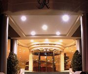
Radisson Blu Resort & Spa Malta Golden Sands
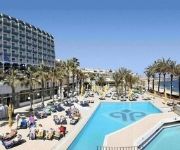
The All Inclusive Riviera Resort and Spa
Qawra Palace Hotel
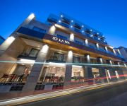
Solana Hotel & Spa
Maritim Antonine Hotel & Spa Malta
Pergola Hotel & Spa
Grand Hotel Malta
Paradise Bay Resort
Ramla Bay Resort
Bella Vista Hotel
Videos from this area
These are videos related to the place based on their proximity to this place.
Popeye village, Malta
Popeye village, Malta island (2009). MY TRAVEL CHANNEL 1: vladamikulec MY TRAVEL CHANNEL 2: placesofinterest.
Generation Next Mellieha Primary
SUSTAINABLE IS POSSIBLE - GENERATION NEXT Eko Skola Committee, together with the SMT, teachers, LSAs School Council and all the students work hard to have an eco friendly school at Maria ...
GOPRO, Harness Attachment on a Staffordshire. At Majjitral Park, Malta. Watch in HD.
The area in the northwest of Malta, which includes the coastal area from Golden Bay to Il-Prajjet and ix- Xagħra l-Ħamra, was declared a national park by the Government of Malta by Legal...
GOPRO, Harness Attachment on a Staffordshire. At Majjitral Park, Malta. Watch in HD.
The area in the northwest of Malta, which includes the coastal area from Golden Bay to Il-Prajjet and ix- Xagħra l-Ħamra, was declared a national park by the Government of Malta by Legal...
Ghajn Tuffieha Bay Riviera Bay Malta - Le spiagge di bambiniconlavaligia.it
Video di una delle migliori spiagge di Malta, Ghajn Tuffieha Bay, anche detta Riviera Bay. Localizzata a nord dell'isola di Malta si raggiunge facilmente con l'auto o con l'autobus, una lunga...
Attempted vandalism of Spring Watch cars.
One of the devices left hidden in the grass in an attempt to disable vehicles used by our Spring Watch teams.
MTB Malta - Tal-Lippija to Ghajn Tuffieha
Some single tracks leading from near Tal-Lippija tower to Triq Ghajn Tuffieha.
Golden Bay Malta Webcam Feb 14 2010 6pm
http://malta3d.com -Golden Bay Malta Webcam. Located on the Radisson SAS Golden Sands on the middle tower.
Videos provided by Youtube are under the copyright of their owners.
Attractions and noteworthy things
Distances are based on the centre of the city/town and sightseeing location. This list contains brief abstracts about monuments, holiday activities, national parcs, museums, organisations and more from the area as well as interesting facts about the region itself. Where available, you'll find the corresponding homepage. Otherwise the related wikipedia article.
Ta' Qali National Stadium
Ta' Qali National Stadium is the national stadium of Malta, and is the home stadium of the Malta national football team. It stages most Maltese Premier League and cup matches, as well as international matches. The stadium seats 17,797 people, and is the largest stadium in Malta.
St Paul's Island
St. Paul's Island (also referred to as Selmunett) is a small island close to Selmun near the north-east of the island of Malta. St. Paul's Island is sometimes split into two islands when the sea is rough. It has been uninhabited since the sole farmer abandoned his tiny dwelling and fields decades ago, thus making it the largest uninhabited island of Malta.
San Andrea School
The San Andrea School is a school in Malta. It was founded in 1992 at Sedqa, Independence Avenue, Naxxar by the Parents Foundation of Education (who also founded San Anton School). At the time it was composed of three classes. In 1995, the school was temporarily moved to a block of flats in Din L-Art Ħelwa.
Għajn Tuffieħa Tower
Ghajn Tuffieha Tower is a fortification that stands on the cliffs overlooking the shore at Ghajn Tuffieha Bay on the north west coast of Malta. It is one of five Lascaris towers that Grand Master Giovanni Paolo Lascaris of the Knights of Malta ordered be built. A watchtower, it was originally armed with a half pounder gun and garrisoned by four men. The tower was renovated in early 2000 with the support of the Director of Public Projects and the philanthropic organisation Din l-Art Helwa.
Qawra Tower
Qawra Tower is a fortification on the island of Malta built by the Knights of Malta in 1637. It is a small fortification, primarily a watchtower. It is also known locally as Fra Ben Tower. To the west it commands the entrance to St. Paul's Bay, to the east Salina Bay along with Għallis Tower. It was built during the reign of Grand Master Giovanni Paolo Lascaris and stands near the tip of Ras il-Qawra (Qawra Point). It is one of five Lascaris towers that he ordered be built.
Għajn Tuffieħa
Għajn Tuffieħa forms part of the Manikata village in Malta which is part of the Mellieħa Local Council. Close to Għajn Tuffieħa three bays are located with popular beaches among tourists. The beach are separated by natural rock formations and therefore each have their own characteristics.
Ċirkewwa
Ċirkewwa is a harbour situated on a point at the northernmost part of Malta. It is the site of the Ċirkewwa Ferry Terminal, where regular car ferries operate to the port of Mġarr on Gozo. In the summer, boat trips to Comino also operate, as well as organised diving excursions. As Ċirkewwa is a point on the northernmost end of the island, and not a town, there is no infrastructure besides the terminal.
RNH Mtarfa
The Royal Navy Hospital Mtarfa was a British naval hospital in Mtarfa, Malta. It was the main hospital for British Forces in the eastern Mediterranean until the British left the now-independent Malta in 1979. The hospital was commissioned in 1912 as a replacement for the then ageing Valletta Hospital. It was used during World War I to hold injured Australian and New Zealand troops from the failed 1915 landings at Gallipoli.
Popeye Village
Popeye Village, also known as Sweethaven Village, is a group of rustic and ramshackle wooden buildings located at Anchor Bay in the north-west corner of the Mediterranean island of Malta, two miles from the village of Mellieħa. It was built as a film set for the production of the 1980 live-action musical feature film Popeye, produced by Paramount Pictures and Walt Disney Productions and starring Robin Williams.
St. Agatha's Tower
St. Agatha's Tower in Malta is similar in style to the Wignacourt towers, though it was completed in 1649 during the Grand Mastership of Giovanni Paolo Lascaris to a design by Antonio Garsin. It is also known as the Red Tower due to the colour it is painted.
Ta' Qali
Ta' Qali is a village in Malta, a wide open space in the middle of Malta containing the national stadium, Ta' Qali National Park and a national vegetable market which is locally known as the Pitkalija. Shortly before World War II, the area was used to build a military aerodrome and a station for the Royal Air Force (RAF), called RAF "Ta Kali". RAF Ta Kali was operational throughout the war and continued to be used as an RAF airfield until the mid-1950s. Latterly, U.K.
Manikata
Manikata is a small village in the limits of Mellieħa in the northwestern part of Malta. It oversees the farming areas in the valley between il-Ballut and il-Manikata. Population 539, Families 40. Geographical coordinates are 35° 56' 24" North, 14° 21' 12" East.
Skorba Temples
The Skorba temples are megalithic remains on the northern edge of Żebbiegħ, in Malta, which have provided detailed and informative insight into the earliest periods of Malta's neolithic culture. The site was only excavated in the early 1960s, rather late in comparison to other megalithic sites, some of which had been studied since the early 19th century. The site's importance has led to its listing as a UNESCO World Heritage Site, a listing it shares with six other megalithic temples in Malta.
Armier Bay
Armier Bay, is situated in the locality of Mellieħa, Malta. The Armier Bay consists of two beaches, the biggest beach is known as Armier and the other one as Little Armier. The sea of this bay is a crystal blue, like the sea of Blue Lagoon. This is because it is situated exactly in the opposite direction of Comino, like Ħondoq ir-Rummien in Gozo, and so makes it the most crystal blue sea around the island of Malta.
Burmarrad
Burmarrad is a village in Malta. The main tourist attraction is the San Pawl Milqi zone, where there is a chapel dedicated to St. Paul, built on the remains of a Roman villa thought to be that of St. Publius.
Ġnejna Bay
Ġnejna Bay is a popular tourist destination located about 1 kilometer from the village of Mġarr on the western coast of Malta. The beach surrounding the bay is mostly sandy. A secluded strip of shore under the steep cliff on the northern side of the bay is a popular nudist beach, although the practice is technically illegal in Malta and frowned upon by the conservative Catholic population. Ġnejna is notable for its striking clay slopes and limestone cliffs.
St. Paul's Bay Tower
Not to be confused with the St Pauls Tower, a 101m-tall skyscraper in Sheffield, UK. 50x40pxThis article does not cite any references or sources. Please help improve this article by adding citations to reliable sources. Unsourced material may be challenged and removed. {{#invoke:Coordinates|coord}}{{#coordinates:35|56|58|N|14|24|10|E|type:landmark_region:MT |primary |name= }} St. Paul's Bay Tower is a fortification on the island of Malta, constructed in 1610 overlooking St Paul's Bay.
St. Paul's Cathedral, Mdina
St. Paul's Cathedral is a Roman Catholic cathedral in the city of Mdina, in Malta. It is built on the site where governor Publius was reported to have met Saint Paul following his shipwreck off the Maltese coast.
Ghajn Hadid Tower
Ghajn Hadid Tower is a fortification on the island of Malta built in 1658 by the Knights of Malta under the auspices of Grand Master Fra. Martino De Redin. A watchtower, it stands on high ground on the cliffs known as Ghajn Hadid Cliffs, facing directly the stretch of coast known as "L-Ahrax tal-Mellieha" on the north shore of Malta. It is one of a chain of de Redin towers towers that permitted communication between Gozo and the Knights headquarters in Valletta.
Ta'Hagrat Temples
The Ta' Ħaġrat temples in Mġarr, Malta is recognized as a UNESCO World Heritage Site, along with several other Megalithic temples. They are amongst the most ancient religious sites on Earth. The larger Ta' Ħaġrat temple dates from the Ġgantija phase (3600–3200 BCE); the smaller is dated to the Saflieni phase (3300–3000 BCE).
Nadur Tower
Nadur Tower is a fortification that stands at Binġemma Gap in the Victoria Lines, Malta. There is also a Nadur Tower on the Island of Gozo. The Malta Nadur Tower is one of the Lascaris towers and not a de Redin tower.
St. Paul's Missionary College
St. Paul's Missionary College (abbreviated SPMC) is a secondary school in Malta founded by Joseph De Piro. There is also a St. Paul's Missionary College in Melbourne Australia. It is the Formation House of the Missionary Society of St Paul in Australia, this venue is also being used as a Retreat and Spirituality Centre.
St. Mary's Tower
St. Mary's Tower or Santa Maria Tower, is a fortification on the island of Comino in the Malta archipelago. One can see it easily from the ferry that crosses from Malta to Gozo.
Faros beach
Faros beach, is situated in the locality of Larnaca, Cyprus, specifically in the village of Pervolia. The beach is sandy with a very wild and resistant to the sun vegetation around the beach . The sea of this bay is a crystal blue and with significant fish life. The beach attracts a significant amount of tourists due to its accessibility from Larnaca International Airport. At the beach there are a number of water sports, cantines and a small volley beach court.
Gozo Channel
The Gozo Channel is short stretch of Mediterranean Sea separating the Maltese island of Gozo from the northern tip of Malta. It is about 7 km long and varies in width from 6.7 km at its widest to 4.5 km at its northeastern end. At the centre of the channel are the two islands of Comino (inhabited) and Cominotto. The channel serves as a sea route link between the two islands with a ferry service running all year round from the ports of Mġarr Harbour and Ċirkewwa.


