Safety Score: 3,6 of 5.0 based on data from 9 authorites. Meaning please reconsider your need to travel to Hong Kong.
Travel warnings are updated daily. Source: Travel Warning Hong Kong. Last Update: 2024-04-26 08:02:42
Delve into Wah Fu
Wah Fu in Southern is located in Hong Kong a little south-west of Hong Kong, the country's capital town.
Current time in Wah Fu is now 05:25 PM (Friday). The local timezone is named Asia / Hong Kong with an UTC offset of 8 hours. We know of 7 airports close to Wah Fu, of which 4 are larger airports. The closest airport in Hong Kong is Chek Lap Kok International Airport in a distance of 15 mi (or 24 km), West. Besides the airports, there are other travel options available (check left side).
There are two Unesco world heritage sites nearby. The closest heritage site is Historic Centre of Macao in China at a distance of 39 mi (or 62 km). We encountered 2 points of interest near this location. If you need a hotel, we compiled a list of available hotels close to the map centre further down the page.
While being here, you might want to pay a visit to some of the following locations: Central, Wan Chai, Hong Kong, Kowloon and Sham Shui Po. To further explore this place, just scroll down and browse the available info.
Local weather forecast
Todays Local Weather Conditions & Forecast: 27°C / 81 °F
| Morning Temperature | 26°C / 79 °F |
| Evening Temperature | 27°C / 81 °F |
| Night Temperature | 27°C / 80 °F |
| Chance of rainfall | 5% |
| Air Humidity | 89% |
| Air Pressure | 1006 hPa |
| Wind Speed | Moderate breeze with 9 km/h (6 mph) from North-East |
| Cloud Conditions | Broken clouds, covering 68% of sky |
| General Conditions | Moderate rain |
Saturday, 27th of April 2024
27°C (81 °F)
24°C (76 °F)
Moderate rain, fresh breeze, few clouds.
Sunday, 28th of April 2024
27°C (80 °F)
26°C (79 °F)
Moderate rain, fresh breeze, broken clouds.
Monday, 29th of April 2024
27°C (80 °F)
27°C (80 °F)
Light rain, moderate breeze, few clouds.
Hotels and Places to Stay
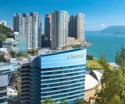
Le Meridien Cyberport
The Murray A Niccolo Hotel
THE LANDMARK MANDARIN ORIENTAL
Ovolo Central
Hotel Madera Hollywood
Grand City Hotel
Eco Tree Hotel
Courtyard Hong Kong
Ovolo Noho
Ovolo Southside
Videos from this area
These are videos related to the place based on their proximity to this place.
Night view over Hong Kong - filmed from the Victoria Peak / Tai Ping Shan
A video which shows the impressive night view over Hong Kong (Kowloon + Hong Kong Island), filmed on April 17th, 2010. It was filmed from "The Peak" (Victoria Peak or Tai Ping Shan). Unfortunatly,...
香港ヴィクトリア・ピークからの眺めとピークトラム
This is the view of Hongkong's downtown and peak tram from Mt. Austin. Date: 13:20, 1 Nov, 2013 (CST)
香港遊車河 Hong Kong scenery (1952)
Images of Western District, Peak Tram, Happy Valley, Aberdeen, Victoria Harbour and Amah Rock in "Twelve Singing Beauties" (1952). 遊車河的路線: 半山, 上環, 中環, 乘山頂覧車,...
hong kong victoria peak - Sky Terrace 428 at night
hong kong victoria peak - Sky Terrace 428 at night 2013.
Eye of the Dragon - Victoria Peak - Making of Part 1
We go round Victoria Peak's 'circle walk' in Hong Kong to shoot our short film 'Eye of the Dragon'. But it doesn't go as planned.
The Peak Hong Kong
Standing at 552 meters above sea level, the Peak is the highest mountain on Hong Kong Island and a natural signaling post for incoming cargo ships in the nineteenth century. The more privileged...
Videos provided by Youtube are under the copyright of their owners.
Attractions and noteworthy things
Distances are based on the centre of the city/town and sightseeing location. This list contains brief abstracts about monuments, holiday activities, national parcs, museums, organisations and more from the area as well as interesting facts about the region itself. Where available, you'll find the corresponding homepage. Otherwise the related wikipedia article.
Pok Fu Lam
Pok Fu Lam or Pokfulam is a residential area on Hong Kong Island, at the western end of the Southern District. Pok Fu Lam is a valley between Victoria Peak and Mount Kellet, around Telegraph Bay.
Wah Fu
Wah Fu is an area located in Southern District, on Hong Kong Island, Hong Kong. Wah Fu mainly consists of the public housing estates, Wah Fu Estate and Wah Kwai Estate. They were built near Waterfall Bay (瀑布灣) and Kellett Bay (雞籠灣). The area also has a notable beach known as Waterfall Bay (瀑布灣). It is long believed that the waterfall at Waterfall Bay Park attracted British ships coming to Hong Kong to fetch fresh water after their long journey.
Waterfall Bay, Hong Kong
Waterfall Bay is a bay on the coast of Wah Fu Estate, Southern District, Hong Kong.
Pok Fu Lam Road
Pokfulam Road, or Pok Fu Lam Road, is a four-lane road in Hong Kong. Built on Hong Kong Island, the road runs between Sai Ying Pun and Wah Fu, through Pok Fu Lam. It runs south from Sai Ying Pun, passing The University of Hong Kong along the Belcher's, with a road junction with Pokfield Road. The vegetation in this area is largely preserved, unlike many roads in the urban built-up areas of Hong Kong.
Pok Fu Lam Reservoir
Pok Fu Lam Reservoir is the first reservoir in Hong Kong. It is located in a valley in Pok Fu Lam. It is actually two reservoirs with capacity of 260 km³.
East Lamma Channel
The East Lamma Channel is a sea channel in Hong Kong. It lies between the western shores of Hong Kong Island and Ap Lei Chau, and the east side of Lamma Island. To the north it leads into the Sulphur Channel and Victoria Harbour, to the south into the South China Sea. The East Lamma Canal is one of the areas in the world with the heaviest traffic with more than 150 deep water vessels of all kinds passing there every day.
Telegraph Bay
Telegraph Bay or Kong Sin Wan, formerly known as Tai Hau Wan (大口灣), is a bay in the west shore near Pok Fu Lam, between Sandy Bay and Waterfall Bay on the Hong Kong Island, Hong Kong. It is where the Cyberport is located.
Kellett Bay
Kellett Bay, or Kai Lung Wan (雞籠灣) is a bay on southwestern Hong Kong Island in Hong Kong. The hill above the bay was a Chinese public cemetery with Victoria Road linking with the northwestern side of the island. In 1960s, the cemetery was replaced with Wah Fu Estate. Most of the area are reclaimed to built Wah Kwai Estate. The pronunciation of Wan (灣) in Kai Lung Wan is like the one in 環. Kellett Bay was named after the naval officer Sir Henry Kellett.
Shek Pai Wan
Shek Pai Wan (石排灣), or Aberdeen Bay is a bay between Aberdeen of Hong Kong Island and Aberdeen Island. The bay is one of traditional fishery port because the hills on two sides forms a nature shelter. The whole bay is zoned as a typhoon shelter, Aberdeen West Typhoon Shelter.
Matilda International Hospital
Matilda International Hospital (明德國際醫院) is a hospital in Hong Kong located at 41 Mount Kellett Road, The Peak. The hospital was built as a result of the last will and testament of Granville Sharp, the husband of Matilda Lincolne Sharp. Granville Sharp was a highly successful banker descended from the well known Sharp family of Romsey, England, another member of which was Conversation Sharp. Matilda Lincolne is thought by some to have been related to the US President's family.
Magazine Island
Magazine Island (火藥洲; Fo Yeuk Chau), originally known as One Tree Island (一木島) is an island of Hong Kong, located off the southwest coast of Hong Kong Island, and off the northwestern tip of Ap Lei Chau. Administratively, it is part of Southern District.
Tai Ho Wan
Tai Ho Wan (Chinese: 大蠔灣, lit. big oyster bay) is a bay on the north shore of Lantau Island in Hong Kong. It is located west of Siu Ho Wan, and northeast of Tung Chung. The surrounding land was originally part of the North Lantau New Town scope, but there is a current slowdown in its plans because of the lack in population growth and environmental groups opposed to the next in abeyance.


