Safety Score: 3,6 of 5.0 based on data from 9 authorites. Meaning please reconsider your need to travel to Hong Kong.
Travel warnings are updated daily. Source: Travel Warning Hong Kong. Last Update: 2024-04-29 08:03:39
Discover Tsing Yi Town
Tsing Yi Town in Kwai Tsing is a town in Hong Kong a little north-west of Hong Kong, the country's capital city.
Current time in Tsing Yi Town is now 02:10 AM (Tuesday). The local timezone is named Asia / Hong Kong with an UTC offset of 8 hours. We know of 7 airports near Tsing Yi Town, of which 4 are larger airports. The closest airport in Hong Kong is Chek Lap Kok International Airport in a distance of 12 mi (or 20 km), West. Besides the airports, there are other travel options available (check left side).
There are two Unesco world heritage sites nearby. The closest heritage site is Historic Centre of Macao in China at a distance of 38 mi (or 61 km). We discovered 2 points of interest in the vicinity of this place. Looking for a place to stay? we compiled a list of available hotels close to the map centre further down the page.
When in this area, you might want to pay a visit to some of the following locations: Tsuen Wan, Sham Shui Po, Wong Tai Sin, Central and Sha Tin. To further explore this place, just scroll down and browse the available info.
Local weather forecast
Todays Local Weather Conditions & Forecast: 26°C / 78 °F
| Morning Temperature | 23°C / 73 °F |
| Evening Temperature | 27°C / 81 °F |
| Night Temperature | 26°C / 78 °F |
| Chance of rainfall | 0% |
| Air Humidity | 82% |
| Air Pressure | 1010 hPa |
| Wind Speed | Moderate breeze with 9 km/h (6 mph) from North |
| Cloud Conditions | Few clouds, covering 14% of sky |
| General Conditions | Few clouds |
Tuesday, 30th of April 2024
26°C (79 °F)
24°C (76 °F)
Light rain, moderate breeze, broken clouds.
Wednesday, 1st of May 2024
22°C (71 °F)
21°C (70 °F)
Very heavy rain, moderate breeze, overcast clouds.
Thursday, 2nd of May 2024
21°C (70 °F)
22°C (71 °F)
Moderate rain, moderate breeze, overcast clouds.
Hotels and Places to Stay
FRASER SUITES HONG KONG
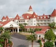
HK DISNEYLAND
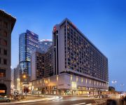
Sheraton Hong Kong Hotel & Towers
THE OLYMPIAN HONG KONG
Dorsett Mongkok
Bay Bridge Hong Kong by Hotel G
L' Hotel Nina et Convention Centre
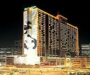
Panda
Royal View Hotel
Hotel Ease Tsuen Wan
Videos from this area
These are videos related to the place based on their proximity to this place.
九巴E31青荃橋 KMB Route E31 Tsing Tsuen Bridge
由荃灣到青衣,橫跨青荃橋。 From Tsuen Wan to Tsing Yi through Tsing Tsuen Bridge.
新輪捌拾捌離開荃灣對開海域
新渡輪旗下雙體船新輪捌拾捌於2008 年9 月16 日08:00 離開荃灣對開海域。 The Catamaran "New Ferry LXXXVIII" left it's temporary stabling place in Tsuen Wan at 08:00,...
青衣自然教育徑暨公園景色 Tsing Yi Nature Trails and Park
香港郊遊遠足行山Hiking in Hong Kong http://www.youtube.com/view_play_list?p=E784C34510D25B91 香江蝶蹤Butterflies in Hong Kong http://www.youtube.com/view_play_list?p=E24DAA349F47...
青衣公園 (Tsing Yi Park)
青衣公園(Tsing Yi Park) - I/2 http://fotowalker.blogspot.com/2014/01/tsing-yi-park-i2.html 青衣公園(Tsing Yi Park) - II/2 http://fotowalker.blogspot.hk/2014/01/tsing-yi-park-ii2.html.
Videos provided by Youtube are under the copyright of their owners.
Attractions and noteworthy things
Distances are based on the centre of the city/town and sightseeing location. This list contains brief abstracts about monuments, holiday activities, national parcs, museums, organisations and more from the area as well as interesting facts about the region itself. Where available, you'll find the corresponding homepage. Otherwise the related wikipedia article.
Tsing Yi
Tsing Yi, or Tsing Yi Island is an island in the urban area of Hong Kong, to the northwest of Hong Kong Island and south of Tsuen Wan. With an area of 10.69 km², the island has extended drastically by reclamation along almost all its natural shore and the annexation of Nga Ying Chau(牙鷹洲) and Chau Tsai. Three major bays or harbours, Tsing Yi Lagoon, Mun Tsai Tong and Tsing Yi Bay(青衣灣) in the northeast, have been completely reclaimed for new towns.
Tung Wah Group of Hospitals S. C. Gaw Memorial College
Tung Wah Group of Hospitals S. C. Gaw Memorial College is a secondary school on the Tsing Yi Island, Hong Kong. The school is under Tiger's Head or Fu Tau Shan (虎頭山), surrounded by four resited villages, Tai Wong Ha, Yim Tin Kok, Lam Tin, and San Uk. S. C. Gaw Memorial College is a co-educational school, accepting both boys and girls. The majority of students are residents on the island though there are many students from various part of Hong Kong.
Mayfair Gardens
Mayfair Gardens is the first private housing estate on Tsing Yi Island of Hong Kong built by Sun Hung Kai Properties, and was established between 1982 and 1984. There are 8 blocks of residence buildings all round the estate, namely Blocks 5 to 12.
Tsing Yi Nature Trail
Tsing Yi Nature Trail, also known as Kwai Tsing Reunification Health Trail is a hiking trail on Tsing Yi Island, Hong Kong. At the highest point, it has a view of Rambler Channel and Ma Wan Channel, with Ting Kau Bridge and Tsing Ma Bridge spanning over, respectively.
Cheung Tsing Tunnel
Cheung Tsing Tunnel, also spelt Cheung Ching Tunnel, is a dual tube 3-lane tunnel on Tsing Yi Island, Hong Kong. It is part of Tsing Kwai Highway of Route 3. Its east end connects to Rambler Channel Bridge and west Cheung Tsing Highway. The tunnel was opened on 1997-05-22 and is the second toll-free tunnel in Hong Kong. Its length is about 1.6 kilometres.
Nam Wan Tunnel
Nam Wan Tunnel is a tunnel in Hong Kong opened to traffic on 20 December 2009, along with the West Tsing Yi Viaduct, East Tsing Yi Viaduct and Stonecutters Bridge. The road tunnel, which forms an important part of the HK$15 billion Route 8, linking Tsing Yi and Sha Tin in the city, has been under construction since 2003 and was completed in 2007.
Tsing Yi Sports Ground
Tsing Yi Sports Ground is a sports ground on Tsing Yi Island, New Territories, Hong Kong. It is built near the east coast of the island, between Tivoli Garden and Tsing Yi Swimming Pool. It consists of a Tartan track and a football pitch. The football pitch hosts part of Hong Kong First Division League.
Tsing Yi Swimming Pool
Tsing Yi Swimming Pool is a public swimming pool on Tsing Yi Island, New Territories, Hong Kong. It is near the east shore of the island, between Maritime Square and Tsing Yi Sports Ground. Currently it is managed by Leisure and Cultural Services Department of Hong Kong Government.
Tsing Yi Heung Sze Wui Road
Tsing Yi Heung Sze Wui Road (Chinese: 青衣鄉事會路; Cantonese Yale: ching1 yi1 heung1 si6 wui2 lou6) is one of the oldest roads on the Tsing Yi Island, Hong Kong. It was built to connect Tsing Yi Town and Tsing Yi Bridge when the bridge was being built. The name "Tsing Yi Heung Sze Wui" derives from the local Cantonese pronunciation of Tsing Yi Rural Committee. After the reclamation of Tsing Yi Lagoon and Tsing Yi Bay, the road ended at Chun Kwan Temple.
Cheung Tsing Highway
Cheung Tsing Highway is a highway of Route 3 between Cheung Tsing Tunnel and North West Tsing Yi Interchange on Tsing Yi Island, Hong Kong. It was built as part of the Airport Core Programme together with the rest of Route 3 to provide a new highway link from North Western New Territories towards Hong Kong Island, and connects with Route 8 to provide access to the new Hong Kong International Airport.
Ching Hong Road
Ching Hong Road is the third major road, connecting Tsing Yi Road and Tsing Yi Road West, built on Tsing Yi Island after the completion of Tsing Yi Bridge, the only road access across Rambler Channel at the time, in Hong Kong. The road, early part of the new town on the island, is the major access for Cheung Ching Estate and later Cheung Hong Estate. Its started from Tsing Yi Road, around Tsing Yung House of Cheung Ching Estate and elongated as the development went uphill.
Public housing estates on Tsing Yi Island
Public Housing Estates on Tsing Yi Island, Hong Kong - including Home Ownership Scheme (HOS), Private Sector Participation Scheme (PSPS), Tenants Purchase Scheme (TPS), Flat-for-Sale Scheme (FFSS)






!['2015/01/18 - Sunset at Tsuen Wan Riviera Park [By Bencenter, Nikon D800E]' preview picture of video '2015/01/18 - Sunset at Tsuen Wan Riviera Park [By Bencenter, Nikon D800E]'](https://img.youtube.com/vi/tLtJbq2LwCU/mqdefault.jpg)


