
Facts and Data
Webpages:
Official Unesco Page
Monte Perdido / Mont Perdu (L'association Mont-Perdu Patrimoine Mondial)
Protectedplanet.net
Basis Data:
Unesco World heritage since: 1997
Size of heritage: 30,639 ha
Coordinates:
Longitude: 0,001°
Latitude: 42,685°
Summary
This outstanding mountain landscape, which spans the contemporary national borders of France and Spain, is centred around the peak of Mount Perdu, a calcareous massif that rises to 3,352 m. The site, with a total area of 30,639 ha, includes two of Europe's largest and deepest canyons on the Spanish side and three major cirque walls on the more abrupt northern slopes with France, classic presentations of these geological landforms. The site is also a pastoral landscape reflecting an agricultural way of life that was once widespread in the upland regions of Europe but now survives only in this part of the Pyrénées. Thus it provides exceptional insights into past European society through its landscape of villages, farms, fields, upland pastures and mountain roads.
Location on Map
Show bigger map on Openstreetmap
UNESCO World Heritage Site: Pyrénées - Mont Perdu
The Pyrénées - Mont Perdu is a UNESCO World Heritage site located in the Midi-Pyrénées region of France and the Autonomous Community of Aragón in Spain. It was inscribed on the World Heritage list in 1997 and extended in 1999 to include the commune of Gèdre in France.
History
The Pyrénées - Mont Perdu has a rich history that dates back thousands of years. The area has been inhabited since prehistoric times, and evidence of human presence can be found in the form of cave paintings and megalithic monuments. The region has also been influenced by various civilizations, including the Romans and the Moors.
In the Middle Ages, the Pyrénées - Mont Perdu became an important pilgrimage route for Christians traveling to Santiago de Compostela. The route, known as the Camino de Santiago, passed through the region and brought economic and cultural prosperity to the area.
In the 19th century, the Pyrénées - Mont Perdu became a popular destination for mountaineers and explorers. The first ascent of Mont Perdu, the highest peak in the area, was made in 1802 by a team of French climbers. This sparked a wave of interest in the region, and it soon became a popular destination for outdoor enthusiasts.
Current State
Today, the Pyrénées - Mont Perdu is a stunning natural landscape that attracts visitors from around the world. The site is characterized by its rugged mountains, deep valleys, and pristine lakes. It is home to a diverse range of flora and fauna, including rare and endangered species.
The Pyrénées - Mont Perdu is also of great cultural significance. The area is dotted with traditional mountain villages, where visitors can experience the unique culture and way of life of the Pyrenean people. The region is known for its traditional crafts, such as woodcarving and pottery, which have been passed down through generations.
Visitors to the Pyrénées - Mont Perdu can explore the area through a network of hiking trails and mountain paths. These routes offer breathtaking views of the surrounding landscape and allow visitors to immerse themselves in the natural beauty of the region. The site is also popular for mountaineering, skiing, and other outdoor activities.
Efforts are being made to preserve and protect the Pyrénées - Mont Perdu. The site is managed by a joint committee of French and Spanish authorities, who work together to ensure the sustainable development of the area. Conservation projects are in place to protect the natural and cultural heritage of the site, and visitors are encouraged to respect the environment and local traditions.
The Pyrénées - Mont Perdu is a unique and captivating World Heritage site that offers a glimpse into the natural and cultural history of the region. Whether you are a nature lover, a history enthusiast, or an adventure seeker, this site has something to offer for everyone.
Hotels and places to stay

Hotel Vignemale
Videos from the area

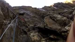
Escalade du Mur de la Cascade à Gavarnie
Le 31/08/2014, Pierre, Max et Richard escaladent le Mur de la Cascade dans le Cirque de Gavarnie.
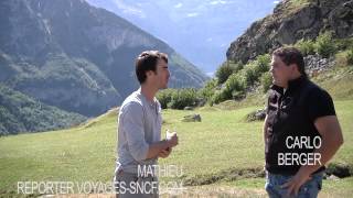
Le Cirque de Gavarnie
Mathieu rencontre Carlo, un berger, qui nous fait découvrir sa production de Mouton AOC Barèges Gavarnie et son métier dans des paysages haut en couleurs.
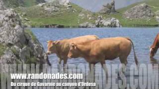
Randonnée Pyrénées Gavarnie Ordesa
http://www.randonades.com/randonnee-pyrenees-cirque-gavarnie-ordesa-mont-perdu-8.htm Cet ensemble calcaire, classé au Patrimoine Mondial de l'Humanité à l'Unesco, recèle quelques merveilles ...
Videos provided by Youtube are under the copyright of their owners. 
 Tarbes-Lourdes-Pyrénées Airport
Medium airport - 34 mi (55 km)
Tarbes Laloubère AirportSmall airport - 37 mi (60 km)
Pau Pyrénées AirportMedium airport - 52 mi (85 km)
 Aeròdrom dels Pirineus-Alt Urgell Airport
Small airport - 76 mi (122 km)
Pamplona AirportMedium airport - 84 mi (135 km)
Dax Seyresse AirportSmall airport - 88 mi (142 km)
Toulouse-Blagnac AirportLarge airport - 95 mi (153 km)
Agen-La Garenne AirportMedium airport - 107 mi (173 km)
Barcelona International AirportLarge airport - 143 mi (231 km)
Bordeaux-Mérignac (BA 106) AirportLarge airport - 152 mi (246 km)
Brive-La Roche AirportLarge airport - 185 mi (299 km)
Palma De Mallorca AirportLarge airport - 259 mi (418 km)
Bigger and popular cities in the wider vicinity are these:
- Abizanda
- Alquezar
- Argeles-Gazost
- Bagneres-de-Bigorre
- Barcabo
- Bielsa
- Biescas
- Boltana
- Broto
- Campo
- Castejon de Sos
- Chia
- Colungo
- Fiscal
- Gistain
- Hoz de Jaca
- Labuerda
- Laspuna
- Naval
- Palo
- Plan
- Puertolas
- Sabinanigo
- Sahun
- Sallent de Gallego
- Seira
- Sesue
- Villanova
- Yebra de Basa
- Yesero
These are some smaller cities that might be interesting. They are all rather close.