Safety Score: 3,4 of 5.0 based on data from 9 authorites. Meaning please reconsider your need to travel to China.
Travel warnings are updated daily. Source: Travel Warning China. Last Update: 2024-04-25 08:17:04
Explore Nêdong
Nêdong in Tibet Autonomous Region is a city in China about 1,576 mi (or 2,536 km) south-west of Beijing, the country's capital.
Local time in Nêdong is now 07:26 AM (Friday). The local timezone is named Asia / Urumqi with an UTC offset of 6 hours. We know of 8 airports in the vicinity of Nêdong. The closest airport in China is Lhasa Gonggar Airport in a distance of 52 mi (or 84 km), West. Besides the airports, there are other travel options available (check left side).
There is one Unesco world heritage site nearby. It's Historic Ensemble of the Potala Palace, Lhasa in a distance of 50 mi (or 80 km), North-West. If you need a place to sleep, we compiled a list of available hotels close to the map centre further down the page.
Depending on your travel schedule, you might want to pay a visit to some of the following locations: Naidong, Changzhug, Pozhang, Dopozhang and Layu. To further explore this place, just scroll down and browse the available info.
Local weather forecast
Todays Local Weather Conditions & Forecast: 13°C / 55 °F
| Morning Temperature | 6°C / 43 °F |
| Evening Temperature | 12°C / 54 °F |
| Night Temperature | 10°C / 50 °F |
| Chance of rainfall | 0% |
| Air Humidity | 21% |
| Air Pressure | 1007 hPa |
| Wind Speed | Gentle Breeze with 6 km/h (4 mph) from South |
| Cloud Conditions | Scattered clouds, covering 29% of sky |
| General Conditions | Light rain |
Saturday, 27th of April 2024
13°C (55 °F)
12°C (54 °F)
Rain and snow, gentle breeze, broken clouds.
Sunday, 28th of April 2024
15°C (59 °F)
12°C (54 °F)
Scattered clouds, fresh breeze.
Monday, 29th of April 2024
15°C (59 °F)
10°C (51 °F)
Light rain, light breeze, broken clouds.
Hotels and Places to Stay
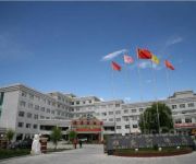
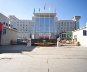
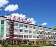
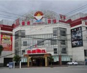
Ya Long He Hotel
Shannan Hotel Domestic only
Shannan Huaxin Business
Jinlong Business Hotel
Xuege Hotel
Videos from this area
These are videos related to the place based on their proximity to this place.
西藏山南寺庙Vlog 请喇嘛喝咖啡是种怎样的体验?Coffee with Lama
2015年7月13日-10月15日单人单车游中国夏珠林寺的视频纪录,全旅程共94天行程21000公里。2015年8月12日,我驱车到了一个少人问津的小寺庙,在这里请喇...
Videos provided by Youtube are under the copyright of their owners.
Attractions and noteworthy things
Distances are based on the centre of the city/town and sightseeing location. This list contains brief abstracts about monuments, holiday activities, national parcs, museums, organisations and more from the area as well as interesting facts about the region itself. Where available, you'll find the corresponding homepage. Otherwise the related wikipedia article.
Tsetang
Zêtang is one of the largest cities in Tibet and is located in the Yarlung Valley, 183 km southeast of Lhasa in Nedong County of Lhoka (Shannan) Prefecture, Tibet Autonomous Region of China. It was (?) the capital of the Shannan Prefecture (Lhoka Prefecture), it "exercises direct control over the affairs of 13 counties: Gongkar, Tranang, Nedong, Changye, Tso-me, Lhodrok, Nakartse, Zangri, Chutsum, Lhuntse, Tsona, Gyatsa and Nang.
Nêdong County
Nêdong County, is a county of the Shannan Prefecture in the Tibet Autonomous Region. Changzhug Temple, an important and very early, Buddhist monastery, dating to the reign of Songtsen Gampo, is located in the Yarlung Valley in Nêdong as is the Yungbulakang Palace.
Tradruk Temple
Tradruk Temple, also written Changzhug Monastery, in the Yarlung Valley is the earliest great geomantic temple after the Jokhang - and some sources say it is even pre-dates the Jokhang. It is located in Nêdong County of Lhoka (Shannan) Prefecture in the Tibet Autonomous Region of China, about seven kilometres south of the county seat Tsetang.
Nêdong (village)
Nedong or Netong, is a village in the Tibet Autonomous Region of China. Nedong was the seat of the Phagmodrupa dynasty which was the dominating regime in Tibet from 1354 to 1435 and maintained a degree of authority until the early 17th century.
Yarlung Valley
The Yarlung Valley is formed by the Yarlung River and refers especially to the district where it joins with the Chongye River, and broadens out into a large plain about 2 km wide, before they flow north into the Yarlung Tsangpo River or Brahmaputra. It is situated in Nedong County of Lhokha Prefecture in the Tibet Autonomous Region of China. The capital of Lhokha Prefecture, Zêtang, in the Yarlung Valley, is one of Tibet's largest cities, and is 183 km southeast of Lhasa.


