Safety Score: 2,8 of 5.0 based on data from 9 authorites. Meaning we advice caution when travelling to Canada.
Travel warnings are updated daily. Source: Travel Warning Canada. Last Update: 2024-04-28 08:22:10
Discover Mission
Mission in British Columbia is a city in Canada about 2,165 mi (or 3,484 km) west of Ottawa, the country's capital city.
Local time in Mission is now 12:31 AM (Monday). The local timezone is named America / Vancouver with an UTC offset of -7 hours. We know of 11 airports in the vicinity of Mission, of which 4 are larger airports. The closest airport in Canada is Abbotsford Airport in a distance of 8 mi (or 13 km), South. Besides the airports, there are other travel options available (check left side).
There is one Unesco world heritage site nearby. The closest heritage site is Olympic National Park in United states at a distance of 96 mi (or 155 km). Also, if you like golfing, there are a few options in driving distance. Looking for a place to stay? we compiled a list of available hotels close to the map centre further down the page.
When in this area, you might want to pay a visit to some of the following locations: Chilliwack, Bellingham, Mount Vernon, Friday Harbor and Coupeville. To further explore this place, just scroll down and browse the available info.
Local weather forecast
Todays Local Weather Conditions & Forecast: 8°C / 46 °F
| Morning Temperature | 4°C / 39 °F |
| Evening Temperature | 10°C / 49 °F |
| Night Temperature | 4°C / 40 °F |
| Chance of rainfall | 3% |
| Air Humidity | 75% |
| Air Pressure | 1017 hPa |
| Wind Speed | Light breeze with 5 km/h (3 mph) from North-East |
| Cloud Conditions | Overcast clouds, covering 100% of sky |
| General Conditions | Rain and snow |
Monday, 29th of April 2024
8°C (47 °F)
5°C (42 °F)
Light rain, light breeze, overcast clouds.
Tuesday, 30th of April 2024
12°C (53 °F)
8°C (47 °F)
Light rain, calm, overcast clouds.
Wednesday, 1st of May 2024
8°C (46 °F)
8°C (46 °F)
Moderate rain, light breeze, overcast clouds.
Hotels and Places to Stay
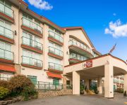
BW PLUS MISSION CITY LODGE
Clayburn Village Bed & Breakfast
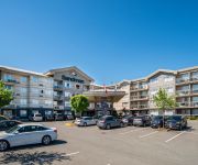
Sandman Hotel Abbotsford
SANDMAN ABBOTSFORD AIRPORT
Videos from this area
These are videos related to the place based on their proximity to this place.
The 2013 Canadian Pacific Holiday Train (13-12-15/16)
The 2013 Canadian Pacific Holiday Train celebrating it's fifteenth year is lead by CP AC4400CW 9815. First seen at Hatzic, BC (MP 84 of CP's Cascade Sub) on December 15, then seen at Coquitlam,...
2012 Canadian Pacific Holiday Train at Ruskin, BC (12-12-18)
The 2012 Canadian Pacific Holiday Train lead by CP AC4400CW 9815 at Ruskin, BC (MP 93 of CP's Cascade Sub). Happy Holidays! Thanks for Watching! Feel free to like, comment and subscribe!
Mill Fire River Rd June 1996 Mission City BC Canada
S-VHS-129 MISSION CITY June 1996 Mission Fire Department responded to this mill fire, when they arrived it was fully involved.
Planes on Trains! BNSF ES44C4 6710 at Mukilteo, WA (13-07-09)
Took a trip across the border to Washington State and stumbled across a surprise! BNSF was pulling some unfinished Boeing 737's. They were dropping some aircraft parts off for the Boeing facility...
CP Heritage Units!!! Port Moody Centennial Train Excursion (13-08-18)
In celebration of the city of Port Moody Centennial, the Port Moody Heritage Society partnered with Canadian Pacific to run two train excursions. The two excursion ran from Port Moody to Mission...
CN 5741 through White Canyon of the Thompson River (13-07-11)
Part 2 of 3 of my trip up the Fraser Canyon/Thompson Canyon. Stay tuned for one more! Part 1: http://youtu.be/mfnvk0rKGXQ Part 3: http://youtu.be/Syw6Ps1h-dE CN 417, lead by CN SD75i 5741...
CN 5784 Winding Along the Thompson River + CN MOW with Caboose (13-07-11)
Part 3 of 3 of my trip up the Fraser Canyon/Thompson Canyon. Part 1: http://youtu.be/mfnvk0rKGXQ Part 2: http://youtu.be/kkMTN97eoc8 Train #1 - CN 411, lead by CN SD75i 5784 & C40-8 2115...
CP 9365 at the Scenic Anderson Creek Bridge (13-07-11)
Part 1 of 3 of my trip up the Fraser Canyon/Thompson Canyon. Stay tuned for more! Part 2: http://youtu.be/kkMTN97eoc8 Part 3: http://youtu.be/Syw6Ps1h-dE Train #1 - CP 201, lead by CP ES44AC...
Big game Sturgeon fishing - Fraser River Sturgeon, Mission BC
Epic big game Sturgeon fishing in BC! Fraser river Sturgeon fishing guide Brian Mack of Silversides Fishing Adventures in Mission, British Columbia guides our guests into some serious White...
#395 Keeping a Lady Waiting 2013-05-13
With freight backed up everywhere, due to river traffic demanding the rail-bridge be opened, VIA Rail's #1 'The Canadian' has been caught up in traffic. With RTC's working hard to get everything...
Videos provided by Youtube are under the copyright of their owners.
Attractions and noteworthy things
Distances are based on the centre of the city/town and sightseeing location. This list contains brief abstracts about monuments, holiday activities, national parcs, museums, organisations and more from the area as well as interesting facts about the region itself. Where available, you'll find the corresponding homepage. Otherwise the related wikipedia article.
Fraser Valley
The Fraser Valley is the region of the Fraser River basin in southwestern British Columbia downstream of the Fraser Canyon. The term is sometimes used outside of British Columbia to refer to the entire basin including the Fraser Canyon and up from there to its source, but in general British Columbian usage of the term refers to the stretch of the river downstream from the town of Hope, and includes all of the Canadian portion of the Fraser Lowland and areas flanking it.
Mission, British Columbia
Mission, the core of which was formerly known as Mission City, is a district municipality in the province of British Columbia, Canada. It is situated on the north bank of the Fraser River overlooking the City of Abbotsford and with that city is part of the Central Fraser Valley. Mission is the 23rd largest municipality in British Columbia, with a population of 34,505 (2006). Mission was incorporated in 1892 and is 225.78 km in size.
Mission Bridge
The Mission Bridge is a steel girder bridge linking the District Of Mission to the City of Abbotsford, British Columbia. The bridge is measured at 3,695 feet long and is the only direct road link between the two.
Mission Raceway Park
Mission Raceway Park, also known as MRP, is an auto racing facility located in Mission, British Columbia, Canada. The facility features a ¼ mile NHRA-sanctioned dragstrip, a 1.4-mile 9-turn road course, and a 2-mile motocross track. It is owned and operated by the B.C. Custom Car Association, and the BCCCA operates the drag strip directly.
Mission City Station
Mission Station is the eastern terminus station on the West Coast Express commuter rail line connecting Vancouver to Mission, British Columbia, Canada. The station is located on the north side of the Canadian Pacific Railway (CPR) tracks in Mission on North Railway Avenue. The station opened in 1995, when the West Coast Express began operating. 254 park and ride spaces are available at the station. All services are operated by TransLink.
Mission Railway Bridge
The Mission Railway Bridge is a Canadian railway bridge spanning the Fraser River at Mission, British Columbia. Replacing an earlier bridge built in 1891, which was the first and only bridge crossing of the Fraser below Siska in the Fraser Canyon until the construction of the New Westminster rail bridge in 1904, it was constructed in 1909 by the Canadian Pacific Railway (CPR). The Mission Railway Bridge is supported by 13 concrete piers and is approximately 533 metres in length.
D'Herbomez Creek
D'Herbomez Creek is a creek in eastern Mission, British Columbia, flowing southeast to join the Fraser River at the Pekw'Xe:yles Indian Reserve (formerly the grounds of St. Mary's Indian Residential School).
Mission Harbour railway station
Mission Harbour railway station is in Mission, British Columbia, Canada at the north end of the Mission Railway Bridge at Harbour Avenue. The station is served by Via Rail's The Canadian three times per week as a flag stop (48 hours advance notice required). The station is only served by eastbound trains. Westbound trains call at the Abbotsford railway station.


