Safety Score: 2,8 of 5.0 based on data from 9 authorites. Meaning we advice caution when travelling to Canada.
Travel warnings are updated daily. Source: Travel Warning Canada. Last Update: 2024-05-11 07:34:58
Delve into Glen Valley
Glen Valley in British Columbia is located in Canada about 2,172 mi (or 3,495 km) west of Ottawa, the country's capital town.
Current time in Glen Valley is now 05:19 PM (Saturday). The local timezone is named America / Vancouver with an UTC offset of -7 hours. We know of 11 airports close to Glen Valley, of which 4 are larger airports. The closest airport in Canada is Abbotsford Airport in a distance of 11 mi (or 18 km), South-East. Besides the airports, there are other travel options available (check left side).
There is one Unesco world heritage site nearby. The closest heritage site is Olympic National Park in United states at a distance of 98 mi (or 158 km). Also, if you like playing golf, there are some options within driving distance. We encountered 2 points of interest near this location. If you need a hotel, we compiled a list of available hotels close to the map centre further down the page.
While being here, you might want to pay a visit to some of the following locations: Bellingham, Chilliwack, Mount Vernon, Friday Harbor and Coupeville. To further explore this place, just scroll down and browse the available info.
Local weather forecast
Todays Local Weather Conditions & Forecast: 19°C / 66 °F
| Morning Temperature | 11°C / 51 °F |
| Evening Temperature | 17°C / 62 °F |
| Night Temperature | 12°C / 53 °F |
| Chance of rainfall | 0% |
| Air Humidity | 47% |
| Air Pressure | 1014 hPa |
| Wind Speed | Light breeze with 5 km/h (3 mph) from North-East |
| Cloud Conditions | Clear sky, covering 8% of sky |
| General Conditions | Sky is clear |
Sunday, 12th of May 2024
15°C (59 °F)
8°C (46 °F)
Light rain, light breeze, overcast clouds.
Monday, 13th of May 2024
19°C (65 °F)
8°C (46 °F)
Broken clouds, light breeze.
Tuesday, 14th of May 2024
20°C (68 °F)
10°C (50 °F)
Few clouds, light breeze.
Hotels and Places to Stay
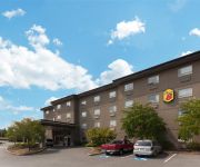
Comfort Inn & Suites Langley
Videos from this area
These are videos related to the place based on their proximity to this place.
Hagrid the Owl At The Vancouver Zoo - Michael Fromberg
Hagrid the Owl is taken from his pen and gets to know the attending crowd at the Vancouver Zoo. Hagrid is part of the zoo's famous Radical Raptors team and a day at the zoo is just not complete...
Lions, Wolves, Bears, Foxes et al. at the Greater Vancouver Zoo
When I was small I visited a nearby place called the Greater Vancouver Game Farm and it was very different from the zoo we see today. In those days you could drive around the entire 120 acres,...
Uncle Ig's Ride to Conquer Cancer!
Donate: http://www.conquercancer.ca/site/TR/Events/Vancouver2011?px=2097340&pg=personal&fr_id=1371 ** In June 2011, Cameron's Uncle Ig will be participating in the Ride to Conquer...
Canada Hwy 1 East Exit 73 264th Street Langley
Taking the 264th Street Exit off of Canada Highway 1. Exit to Vancouver Game Farm, USA Border, Industrial Park etc etc.
10567 243 Street Maple Ridge BC - Real Estate Virtual Tour - John Cashin
View http://www.seevirtual360.com/28675 to see PRICE and more PHOTOS. SPECTACULAR High Efficiency home in one of the BEST Culdesacs in Maple Ridge. Homes rarely come available here.
#7 24185 106B Ave Maple Ridge BC - Real Estate Virtual Tour - Kelly Boros
View http://kellyboros.com/mylistings.html/videos-40854064 to see PRICE and more PHOTOS. WELCOME TO TRAILS EDGE. This END UNIT C Plan with MASTER ON THE MAIN features a number of ...
Alouette Lake September 21, 2014
Alouette lake is a local lake only 20 minutes from our house. It has miles of secluded boat access only camping and day use shoreline. The water is a bit chilly but on this late September day...
Roots of Doom Hare Scramble 2012
Roots of Doom Hare Scramble 2012 took place in Whiskey Creek, near Qualicum Beach, BC on Vancouver Island. This was one of the best races we attended in 2012. Great course and perfect ...
Cane Walking
It was a good job I did I'm proud of myself. Brain injury patient re-learns how to walk using a few different types of canes. My journey through my 4 phases of re-learning how to walk - link...
Videos provided by Youtube are under the copyright of their owners.
Attractions and noteworthy things
Distances are based on the centre of the city/town and sightseeing location. This list contains brief abstracts about monuments, holiday activities, national parcs, museums, organisations and more from the area as well as interesting facts about the region itself. Where available, you'll find the corresponding homepage. Otherwise the related wikipedia article.
Ruskin, British Columbia
Ruskin is a rural and industrial area about 40 kilometres east of Vancouver, British Columbia straddling the border between the suburban municipalities of Maple Ridge and Mission, on the west bank of the lower Stave River.
Whonnock
Whonnock, British Columbia is a small community. It is located within the district municipality of Maple Ridge, British Columbia, about two miles west of the confluence of the Stave and Fraser Rivers. The community's name derives from honnock, the Halkomelem word for humpback salmon, which is the only kind of salmon to ascend Whonnock Creek, which flows through the community south from Whonnock Lake, which is just south of the Dewdney Trunk Road at the community's northern end.


