Safety Score: 2,8 of 5.0 based on data from 9 authorites. Meaning we advice caution when travelling to Canada.
Travel warnings are updated daily. Source: Travel Warning Canada. Last Update: 2024-04-28 08:22:10
Discover Albion
Albion in British Columbia is a place in Canada about 2,175 mi (or 3,501 km) west of Ottawa, the country's capital city.
Current time in Albion is now 12:53 AM (Monday). The local timezone is named America / Vancouver with an UTC offset of -7 hours. We know of 11 airports near Albion, of which 4 are larger airports. The closest airport in Canada is Abbotsford Airport in a distance of 14 mi (or 22 km), South-East. Besides the airports, there are other travel options available (check left side).
There is one Unesco world heritage site nearby. The closest heritage site is Olympic National Park in United states at a distance of 99 mi (or 160 km). Also, if you like playing golf, there are a few options in driving distance. We encountered 3 points of interest in the vicinity of this place. If you need a hotel, we compiled a list of available hotels close to the map centre further down the page.
While being here, you might want to pay a visit to some of the following locations: Bellingham, Chilliwack, Mount Vernon, Friday Harbor and Coupeville. To further explore this place, just scroll down and browse the available info.
Local weather forecast
Todays Local Weather Conditions & Forecast: 10°C / 49 °F
| Morning Temperature | 4°C / 38 °F |
| Evening Temperature | 10°C / 50 °F |
| Night Temperature | 4°C / 39 °F |
| Chance of rainfall | 2% |
| Air Humidity | 62% |
| Air Pressure | 1017 hPa |
| Wind Speed | Gentle Breeze with 7 km/h (4 mph) from North-East |
| Cloud Conditions | Overcast clouds, covering 85% of sky |
| General Conditions | Rain and snow |
Monday, 29th of April 2024
9°C (48 °F)
5°C (42 °F)
Light rain, light breeze, overcast clouds.
Tuesday, 30th of April 2024
12°C (53 °F)
8°C (47 °F)
Light rain, light breeze, overcast clouds.
Wednesday, 1st of May 2024
9°C (47 °F)
8°C (47 °F)
Moderate rain, light breeze, overcast clouds.
Hotels and Places to Stay
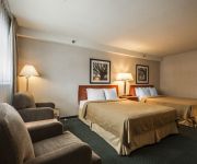
Econo Lodge Maple Ridge
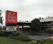
Econo Lodge
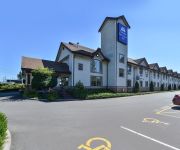
Canadas Best Value Inn - Langley / Vancouver
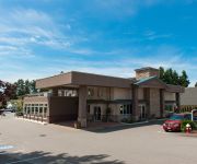
BEST WESTERN MAPLE RIDGE HOTEL
Comfort Inn & Suites Langley
Videos from this area
These are videos related to the place based on their proximity to this place.
Maple Ridge Skatepark - Opening Day
After skating some streets spots outside of Vancouver, Montie and I decided to go play around at the new Maple Ridge skatepark. We arrived just as the opening day contest was finishing, which...
10567 243 Street Maple Ridge BC - Real Estate Virtual Tour - John Cashin
View http://www.seevirtual360.com/28675 to see PRICE and more PHOTOS. SPECTACULAR High Efficiency home in one of the BEST Culdesacs in Maple Ridge. Homes rarely come available here.
#7 24185 106B Ave Maple Ridge BC - Real Estate Virtual Tour - Kelly Boros
View http://kellyboros.com/mylistings.html/videos-40854064 to see PRICE and more PHOTOS. WELCOME TO TRAILS EDGE. This END UNIT C Plan with MASTER ON THE MAIN features a number of ...
Roots of Doom Hare Scramble 2012
Roots of Doom Hare Scramble 2012 took place in Whiskey Creek, near Qualicum Beach, BC on Vancouver Island. This was one of the best races we attended in 2012. Great course and perfect ...
E-Flite Taylorcraft 450 Re-Maiden #2
Finally finished my 2nd re-build of my Taylorcraft. Clipped another 2" off each wing, and completely re-covered the plane in Monokote (tail still to be done).
Fort Langley Colonics - Colon Hydrotherapy and Colonics
http://www.fortlangleycolonics.com PH: 778 298 4325 Clinic Address: 8888 Hadden St, Fort Langley, BC, Canada, V1M 3T3 1975 McCallum Road Abbotsford - Red Cedar Clinic "Would you like...
oTENTik Camping Review Fort Langley Historic Park British Columbia
oTENTiks are exclusive to Parks Canada. They are a spacious blend of a tent and an A-frame cabin equipped with beds and furniture on a raised floor. The cool feature of the oTENTiks at Fort...
How does Colonics work? Fort Langley Colonics - Colon Hydrotherapy to Improve Your Health
http://www.fortlangleycolonics.com 778 298 4325 Clinic Address: 8888 Hadden St, Fort Langley, BC, Canada, V1M 3T3 Enjoy the benefits of colon hydrotherapy. Many of our clients claim that...
Videos provided by Youtube are under the copyright of their owners.
Attractions and noteworthy things
Distances are based on the centre of the city/town and sightseeing location. This list contains brief abstracts about monuments, holiday activities, national parcs, museums, organisations and more from the area as well as interesting facts about the region itself. Where available, you'll find the corresponding homepage. Otherwise the related wikipedia article.
Fort Langley, British Columbia
Fort Langley is a village with a population of 2,700 and forms part of the Township of Langley. It is the home of Fort Langley National Historic Site, a former fur trade post of the Hudson's Bay Company.
Fort Langley National Historic Site
Fort Langley is a former trading post of the Hudson's Bay Company, now located in the village of Fort Langley, British Columbia. Commonly referred to as "the birthplace of British Columbia", it is designated a National Historic Site of Canada and administered by Parks Canada.
Arthur Peake Centre
Arthur Peake Centre is an adult learning centre in Maple Ridge part of School District 42 Maple Ridge-Pitt Meadows. It is located on 116th Ave. , across from Thomas Haney Secondary School.
Thomas Haney Secondary School
Thomas Haney Secondary School is a public high school in Maple Ridge, British Columbia, Canada, under the authority of School District 42 Maple Ridge-Pitt Meadows. Athletic organizations within the school are known as the Thomas Haney Thunder.
McMillan Island
McMillan Island is an island in the Fraser River. Located to the north of Fort Langley and south of Maple Ridge.
Albion, British Columbia
Albion, British Columbia is a neighbourhood in Maple Ridge, British Columbia and is one of several small towns incorporated within the municipality at its creation. It is the oldest non-indigenous community of the district's settlements, and is only slightly younger than Fort Langley, adjacent across the Fraser River, and Kanaka Creek, which is just to the west and lies along the creek of the same name.
Bedford Channel
The Bedford Channel is a small side channel of the Fraser River near the north end of the Township of Langley, on the south side of McMillan Island. The pair of islands--Brae Island and McMillan Island that protect the riverfront of Fort Langley, British Columbia are reached by the bridge that crosses the Bedford Channel on the way to the now-closed Albion Ferry terminal and the main reserve community of the Kwantlen First Nation on McMilland Island.
Kanaka Creek Regional Park
Kanaka Creek Regional Park is a regional park of the Metro Vancouver regional district, located in the District of Maple Ridge, British Columbia, flanking both sides of Kanaka Creek from its confluence with the Fraser River just east of Haney and extending approximately 11 km (7 mi) up the creek to just south of the community of Webster's Corners. The 400 ha. park has three main areas.


