Safety Score: 2,8 of 5.0 based on data from 9 authorites. Meaning we advice caution when travelling to Canada.
Travel warnings are updated daily. Source: Travel Warning Canada. Last Update: 2024-04-28 08:22:10
Delve into Clayburn
Clayburn in British Columbia is located in Canada about 2,164 mi (or 3,483 km) west of Ottawa, the country's capital town.
Current time in Clayburn is now 05:00 PM (Sunday). The local timezone is named America / Vancouver with an UTC offset of -7 hours. We know of 12 airports close to Clayburn, of which 4 are larger airports. The closest airport in Canada is Abbotsford Airport in a distance of 6 mi (or 9 km), South-West. Besides the airports, there are other travel options available (check left side).
There is one Unesco world heritage site nearby. The closest heritage site is Olympic National Park in United states at a distance of 93 mi (or 150 km). Also, if you like playing golf, there are some options within driving distance. If you need a hotel, we compiled a list of available hotels close to the map centre further down the page.
While being here, you might want to pay a visit to some of the following locations: Chilliwack, Bellingham, Mount Vernon, Friday Harbor and Coupeville. To further explore this place, just scroll down and browse the available info.
Local weather forecast
Todays Local Weather Conditions & Forecast: 9°C / 47 °F
| Morning Temperature | 4°C / 39 °F |
| Evening Temperature | 10°C / 49 °F |
| Night Temperature | 4°C / 38 °F |
| Chance of rainfall | 3% |
| Air Humidity | 71% |
| Air Pressure | 1017 hPa |
| Wind Speed | Gentle Breeze with 6 km/h (4 mph) from North-East |
| Cloud Conditions | Overcast clouds, covering 100% of sky |
| General Conditions | Light rain |
Monday, 29th of April 2024
9°C (49 °F)
4°C (40 °F)
Light rain, light breeze, overcast clouds.
Tuesday, 30th of April 2024
12°C (53 °F)
8°C (47 °F)
Overcast clouds, calm.
Wednesday, 1st of May 2024
8°C (47 °F)
4°C (40 °F)
Moderate rain, light breeze, overcast clouds.
Hotels and Places to Stay
SWEET DREAMS LUXURY INN
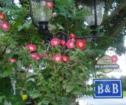
Clayburn Village Bed & Breakfast
Travelodge Abbotsford
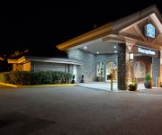
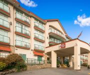
BEST WESTERN PLUS REGENCY INN
BW PLUS MISSION CITY LODGE
Abbotsford Hotel
BEST WESTERN BAKERVIEW INN
Country Charm Bed & Breakfast
COAST ABBOTSFORD HOTEL AND SUITES
SUPER 8 ABBOTSFORD BC
Videos from this area
These are videos related to the place based on their proximity to this place.
#395 Keeping a Lady Waiting 2013-05-13
With freight backed up everywhere, due to river traffic demanding the rail-bridge be opened, VIA Rail's #1 'The Canadian' has been caught up in traffic. With RTC's working hard to get everything...
#389 CN Sulphur and More 2013-05-01
CNTrain 408 turned out to be a mixed eastbound. Headed by CN8901 and CN2519, this nearly twelve thousand foot train was caught at the Sorenson Street crossing in Matsqui. Meanwhile, CN401,...
#131 Not Too Old 2011-10-27
A culvert under the tracks is dated "1912" The right-of-way dates from 1891. This is part of the Mission Subdivision of Canadian Pacific Railway. The four locomotives in this segment are comparativ...
Ryguys skydiving adventure
so this is the video of my first sky dive in abbotsford bc Canada, it was the time of my life I cant wait to go again.
#536 Three At Bell Road 2014-12-01
The first half of the day had been lost to getting the vehicle serviced and it was gone one o'clock (thirteen hundred, for purists) when I texted Chris to see if anything was happening. (Text...
#535 How Do You Lift 15,000 Tons of Coal? 2014-11-17
Canadian Pacific Train #863 had been sitting at Mile 84 on Canadian National's Yale sub for several hours. The crew had run out of operating time and the replacement was not quick in coming....
#533 Chasing BNSF on SRY 2014-11-13
In an effort to capture Burlington Northern Santa Fe coal trains running empty down Southern Railway of BC tracks in a variety of locations, I have been researching on Google Earth and then...
CP ES44AC 8916 at Abbotsford, BC (11-12-04)
Train #1: CP ES44AC 8916 leads a loaded unit coal train westbound at MP 87 of CN's Yale Sub (Matsqui, BC). With CP AC4400CW 9758 & 8549 as mid and rear end DPU's. Train #2: CP ES44AC ...
#558 The Steel Gang 2015-03-04
You will either find this interesting, or it will bore you to tears. On my railway, when rail needs repair or replacement, the Big Giant Hand comes along, unscrews some clamps, picks-up the...
Videos provided by Youtube are under the copyright of their owners.
Attractions and noteworthy things
Distances are based on the centre of the city/town and sightseeing location. This list contains brief abstracts about monuments, holiday activities, national parcs, museums, organisations and more from the area as well as interesting facts about the region itself. Where available, you'll find the corresponding homepage. Otherwise the related wikipedia article.
Fraser Valley
The Fraser Valley is the region of the Fraser River basin in southwestern British Columbia downstream of the Fraser Canyon. The term is sometimes used outside of British Columbia to refer to the entire basin including the Fraser Canyon and up from there to its source, but in general British Columbian usage of the term refers to the stretch of the river downstream from the town of Hope, and includes all of the Canadian portion of the Fraser Lowland and areas flanking it.
Abbotsford (electoral district)
Abbotsford is a federal electoral district in British Columbia, Canada, that has been represented in the Canadian House of Commons since 2004.
Yale Secondary School
Yale Secondary is a public high school in Abbotsford, British Columbia part of School District 34 Abbotsford. There are approximately 1200 full-time students in grades 9 through 12. The current principal is Jay Pankratz, who has been the principal since the middle of the 2009–2010 school year. He assumed this position from Mr. Glen Roger, who retired earlier that year.
Abbotsford Virtual School
Abbotsford Virtual School (abbreviated as AVS) is a Distributed Learning school, located in Abbotsford, British Columbia, that provides collaborative educational programs for Kindergarten to Grade 12 students and any BC resident wanting to complete courses to graduate. All adults can take courses at AVS for free and courses can lead to an adult graduation. Abbotsford Virtual School offers Virtual courses, as well as "any pace, any place" courses.
District of Matsqui
Matsqui is a former District Municipality in British Columbia, Canada. It was incorporated in 1892, and merged with the District Municipality of Abbotsford in 1995 to create the new City of Abbotsford. Matsqui used to be the west part of what is now Abbotsford. It had commercial growth in the Clearbrook area which then spilled over to Abbotsford.
Abbotsford railway station
Abbotsford railway station is in Abbotsford, British Columbia, Canada. The station is served by Via Rail's The Canadian three times per week as a flag stop (48 hours advance notice required). The station is only served by west-bound trains to Vancouver. East-bound trains call at the Mission Harbour railway station.
Bateman Park
Bateman Park is a soccer stadium located in Abbotsford, British Columbia. It is the home venue for the University of the Fraser Valley soccer teams and the Abbotsford Mariners.
Central Fraser Valley Regional District
The Central Fraser Valley Regional District was a regional district in the province of British Columbia, Canada, located in the Lower Mainland region, south of the Fraser River and west of Chilliwack. It comprised the Township and City of Langley, the Village of Abbotsford, and the Districts of Matsqui and Sumas, plus adjoining unincorporated areas.


