Safety Score: 2,8 of 5.0 based on data from 9 authorites. Meaning we advice caution when travelling to Canada.
Travel warnings are updated daily. Source: Travel Warning Canada. Last Update: 2024-05-02 08:23:34
Explore Huntingdon
The district Huntingdon of Abbotsford in British Columbia is located in Canada about 2,165 mi west of Ottawa, the country's capital.
If you need a place to sleep, we compiled a list of available hotels close to the map centre further down the page.
Depending on your travel schedule, you might want to pay a visit to some of the following locations: Bellingham, Chilliwack, Mount Vernon, Friday Harbor and Coupeville. To further explore this place, just scroll down and browse the available info.
Local weather forecast
Todays Local Weather Conditions & Forecast: 19°C / 67 °F
| Morning Temperature | 8°C / 46 °F |
| Evening Temperature | 14°C / 57 °F |
| Night Temperature | 9°C / 49 °F |
| Chance of rainfall | 0% |
| Air Humidity | 41% |
| Air Pressure | 1009 hPa |
| Wind Speed | Light breeze with 4 km/h (3 mph) from North-East |
| Cloud Conditions | Overcast clouds, covering 100% of sky |
| General Conditions | Overcast clouds |
Saturday, 4th of May 2024
16°C (60 °F)
8°C (46 °F)
Overcast clouds, gentle breeze.
Sunday, 5th of May 2024
8°C (47 °F)
7°C (45 °F)
Moderate rain, gentle breeze, overcast clouds.
Monday, 6th of May 2024
11°C (51 °F)
6°C (43 °F)
Light rain, light breeze, overcast clouds.
Hotels and Places to Stay
SWEET DREAMS LUXURY INN
Travelodge Abbotsford
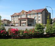
BEST WESTERN PLUS REGENCY INN
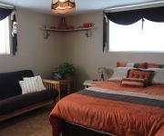
Clayburn Village Bed & Breakfast
Abbotsford Hotel
BEST WESTERN BAKERVIEW INN
Country Charm Bed & Breakfast
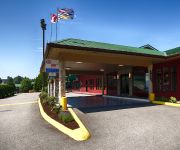
SUPER 8 ABBOTSFORD BC
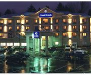
COAST ABBOTSFORD HOTEL AND SUITES
Quality Hotel & Conference Centre
Videos from this area
These are videos related to the place based on their proximity to this place.
Severe Thunderstorm July 25,2009 Abbotsford,B.C.
A not too common intense high energy thunderstorm came through with lots of cloud to ground lightning strikes,this was the first cell to come through.This video is unedited,it is just as I...
Abbotsford Children Photography - The Shemavas - photoart by simpson
Abbotsford Children Photography - The Shemavas - photoart by simpson "Who is that at my door? Knocking so loud I can't ignore! My sisters, my friends, they've come to play! To dance, to sing...
AbbotsDreDays - ABBOTSFORD skatePARK rain or shine!
Gansta Ass Andre Tsoug(rianis) Skates ABBOTSFORD SKATEPARK. Lanny skates the puddles.
35315 Munroe Ave Abbotsford BC - Real Estate Virtual Tour - Michele Cartwright PREC
View http://michelecartwright.com/mylistings.html/videos-46689373 to see PRICE and more PHOTOS. Honey Stop The Car! Beautiful Custom Built Home nestled in preferred East Abbotsford! Formal...
Abbotsford High School Senior Prom Photography - Zoe - photoart by simpson
Abbotsford High School Senior Prom Photography - Zoe - photoart by simpson Beautiful, with attitude. photography by - A. Simpson Capturing Life. Creating Art. Find out more at: http://www.phot...
Abbotsford Children Photographer - Peary - photoart by simpson
Abbotsford Children Photographer - Peary - photoart by simpson Mira, Kira, Deja, Tarik, Carson & Indigo were all great and fun to photograph. Each with their own unique character. Couldn't...
Wings Restaurants & Pubs - Abbotsford Tour
A walk-though tour of Wings Restaurant in Abbotsford. Easily accessible from Hwy 1, located in the heart of Restaurant row on Sumas Way with ample free parking. Family friendly and kids welcome....
Abbotsford Wedding Photography - Lucas - photoart by simpson
Abbotsford Wedding Photography - Lucas - photoart by simpson Once in awhile, right in the middle of an ordinary life, Love gives us a fairy tale, that has no ending. photography by - A....
Pick It Up Parcel Service | Best Border Shipping Company in Sumas
Welcome To PIC-IT-UP - Cross Border Shipping Outlet http://picitupinsumas.com/ Pick It Up Parcel Service | Best Border Shipping Company Serving Sumas, Aldergrove, Lynden, Abbotsford, Langley,...
Videos provided by Youtube are under the copyright of their owners.
Attractions and noteworthy things
Distances are based on the centre of the city/town and sightseeing location. This list contains brief abstracts about monuments, holiday activities, national parcs, museums, organisations and more from the area as well as interesting facts about the region itself. Where available, you'll find the corresponding homepage. Otherwise the related wikipedia article.
Nooksack, Washington
Nooksack is a city in Whatcom County, Washington, close to the border with Canada. The population was 1,338 at the 2010 census. This town shares Nooksack Valley School District with Sumas and Everson. The town is just a handful of buildings built around the highway that runs through it. The post office lost its official status in 1992 (and is now a department of neighboring town, Everson), but still exists across from a small city park. The USPS has since closed the remote office.
Sumas, Washington
Sumas is a small town in Whatcom County, Washington, United States. The population was 1,307 at the 2010 census. Sumas is located adjacent to the Canadian border and borders the city of Abbotsford, British Columbia. The Sumas-Huntingdon port of entry at the north end of State Route 9 operates 24 hours a day. Sumas shares Nooksack Valley School District with the towns of Nooksack and Everson.
Fraser Valley
The Fraser Valley is the region of the Fraser River basin in southwestern British Columbia downstream of the Fraser Canyon. The term is sometimes used outside of British Columbia to refer to the entire basin including the Fraser Canyon and up from there to its source, but in general British Columbian usage of the term refers to the stretch of the river downstream from the town of Hope, and includes all of the Canadian portion of the Fraser Lowland and areas flanking it.
Abbotsford, British Columbia
Abbotsford is a Canadian city located in the Lower Mainland of British Columbia, adjacent to Greater Vancouver. It is the fifth largest municipality in British Columbia, home to 133,497 people (2011). Its Census Metropolitan Area, which includes the District of Mission, is the 23rd largest in Canada, with 170,191 people (2011). Abbotsford has the third highest proportion of visible minorities among Census Metropolitan Areas in Canada, after the Greater Toronto Area and Greater Vancouver.
CHNU-DT
CHNU-DT is an English-language television station serving southwestern British Columbia, Canada and is licensed to the Fraser Valley Regional District. It serves as an owned-and-operated station of Joytv and features a variety of multi-faith and family-oriented programming. It broadcasts a high-definition digital signal on UHF channel 47 from a transmitter on Sumas Mountain in Abbotsford. Owned by ZoomerMedia, its studios are located on 192 Street/Highway 10 in Surrey.
Abbotsford (electoral district)
Abbotsford is a federal electoral district in British Columbia, Canada, that has been represented in the Canadian House of Commons since 2004.
University of the Fraser Valley
The University of the Fraser Valley (UFV), (formerly known as University College of the Fraser Valley and Fraser Valley College) is a Canadian public university with campuses in Abbotsford, Chilliwack, Mission and Hope, British Columbia. Founded in 1974 as Fraser Valley College, it was a response to the need for expanded vocational training in the communities of the Fraser Valley. In 1988, it became a university college, with degree-granting status.
W. J. Mouat Secondary School
W.J. Mouat Secondary is a secondary school located in Abbotsford, B.C. The school was recognized in the August 23, 2004 edition of MacLean's magazine as one of the “Ten Most Innovative Schools in Canada. ” W. J. Mouat is a large school, with around 1,900 students.
Abbotsford Traditional Secondary School
Abbotsford Traditional Secondary School is a public high school in Abbotsford, British Columbia, Canada, and is part of School District 34 Abbotsford.
Abbotsford Career Technical Centre
Abbotsford Career Technical Centre is a public high school in Abbotsford, British Columbia part of School District 34 Abbotsford. It is now located at the Abbotsford Collegiate campus.
Yale Secondary School
Yale Secondary is a public high school in Abbotsford, British Columbia part of School District 34 Abbotsford. There are approximately 1200 full-time students in grades 9 through 12. The current principal is Jay Pankratz, who has been the principal since the middle of the 2009–2010 school year. He assumed this position from Mr. Glen Roger, who retired earlier that year.
Abbotsford Collegiate
Abbotsford Collegiate formerly Abbotsford Senior Secondary is a public high school in Abbotsford, British Columbia part of School District 34 Abbotsford. The school name was changed over the summer of 2006, as part of the school district merging Abbotsford Senior Secondary and the Career Technical Centre. Abbotsford Collegiate's International Baccalaureate program is a very good way to attract attention of post secondary schools.
Abbotsford Entertainment & Sports Centre
The Abbotsford Entertainment & Sports Centre is a 7,000-seat multi-purpose arena in Abbotsford, British Columbia, Canada. The arena was expected to cost $64.7-million. Construction began on September 24, 2007. Its current tenant is the Abbotsford Heat, the Calgary Flames' American Hockey League affiliate. Beginning in fall 2012, it will also be home to the BC Angels of the Lingerie Football League's Canadian Division.
Abbotsford Virtual School
Abbotsford Virtual School (abbreviated as AVS) is a Distributed Learning school, located in Abbotsford, British Columbia, that provides collaborative educational programs for Kindergarten to Grade 12 students and any BC resident wanting to complete courses to graduate. All adults can take courses at AVS for free and courses can lead to an adult graduation. Abbotsford Virtual School offers Virtual courses, as well as "any pace, any place" courses.
Clearbrook, Abbotsford
Clearbrook is a neighbourhood of the City of Abbotsford, British Columbia, located in the western portion of the city in the vicinity of Clearbrook Road. The area was originally known as Sandy Flats or West Abbotsford, and was located in the Poplar district of the Matsqui Municipality. It became known as Clearbrook by the late 1940s, most likely named after Clearbrook Road, a road that originally ran from Old Yale Road south across the Canada-USA border to nearby Clearbrook, Washington.
Rotary Stadium
Jane & Gerry Swan Track at Rotary Stadium is a fully lighted, multi-purpose stadium located in Abbotsford, British Columbia. It features a rubberized 400 metre running track ("Jane & Gerry Swan Track") with wide turns and full field event facilities. The grandstand contains 4,000 seats (3,000 covered). Rotary Stadium is the home of the Valley Royals Track & Field Club, the Fraser Valley Venom, and the Abbotsford Falcons.
Columbia Bible College (Abbotsford, British Columbia)
Columbia Bible College is an institution of higher education in Abbotsford, British Columbia. The college states that its mission is to "equip people for a life of discipleship, ministry and leadership in service to the church and community". Theologically, Columbia Bible College is evangelical Anabaptist and is operated by two regional Mennonite conferences, British Columbia Mennonite Brethren and Mennonite Church British Columbia.
Huntingdon, Abbotsford
Huntingdon is a community within Abbotsford, British Columbia, Canada. It is located immediately north of the Canada - US Border. The main road through the community is Highway 11. The name of the community is also the present name of the border crossing connecting to Sumas, Washington. Member of Parliament for Abbotsford, Ed Fast, is spearheading an effort to have the border crossing renamed to Abbotsford.
Swift Creek Landslide
The Swift Creek Landslide is an active, slow moving landslide located in western Washington, USA, due east of Everson on Sumas Mountain. Asbestos laden sediment originating from the landslide has recently generated much interest in this area. Asbestos is a known carcinogen. EPA sampling has documented asbestos in sediments in Swift Creek and in downstream Sumas River.
Nooksack Valley High School
Nooksack Valley High School is a four-year public secondary school in Everson, Washington. The school mascot is a Pioneer and the school colors are purple and white. It is located just north of Nooksack, at the junction of State Route 9 and State Route 546, and is on E. Badger Road.
District of Matsqui
Matsqui is a former District Municipality in British Columbia, Canada. It was incorporated in 1892, and merged with the District Municipality of Abbotsford in 1995 to create the new City of Abbotsford. Matsqui used to be the west part of what is now Abbotsford. It had commercial growth in the Clearbrook area which then spilled over to Abbotsford.
Envision Athletic Centre
The Envision Athletic Centre is a 21,500-square-foot multi-purpose athletics facility on the campus of the University of the Fraser Valley in Abbotsford, British Columbia, Canada. It opened in May 2002 and was upgraded in 2005. It hosts the University of the Fraser Valley Cascades basketball team on a basketball court that seats 1,700. It also has a second court seating 350.
Bateman Park
Bateman Park is a soccer stadium located in Abbotsford, British Columbia. It is the home venue for the University of the Fraser Valley soccer teams and the Abbotsford Mariners.
Central Fraser Valley Regional District
The Central Fraser Valley Regional District was a regional district in the province of British Columbia, Canada, located in the Lower Mainland region, south of the Fraser River and west of Chilliwack. It comprised the Township and City of Langley, the Village of Abbotsford, and the Districts of Matsqui and Sumas, plus adjoining unincorporated areas.
Gur Sikh Temple
The Gur Sikh Temple of Abbotsford in British Columbia is the oldest existing Sikh temple in North America and a National Historic Site of Canada. This makes it currently (2010) the only Sikh temple outside of India and Pakistan, that is designated as national historic site. A gurdwara (Punjabi: ਗੁਰਦੁਆਰਾ, gurdu'ārā or ਗੁਰਦਵਾਰਾ, gurdvārā), meaning "the doorway to the Guru", is the Sikh place of worship and may be referred to as a Sikh temple.


