Explore Tuggerah
The district Tuggerah of in Wyong Shire (New South Wales) is located in Australia about 188 mi north-east of Canberra, the country's capital.
If you need a place to sleep, we compiled a list of available hotels close to the map centre further down the page.
Depending on your travel schedule, you might want to pay a visit to some of the following locations: Sydney, Parramatta, Katoomba, Canberra and . To further explore this place, just scroll down and browse the available info.
Local weather forecast
Todays Local Weather Conditions & Forecast: 15°C / 60 °F
| Morning Temperature | 9°C / 48 °F |
| Evening Temperature | 15°C / 60 °F |
| Night Temperature | 14°C / 58 °F |
| Chance of rainfall | 1% |
| Air Humidity | 55% |
| Air Pressure | 1022 hPa |
| Wind Speed | Moderate breeze with 12 km/h (7 mph) from North-East |
| Cloud Conditions | Clear sky, covering 1% of sky |
| General Conditions | Light rain |
Tuesday, 21st of May 2024
16°C (61 °F)
13°C (56 °F)
Light rain, moderate breeze, overcast clouds.
Wednesday, 22nd of May 2024
16°C (61 °F)
12°C (53 °F)
Sky is clear, gentle breeze, clear sky.
Thursday, 23rd of May 2024
16°C (61 °F)
12°C (54 °F)
Sky is clear, light breeze, clear sky.
Hotels and Places to Stay
Oaks Waterfront Resort
Mercure Kooindah Waters Central Coast
Lavender House B&B
Grand Hotel Wyong
ibis Styles The Entrance
El Lago Waters Motel
Shelly Beach Holiday Park
Gosford Inn Motel
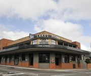
The Lakes Hotel
Cameo Inn Motel
Videos from this area
These are videos related to the place based on their proximity to this place.
2008 Ford Territory SY TX (4X4) Silver 6 Speed Auto Seq Sportshift Wagon
http://www.friendleeautos.com.au/
Man Vs. Wild meets the DJ's
Inspired by Bear Grylls and his show: Man Vs. Wild, DJ & DJ set out to show you how to survive in the Outback with nothing more than a knife, a water bottle, their camera crew, a machette,...
Bloody Cyclists
Damn those lycra clad fuckers on push bikes! How dare they clog up the roads that we pay for right? Oh wait a minute - I AM A CYCLIST. A few things you need to know about cycling and our public...
Videos provided by Youtube are under the copyright of their owners.
Attractions and noteworthy things
Distances are based on the centre of the city/town and sightseeing location. This list contains brief abstracts about monuments, holiday activities, national parcs, museums, organisations and more from the area as well as interesting facts about the region itself. Where available, you'll find the corresponding homepage. Otherwise the related wikipedia article.
Wyong, New South Wales
Wyong was proclaimed a town in 1888 and is a major northern suburb of the Central Coast region of New South Wales, located approximately 89 km NNE of Sydney. It is the administrative centre for the Wyong Shire local government area.
Tuggerah Lake
Tuggerah Lake, an intermittently open intermediate wave dominated barrier estuary, is located within the Wyong Shire local government area in the Central Coast region of New South Wales, Australia. The lake is located near Wyong and is situated about 90 kilometres north of Sydney.
Wyong Shire
Wyong Shire is a local government area located in the Central Coast region of New South Wales, Australia, north of Sydney. Wyong Shire is located around the coastal lake system of Tuggerah Lake, Budgewoi Lake and Lake Munmorah.
Kangy Angy, New South Wales
Kangy Angy is a semi-rural suburb of the Central Coast region of New South Wales, Australia. It is in a small valley along Ourimbah Creek and the Pacific Highway. It is part of the Wyong Shire local government area. Home to a section of the convict built Great North Road, the area remained important as a hill crossing between Sydney and Newcastle until large scale earthworks permitted the development of more direct roads and highways.
Watanobbi, New South Wales
Watanobbi is a suburb of the Central Coast region of New South Wales, Australia. It is part of the Wyong Shire local government area, and is part of the Warnervale development precinct.
Wyong railway station
Wyong railway station is located in Wyong on the Central Coast of New South Wales, Australia. The station is a side station with three platforms, including one for terminating intercity trains from Sydney, half of which terminate here (the other half continuing to Newcastle). The station is a hub for transport on the Central Coast with bus and taxi connections. The station is attended by station staff and is staffed from the first train service to the last.
Tuggerah railway station
Tuggerah railway station is located in Tuggerah on the Central Coast of New South Wales, Australia on the Newcastle & Central Coast Line. The station has two platforms. The station is served by intercity trains to Sydney and Newcastle.
Ourimbah railway station
Ourimbah railway station is located in Ourimbah on the Central Coast of New South Wales, Australia on the Newcastle & Central Coast Line. The station has two platforms. The station was built in 1886 and opened on 15 August 1887. It is served by intercity trains to Sydney & Newcastle, with approximately 40 services each way per day. More than 2,000 passengers use the station per week. Pedestrian signals were installed at the Highway crossing adjacent to the station in 1997.
Tuggerah, New South Wales
Tuggerah is a suburb of the Central Coast region of New South Wales, Australia, situated on the Main North Line and Sydney-Newcastle Freeway about 90 km north of Sydney. It is part of the Wyong Shire local government area. Not to be confused with Tuggerah, QLD, Tuggerah was originally an Aboriginal word but its true meaning is not agreed upon by all sources. Some say that it originally meant 'cold' or 'cold place' and some say 'savannah grasslands'.
Westfield Tuggerah
Westfield Tuggerah is a shopping centre located at Tuggerah on the Central Coast of New South Wales approximately 5 km south of the Wyong CBD. The complex was constructed in 1995. The centre completed a large upgrade in 2005 and is now host to 245 stores plus an 8 cinema Greater Union complex, including Senstadium seating. It is currently the second largest shopping centre on the Central Coast after Erina Fair.
Berkeley Vale, New South Wales
Berkeley Vale is a suburb of the Central Coast region of New South Wales, Australia. It is part of the Wyong Shire local government area. Wyong Road is the main road that runs through Berkeley Vale. Berkeley Vale contains two public schools - Berkeley Vale Campus, which is a part of Tuggerah Lakes Secondary College, and Berkeley Vale Primary School. There is a private hospital and a retirement village on the lake side of Wyong Road.
Alison, New South Wales
Alison is a semi-rural suburb of the Central Coast region of New South Wales, Australia, located on the north bank of the Wyong River 4 kilometres northwest of the regional centre of Wyong. It is part of the Wyong Shire local government area.
Chittaway Bay, New South Wales
Chittaway Bay is a suburb of the Central Coast region of New South Wales, Australia. It is part of the Wyong Shire local government area. The main road through the suburb, Chittaway Road, has on it a four star motel, service station, and a shopping centre known as Chittaway Centre, it also has a pub called Chittaway Bay Tavern, but more commonly known to locals as "The Tav".
Chittaway Point, New South Wales
Chittaway Point is a suburb of the Central Coast region of New South Wales, Australia. It is part of the Wyong Shire local government area.
Fountaindale, New South Wales
Fountaindale is a semi-rural suburb of the Central Coast region of New South Wales, Australia. It is part of the Wyong Shire local government area. {{#invoke:Coordinates|coord}}{{#coordinates:-33.340|151.393|type:city_region:AU-NSW|||||| |primary |name= }} {{#invoke: Navbox | navbox }} Fountaindale is also the location of a Rudolf Steiner School, which moved from North Gosford. This school has benefited the community with a new roundabout as well as other road repairs and upgrades.
Glenning Valley, New South Wales
Glenning Valley is a suburb of the Central Coast region of New South Wales, Australia, located between The Entrance and Wyong. It is part of the Wyong Shire local government area.
Killarney Vale, New South Wales
Killarney Vale is a suburb of the Central Coast region of New South Wales, Australia, located northwest of Bateau Bay. It is part of the Wyong Shire local government area. Killarney Vale contains a 2 public primary school one oval Eastern Road Oval and a private hospital. Wyong Road is the main road that runs through Killarney Vale second being Eastern Road. Along Wyong Road, there is Killarney Shops which houses a Bi-Lo store. It was named after the town of Killarney in Ireland.
Mardi, New South Wales
Mardi is a suburb of the Central Coast region of New South Wales, Australia. It is part of the Wyong Shire local government area. The origin of the name is an Aboriginal word meaning 'stone knife'.
Palmdale, New South Wales
Palmdale is a suburb of the Central Coast region of New South Wales, Australia. It is part of the Wyong Shire local government area. It is bounded on most sides by the Ourimbah State Forest, and is home to the Palmdale Memorial Park and Crematorium. It is a sister suburb to Palmdale Spain and home to local motocross champion Phil Bailey.
Rocky Point, New South Wales
Rocky Point is a suburb of the Central Coast region of New South Wales, Australia. It is part of the Wyong Shire local government area.
Tacoma South, New South Wales
Tacoma South is a suburb of the Central Coast region of New South Wales, Australia. It is part of the Wyong Shire local government area. The suburb, which is primarily bushland, is bordered by Wyong River and Tuggerah Nature Reserve. There is only one way in and out of the suburb.
Tacoma, New South Wales
Tacoma is a suburb of the Central Coast region of New South Wales, Australia. It is part of the Wyong Shire local government area. Tacoma is located on the northern bank of the Wyong River where it opens up onto Tuggerah Lake. It has a general store, a school, Tacoma Public School and a Fishermans Co-operative. It is also the home of the Wyong Lakes Magpies Australian Football Club.
Ourimbah Campus
The Ourimbah Campus is a multi-sector campus which offers University, TAFE and Community College programs and courses. The Ourimbah campus is a partnership of The University of Newcastle and TAFE NSW - Hunter Institute. Affiliates are the Central Coast Community College and the Central Coast Conservatorium of Music. Ourimbah Campus is located in Ourimbah, New South Wales, just between Newcastle and Sydney. It is a bushland campus, offering a quiet environment for students and visitors.
Wadalba, New South Wales
Wadalba is a suburb of the Central Coast region of New South Wales, Australia. It is part of the Wyong Shire local government area. It contains Wadalba Community School as well as a mobile home village, a rural pet supply store, Mitre 10, a Coles shopping centre, a childcare centre, liquor store, golf range and caravan park.
Wyong Public School
Wyong Public School is a school situated on the Central Coast, north of Gosford, New South Wales. The township of Wyong was first established in 1887. The first Wyong School was opened on 2 July 1888 in temporary premises known as Watt's Concert Hall. In May 1889, the pupils moved to the Alison Road School. In September 1979, the new school opened at the present site in Cutler Drive, Wyong.


