Discover Waterloo
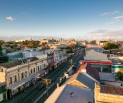
The district Waterloo of in Sydney (New South Wales) is a subburb in Australia about 151 mi north-east of Canberra, the country's capital city.
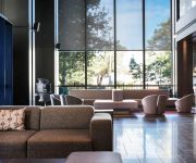
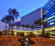
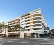
If you need a hotel, we compiled a list of available hotels close to the map centre further down the page.
While being here, you might want to pay a visit to some of the following locations: Sydney, Parramatta, Katoomba, Canberra and . To further explore this place, just scroll down and browse the available info.
Local weather forecast
Todays Local Weather Conditions & Forecast: 19°C / 67 °F
| Morning Temperature | 16°C / 61 °F |
| Evening Temperature | 19°C / 66 °F |
| Night Temperature | 17°C / 63 °F |
| Chance of rainfall | 0% |
| Air Humidity | 67% |
| Air Pressure | 1028 hPa |
| Wind Speed | Gentle Breeze with 6 km/h (4 mph) from West |
| Cloud Conditions | Scattered clouds, covering 41% of sky |
| General Conditions | Scattered clouds |
Sunday, 28th of April 2024
21°C (69 °F)
19°C (66 °F)
Light rain, moderate breeze, clear sky.
Monday, 29th of April 2024
22°C (72 °F)
21°C (69 °F)
Light rain, gentle breeze, clear sky.
Tuesday, 30th of April 2024
17°C (63 °F)
18°C (64 °F)
Heavy intensity rain, strong breeze, overcast clouds.
Hotels and Places to Stay
Pullman Sydney Airport
Stamford Plaza Sydney Airport
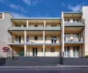
Meriton Suites Waterloo
Adina Sydney Airport
Shakespeare Hotel Surry Hills
Quest Mascot
The Urban Newtown
Adina Apartment Hotel Sydney Chippendale
Adina Sydney Chippendale
Central Railway Hotel
Videos from this area
These are videos related to the place based on their proximity to this place.
Panic Agrophobic Journey Vlog Episode 6
The Return of the Panic! My greatest challenge yet - travelling at night! Anxiety was sky high! :( Sorry the lighting is so bad, but it was night time.
Raine & Horne Bondi Junction | Coogee/Clovelly - 25 Maitland Avenue, Kingsford - Tony Laing
25 Maitland Avenue Kingsford NSW Marketed by: Raine & Horne Coogee/Clovelly 8383 9999 rhbjcc.com.au Contact: Justin Bell Tel 8383 9976 | 0412 429 300, Email jbell@rhbjcc.com.au Video ...
Off-grid urban home in Sydney reuses own sewage
Sustainable House Sydney produces power, water and even reuses its own sewage, right in the middle of Australia's biggest city. Original story here: http://faircompanies.com/videos/view/sydneys-sus...
City Sightseeing 427, MCW Metrobus with Cummins ISC Euro IV engine
Due to regulations, it had its Gardner 6LXCT engine replaced by the Euro IV spec Cummins ISC engine.
Highlights RND 1 - Emirates Australian Open 2014
American Jordan Spieth has celebrated his first trip Down Under with a dazzling first round in the Emirates Australian Open.
Mascot lunchtime time lapse
Decided to set up my phone for a timelapse during lunch. Clouds floating across the sky and the work progressing on the latest residential development in the Mascot neighbourhood. Interesting...
Videos provided by Youtube are under the copyright of their owners.
Attractions and noteworthy things
Distances are based on the centre of the city/town and sightseeing location. This list contains brief abstracts about monuments, holiday activities, national parcs, museums, organisations and more from the area as well as interesting facts about the region itself. Where available, you'll find the corresponding homepage. Otherwise the related wikipedia article.
City of Botany Bay
The City of Botany Bay is a local government area in south eastern Sydney, in the state of New South Wales, Australia. The area encompasses the suburbs to the north of Botany Bay, such as Botany. The administrative centre is located at Mascot, which is 7 kilometres south of the Sydney central business district. Before 1996, the city was known as the Municipality of Botany. The Mayor of the City of Botany Bay Council is Cr.
Mascot, New South Wales
Mascot is a suburb in south-eastern Sydney, in the state of New South Wales, Australia. Mascot is located 7 kilometres south of the Sydney central business district and is the administrative centre of the City of Botany Bay. Mascot is on the north-west side of Botany Bay and contains Sydney Airport.
Waterloo, New South Wales
Waterloo is an inner-city suburb of Sydney, New South Wales, Australia. Waterloo is located 4 kilometres south of the Sydney central business district and is part of the local government area of the City of Sydney.
Alexandria, New South Wales
Alexandria is an inner-city suburb of Sydney, New South Wales, Australia. Alexandria is located 4 kilometres south of the Sydney central business district and is part of the local government area of the City of Sydney. The postcode is 2015. The rough boundaries of Alexandria are Botany Road to the east, Gardeners Road to the south, Mitchell Road and Sydney Park to the west, and Henderson Road to the north. It is approximately 2 km south of Central Station.
Zetland, New South Wales
Zetland is an inner-city suburb of Sydney, New South Wales, Australia. Zetland is located 4 kilometres south of the Sydney central business district, in the local government area of the City of Sydney. Zetland is a largely industrial suburb with medium to high density residential areas. Zetland is part of the Green Square district which is currently undergoing gentrification. This involves an urban renewal project that is constructing modern retail, business and residential developments.
Division of Sydney
The Division of Sydney is an Australian Electoral Division in the state of New South Wales. It is located around the central city area of Sydney, and includes many inner suburbs such as Darlinghurst, Surry Hills, Ultimo, Redfern, Camperdown, Glebe, Annandale, Balmain, Potts Point and the Sydney central business district itself. The Division also incorporates all the waters of Port Jackson, except for Middle Harbour and North Harbour. It also covers Lord Howe Island.
Erskineville, New South Wales
Erskineville is an inner-city suburb of Sydney, in the state of New South Wales, Australia. Erskineville is located about 3 kilometres south of the Sydney central business district and is part of the local government area of the City of Sydney. Erskineville is informally part of the region of the Inner West, but is also more correctly considered to be part of the Inner City because of its proximity to the city. Erskineville is colloquially known as Erko.
St Peters railway station
St Peters railway station is part of the CityRail network. Straddling the border of the Sydney suburbs of St Peters and Newtown, it services a residential and industrial area. This station does not have easy access for wheelchairs. St Peters is used by an average of 5180 daily weekday commuters. It is located on CityRail's Bankstown line, but Illawarra and East Hills line services also pass through without stopping.
Rosebery, New South Wales
Rosebery is a suburb in south-eastern Sydney, in the state of New South Wales, Australia. Rosebery is located 6 kilometres south of the Sydney central business district and is part of the local government area of the City of Sydney. Rosebery has a mix of residential, commercial and industrial developments. The northern parts of Rosebery and the adjacent Green Square are part of an area that is currently undergoing gentrification.
Beaconsfield, New South Wales
Beaconsfield is a small inner-city suburb of Sydney, New South Wales, Australia. Beaconsfield is located 5 kilometres south of the Sydney central business district and is part of the local government area of the City of Sydney. The postcode is 2015. Beaconsfield has a mixture of industrial and medium to high density residential areas. Beaconsfield is part of the Green Square district which is currently undergoing gentrification.
Erskineville railway station
Erskineville railway station is part of the CityRail network. Located in the Sydney suburb of Erskineville, it services a residential area. Physically, Erskineville lies on the Illawarra line, although only Bankstown line trains currently stop there with all Illawarra and East Hills line services passing through. The station has six platforms (two of which are incomplete), with 2 side and 2 island, which retain their original brick platform buildings. There is currently no wheelchair access.
Eastern Distributor
The Eastern Distributor, also identified as the M1, is a 6-kilometre long motorway in Sydney, New South Wales, Australia. Part of Metroad 1, it links the Sydney central business district (CBD) with the Airport. The centre-piece is a 1.7 km tunnel running from Woolloomooloo to Surry Hills. The motorway is tolled in one direction (northbound) with the toll plazas at Woolloomooloo and at the William Street exit.
Green Square railway station
Green Square railway station is an underground station on the Airport branch of the Airport and East Hills line in Sydney, Australia. It is located at Green Square, a complex road intersection at the northern tip of Alexandria. The station is accessible by disabled passengers and is generally staffed, except at later hours of the day.
Mascot railway station
Mascot (also known as Mascot Suburban to avoid confusion with the neighbouring airport stations) is the second station from the city on the Airport branch of the CityRail Airport and East Hills line in Sydney. It is located in the business area of the suburb of Mascot and was opened along with the rest of the Airport branch in May 2000.
Alexandria Park Community School
Alexandria Park Community School (APCS) is a dual campus, partially selective, co-educational Kindergarten to Year 12 School. The school has a junior (K-4), middle school (5-7) and senior (8-12) structure with Opportunity Classes in Year 5 and Year 6 as well as a selective stream in Year 7 to Year 12 for academically gifted and talented students. The Junior Campus (K-7) is located at Park Road and the Senior Campus (8-12) on Mitchell Rd Alexandria.
Green Square, New South Wales
Green Square is a district in the inner-city of Sydney in the suburbs of Alexandria, Zetland, Waterloo and Beaconsfield. It is located 4 km south of the Sydney central business district and is part of the local government area of the City of Sydney. The centre of the Green Square district is at the junction of Bourke Road, Botany Road and O'Riordan Street. Green Square railway station on the Airport and East Hills Line is located at this junction.
Australian Technology Park
The Australian Technology Park (ATP) is a business and technology centre in Eveleigh, an inner-city suburb of Sydney, in the state of New South Wales, Australia. It is located about 3 km south of the Sydney central business district, adjacent to Redfern railway station spread over 13.9 hectares of land. Australian Technology Park primarily houses start-up hi-tech companies, especially biotech firms, and spin-offs from University research.
Fire and Rescue NSW
Fire and Rescue NSW (previously known as New South Wales Fire Brigades), an agency of the Government of New South Wales, Australia, is responsible for firefighting, rescue and hazmat services in the major cities, metropolitan areas and towns across rural and regional New South Wales.
Erskineville Oval, Sydney
Erskineville Oval is a rugby league ground in the Sydney suburb of Erskineville, New South Wales, Australia. The ground features a small old grandstand of approximately 1-2000 capacity, with an encircling grassy hill. There are bricked up ticket windows and rundown, closed public toilets. There are night-lights that provide adequate lighting for training purposes only.
Redfern Oval
Redfern Oval is an Australian football ground, located in Sydney suburb of Redfern, New South Wales. The South Sydney Rabbitohs Rugby League Football Club played at Redfern Oval between 1948 and 1987. Rabbitoh supporters often refer to Redfern Oval as "The Holy Land". The former National Rugby League ground had a main grandstand on the wing with seats on either side and a hill surrounding the rest of the ground with a few rows of seats near the fence.
The Australian Golf Club
The Australian Golf Club is a golf club located in Rosebery, a suburb of Sydney, Australia. Although it survived numerous course location changes, it is arguably the oldest golf club in Australia. To date the course has held 17 Australian Opens, the most recent being from 13–16 December 2007, which was won by Craig Parry. The course has been rated the 9th best in the country.
Victoria Park Racecourse, Sydney
For the park in Camperdown, Sydney, see Victoria Park, Sydney {{#invoke:Coordinates|coord}}{{#coordinates:-33.908|151.2105|dim:750|||||| |primary |name= }} Victoria Park Racecourse was a racecourse in Zetland, an inner-city suburb, south of Sydney, New South Wales, Australia. It was bordered by O’Dea Avenue, South Dowling Street, Epsom Road and Joynton Avenue. The site was originally a lagoon and swamp which was drained in the early 1900s to create the racecourse.
Royal South Sydney Hospital
Royal South Sydney Hospital was a hospital in the southern Sydney suburb of Zetland, New South Wales, Australia. Initial efforts to open a hospital in South Sydney began in 1908 when fundraising efforts by local residents saw James Joynton Smith, local businessman and racecourse owner, elected as provisional president of a future hospital. In 1912, construction of a 25 bed public hospital began and was opened in 1913.
J J Cahill Memorial High School
J J Cahill Memorial High School, (frequently abbreviated to JJCMHS; colloquially known as JJ) is a school in Mascot, New South Wales, Australia, on Sutherland Street. It is a co-educational high school operated by the New South Wales Department of Education and Training with students from years 7 to 12. The school was established in 1961 as a comprehensive High School, named in memory of local member and Premier of New South Wales, John Joseph Cahill.
Sydney Corporate Park
Sydney Corporate Park (SCP) is a corporate business centre based in the Sydney suburb of Alexandria. It is home to more than 90 businesses, estimated to be employing over 6000 people. It is located between O'Riordan St, Doody St and Bourke Rd, it is spread over 17 hectares, close to the CBD and only a few minutes from Sydney Airport.


